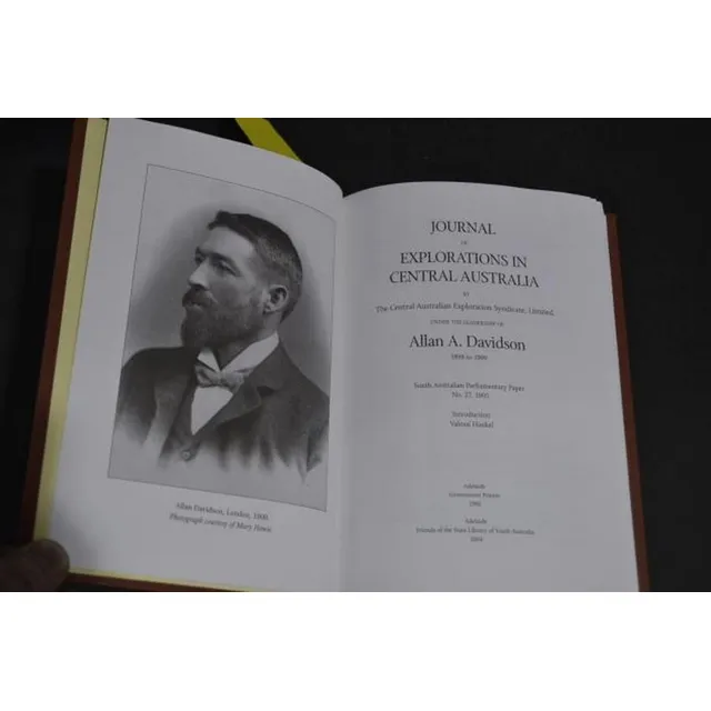
Central Australia Exploration Journal with Maps (Facsimile Edition)
Allan A. Davidson - Journal of Explorations in central Australia 1905 (2004 facsimile edition) no. 18 of 99, bound in quarter leather with separate facsimile edition of the maps (two)
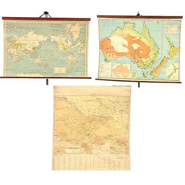
Educational Hanging Maps Set
Three educational hanging maps including Robinson map of the world showing products; and Johnston's map of Australia, and one other largest 87 cm high, 110 cm wide (3)
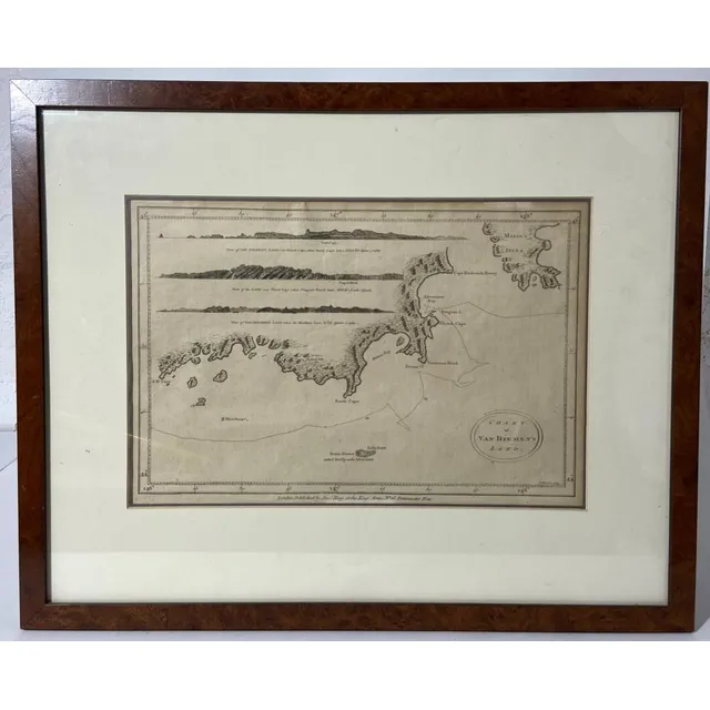
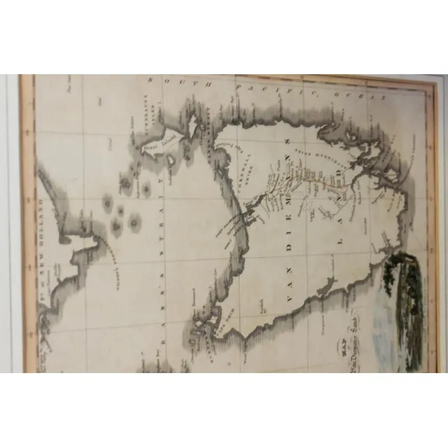
Bowen, T. Chart of Van Diemen's Land, engraved chart, London, Published by Alex Hogg c.1785, a copy of Cook's chart published by A Hogg in Andersons collection of Voyages Round the World, which included Cook's voyages, mounted & framed, paper browned…
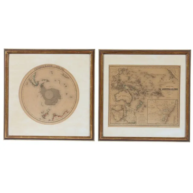
Meyer's Hand Atlas: Australia & Antarctica (1846) - Framed Maps
Framed maps two from Meyer's Hand Atlas, Australia 1846 and Antarctica, 48 x 48 cm
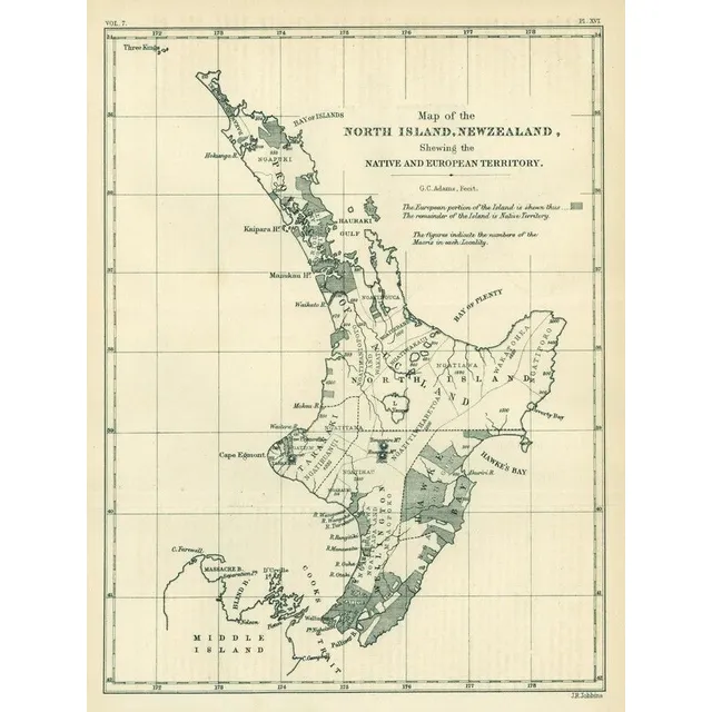
Fold-out maps of New Zealand and Scottish territories
New Zealand: c1832-70 fold-out maps, most published by the Royal Geographic Society, noted 'Map of the North Island, New Zealand, Shewing the Native and European Territory' & 'Map of the Southern Alps', also one Sottish map.
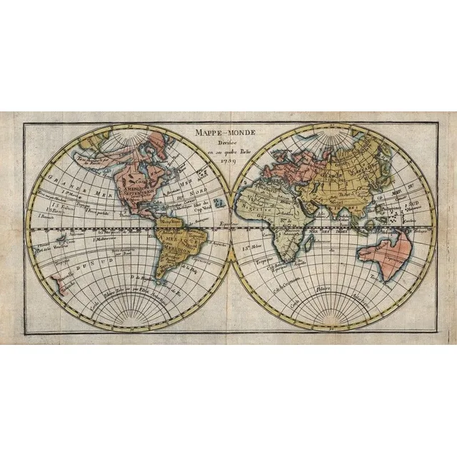
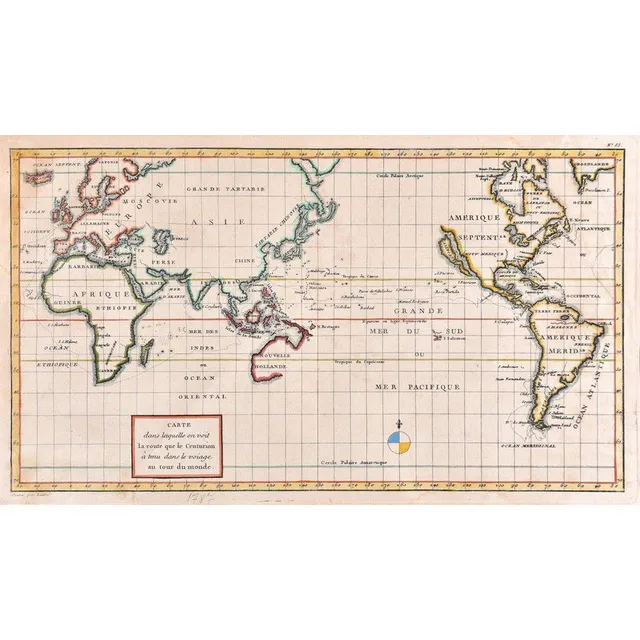
1759 Map of Australia and Pacific Islands
Mappe-Monde, Divisee en ses quatre Partie 1759' (Paris, 1759), double-hemisphere map showing east coast of Australia stretching from Tasmania via New Hebrides to New Guinea, hand-coloured, size 34 x 17 cm.,
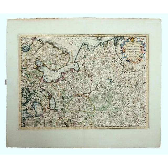
"Northern Russia Map, Ottens 1720"
Map, Ottens Carte Nouvelle Moscovie. Map of Northern Russia after cartographer de L'Isle, pub, by Reiner & Joshua Ottens, Amsterdam, 1720. Hand coloured copper engraving, 42 x 56 cm
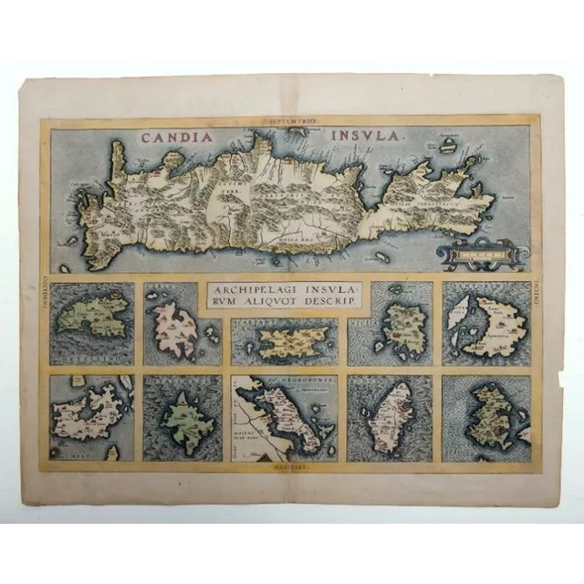
Ortelius' Map of Crete and 10 Additional Islands
Map, Ortelius Candia Insula. Map of Crete with 10 additional islands, by Abraham Ortelius, pub. Antwerp, 1573. Descriptive Latin text verso. Hand coloured copper engraving, 36 x 51 cm
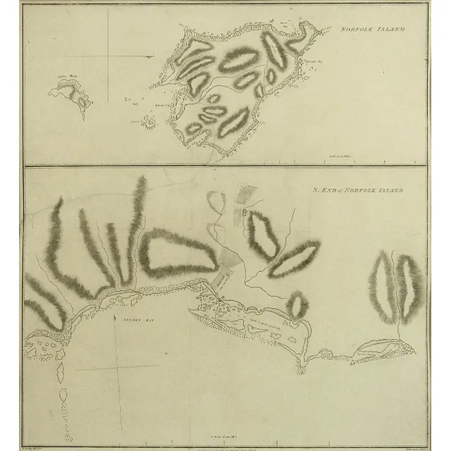
Early Settlement of Norfolk Island, 1789
Chart of Norfolk Island showing the early Settlement 1789. Drawn by William Bradley 1788, pub.by J.Stockdale, 1789. Paper has watermark G.R. (government issue). Engraving. 47 x 43 cm
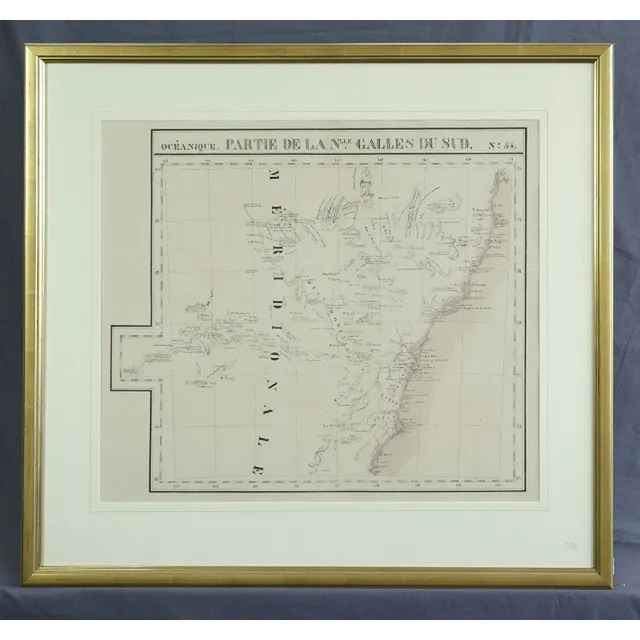
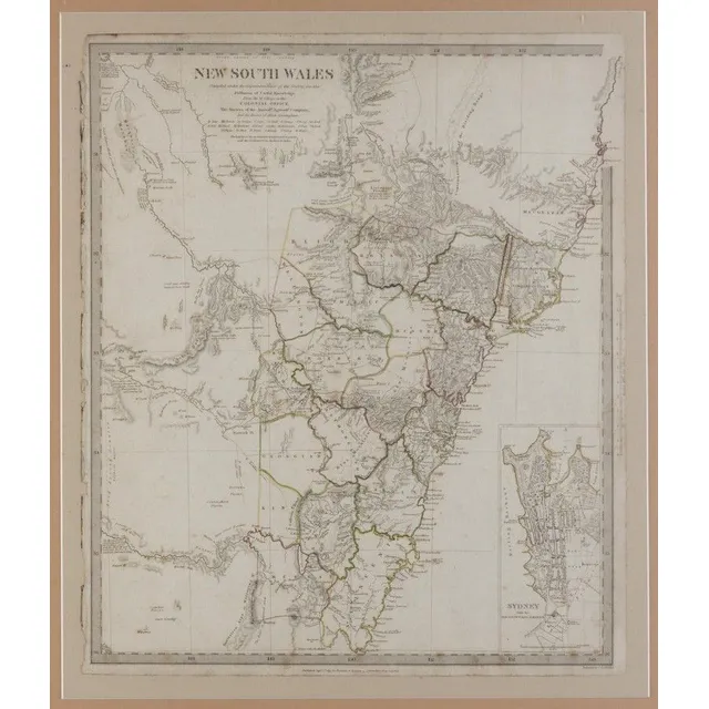
NSW Coast Map 1827 by Vandermaelen
Map, NSW Coast Partie de la Nlle Galles du Sud. By Philippe Vandermaelen, published Brussels 1827. Coloured lithograph. 48 x 57 cm
Hand-drawn Colonial Maps of Australia
Five Australian Colonial hand drawn maps, including Rushcutters Bay Act of 1878, sketch of Subdivisions of Francis Giles Point Piper, Divisions beside James Mc Arthurs Moreton Park, 1862 tracing Calderwood and Parish of Wongawilli (5)
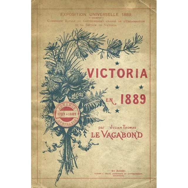
'Victoria 1889: Illustrated Guide for Exposition Universelle'
'Victoria en 1889' by Julian Thomas 'Le Vagabond' [French edition, Melbourne, 1889], illustrated with 24 plates and a folding map, 55pp. Published for distribution at the Exposition Universelle, 1889
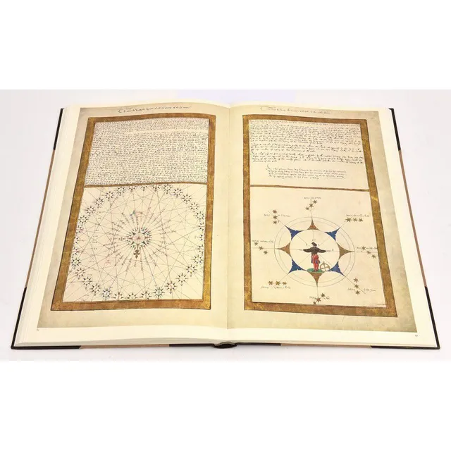
Rotz Atlas: 1542 Cartography for King Henry VIII
The Rotz Atlas; the maps and text of the Boke of Idrography presented in 1542 by Jean Rotz to King Henry VIII. Published by the Roxburghe club, 1981. Half leather binding with linen boards.
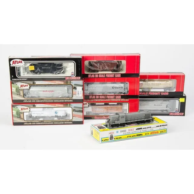
Atlas Diesel and Rolling Stock Set - NIB
Atlas: Rsd 4/5 diesel no.7080 (Undecorated) together with rolling stock: 33,000 Gal. Tank car (Suburban Propane), 3-Bay cylindrical Hoppers (Indusmin & New York System), 36' wood Reefer car (Evansville packing), Kaolin tank car (Anglo-American Clays),…
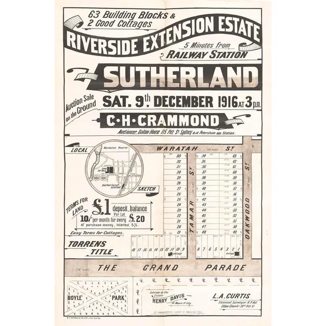
Riverside Estate Lithograph Advertisement, circa 1916
'Riverside Extension Estate, Sutherland, Sydney' lithograph real estate advertising with locality map, circa 1916. Printed by W.C.Penfold & Co Ltd. Litho. Sydney. 51 x 74 cm
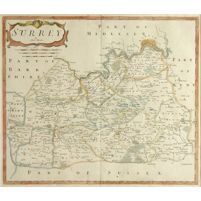
18th Century Sussex Map by Robert Morden
An 18th century map 'Part of Sussex' by Robert Morden, hand coloured in outline. 36 cm x 41 cm
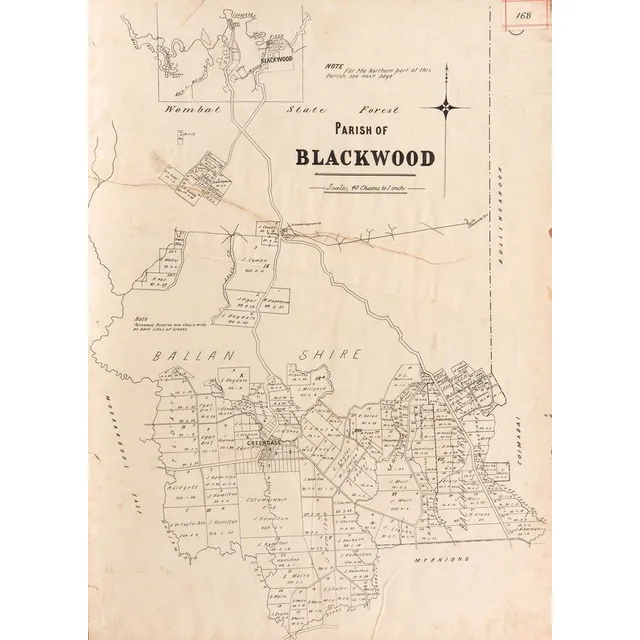
Victorian Maps of Bendigo, Sunbury, Moe, and More
Victorian Maps: c1865-92 maps, noted 'New Map of Bendigo & District', 'Township of Sunbury', 'Moe', 'Kororoit', 'Doutta Galla', 'Merino', 'Trawool', 'Blackwood', 'Grassdale', 'Tragowel', 'Goornong', 'Baynton'. Various sizes. Poor/G condition.,
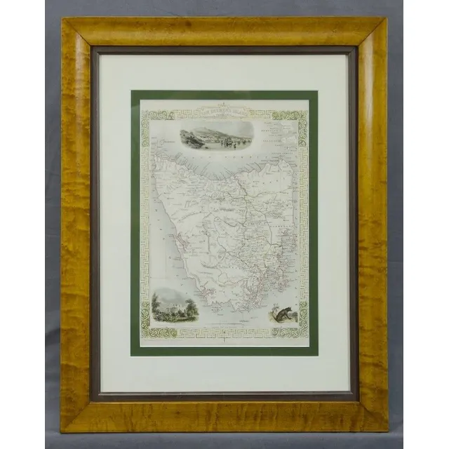
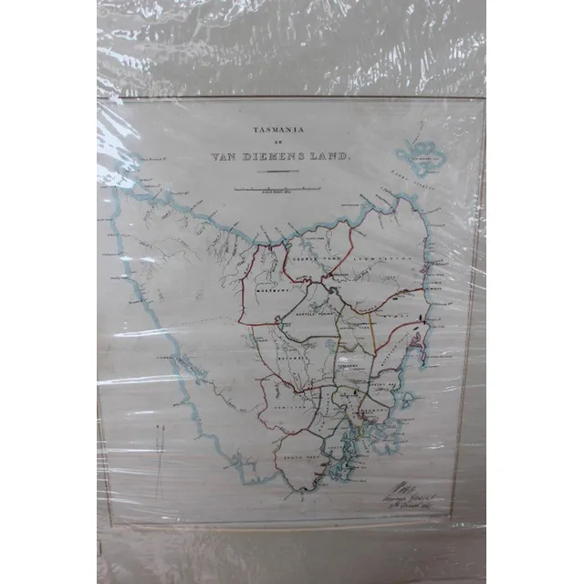
Van Diemens Land/Tasmania Map by J. Rapkin/Tallis
Map, 'Van Diemens Land or Tasmania.' J Rapkin / John Tallis. Coloured engraving. 35 x 25 cm
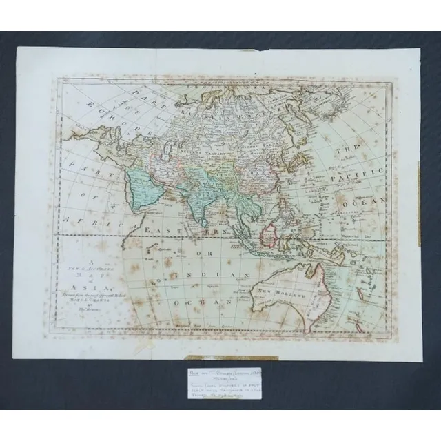
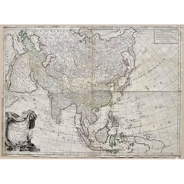
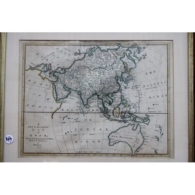
Accurate Map of Asia, Bowen, London c.1790
Map, a new and Accurate map of Asia. Thomas Bowen, London. Pub. C.1790. Copper engraving & hand coloured. 33 x 4 3 cm

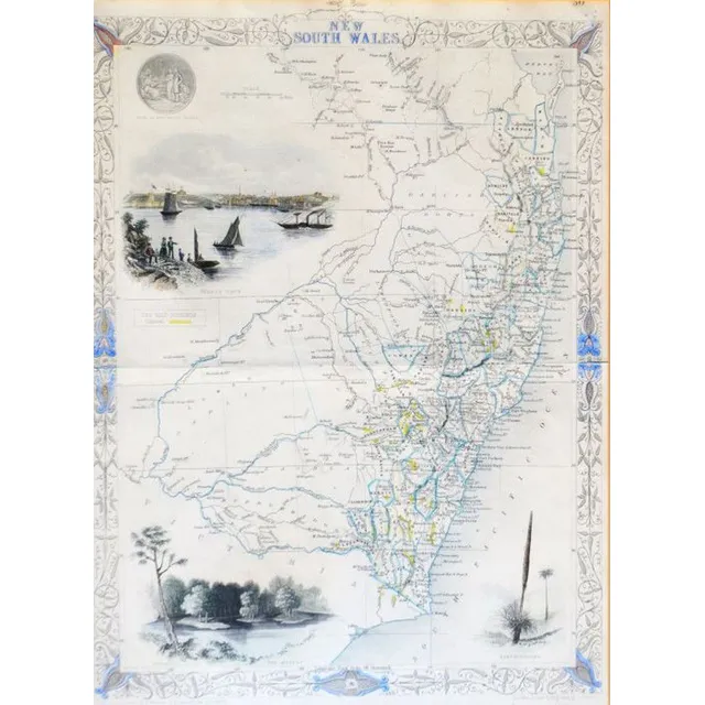
Map of NSW, New Zealand, New Hebrides & Adjacent Islands
Map, NSW, New Zealand, New Hebrides & the Islands Adjacent. Robert Wilkinson, pub. London 1808. Inset map of port Jackson & Environs. Coloured engraving
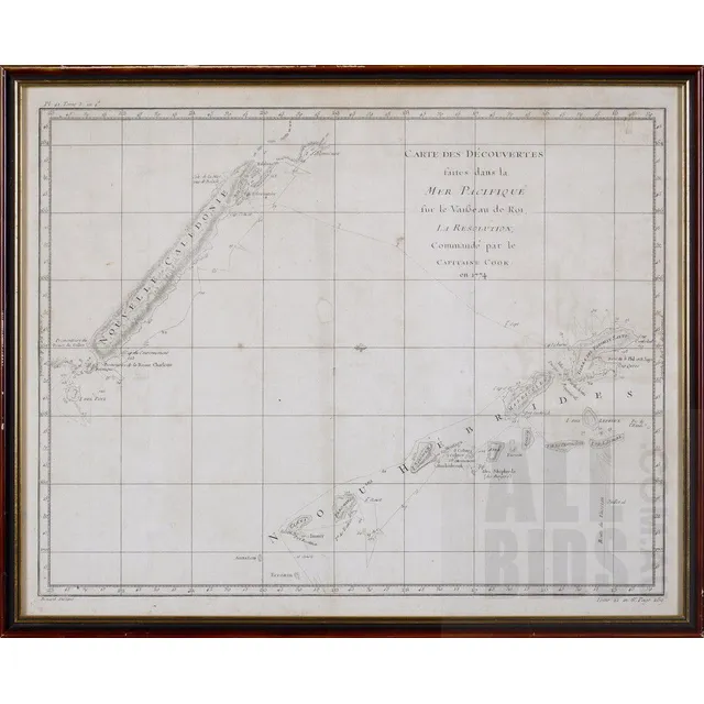
Pacific Discoveries Map 1774
Robert Benard (French active 1750-1785) carte des decouvertes faites dans la Mer Pacifique ...1774, Published Paris 1785
Cartes et plans de l'Amerique, c.1742
Bellin, Jacques Nicolas, 1703-1772 - Cartes et plans de l'Amerique, c.1742. Facsimile from original plate. Framed and mounted. 56 cm x 86 cm
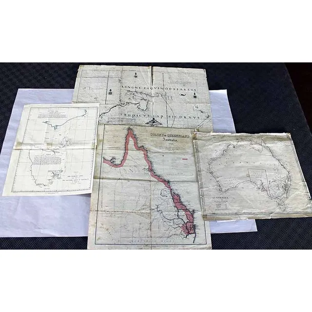
Colonial Maps of Australia and Van Dieman's Land
Four Colonial maps, including 'Colony of Queensland Australia' and 'Chart of van Dieman's Land'
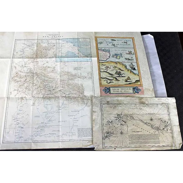
Dampier's Discoveries and New Guinea Explorer's Maps
A map of the Discoveries made by Captain William Dampier, circa 1744. Together with two Explorer's maps of New Guinea
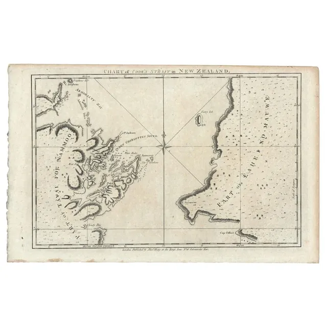
Cook's Strait Chart in New Zealand (1784)
New Zealand: 'Chart of Cook's Strait in New Zealand. From Alexander Hogg's edition of Cook's voyage to the South Pacific, (1784), copper plate engraving, 23 x 33.5 cm.
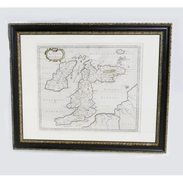
17th Century Hand-Coloured Map of Great Britain by Blaeu
17th century hand coloured map of Great Britain, A c.1654 map of the British Isles entitled 'Insulae Albion et Hibernia cum Minoribus Adjacentibus' by Johanes Blaeu. Original outline colouring. Dutch. 47.5 cm x 60 cm
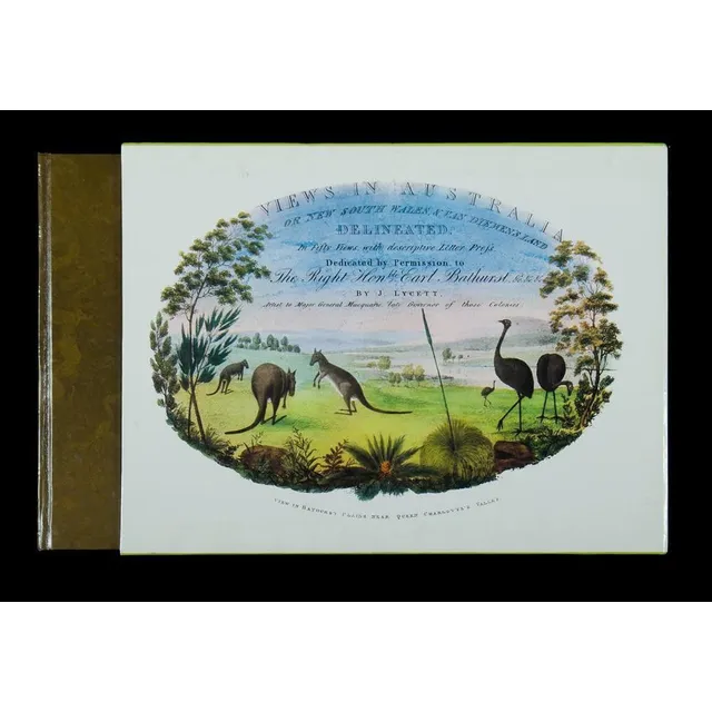
Views in Australia: 1824-1825
Book, 'Views in Australia or New South Wales & Van Diemen's Land.' by J Lycett, facsimile of the 1824-1825 edition. Oblong Quarto with 50 coloured plates and descriptive letter press, including two full page maps and 48 full page coloured plates and a…
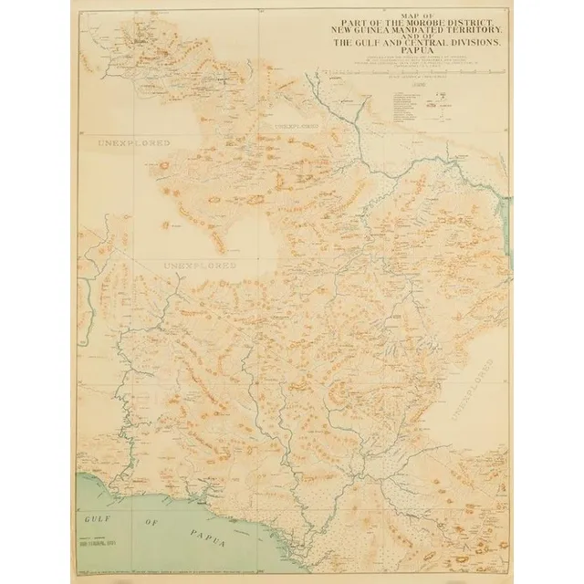
Map of Morobe District and Gulf, New Guinea (1933-1935)
Map of part of the Morobe District New Guinea Mandated Territory and of the Gulf and central Div. 1933-1935. Drawn by J. Nason-Jones, printed by H.E.C Robinson Ltd, 221-3 George Street, Sydney
Framed Paterson, Unframed Surrounding Maps Set
Framed Paterson map, along with unframed Dungog, Newcastle, lake Macquarie and singleton
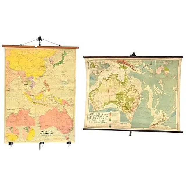
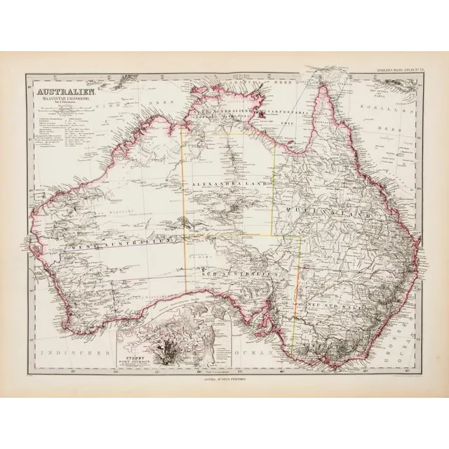
Educational Hanging Maps: Australia & SE Asia, Australia & NZ
Two educational hanging maps including Australia and South-East asia; and Australia and New Zealand, largest 115 cm high, 88 cm wide (2)
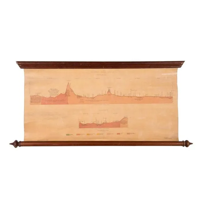
Ararat Gold Field Map, 1875
Ararat Gold Field, Section Ab on Plan, Section Cd on Plan. Lithographed at the Mining Department, Melbourne. Ferdinand M. Krause, Geol. Surveyor, Ararat, June 1875, linen-backed roll-up map, size 69 x 35 cm.
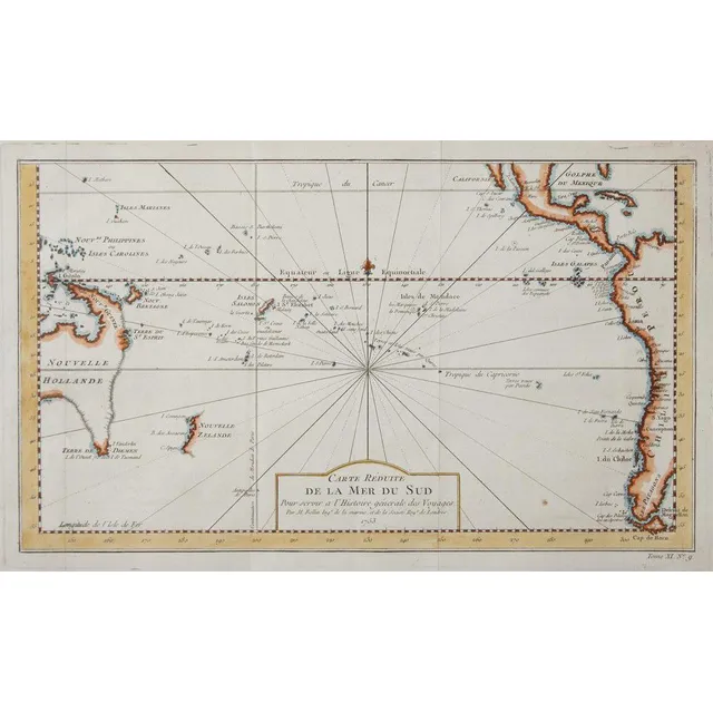
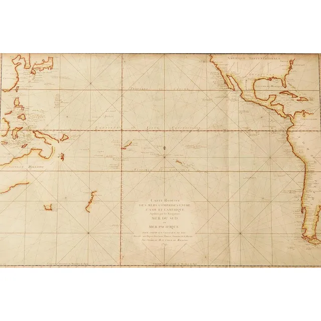
South Pacific Ocean Map (1753)
Jacques-Nicolas Bellin - map of South Pacific Ocean, C.1753, engraved on paper, 230 x 38 cm
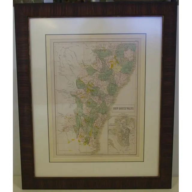
Antique NSW maps: Lizars & Society for Useful Knowledge
NSW Maps: 'Map of Part of New South Wales' by Lizars [Edinburgh, 1824], plus 'New South Wales, Compiled under the Superintendence of the Society for the Diffusion of Useful Knowledge' [London, 1833], both framed, various sizes.
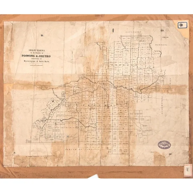
Victorian County Maps: Mornington & Cranbourne (1875-1904)
Mornington County & Cranbourne Maps: c1875-1904 maps, noted 'The Township of Mornington, Snapper Point', 'Cranbourne', 'Balnarring', 'Pakenham', 'Woolamai', 'Nar-Nar-Goon', 'Poowong & Jeetho', 'Korumburra'. Various sizes. Poor/G condition.,
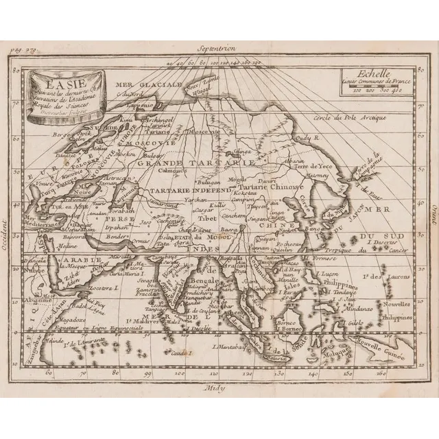
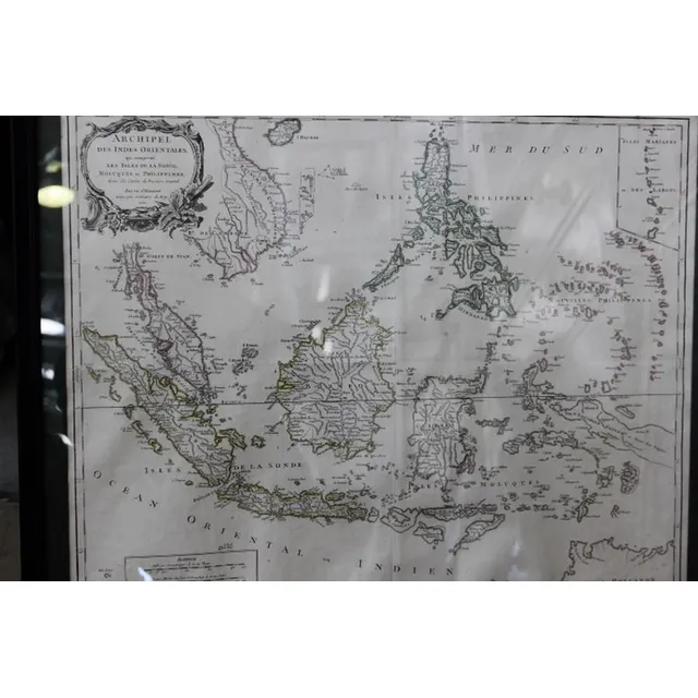
Map of Central Asia with New Guinea (1784)
MAP - Santini, Francois. L'Asie divisee en ses, principaux Etats, assujette aux observations, astronomiq. Venice, M. Remondini, c.1784, engraved map, depicting central divisions of Asia; from the Mediterranean to Japan and south to the East Indies.…
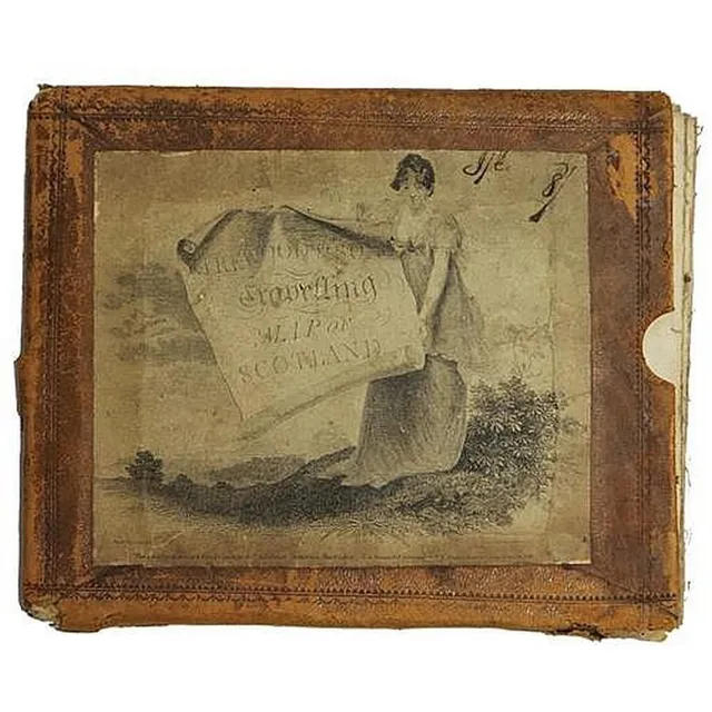
1804 Scotland Travelling Map with Historic Routes
George IV 'Kirkwood & Sons Travelling Map of Scotland' dated 1804 showing the routes of Pennant, Garnett, Lettice, Campbell in original leather bound cover. Dimensions 71.5 x 58 cm
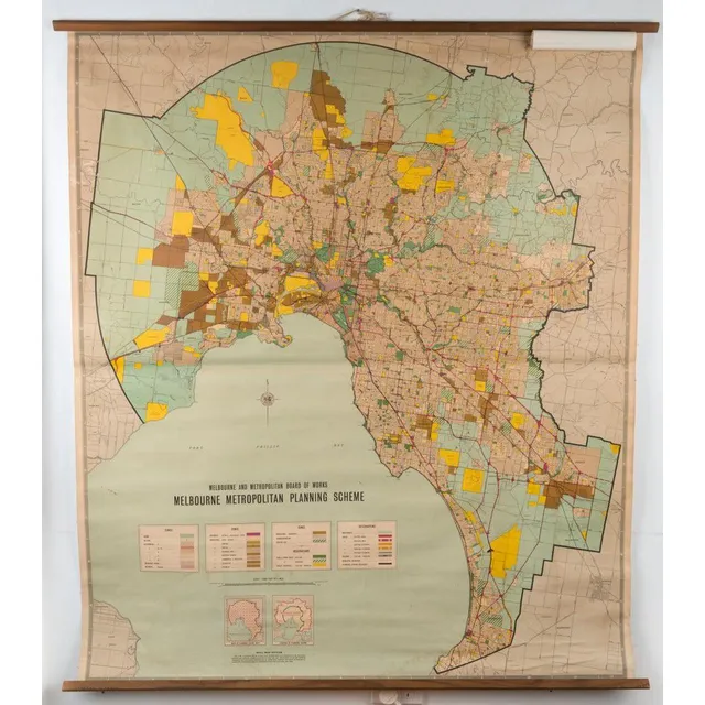
Melbourne Metro Planning Scheme 1968 Wall Map
'Melbourne Metropolitan Planning Scheme', 1968 wall map by the Melbourne & Metropolitan, Board of Works, linen backed and with wooden, rollers top and bottom, 138 x 119 cm.
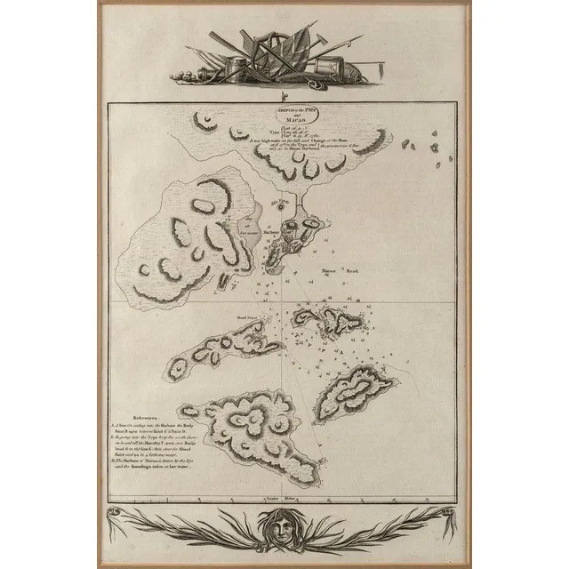
Macao Maps and Views Collection
'Sketch of the Typa and Macao' Detailed chart of Macao and neighboring islands from Cook's Voyages, c.1785. overall 34 x 22 cm Includes town plan, soundings, some topography and notes and observations. also, 'View of Macao in China' by James Heath (c…
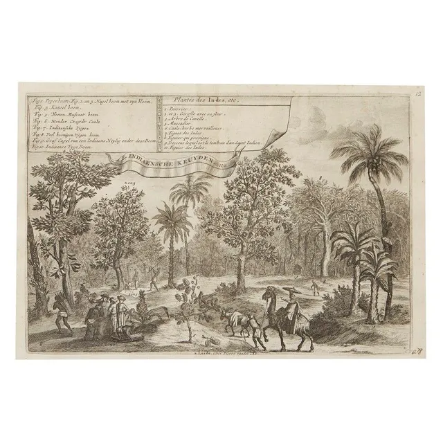
"Indian Plants" and "Java Map" Engravings by Pieter van Der Aa
Two engravings by Pieter van Der Aa, 18th century, 'Plantes Des Indes', Description of Indian plants in French and Dutch by Romeyn de Hooghe (1645-1708), 28.5 x 19 cm, 'Het Eiland Java', a map of the island of Java in French and Dutch after Lopo Vaz de…
Framed antique maps of Atlantic, Indian and Asian regions
Maps: 'Een Schets van de Algemeene Passaad-Winden in de Atlantische en Indiansche Zeen' by Dampier [1698], 'L'Asie' by Macquart [1739] & 'East Indies' by Jeffreys [1778], all framed, various sizes.
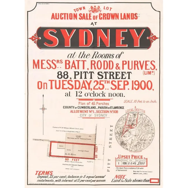
Sydney Crown Lands Auction: Town Lot Sale (9 words)
'Town Lot Auction Sale of Crown Lands at Sydney' lithograph real estate advertising with locality map, circa 1900. Litho'd & Printed at the Dept. of Lands Sydney. 47 x 63 cm
Evolution of Australian Maps: 1839-20th Century
Maps: Group of 8 maps of Australia including c1839 showing the Colony of South Australia. 19th & 20th century. Varying sizes
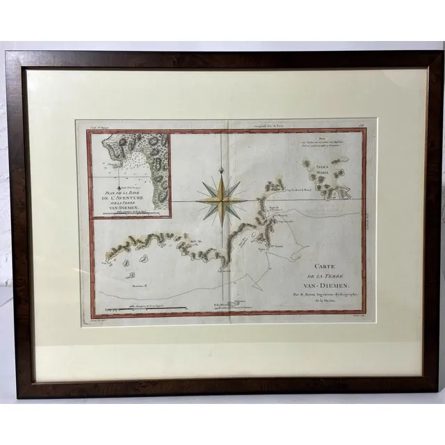
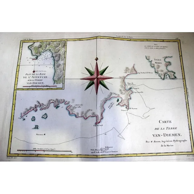
Bonne, R. Carte De La Terre Van-Diemen, handcoloured French chart of the coast of Tasmania based on Cook's 3rd Voyage, c.1788 (Plate 138), inset chart of Adventure Bay & large compass rose, mounted & framed, 26 x 36 cm, frame 42 x 53 cm
Coast of Victoria map, 1800
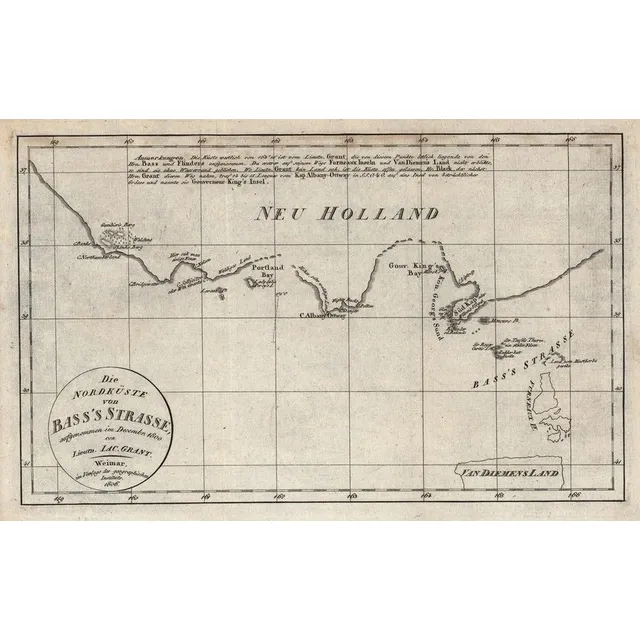
Die Nordkuste von Bass's Strasse, aufgenommen im Decemr. 1800 von Lieutn Jac.Grant' (Weimar, 1806), early map of the coast of Victoria with Portland Bay, 29 x 19 cm.,
Eastern Hemisphere Map, 1776
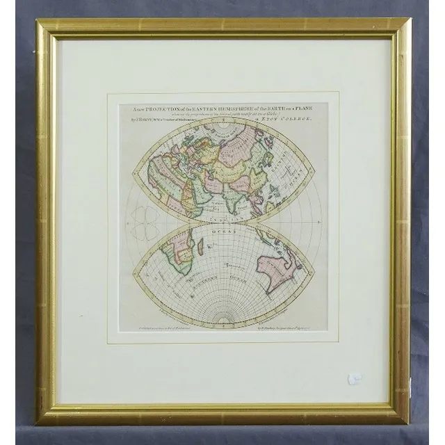
Map, Eastern Hemisphere of the earth on a Plane. By J.Hardy, pub. By Newbery, London 1776. Shows van Diemens Land attached to mainland Australia. Hand coloured copper engraving. 24 x 22 cm
Aerial View of Toledo with Cathedral and Palace, 1598
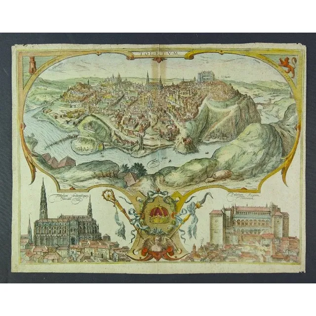
Circa 1598 Braun & Hogenberg map of Toledo. Hand coloured aerial perspective view of Toledo with vignettes of the Cathedral & Palace. Text verso. Fold line, tear & foxing. Coloured copper engraving. 40 x 52 cm
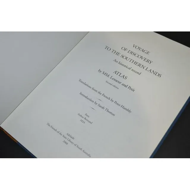
Peron's Atlas (Facsimile Edition)
Facsimile edition - Peron, The Atlas only 1824 (2008) bound in half leather no. 18 of 150
Colonial County Maps of Australia (1848)
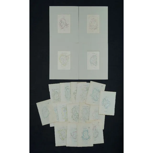
Maps (20), various Colonial County Maps. Octavo sized County/Parish maps as pub. 'A Geographical Dictionary or Gazetteer of the Australian Colonies,' W H Wells, published 1848. Boundaries are hand coloured. Majority are NSW, 23 x 15 (paper size)
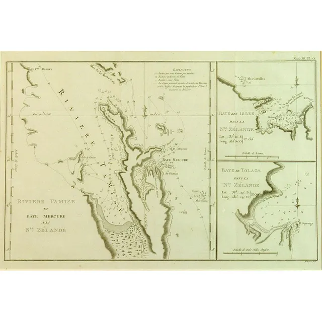
New Zealand Coastal Map with Insets
Copper engraved map of Firth of Thames, Bay of Islands and Tolaga Bay entitled 'riviere Tamise et Baye Mercure a la Nle. Zelande' with insets 'Baye des Isles dans la Nle. Zelande' and 'Baye de Tolaga dans la Nle. Zelande', engraved by Robert Benard. From…
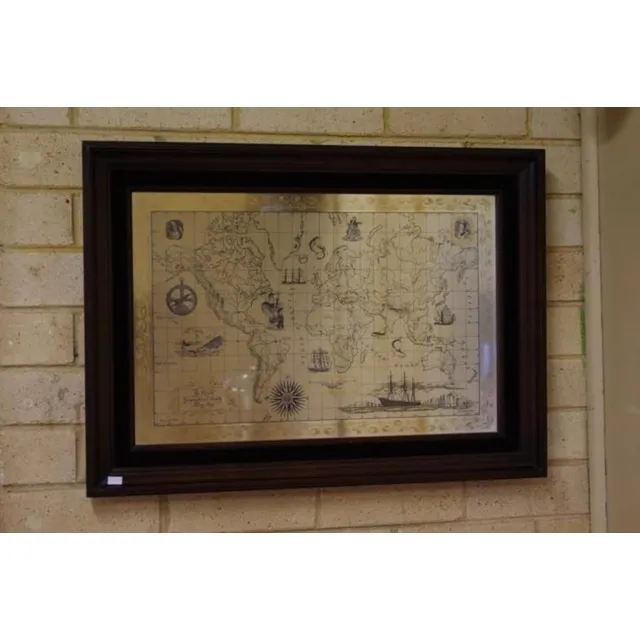
Sterling Silver World Map by RGS (1976)
Royal Geographic Society sterling silver world map circa 1976, marked 925/1000, 51 cm x 70 cm (frame)
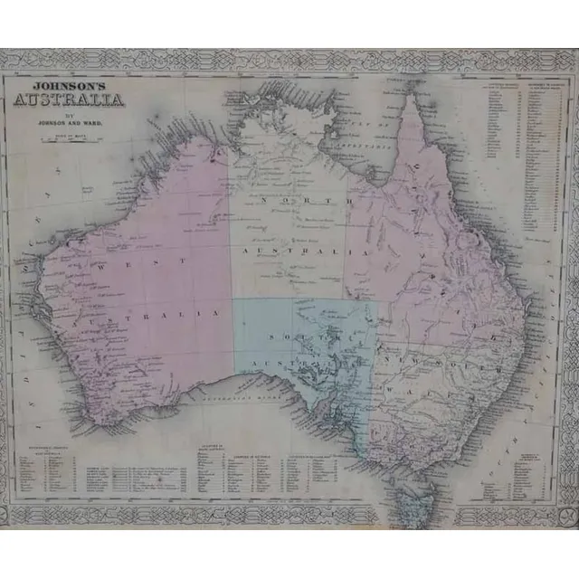
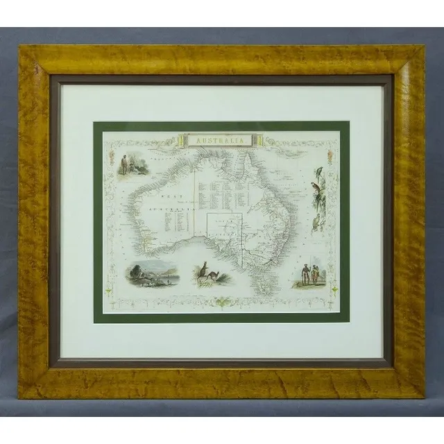
Antique Framed Maps: Australia & World with Cook's Routes
i) A 'Johnson's Australia' framed map, c.1864, by Johnson & Ward hand coloured engraved print. 32 x 40 cm (image); ii) 'The world on Mercator's Projection' framed map Published 1816 London, by C.S. Smith hand coloured engraved print note: showing Capt.…
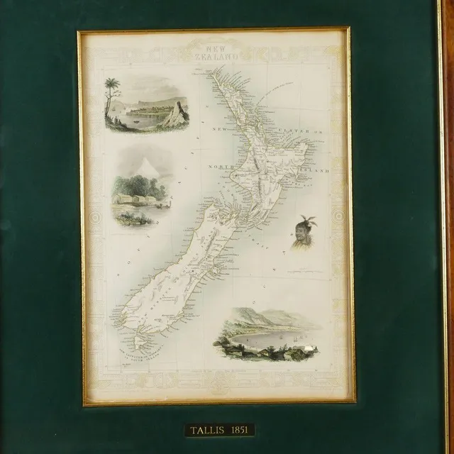
Tallis' Engraved Map of New Zealand (1851)
John Tallis steel engraved map of New Zealand, with hand-coloured outline and vignettes of Auckland, Wellington, Mount Egmont from New Plymouth and a Maori warrior. From 'The Illustrated Atlas and Modern History of the World', pub. London 1851. 26.5 cm x…
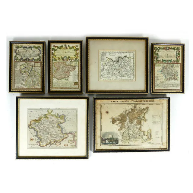
Collection of 6 Antique English County Maps
Six small antique English Counties maps, Worcestershire (3), Essex, Surrey and Cambridgeshire, largest 20 x 29.5 cm.
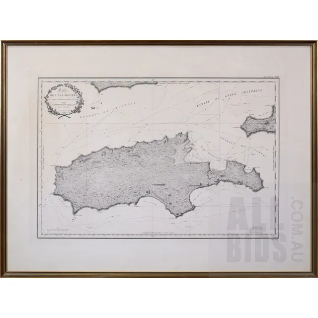
Freycinet's Map of Decres Island, 1812
Louis Claude Desaulses de Freycinet (French 1779-1842) carte de L'Ile Decres (a la Nouvelle Hollande) 1802 and 1803, Published Paris 1812
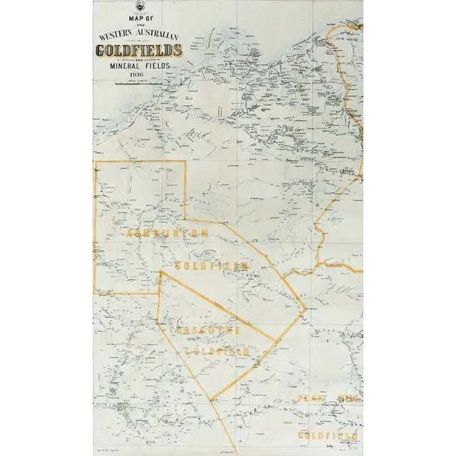
West Australian Goldfields and Mineral Fields Maps (1936-1937)
Two early 20th century West Australian goldfields and mineral fields maps, 1936 and 1937 showing localities of Ashburton, goldfields, Gascoyne, Peak hill, Pilbarra, Nullacine lithograph No.114, sheet No.5 and No.6 one dated 18.1.36, the other, 12.2.37. 96…
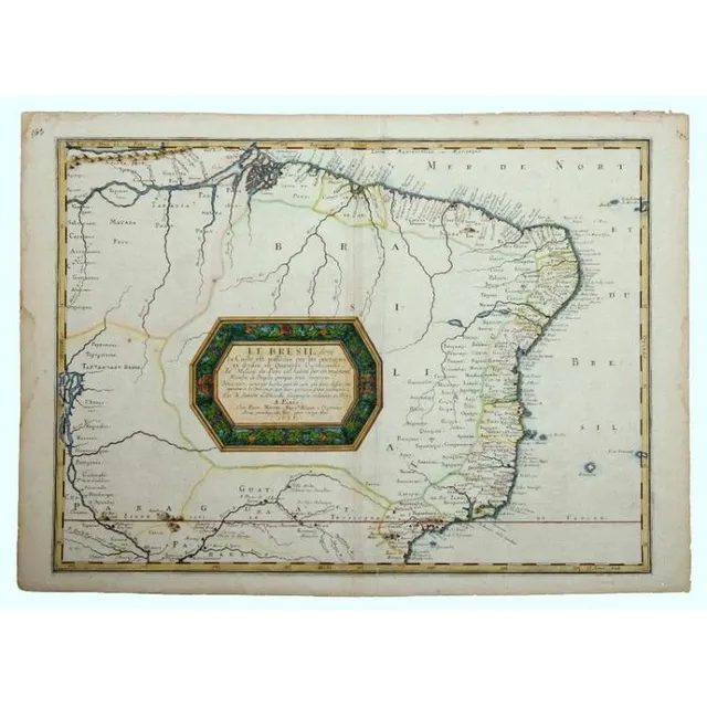
Brazil Map by Nicholas Sanson, 1656
Map, Sanson, Le Bresil, dont la Coste. Brasil from the Amazon to Rio de Janeiro by Nicholas Sanson, pub. Paris, 1656. Later colouring to cartouche. Hand coloured copper engraving, 40 x 55 cm
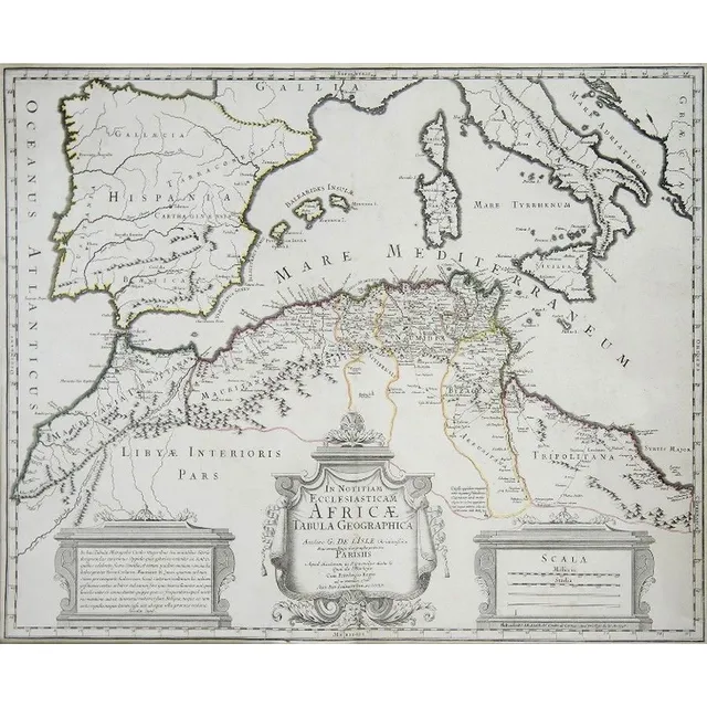
Africa and Mediterranean Map, 1745
Map, in Notitiam Ecclesiasticam Africae. Map of Spain, Eastern Mediterranean and north Africa by Philippe Buache, pub. Paris 1745. Hand coloured copper engraving. 49 x 64 cm
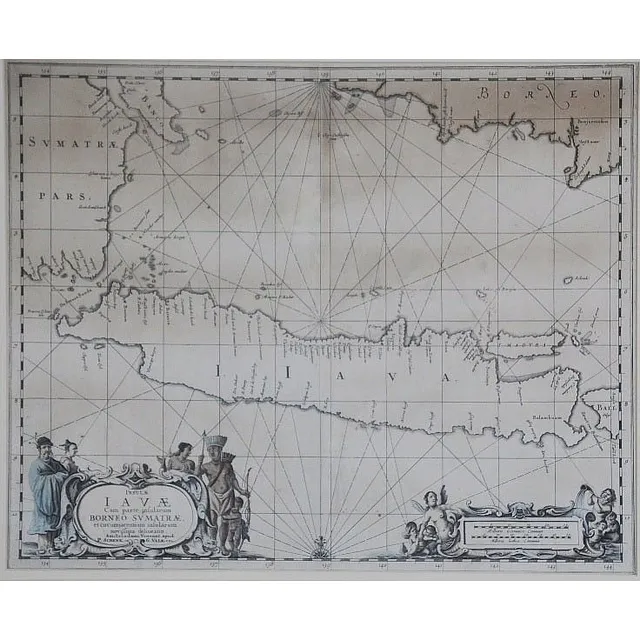
17th Century Map of Java, Borneo & Sumatra
17th century map of Java and part Borneo, Sumatra. 'Insul' Iav' Cum Parte Insularum Borneo Sumatr',' by Schenk and Valk, pub. Amsterdam c.1650. Hand coloured engraving. 40 x 51 cm
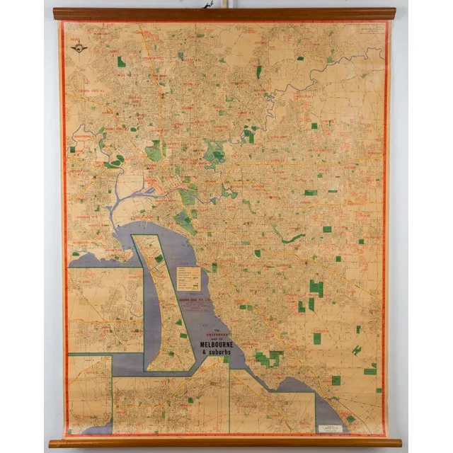
Melbourne Map 1963
'The Universal Map of, Melbourne & suburbs', 1963; mounted on linen with wooden, supports top and bottom, 115 x 86 cm.
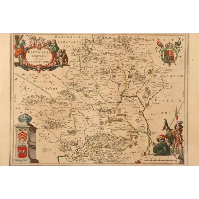
Hertfordshire Map from Blaeu's Atlas Major (1662)
17th century map of Hertfordshire, taken from Blaeu's atlas Major of 1662, copper engraved with hand coloured accents, with Latin text verso, 53 cm x 63 cm (frame)
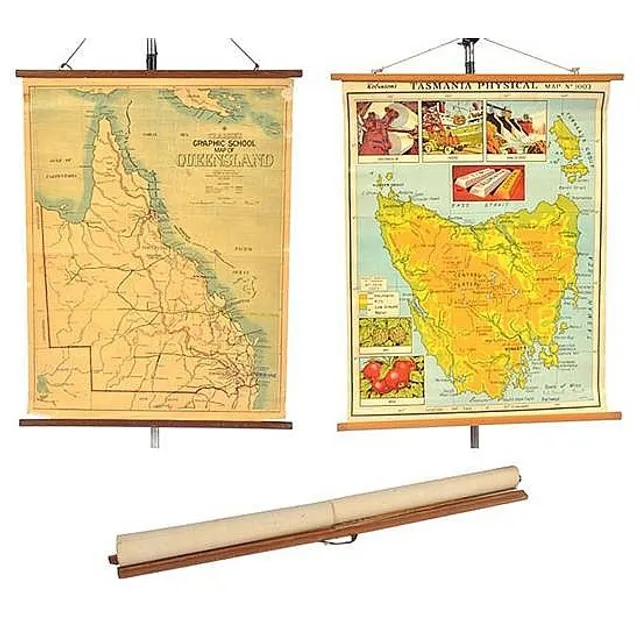
Educational Hanging Maps of Tasmania, Queensland, and Victoria
Three educational hanging maps including robinson's physical map of tasmania; craigie's graphic school map of queensland; and Victoria, largest 99 cm high, 75 cm wide (3)
Centurion's Route Map, France 1787
Carte Dans Laquelle on Voit La Route Que Le centurion a Tenu; Jean Lattre, France, circa 1787; hand coloured copper engraving. 42 cm x 23 cm
Antique Australian Maps Collection: 19th-20th Century
Maps: Group of 10 maps of Australia, late 19th & early 20th century including Van Diemen's Land. Various sizes
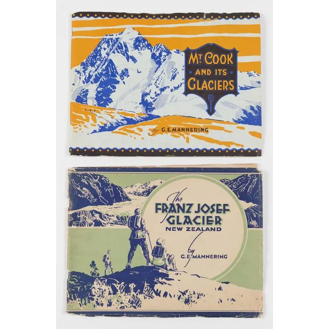
Glaciers of New Zealand by Mannering
(New Zealand) Mannering, George Edward (2 vols.), Mt.Cook and its Surrounding Glaciers (1930) 23 plates, 2 maps, also, The Franz Josef Glacier New Zealand (1931) 23 plates, 1 map. Both with original pictorial paper covers.
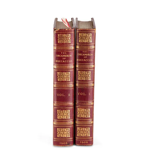
Boccaccio's Decameron with Cary Grant's Bookplate
Boccaccio (Giovanni): 'The Decameron', London 1906, 2 vols, illustrated by Louis Chalon, full morocco gilt, silk endpapers, with the bookplate of Cary Grant
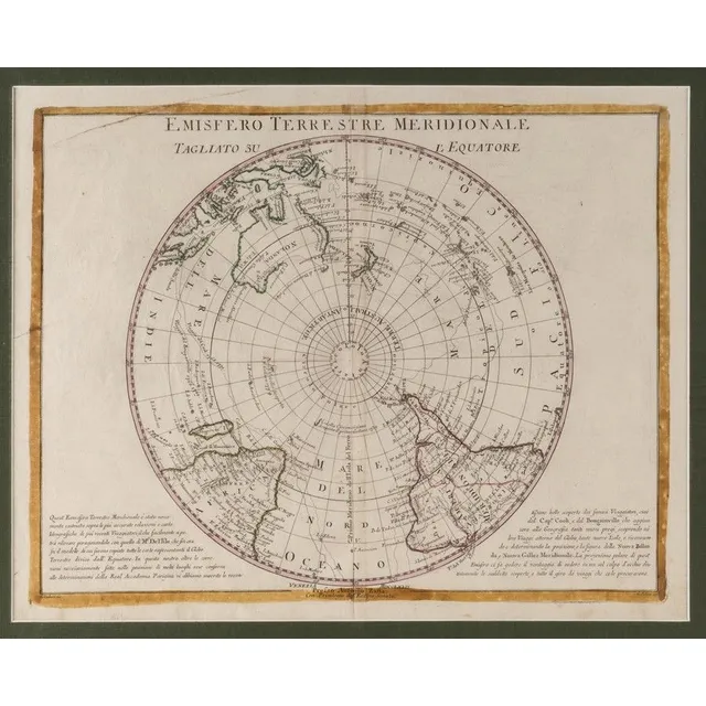
Antarctic Hemisphere and Captain Cook's Route Map
Emisfero Terrestre Meridionale, Tagliato Su L'Equatore', map from Zatta's atlas 'Atlante Novissimo' [Venice, 1779], depicts the Antarctic Hemisphere to the equator and Captain Cook's route on his first voyage. New Zealand and the Australian east coast are…
Map of Southern Australia, 1847-48
Map of South Australia, New South Wales, Van Diemen's Land and Settled parts of Australia' by James Wyld (London, 1847-48), engraved map with hand-colouring, dissected and laid down on linen, with original card slip-case with printed label on front.…
Australian Maps, 1863-80s: NSW, QLD, VIC, WA, SA, NT
AUSTRALIA MAPS, c1863-80s, noted NSW (3), Queensland, Victoria (2), WA, South Australia &Northern Territory, 'The Overland Route to Australia'
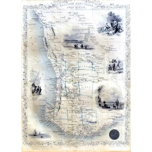
1851 West Australia Map with Illustrations
John Tallis & Co map, c.1851, 'West Australia Swan River', the map is engraved by J. Rapkin, with illustrations, by a H Wray, showing vignettes of sheep shearing, Perth from mount Eliza, Aboriginal natives and three, others, 35 x 25 cm
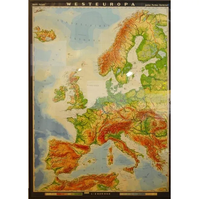
Cold War Europe Map by Justus Perthes Darmstadt
A large German map of cold war Europe, published by Justus Perthes Darmstadt
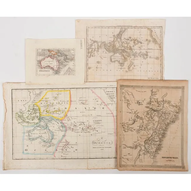
A group of maps comprising of 'Melanesia' (c.1826), 'Oceania di G.L.Dy de Rienzi' (1838), 'L'Oceania' (1846), 'New south Wales' (1841). Various sizes. (4 items).
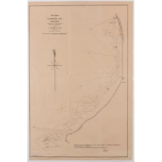
South Australia Coastal Maps: Shipping Routes and Depths
Two maps of South Australia, Lacepede bay, cape Jaffa and the Southern coastline, showing shipping courses and depth, surveyed by P a Nation and G E Demole 1859, 66 x 43.5 cm and 45.5 x 38.5 cm
Engraved Maps of Australia with Vignettes, 1851
John Tallis: 'New South Wales', 'Part of South Australia', 'Van Diemen's Island Or Tasmania' & 'Western Australia, Swan River', engraved maps (4) (London, 1851) with beautiful engraved vignettes (including Aborigines) & hand-coloured outlines, each 27 x…
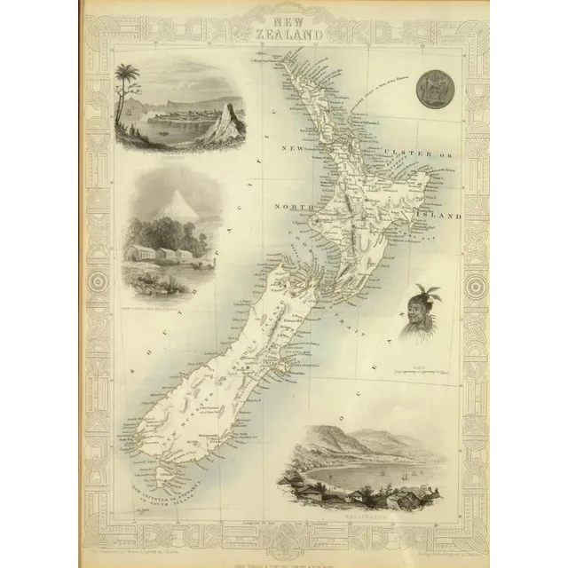
Tallis Map of New Zealand with Decorative Vignettes
A John Tallis map of New Zealand, c.1850s, includes decorative vignettes of Auckland, Wellington and Mt Egmont from New Plymouth, a Maori warrior and seal. Engraved for R. Montgomery Martin's Illustrated Atlas. 26.5 cm x 26 cm, gilt framed under glass
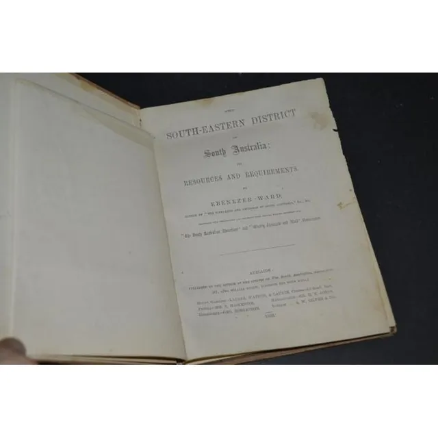
South-Eastern District of South Australia (1869)
Ebenezer Ward 'The South-Eastern District of South Australia' 1869 with 1867 map
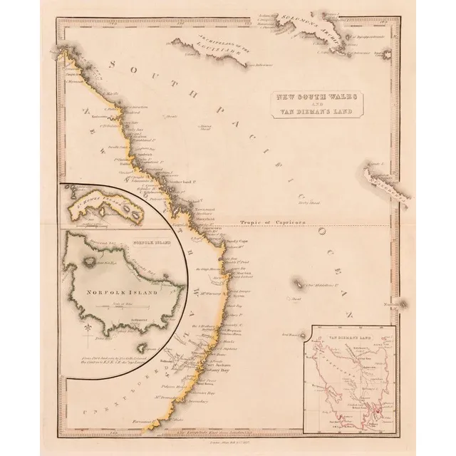
New South Wales and Van Diemen's Land Map
Allan Bell & Co. New South Wales and Van Diemen's Land [London, 1837] hand-coloured copper engraving with inset maps of Norfolk Island, Lord Howe Island, N. Caledonia and the Solomons Archipelago 36 x 30 cm.
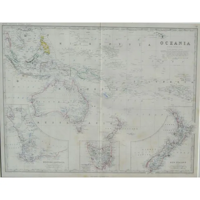
Antique Hand Coloured Maps of Oceania and New Zealand
Australian Interest: two framed hand coloured antique Maps i) Oceania Keith Johnston's General Atlas, London 44 x 57 cm ii) West-Australien & Neu Seeland (New Zealand ) c.1863, Stieler's hand-Atlas 33 x 40.5 cm
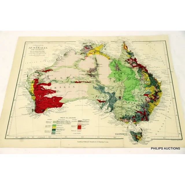
Vintage Maps of Australia: Settlers, Geology, Exploration & Railways
A folio of over fifty maps of Australia, mostly 19th century maps, including maps showing British settlements, coloured geological maps, explorer and rail and proposed rail route maps
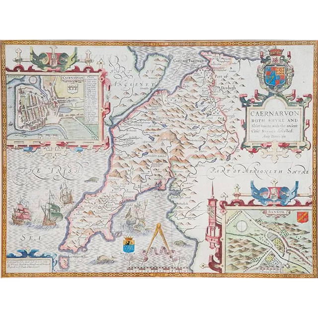
Antique Hand-Coloured Map of Caernarvon-Shire by John Spede
Hand coloured antique map of Caernarvon-Shire by John Spede, 38 x 51 cm
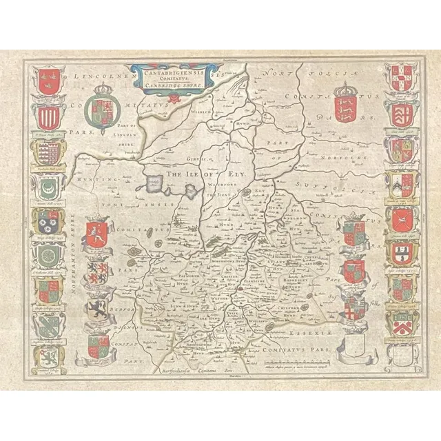
Handcoloured Map of Cambridge shire with College Coats of Arms
Cantabrigiensis Comitatus: Cambridge shire, handcoloured engraved map including Coats of arms of all the Colleges, pub. C.1650, Johannes Blaeu, centre fold, plate: 41.8 x 52.3 cm frame: 54 x 66 cm
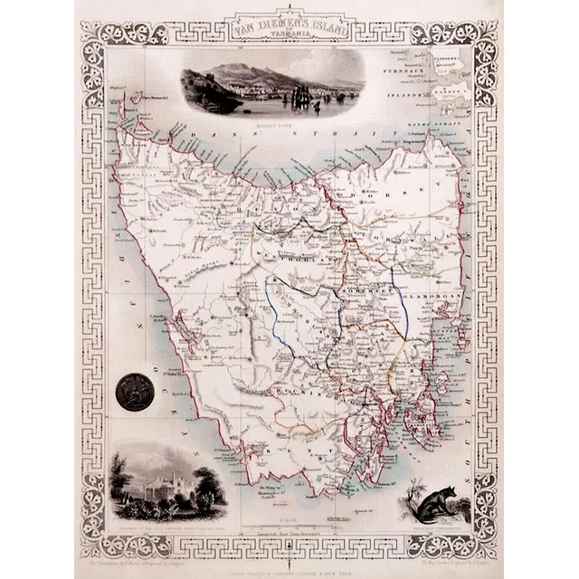
Set of 6 Framed Tallis Maps of Australia (or) Australian Tallis Map Collection
Set of 6 x original Tallis maps Published London, c.1855 all, good condition, framed with original colour outlining. Good historical maps all with pictorial vignettes. Australia, Western Australia, Tasmania, Victoria, South Australia and New South Wales.…
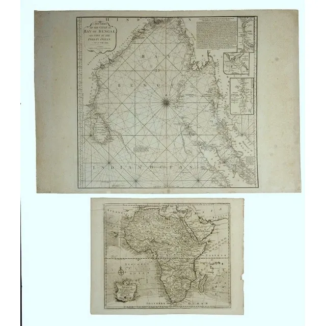
Africa & Bay of Bengal Maps
Maps 2, Africa & Bay of Bengal. A new & correct map of Africa, by Emanuel Bowen, pub. London 1744; & a new Chart of the Gulf or Bay of Bengal, by Laurie & Whittle, pub. London, 1797. Copper engraving, 38 x 46 cm & 62 x 66 cm
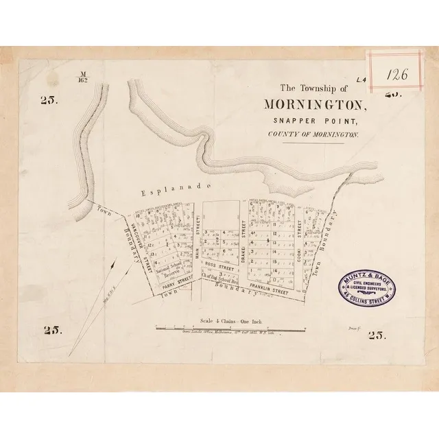
Mornington & Cranbourne Maps (1875-90)
MORNINGTON &CRANBOURNE MAPS: c1875-90 maps, 'The Township of Mornington, Snapper Point', 'Plan of Subdivision of Sections 22 &23 Snapper Point Division', 'Towns of Cranbourne, Parish of Cranbourne, County of Mornington'. Various sizes. Poor/G condition
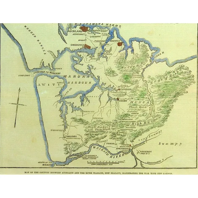
New Zealand Wars: Illustrated Map (1862)
A hand coloured map of the New Zealand Wars, from the 1862 publication of the Illustrated London News
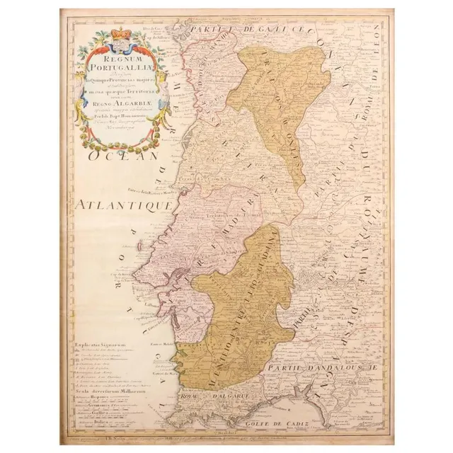
Portuguese Maps Collection
Three Maps. 'Regnum Portugallia', 'Portugal', 'Portugalia Et. Algarve'. By Johannes Baptist Homann, and. Height Moll 1727, and unknown. All hand coloured. 62 x 48 cm, 27 x 20 cm. 19 x 26 cm. Posters
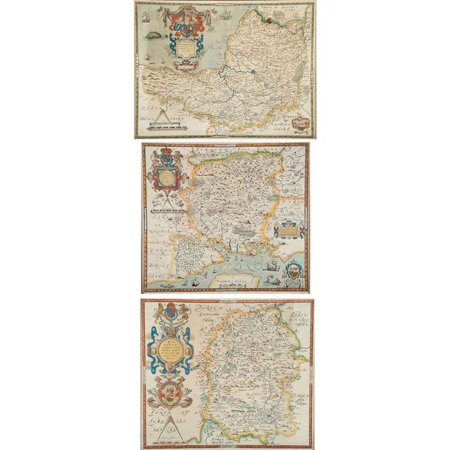
Antique Hand Coloured Maps of Somerset, Southampton, and Wiltshire
Three antique hand coloured maps after Saxton, Somerset 41 x 53 cm, south Hampton 41 x 45 cm, Wiltshire 44 x 49 cm
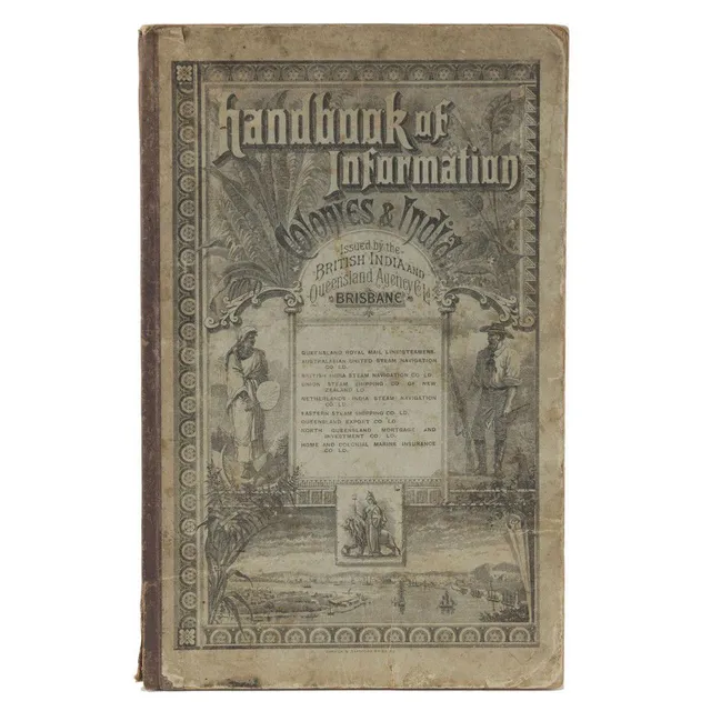
Colonial Handbook 1888
Handbook Of Information for The Colonies And India, Issued By The British India & Queensland Agency Co. Ltd. [Published by Warwick & Sapsford, Printers, Brisbane, 1888], 112pp + 46pp of advertisements, maps, plates and numerous, illustrations in the text.…
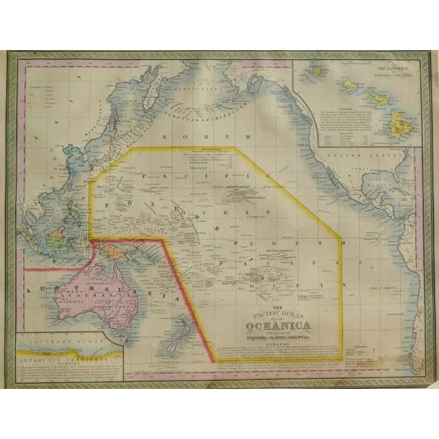
Antique Hand Coloured Maps of Pacific and Australia-Oceanica
Australian Interest: two framed hand coloured antique Maps i) the Pacific Ocean, including Oceanica Entered 1850 by Thomas Cowperthwait & Co, USA 32 x 40 cm (image) ii) Johnson's china, East Indies, Australia and Oceanica, circa - mid 19th century, by…