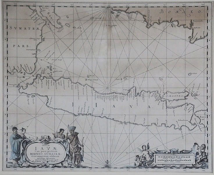
17th Century Map of Java, Borneo & Sumatra
You must be a subscriber, and be logged in to view price and dealer details.
Subscribe Now to view actual auction price for this item
When you subscribe, you have the option of setting the currency in which to display prices to $Au, $US, $NZ or Stg.
This item has been included into following indexes:
- maps - general 445
Visually similar items
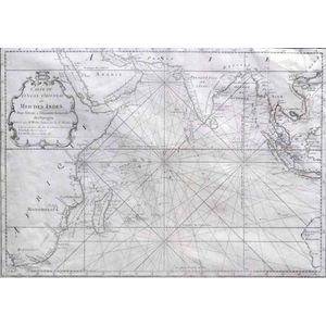
MAP - Bellin, Jacques Nicolas. Carte de L'Ocean Oriental ou Mer Des Indes, Paris, Didot, 1750. Engraved map, covers the entire Indian Ocean. Eastern coast of Africa and Madagascar depicted along with southern Arabia and India. Indonesian Islands and south-

Henri Van Raalte (1881-1929), Calm Morning, etching 14/25, 20 x 22 cm

Harold Brocklebank Herbert (1892-1945): etching 'An Old Gumtree' 24/50 (framed) 12 cm x 15 cm; plus two George Colville unframed etchings 'Xmas 1941' and 'The Little Dock' c1941. (3 items)

Italian 18th century map of the South Sea titled 'Mare Del Sud' by Antonio Zatta [Venice 1776]. 42 x 32 cm