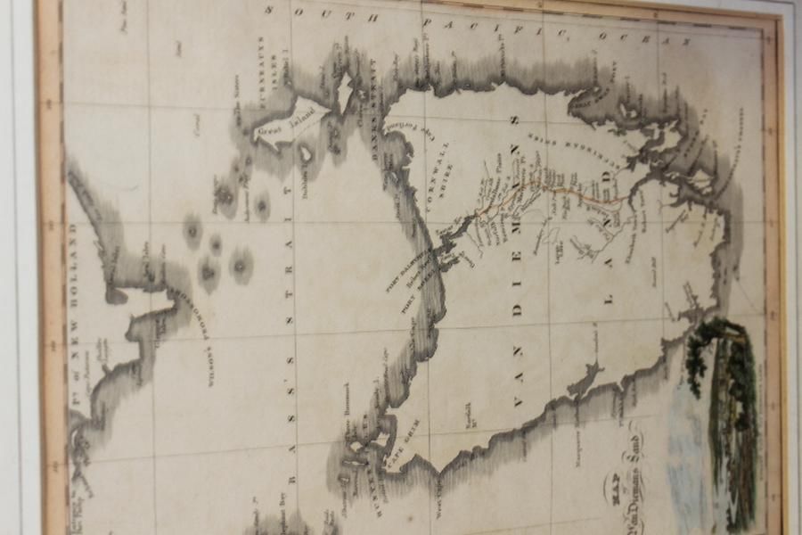
Coloured Map of Van Diemans Land
You must be a subscriber, and be logged in to view price and dealer details.
Subscribe Now to view actual auction price for this item
When you subscribe, you have the option of setting the currency in which to display prices to $Au, $US, $NZ or Stg.
This item has been included into following indexes:
- maps - general 445
Visually similar items

Italian 18th century map of the South Sea titled 'Mare Del Sud' by Antonio Zatta [Venice 1776]. 42 x 32 cm

Thomes Bowen (?-1790) A new and Accurate map of Asia, drawn from the most modern Maps and Charts, 1799 Handcoloured & engraved, for Middletons complete System of Geography 32.5 x 42.5 cm

Louis Kahan: Shearing the Lambs 1982 etching, signed dated and editioned to margin, 40 x 29 cm

Framed hand coloured Chart, the Track of the Centurion round the world. Engraver Rw Seale