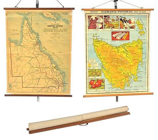
Educational Hanging Maps of Tasmania, Queensland, and Victoria
You must be a subscriber, and be logged in to view price and dealer details.
Subscribe Now to view actual auction price for this item
When you subscribe, you have the option of setting the currency in which to display prices to $Au, $US, $NZ or Stg.
This item has been included into following indexes:
- maps - general 445
Visually similar items

Victoria: 'E.L. Robinson's New Pocket Map of Victoria' (Robinson, Melbourne, 1862) engraved by W.Palmer. Linen-backed folding map contained in a pocket-book sized gilt-lettered cloth folder with ties. Affixed to the inside front cover is a list of the numb

A rectangular porcelain tile, a Mandarin dressed in Ming attire keeping cool in the garden with an attendant and children, Qing Dynasty 25 x 41 cm

A tube sarong batik, Cirebon, North coast of Java, early 20th century with floral borders and ship motifs and fanciful sea creatures in centre fields, 104 cm x 202 cm. Provenance: NSW Private Collection

Set of six 20th century maps of sheep stations