17th Century Hand-Coloured Map of Great Britain by Blaeu
click the photo to enlarge
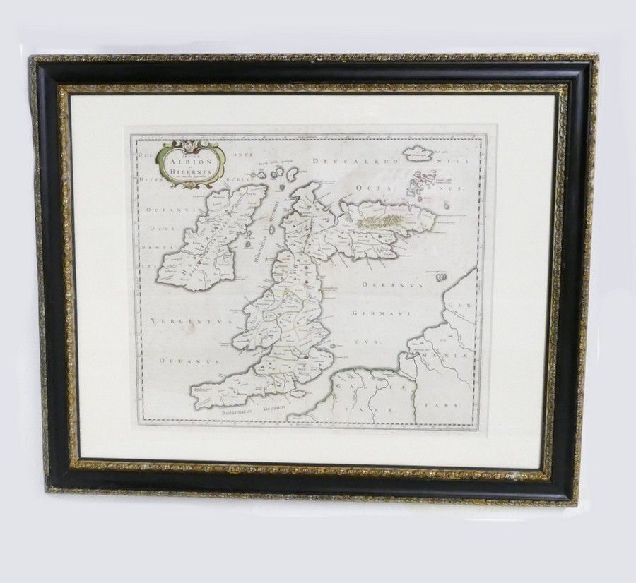
17th century hand coloured map of Great Britain, A c.1654 map of the British Isles entitled 'Insulae Albion et Hibernia cum Minoribus Adjacentibus' by Johanes Blaeu. Original outline colouring. Dutch. 47.5 cm x 60 cm
You must be a subscriber, and be logged in to view price and dealer details.
Subscribe Now to view actual auction price for this item
When you subscribe, you have the option of setting the currency in which to display prices to $Au, $US, $NZ or Stg.
This item has been sold, and the description, image and price are for reference purposes only.
This item has been included into following indexes: