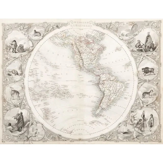
Tallis' Illustrated Atlas with 78 Engraved Maps
World: John Tallis: 'Wrights Universal Dictionary - Atlas' [London, c1852-56], with 78 double-page maps by Tallis with decorative borders & vignette illustrations, engraved maps with original hand-coloured outlines, each c27 x 35 cm, occasional slight…
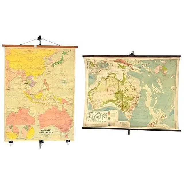
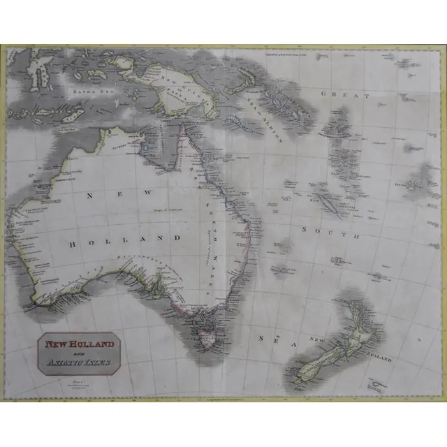
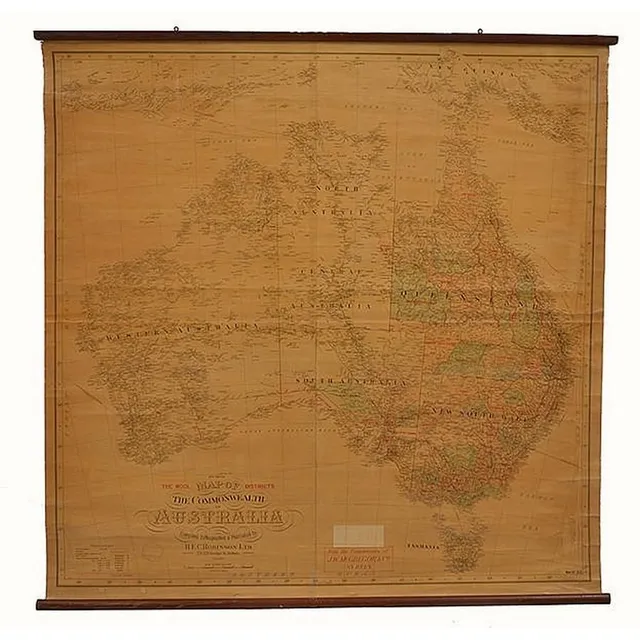
Educational Hanging Maps: Australia & SE Asia, Australia & NZ
Two educational hanging maps including Australia and South-East asia; and Australia and New Zealand, largest 115 cm high, 88 cm wide (2)
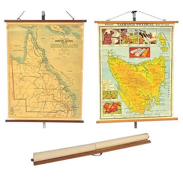
Educational Hanging Maps of Tasmania, Queensland, and Victoria
Three educational hanging maps including robinson's physical map of tasmania; craigie's graphic school map of queensland; and Victoria, largest 99 cm high, 75 cm wide (3)
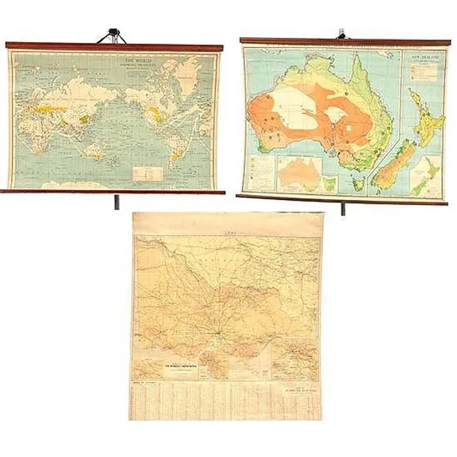
Educational Hanging Maps Set
Three educational hanging maps including Robinson map of the world showing products; and Johnston's map of Australia, and one other largest 87 cm high, 110 cm wide (3)
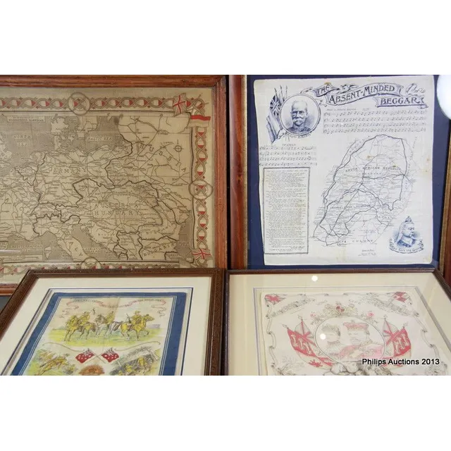
Historical Fabric Pieces Framed
A group of four printed fabric pieces of historical Interest, a Boer war-related handkerchief printed with Kipling's 'The Absent-Minded Beggar', music for it by Sullivan, a map of part of South Africa, and images of Lord Roberts and Queen Victoria; a…
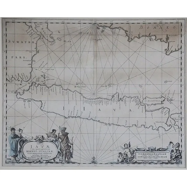
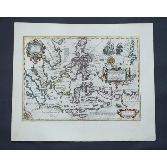
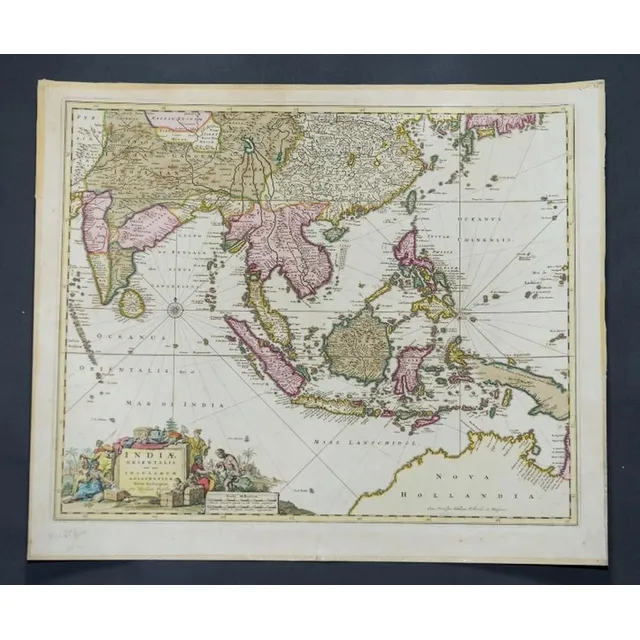
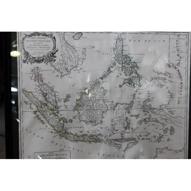
17th Century Map of Java, Borneo & Sumatra
17th century map of Java and part Borneo, Sumatra. 'Insul' Iav' Cum Parte Insularum Borneo Sumatr',' by Schenk and Valk, pub. Amsterdam c.1650. Hand coloured engraving. 40 x 51 cm
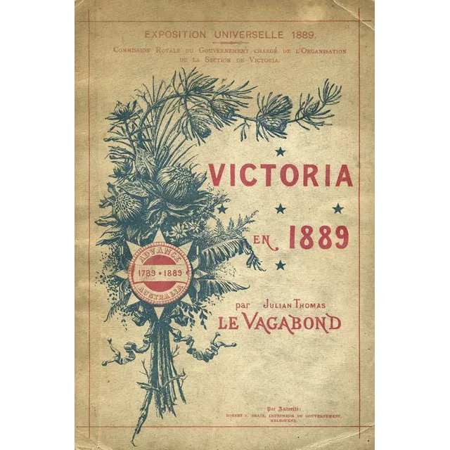
'Victoria 1889: Illustrated Guide for Exposition Universelle'
'Victoria en 1889' by Julian Thomas 'Le Vagabond' [French edition, Melbourne, 1889], illustrated with 24 plates and a folding map, 55pp. Published for distribution at the Exposition Universelle, 1889
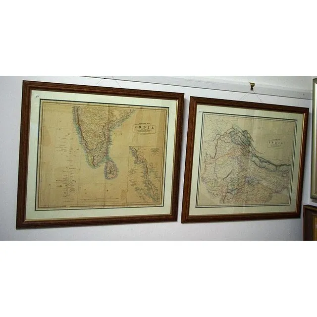
Engraved Maps of Australia with Vignettes, 1851
John Tallis: 'New South Wales', 'Part of South Australia', 'Van Diemen's Island Or Tasmania' & 'Western Australia, Swan River', engraved maps (4) (London, 1851) with beautiful engraved vignettes (including Aborigines) & hand-coloured outlines, each 27 x…
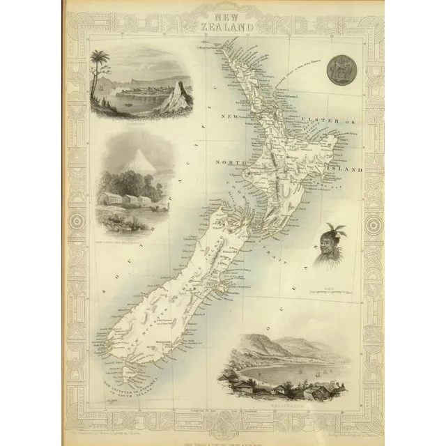
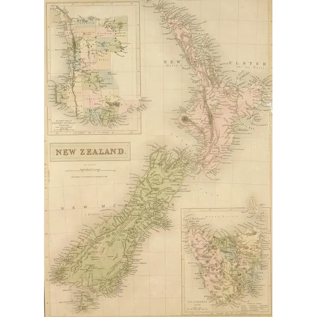
Tallis Map of New Zealand with Decorative Vignettes
A John Tallis map of New Zealand, c.1850s, includes decorative vignettes of Auckland, Wellington and Mt Egmont from New Plymouth, a Maori warrior and seal. Engraved for R. Montgomery Martin's Illustrated Atlas. 26.5 cm x 26 cm, gilt framed under glass
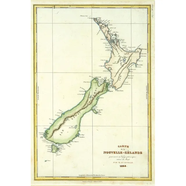
1835 Map of New Zealand by Ambroise Tardieu
An 1835 map of New Zealand, 'Carte de la Nouvelle - Zelande', engraved by Ambroise Tardieu, from d'Urville's Atlas. Errors by Cook, now updated. Dumont d'Urville was second in Command of Duperrey's Expedition of 1824 and later led his own expedition to…
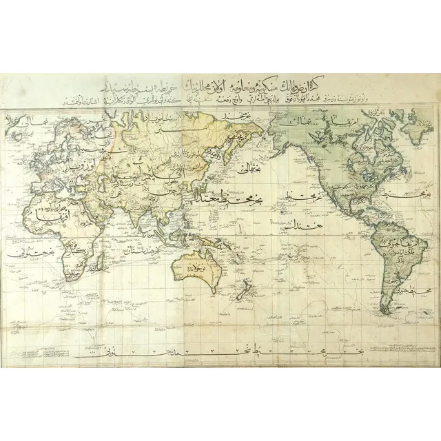
Rare Ottoman Hand-Coloured World Map from 1803
A very rare ottoman hand-coloured world map from the 'Cedid Atlas' (Atlas-i Cedid), the first published atlas in the Muslim world, printed and published in Istanbul, 1803. Based on late 18th century European world maps it details Cook's three voyages of…
Hand-coloured map of 19th century New Zealand
A 19th century hand coloured steel engraved map of New Zealand by W. Hughes, published Edinburgh by A. & C. Black, unframed. 40 cm x 28 cm
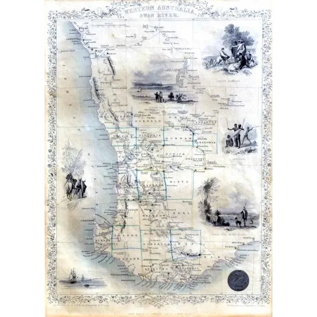
1851 West Australia Map with Illustrations
John Tallis & Co map, c.1851, 'West Australia Swan River', the map is engraved by J. Rapkin, with illustrations, by a H Wray, showing vignettes of sheep shearing, Perth from mount Eliza, Aboriginal natives and three, others, 35 x 25 cm
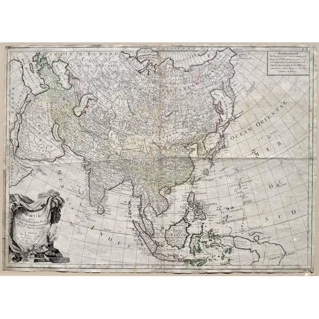
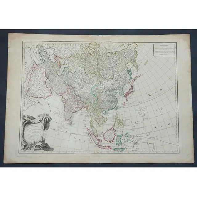
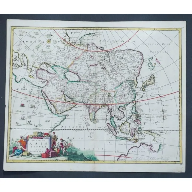
Map of Central Asia with New Guinea (1784)
MAP - Santini, Francois. L'Asie divisee en ses, principaux Etats, assujette aux observations, astronomiq. Venice, M. Remondini, c.1784, engraved map, depicting central divisions of Asia; from the Mediterranean to Japan and south to the East Indies.…
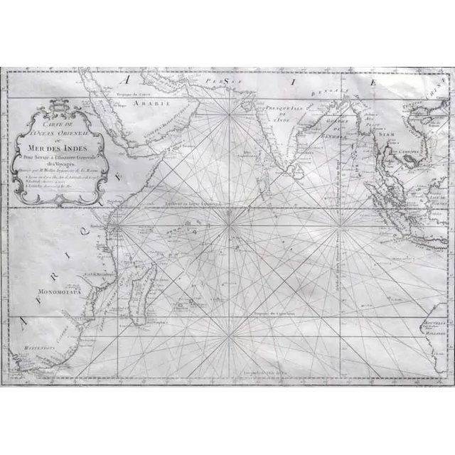
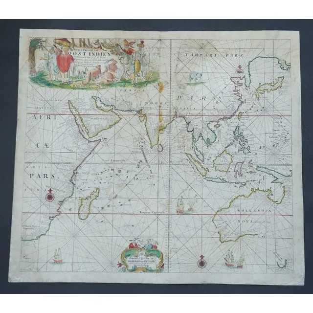
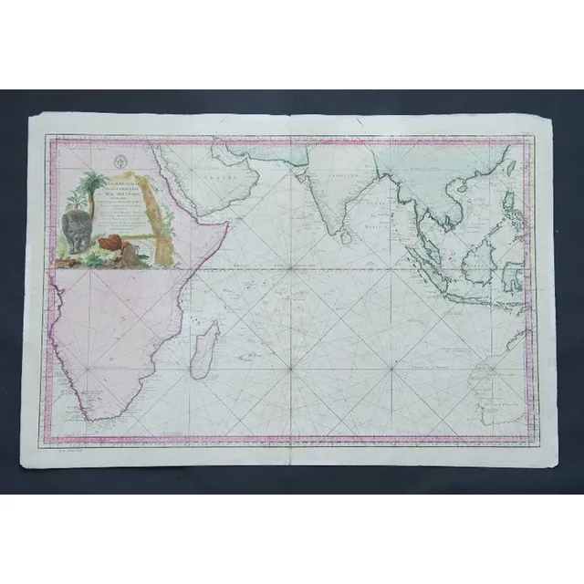
Carte de L'Ocean Oriental (Map of Eastern Ocean)
MAP - Bellin, Jacques Nicolas. Carte de L'Ocean Oriental ou Mer Des Indes, Paris, Didot, 1750. Engraved map, covers the entire Indian Ocean. Eastern coast of Africa and Madagascar depicted along with southern Arabia and India. Indonesian Islands and…
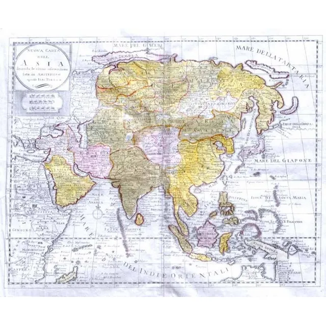
1740 Map of Asia, Indonesia, Australia, and Africa
MAP - Tirion, Isaak. Nouva Carta dell Asia Venice, Giovanni Albrizzi, 1740 engraved map, hand coloured outline and original wash, watermarked paper. Covers mainland Asia and Indonesian islands, also features East African coast and Arabia. Small aspects of…
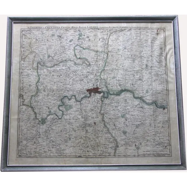
London Environs Antique Map
Antique map of environs. Twenty miles around London drawn from accurate surveys by Thomas Kitchin. Published by R & I Godsley. Circa 1756. 53 x 60 cm
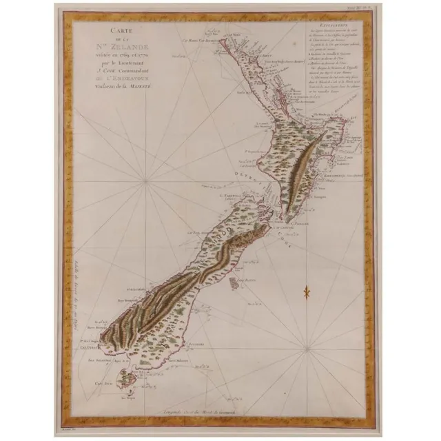
1769 New Zealand Map by Lieutenant J. Cook
'Carte De La Nouvelle Zelande Vifite'e En 1769'. By Lieutenant J Cook, Commander of the Endeavour 1770. Hand coloured. 49 x 39.5 cm
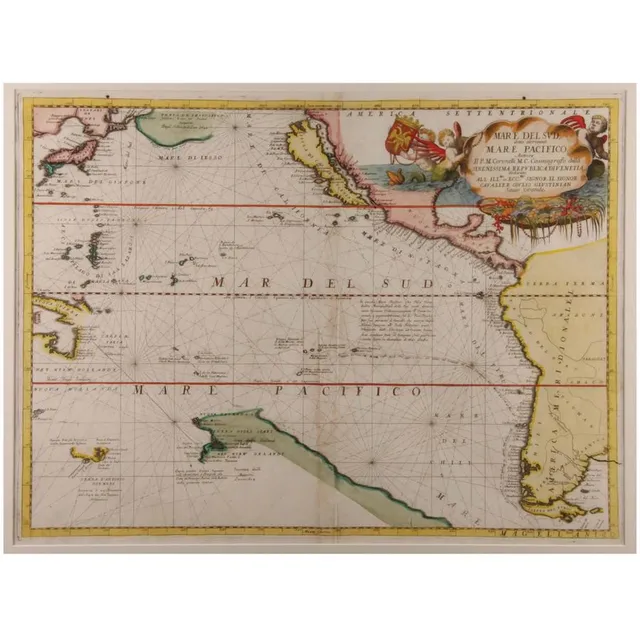
"Mare Del Sud" Map by Vincenzo Coronelli
'Mare Del Sud Detto Altrimenti Mare Pacifico'. By Vicenzo Coronelli. Hand coloured. 45 x 65 cm
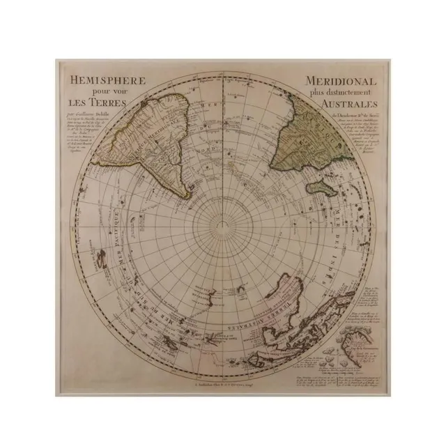
Hemisphere Terres
'Hemisphere Pour Voir Les Terres'. By Guillaume Delifle 1739. Hand coloured. 48 x 48 cm
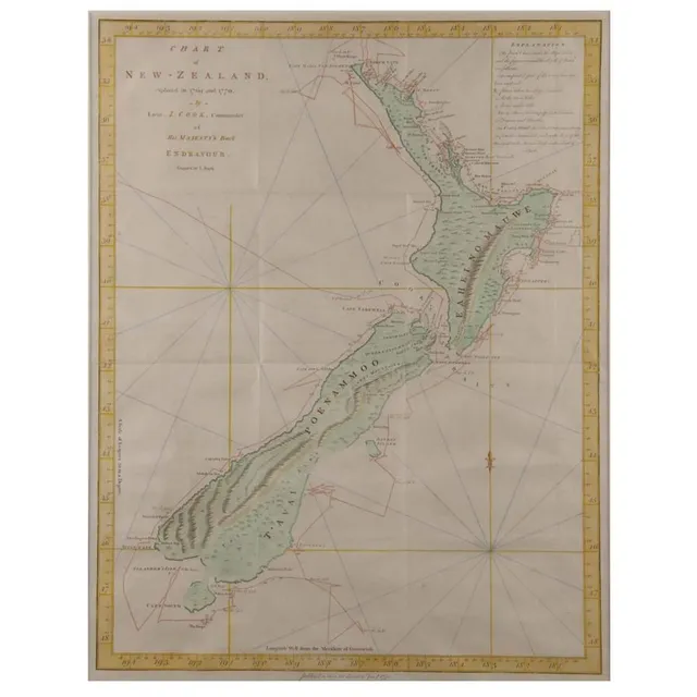
Cook's 1770 Chart of New Zealand
'Chart of New Zealand Explored in 1769 and 1770'. By Lieutenant J Cook, Commander of Her Majesty's barque Endeavour. Hand coloured. 50 x 38 cm
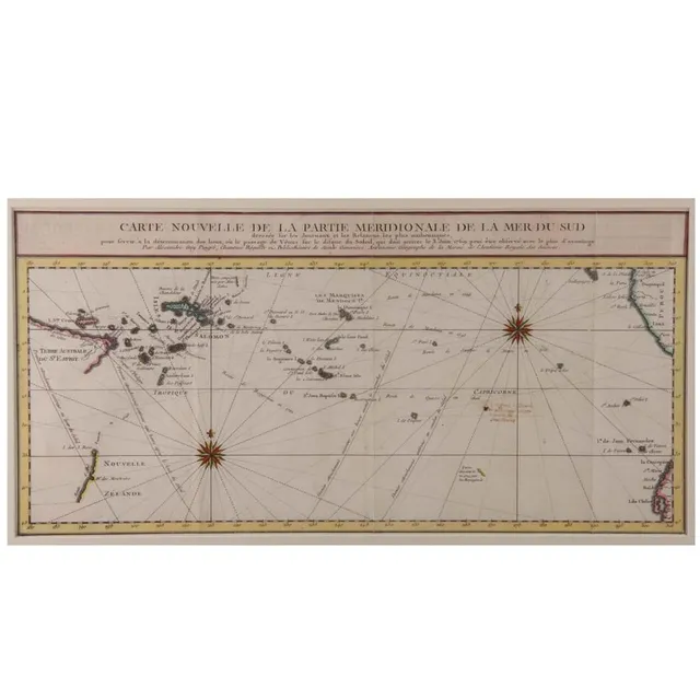
Southern Pacific Ocean Map
'Carte Nouvelle De La Partie Meridionale De La Mer Du Sud'. By Aleaxandre Guy Pingre. Hand coloured. 23 x 48 cm
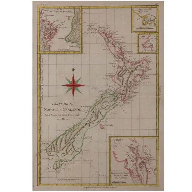
New Zealand Map by M. Bonne (Hand-Coloured)
'Carte De La Nouvelle Zeelande'. By M. Bonne. Hand coloured. 37 x 25 cm
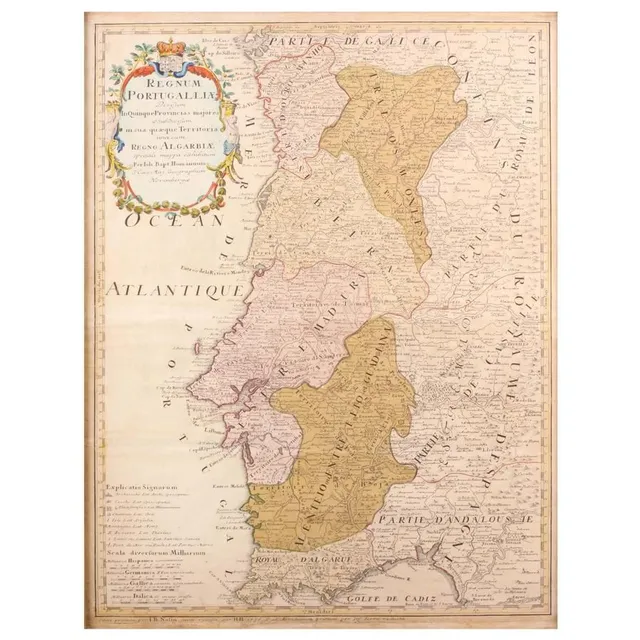
Portuguese Maps Collection
Three Maps. 'Regnum Portugallia', 'Portugal', 'Portugalia Et. Algarve'. By Johannes Baptist Homann, and. Height Moll 1727, and unknown. All hand coloured. 62 x 48 cm, 27 x 20 cm. 19 x 26 cm. Posters
17th Century Jansson Map: Mar del zvr Hispanis Mare Pacificum
Rare antique 17th century map by Jansson, Jan, 1588-1664 - titled Mar del zvr Hispanis Mare Pacificum, approx 46 cm x 56 cm
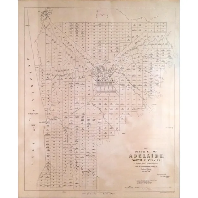
Adelaide District Map, 1840
Map of the District of Adelaide, South Australia, published by John Arrowsmith, 1840, lithograph, 65 x 55 cm
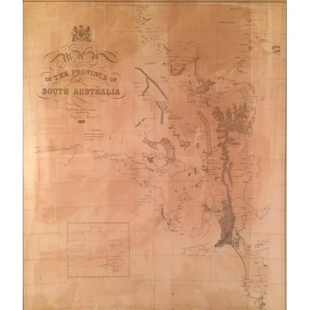
1862 Map of South Australia
Map of the Province of South Australia 1862, printed by R. K. Burt London, lithograph, 76 x 66 cm
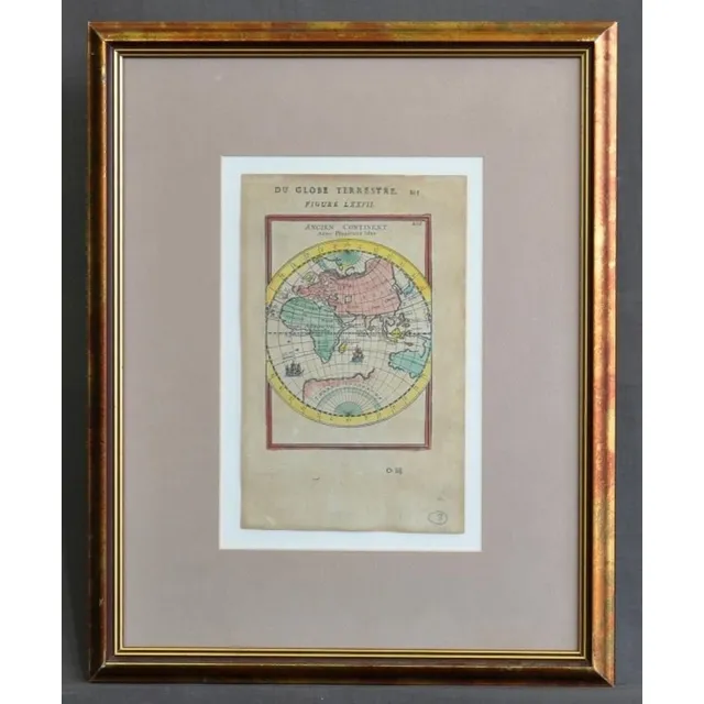
Ancien Continent Map
Map, 'Ancien Continent.' plate 77 from mallet's 'Du globe Terrestre,' Paris, 1863. 22 x 13 cm (page)
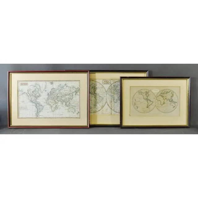
Early World Maps (Three Examples)
Three early world maps, Kelly, Thomas, (2) 'The world with the Tracts & Discoveries of the Latest Navigators,' pub. C.1820; 'The world on Mercator's pair of ojection,' pub. 1824; & 'World from the Best Authorities,' pub. T.Tegg, London 1814. 23 x 42 cm,…
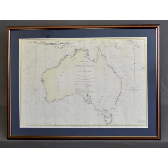
Flinders' 1814 Map of Terra Australis Reprint
Map, 'General Chart of Terra Australis.' official reprint of 1814 map charted by Matthew Flinders of the Investigator. Pair of int. 60 x 87 cm
Australian Maps: 19th & 20th Century Collection
Maps: Group of 10 maps of Australia, 19th & 20th century. Various sizes.
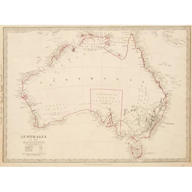
Evolution of Australian Maps: 1839-20th Century
Maps: Group of 8 maps of Australia including c1839 showing the Colony of South Australia. 19th & 20th century. Varying sizes
Antique Australian Maps Collection: 19th-20th Century
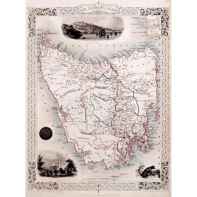
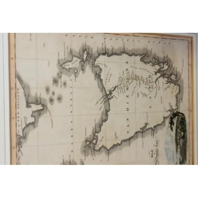
Maps: Group of 10 maps of Australia, late 19th & early 20th century including Van Diemen's Land. Various sizes
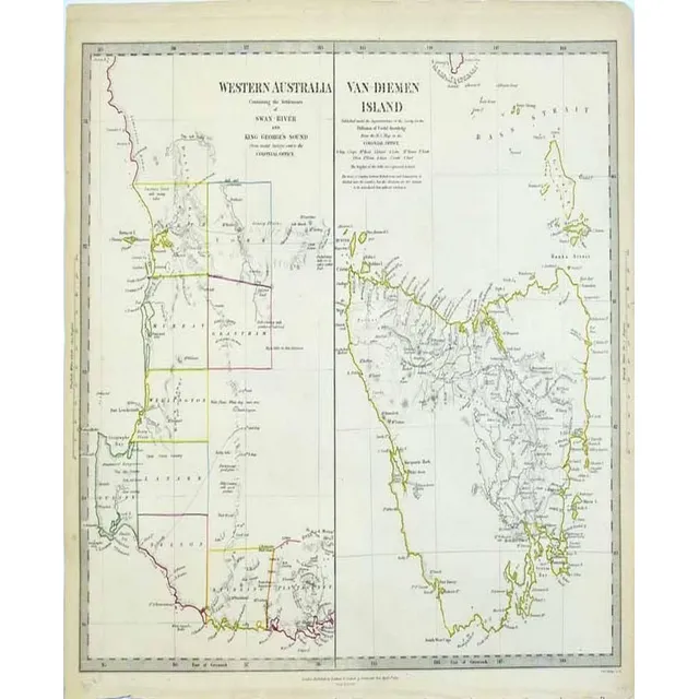
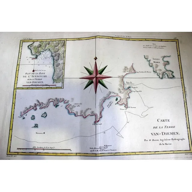
Western Australia and Van-Diemen's Island Map
Map: Western Australia and van-Diemen's Island a map of Western Australia containing the settlements of swan river and King George sound from recent surveys sent to the Colonial office. The other section of the map depicting van-Diemen Island, published…
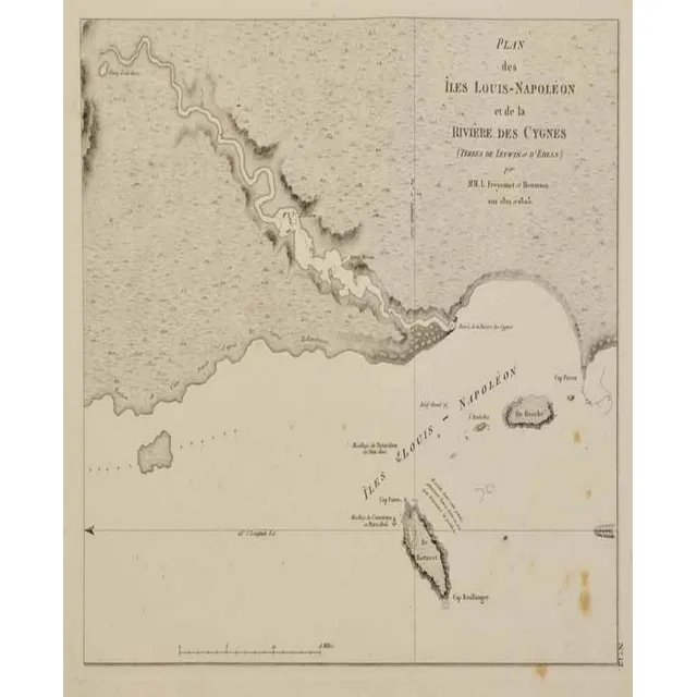
Map of Iles Louis-Napoleon and Swan River, 1807
Map: plan des Iles Louis-Napoleon et de la riviere. Des Cygnes (swan river) Freycinet, Louis Claude. Published Paris 1807 / 1811. Charting undertaken on the W.A. Coast 1801 - 1803. 16.8 x 21 cm
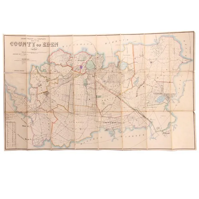
Hand-Coloured Map of Eden Auckland, c. 1880
A hand coloured map of the 'County of Eden Auckland', c. 1880, by Champtaloup and Cooper. Some hand notation to side. 53 x 87 cm
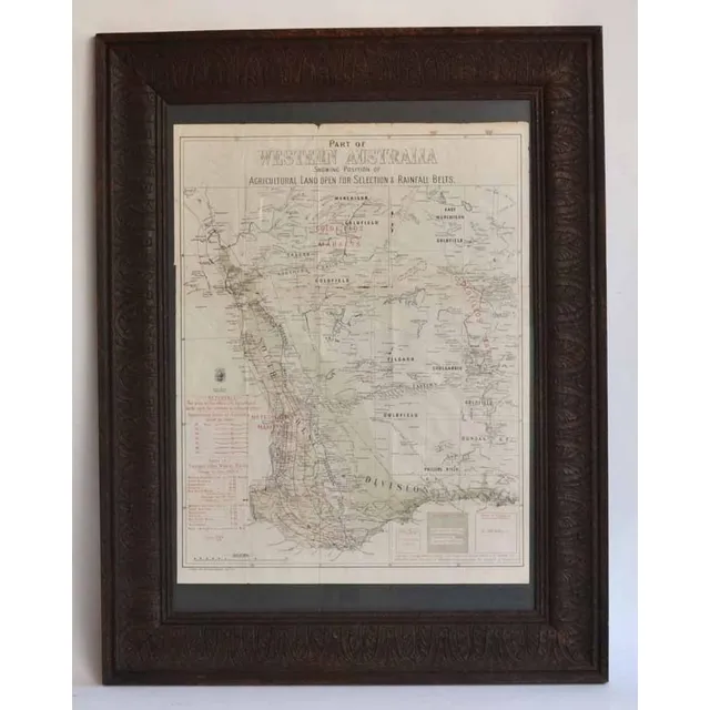
Western Australia Agricultural Land and Rainfall Map
A lithograph map of Western Australia c.1903 - 04 showing Position of Agricultural Land open for selection & Rainfall Belts. Pether, Governmen Lithographer Perth W.A. 63 x 48.5 cm (poster image size)
Early Australian and World Maps (8)
Maps, two early Maps of Australia. A chart exhibiting recent discoveries from Cook?s Voyages torn at top, together with map of new Holland and Asia, together with 6 other maps Scotland, china etc c.1800. Maps (8). 32 x 27 cm (average)
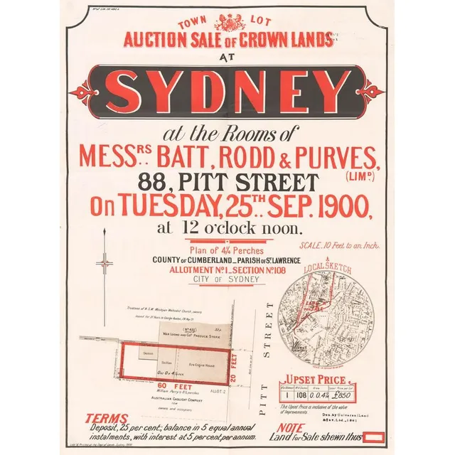
Sydney Crown Lands Auction: Town Lot Sale (9 words)
'Town Lot Auction Sale of Crown Lands at Sydney' lithograph real estate advertising with locality map, circa 1900. Litho'd & Printed at the Dept. of Lands Sydney. 47 x 63 cm
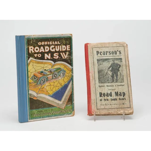
Road Maps of New South Wales (1905-1920)
Pearson's Cyclist's and Traveller's District road map of New South Wales c1905 and an Official Road Guide to New South Wales c1920 (Australian Guide Book Company). (2)
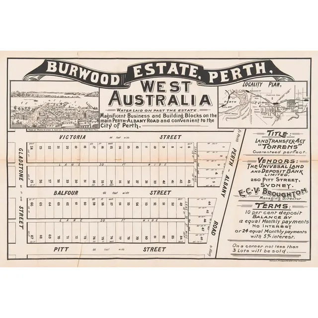
Perth Real Estate Lithograph Advertising (2 items)
'Burwood Estate, Perth' & 'Albert Park Estate, Perth' lithograph broadside real estate advertising both with locality map & one with engraved view, printed by Websdale, Shoosmith & Co Litho, Sydney. Some rips along the folds & the bottom margin. Early…
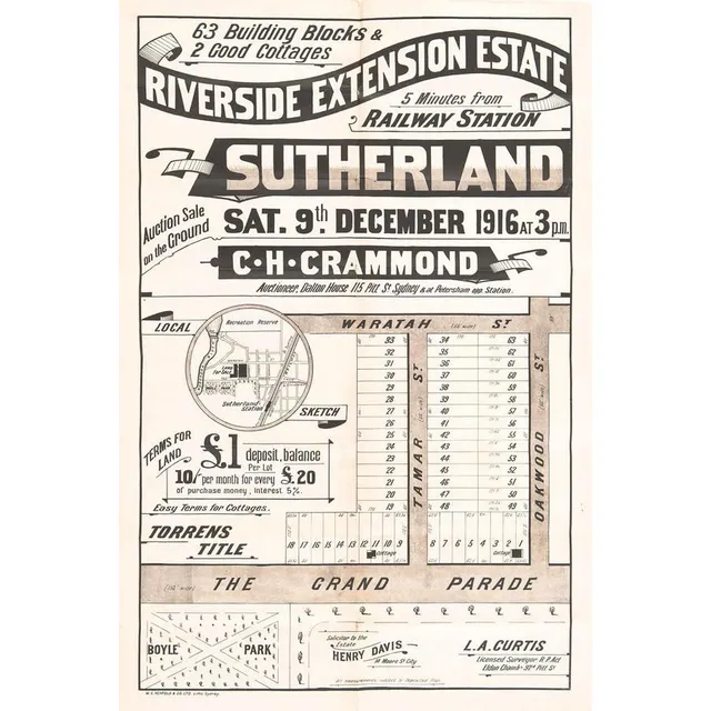
Riverside Estate Lithograph Advertisement, circa 1916
'Riverside Extension Estate, Sutherland, Sydney' lithograph real estate advertising with locality map, circa 1916. Printed by W.C.Penfold & Co Ltd. Litho. Sydney. 51 x 74 cm
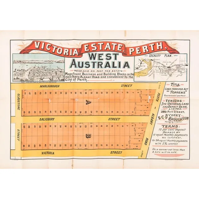
Victoria Estate Lithograph Advertisement
'Victoria Estate, Perth, West Australia' lithograph real estate advertising with lithograph view & locality map, printed by Websdale, Shoosmith & Co Litho, Sydney. Multiple rips particularly to the folds. 78 x 57 cm
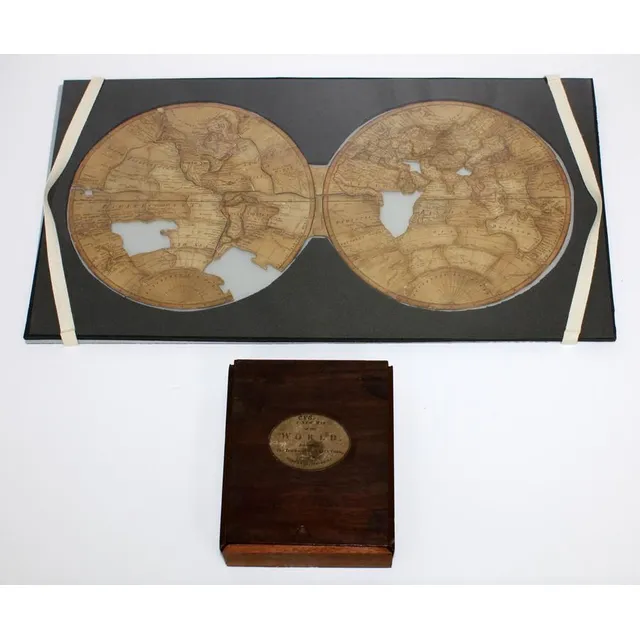
Captain Cook's World Map Puzzle
'A New Map of the World, exhibiting the tracks of Captain Cook and all the modern discoveries' A dissected puzzle made in England circa 1790, missing three pieces. A wooden boxed set depicting a map of the world charting Cook's three voyages and the…
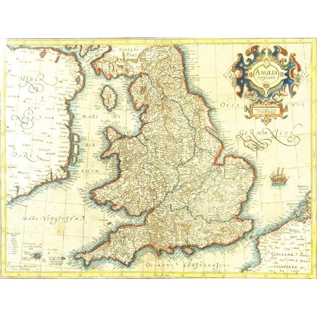
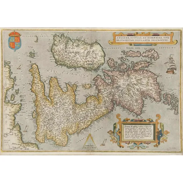
16th Century Map of England and Wales by Mercator
A 16th century map of England and Wales by Gerhard Mercator, published by Hondius c.1630s, entitled in a decorative cartouche, 'Anglia Regnum'. Detailed with Latinized names of counties and detailed with town names from Saxton's Map of 1579, additionally…
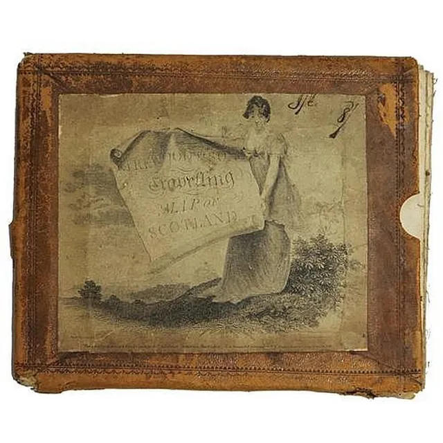
1804 Scotland Travelling Map with Historic Routes
George IV 'Kirkwood & Sons Travelling Map of Scotland' dated 1804 showing the routes of Pennant, Garnett, Lettice, Campbell in original leather bound cover. Dimensions 71.5 x 58 cm
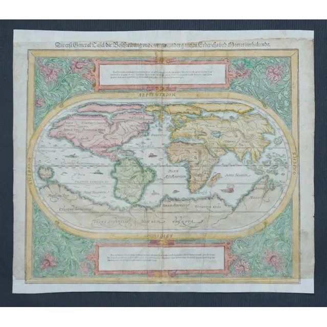
Munster's 1550 Hand-Coloured World Map
Map, c1550 world map by Munster. 'Die erste General Tafel/die Beschreibung und den Zirkel des ganzen Erdrichs un Meeresinnhaltende.' central fold line with repair. Also lower margin restored. Top margin trimmed into title. Hand coloured Woodcut. 33 x 3 6…
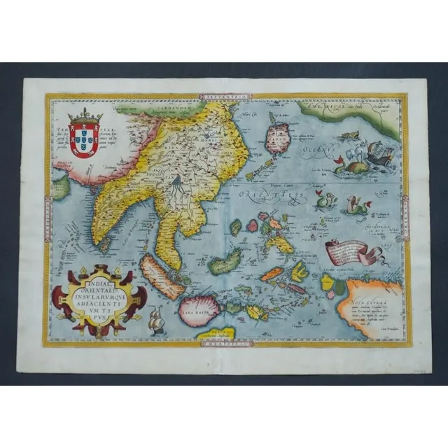
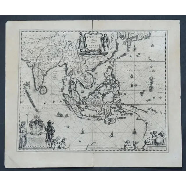
India Orientalis Map, Ortetius, 1570
Map, India Orientalis. Published c.1570 Abraham Ortetius. Some restoration to centre fold. Hand coloured engraving. 35 x 5 0 cm
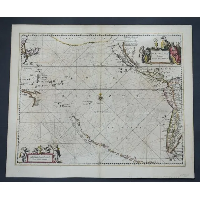
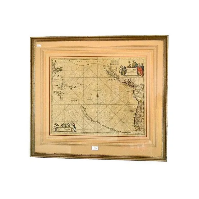
Mar Del Zur Hispanis Mare Pacificum Map, 1650
Map, Mar Del Zur Hispanis Mare Pacificum. Jan Jansson mapmaker, published Amsterdam 1650. Hand coloured engraving. 44 x 5 5 cm
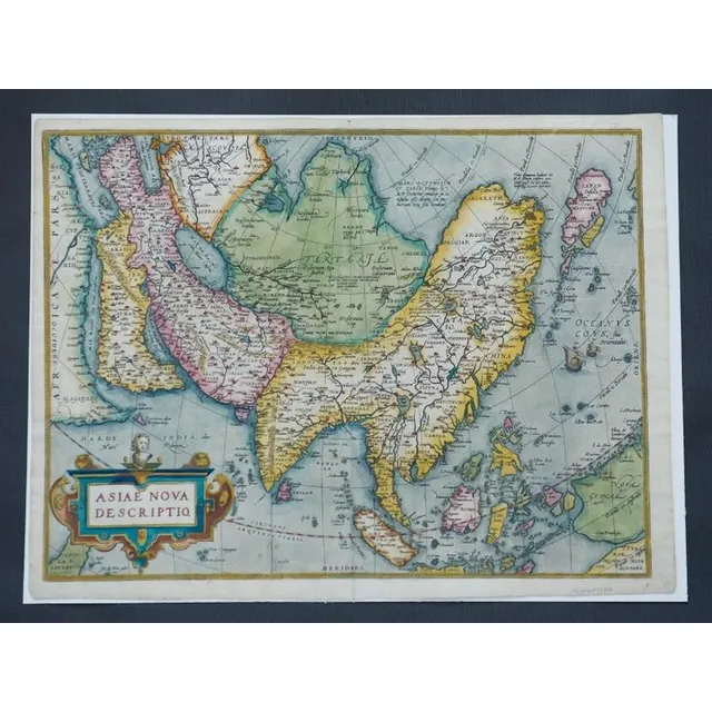
Ortelius' Map of Asia, 1574
Map, Asiae Nova Descriptio. Map of Asia by Abraham Ortelius, pub. Amsterdam c.1574. Hand coloured engraving. 37 x 4 9 cm
East India & Australia Map c.1700 by van Kenlen
Map, East India & Australia c1700. Africa to Japan incl. Australia. Made by van Kenlen, Amsterdam. Staining, watermarks & a few holes near the margins. Rebacked. Hand coloured engraving. 53 x 6 0 cm
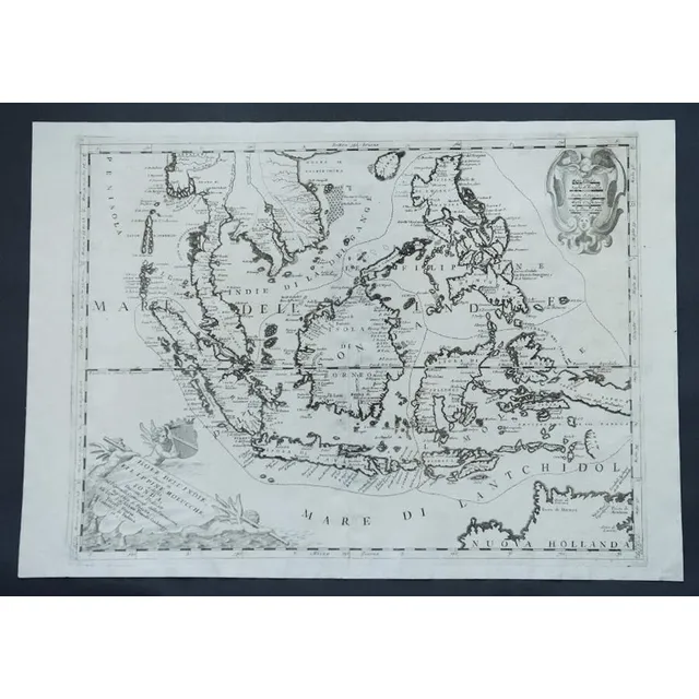
Indonesia, Australia & Philippines Map by Coronelli (c1690)
Map, c1690 Indonesia, Australia & Philipines. Mapmaker Vincenzo Maria Coronelli, 'Isole Dell' Indie diuise in Filippine, Molucche e della Sonda. Pub. Venice. Engraving. 47 x 6 2 cm
Asia's Main States
Map, L'Asie Divisee en ses pair of incipaux Etats. Mapmaker, Jean Janvier, pub. Paris 1760. Hand coloured engraving. 49 x 6 8 cm
Eastern Islands of Moluccae
Map, Insulae Indaie Orientalis in Quibus Moluccae Celeberrimae Sunt. Mapmaker Hondius, pub. Amsterdam 1613. Hand coloured engraving. 35 x 4 8 cm
Eastern Ocean Map, Bellin, Paris 1757
Map, Carte Reduite de L'Ocean Oriental ou Mer des Indes. Mapmaker J N Bellin, pub. Paris, 1757. Hand coloured engraving. 56 x 8 8 cm
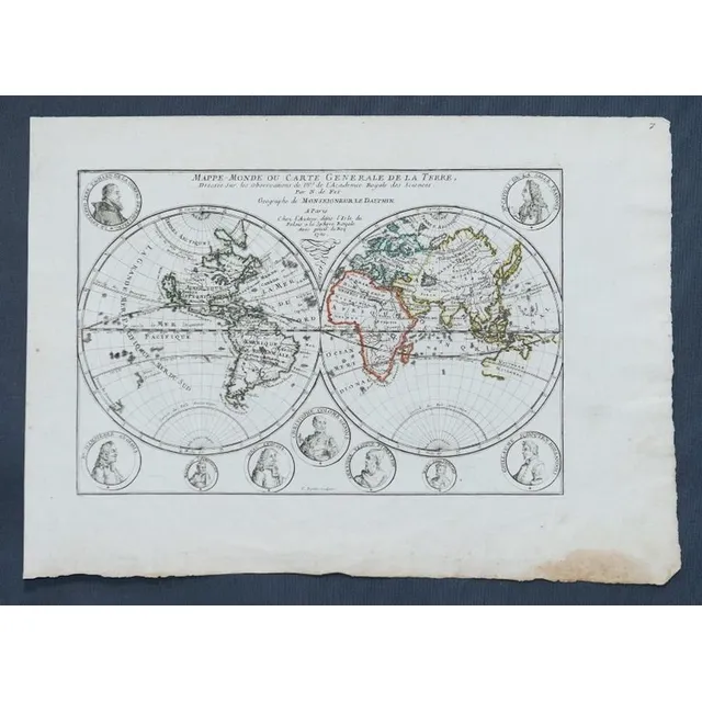
1700 French World Map with Explorer Cartouches
Map, Mappe-Monde Ou Carte Generale de La Terre. Pub. France c.1700. General world view with cartouches of explorers. Copper engraving & hand coloured. 24 x 3 5 cm
Australia & Adjacent Isles Map, 1819
Map, Australia & the Adjacent Isles. John Cary, pub. London 1819. Hand coloured steel engraving. 26 x 3 2 cm
NSW Map with Sydney Inset and Goldfields (1855)
MapS (2), NSW, Bartholomew, pub. Edinburgh. Has inset map of Sydney. Indicates goldfields c.1855; & NSW by W.H. Lizars, pub. Edinburgh c.1824. R.H. Margin missing. Coloured engraving. 38 x 2 7 cm. & 30 x 2 2 cm

Map of NSW, New Zealand, New Hebrides & Adjacent Islands
Map, NSW, New Zealand, New Hebrides & the Islands Adjacent. Robert Wilkinson, pub. London 1808. Inset map of port Jackson & Environs. Coloured engraving
India and Adjacent Islands Map by Blaeu, c.1635
Map, India Quae Orientalis et Insulae Adiacinte. Mapmaker, Willem Janszoon Blaeu, c.1635. Engraving. 43 x 5 2 cm
New Map of East India and Adjacent Islands, 1670
Map, Indiae Orientalis nec Non Insularum Adiacentium Nova Descriptio. Map maker Nicholaus Visscher, pub. Amsterdam, 1670. Hand coloured engraving. 48 x 5 8 cm
Accurate Map of Asia, Bowen, London c.1790
Map, a new and Accurate map of Asia. Thomas Bowen, London. Pub. C.1790. Copper engraving & hand coloured. 33 x 4 3 cm
1690 Hand-Coloured Map of Asia by Joannem de Ram
Map, Asia, Joannem de ram Novatotius Asiae Tabula, published Amsterdam c.1690. Hand coloured engraving. 46 x 5 7 cm
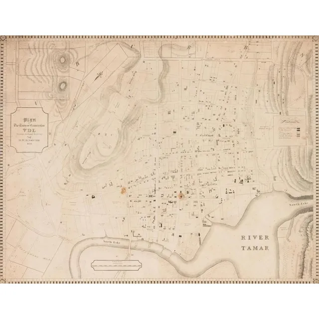
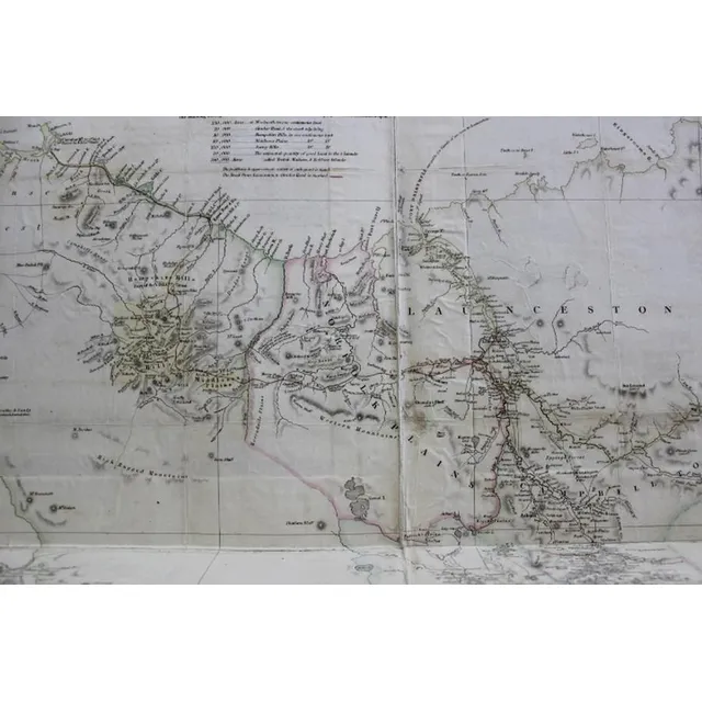
Launceston Town Map, Van Diemen's Land, 1855
A colonial surveyor's map, 'Plan of the town of Launceston, Van Diemen's Land, from the actual survey by H. W. H. Smythe, 1855', 64 cm high, 78 cm wide
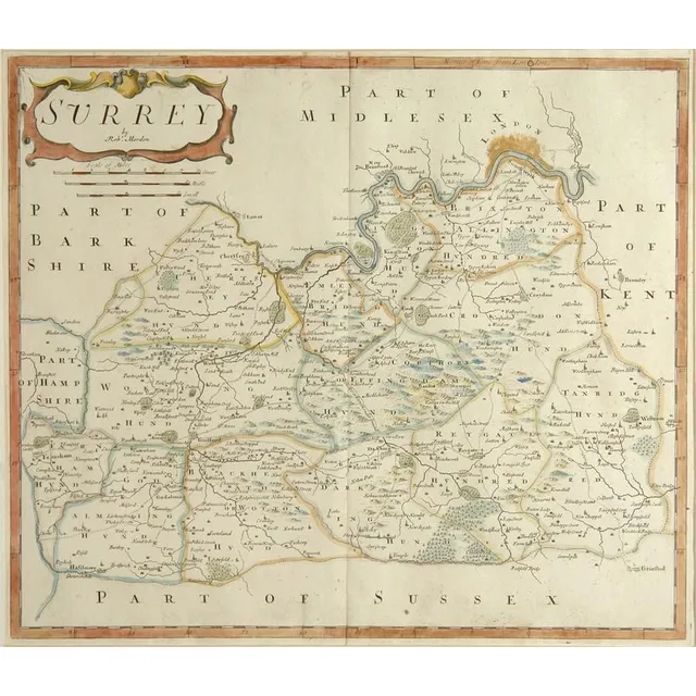
18th Century Sussex Map by Robert Morden
An 18th century map 'Part of Sussex' by Robert Morden, hand coloured in outline. 36 cm x 41 cm
Centurion's Global Journey: Hand-Colored Chart by Rw Seale
Framed hand coloured Chart, the Track of the Centurion round the world. Engraver Rw Seale
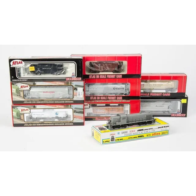
Atlas Diesel and Rolling Stock Set - NIB
Atlas: Rsd 4/5 diesel no.7080 (Undecorated) together with rolling stock: 33,000 Gal. Tank car (Suburban Propane), 3-Bay cylindrical Hoppers (Indusmin & New York System), 36' wood Reefer car (Evansville packing), Kaolin tank car (Anglo-American Clays),…
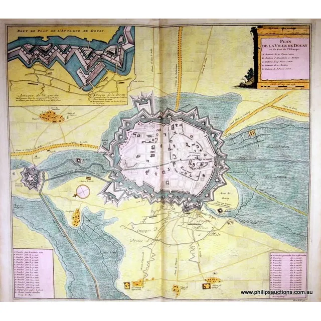
18th Century Topographical Maps and Strategic Plans
Twenty antique Topographical Maps and Strategic Plans, 18th century, including ten engraved maps of Europe from Thomas Bankes's 'New System of Geography' and ten plans of French and Flemish towns, St Omer, Mons, Eckern, Oudenard, Tournay, Menin, Daway,…
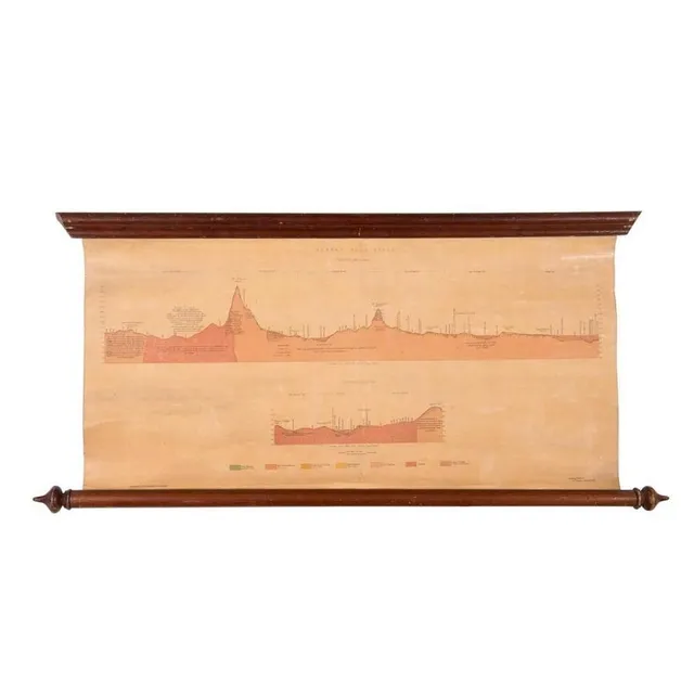
Ararat Gold Field Map, 1875
Ararat Gold Field, Section Ab on Plan, Section Cd on Plan. Lithographed at the Mining Department, Melbourne. Ferdinand M. Krause, Geol. Surveyor, Ararat, June 1875, linen-backed roll-up map, size 69 x 35 cm.
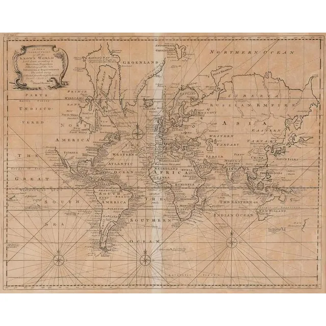
Emanuel Bowen's World Map, London 1744
A New & Correct Chart of all the Known World by Emanuel Bowen [London 1744]. 46 x 38 cm
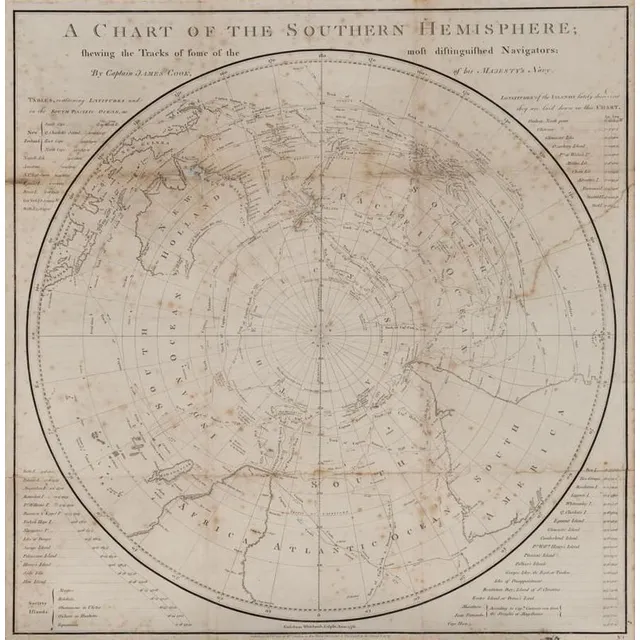
Captain Cook's Southern Hemisphere Chart (1777)
A Chart of the Southern Hemisphere by Captain James Cook, published by William Strahan [London 1777]. 55 x 57 cm
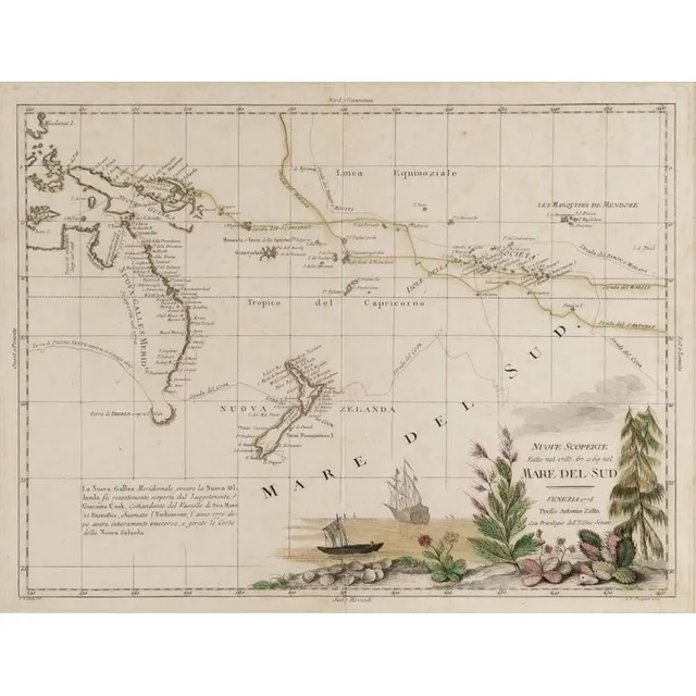
"Mare Del Sud" Map by Antonio Zatta (1776)
Italian 18th century map of the South Sea titled 'Mare Del Sud' by Antonio Zatta [Venice 1776]. 42 x 32 cm
![Carte Generale De L'Oceanie by Brue [Paris 1827]. 52 x 58 cm](https://img.carters.com.au/640x640/39579bcec98bcd6dcbac9d546d8c9d6a.webp)
Oceanie Map by Brue [Paris 1827] - 52 x 58 cm
Carte Generale De L'Oceanie by Brue [Paris 1827]. 52 x 58 cm
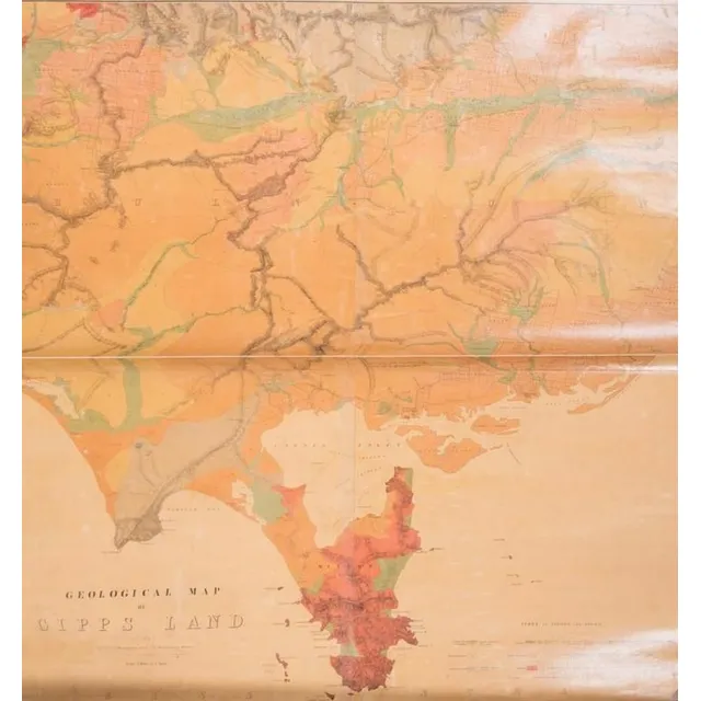
Gipps Land Geological Map (c.1875)
Geological Map of Gipps Land (Sheet No.1), Surveyed by R. A. F. Murray under the direction of the Mining department, Melbourne [c1875], linen-backed roll-up map, size 97 x 110 cm.
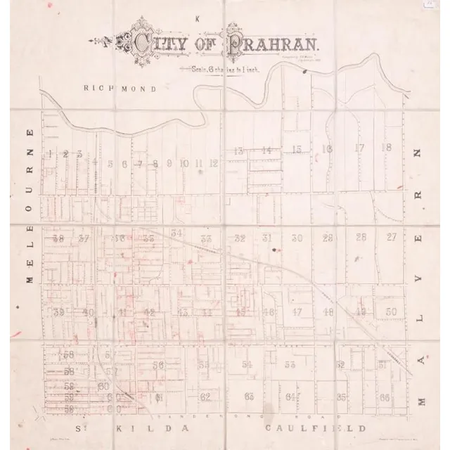
Prahran City Map 1882
City of Prahran. Compiled by T. B. Muntz, City Surveyor, 1882, fold-up map in 16 sections on linen-backing, with many properties added in red ink, overall 83 x 90 cm.

Hawthorn-Prahran 1887 Map Set
Hawthorn - Prahran circa 1887. Two canvas backed maps scale 400 feet to an inch, stone engraved by Clarence Woodhouse [printed by John Batton 79 Queen St], housed in original black cloth covered boards with gilt lettering.
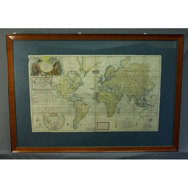
Herman Moll's 1719 World Map
Map, New & Correct Map of the Whole World. Made or published by Herman Moll, London, 1719. Four joined sheets, hand coloured. Various repaired tears & small losses to the margins. 73 x 123 cm
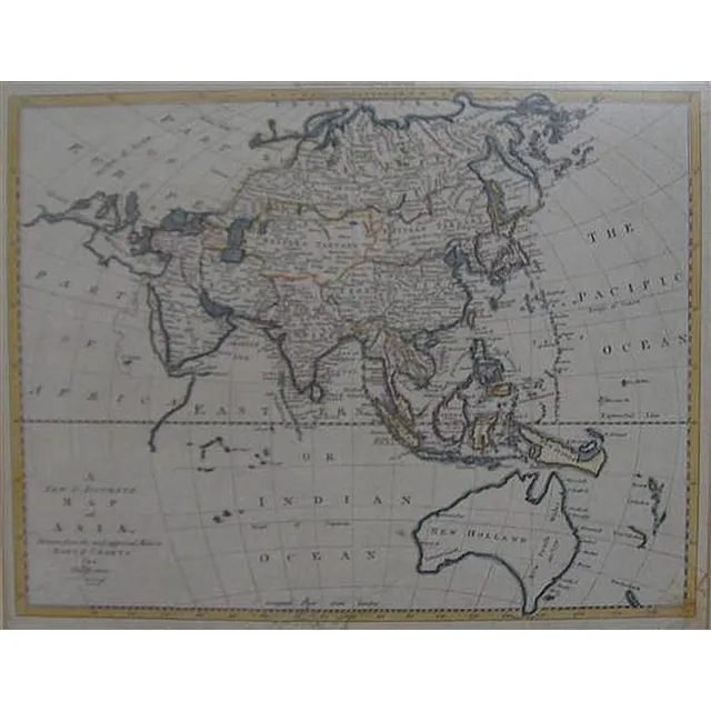
Accurate Map of Asia, 1799
Thomes Bowen (?-1790) A new and Accurate map of Asia, drawn from the most modern Maps and Charts, 1799 Handcoloured & engraved, for Middletons complete System of Geography 32.5 x 42.5 cm
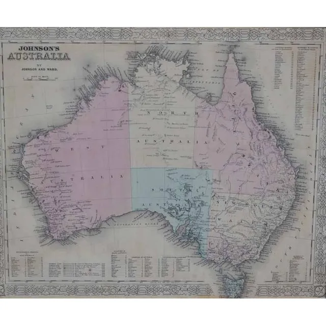
Antique Framed Maps: Australia & World with Cook's Routes
i) A 'Johnson's Australia' framed map, c.1864, by Johnson & Ward hand coloured engraved print. 32 x 40 cm (image); ii) 'The world on Mercator's Projection' framed map Published 1816 London, by C.S. Smith hand coloured engraved print note: showing Capt.…
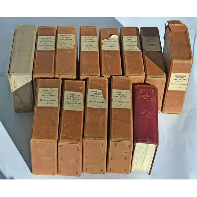
The Story of Anzac: C.E.W. Bean's 12 Volumes
Charles Edwin Woodrow bean (C.E.W. Bean) 1879 - 1968. The story of Anzac; 12 volumes with original covers 'From the outbreak of war to the end of the first phase of the Gallipoli campaign, May 4, 1915', with 111 maps and 56 illustrations Ninth edition,…
Sketch of Van Diemens Land History and Arrowsmith Map
Book, 1832, sketch of the History of van Diemens Land, James Bischoff, including Arrowsmith map, separately mounted
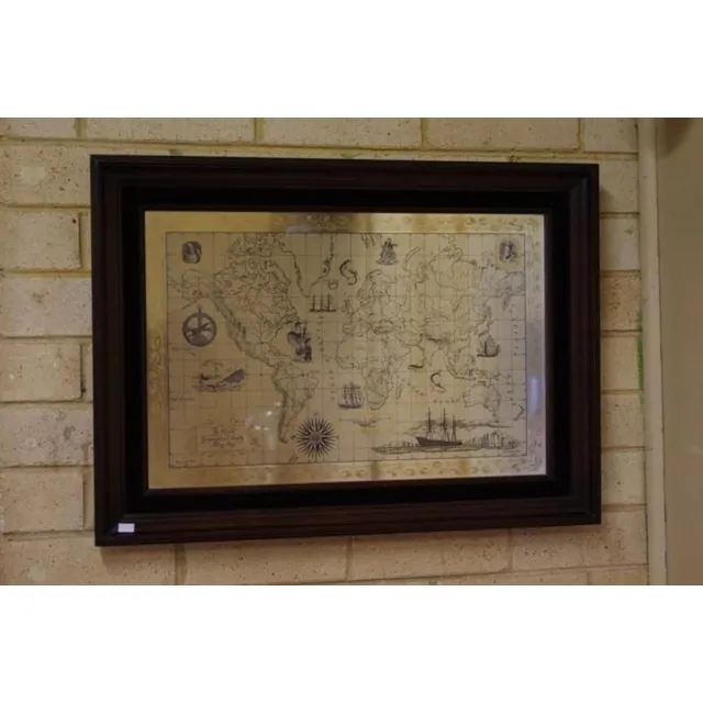
Sterling Silver World Map by RGS (1976)
Royal Geographic Society sterling silver world map circa 1976, marked 925/1000, 51 cm x 70 cm (frame)
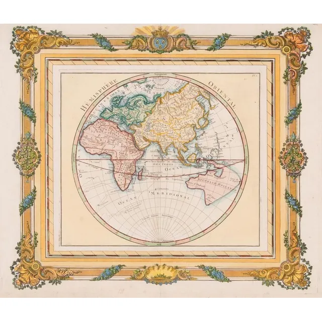
French Hemisphere Oriental Map, 1768
Map: A French hand coloured map 'Hemisphere Oriental', circa 1768, attributed to Brion de la Tour, pre Captain Cook with undefined east coast of Australia. 42 x 36 cm
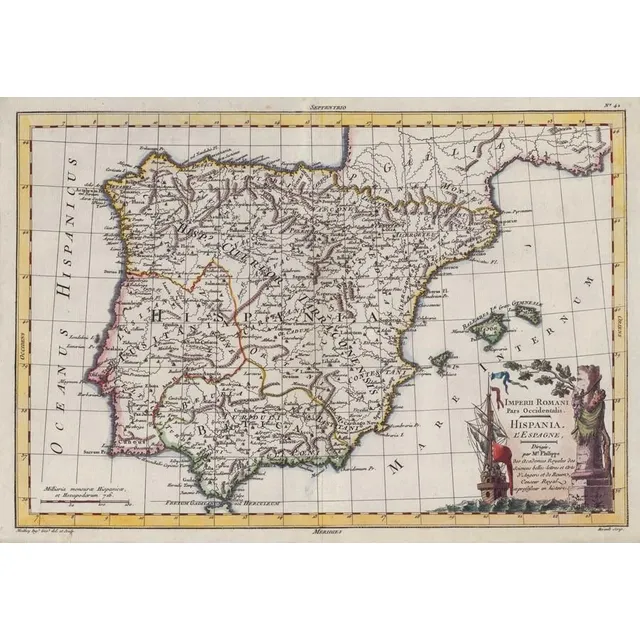
Imperii Romani Pars Occidentalis: Hispania Map (c.1780)
Map: 'Imperii Romani Pars Occidentalis. Hispania. L'Espagne' engraved map published by Moithey [Paris, c1780], size 44 x 28 cm.
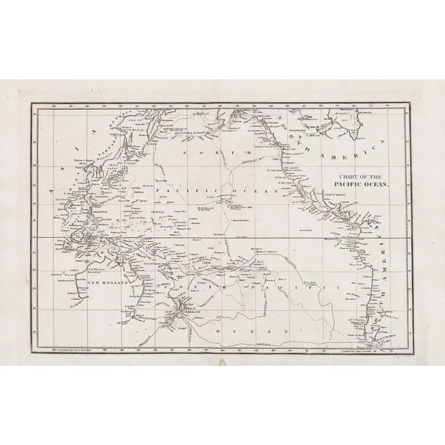
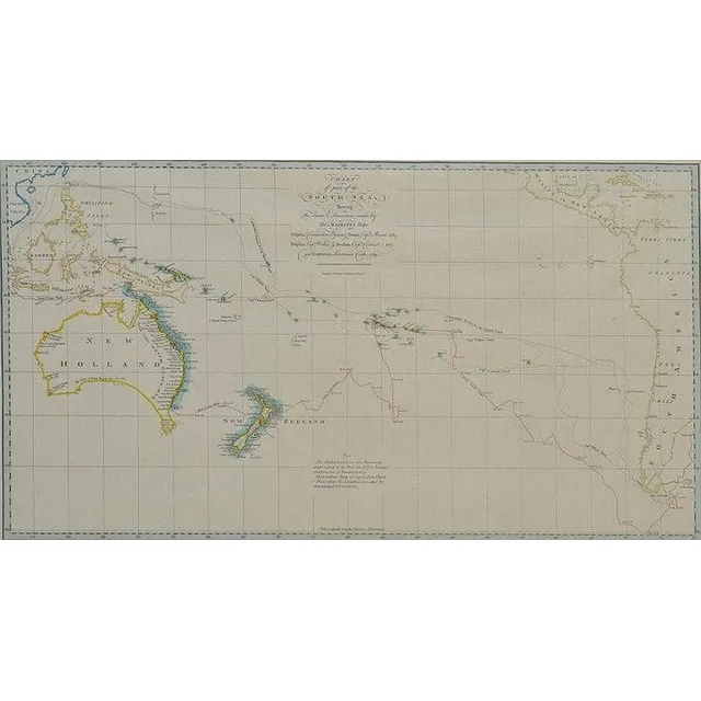
Chart of Pacific Ocean with Cook's voyages and incomplete coastlines
Map: 'Chart of the Pacific Ocean' circa 1820 showing New Holland with incomplete northern and southern coastlines and only the east coast of Van Diemen's Land; Papua or New Guinea largely incomplete; Japan, Philippines, eastern China and the north and…
Antique Hand Coloured Maps of British Isles and Munster
Two framed antique hand coloured maps of the British Isles & the Province of Munster. Frames approximately 182 cm x 67 cm