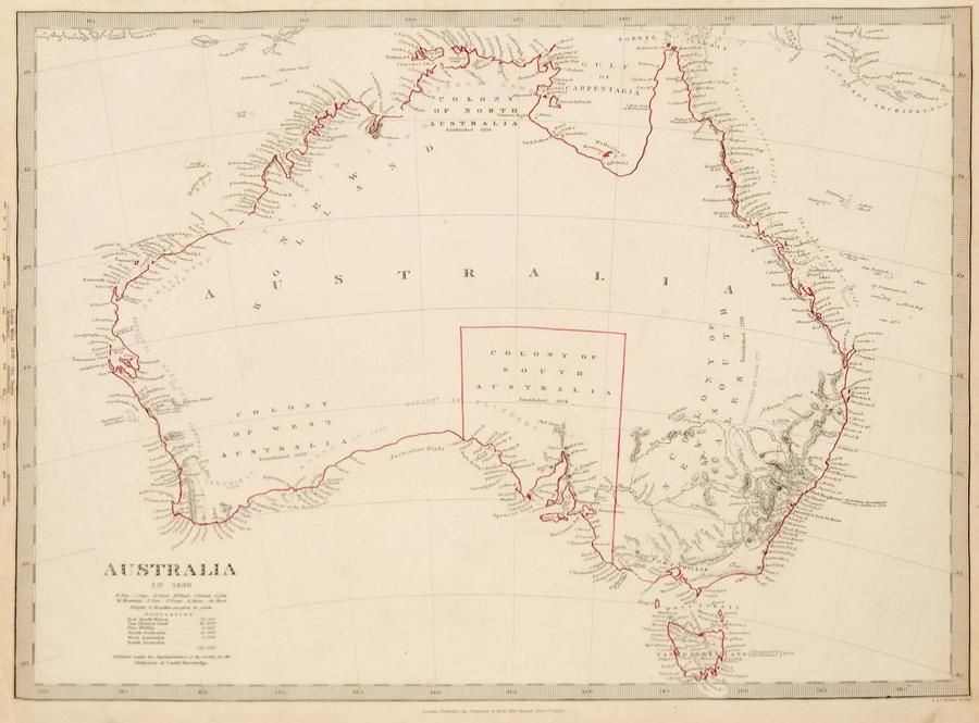
Evolution of Australian Maps: 1839-20th Century
You must be a subscriber, and be logged in to view price and dealer details.
Subscribe Now to view actual auction price for this item
When you subscribe, you have the option of setting the currency in which to display prices to $Au, $US, $NZ or Stg.
This item has been included into following indexes:
- maps - general 445
Visually similar items

Carte Generale De L'Oceanie by Brue [Paris 1827]. 52 x 58 cm

(World map) Heinrich Robert / F. A. Schraembl, 1789, Generalkarte soemmtlicher Entdeckungen auf den drei Grossen Weltreisen des Kapit Jacob Cook. Two sheets, each 49 x 60 cm to the printed margins. Large world map showing the routes of three voyages made b

Thomes Bowen (?-1790) A new and Accurate map of Asia, drawn from the most modern Maps and Charts, 1799 Handcoloured & engraved, for Middletons complete System of Geography 32.5 x 42.5 cm

Map: Western Australia and van-Diemen's Island a map of Western Australia containing the settlements of swan river and King George sound from recent surveys sent to the Colonial office. The other section of the map depicting van-Diemen Island, published Lo