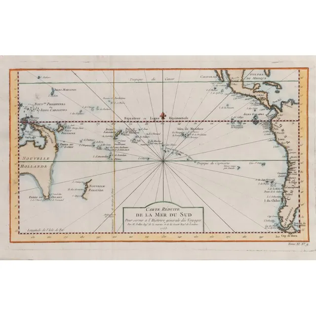
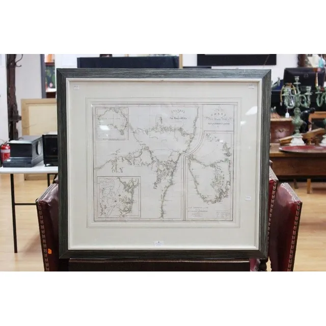
Carte Reduite-De La Mer De Sud 1753., and, Chart of Part of The Coast of New South Wales From Cape Tribulation to Endeavour Straits By Lieut. J Cook 1770, two engravings, each with printed text in image, 20.5 x 35.5 cm and 30 x 34 cm
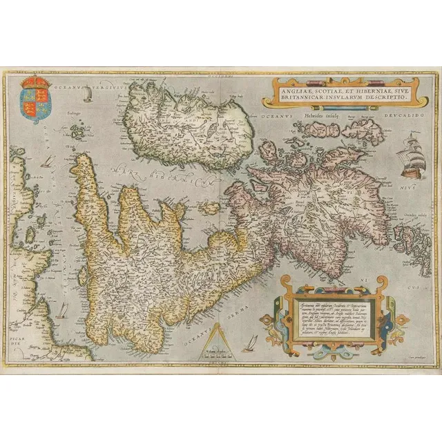
Antique Hand Coloured Maps of British Isles and Munster
Two framed antique hand coloured maps of the British Isles & the Province of Munster. Frames approximately 182 cm x 67 cm
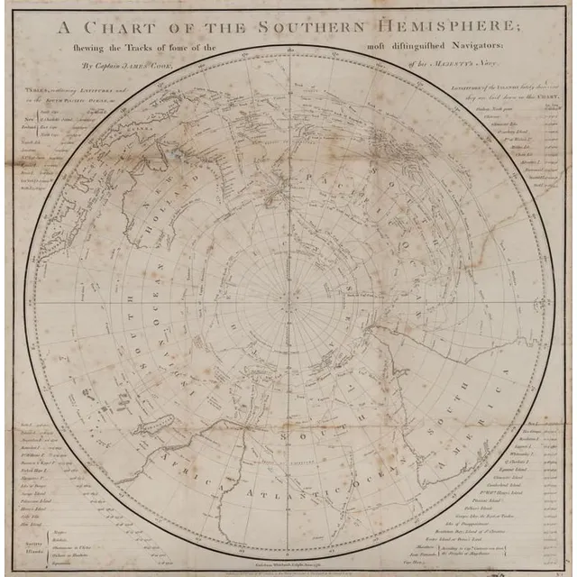
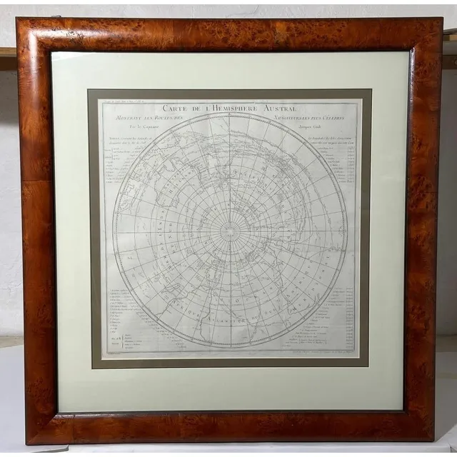
Captain Cook's Southern Hemisphere Chart (1777)
A Chart of the Southern Hemisphere by Captain James Cook, published by William Strahan [London 1777]. 55 x 57 cm
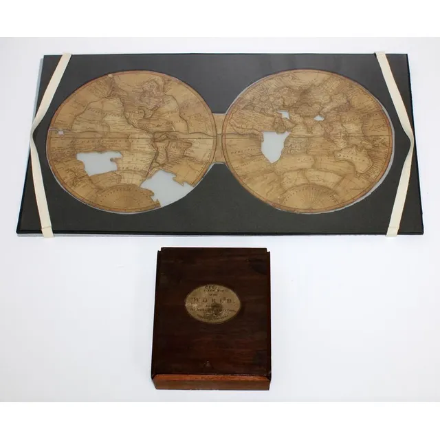
Captain Cook's World Map Puzzle
'A New Map of the World, exhibiting the tracks of Captain Cook and all the modern discoveries' A dissected puzzle made in England circa 1790, missing three pieces. A wooden boxed set depicting a map of the world charting Cook's three voyages and the…
(Cook, James) Carte de L'Hemisphere Austral, montrant les Routes des Navigateurs les plus Celebres, engraved chart, French edition (1778) of Cook's chart showing tracks of Cook's three circumnavigations, good condition, mounted & framed, 56 x 56 cm, frame…
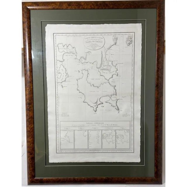
Freycient, L. Carte Particuliere De La Cote Sud-Est De La Terra De Diemen, (Paris, 1812), engraved chart of the southeast portion of Tasmania, surveyed during the Baudin expedition and published by Freycinet, five inset charts, center fold, good condition…
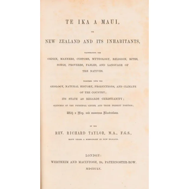
Te Ika A Maui: New Zealand and Its Inhabitants (1855)
(New Zealand) Taylor, Rev. Richard, Te Ika A Maui, New Zealand And Its Inhabitants, (Wertheim and Macintosh, London 1855) Green blindstamped pebbled cloth, gilt lettering on spine, 490 pp. plus 6 pp. publishers ads at rear, brown endpapers. Includes the…
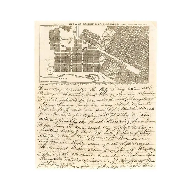
1854 Melbourne Map & Letter on Firearms Sales in Victoria
A lettersheet (folded to provide 4 sides) headed 'Map of Melbourne & Collingwood' with a detailed representation of the street grid, gardens and some significant buildings, with numbered references below the map. [Published by Blundell, engraved and…
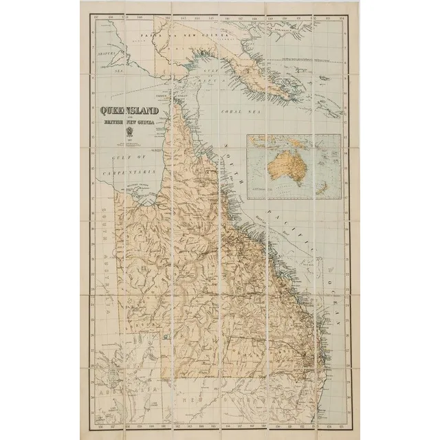
Queensland and British New Guinea 1897' large format map printed by the Surveyor General's Office, Brisbane, in 36 sections laid down on stiffened linen. Overall 103 x 69.5 cm.
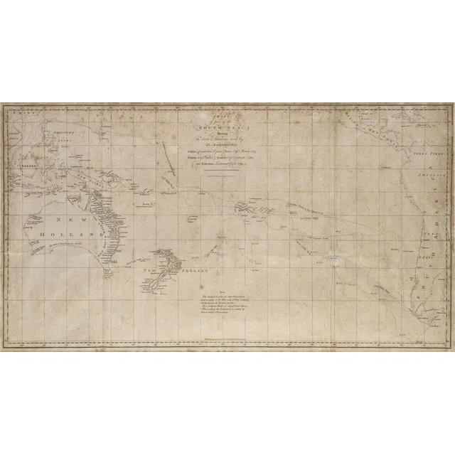
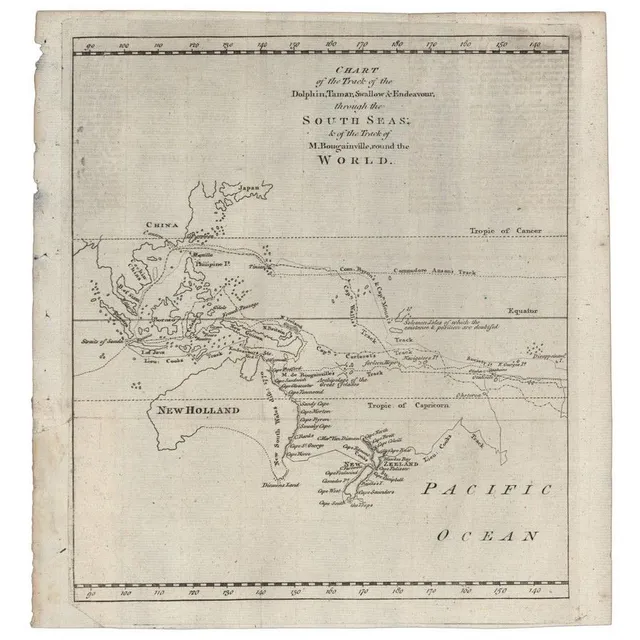
South Sea Discoveries Chart, 1765-1769
Chart of part of the South Sea shewing the tracts & discoveries made by His Majestys Ships Dolphin...& Tamer....1765, Dolphin...& Swallow...1767, and Endeavour, Lieutenant Cooke, 1769', engraved by W.Whitchurch [London, 1773], window mounted, framed &…
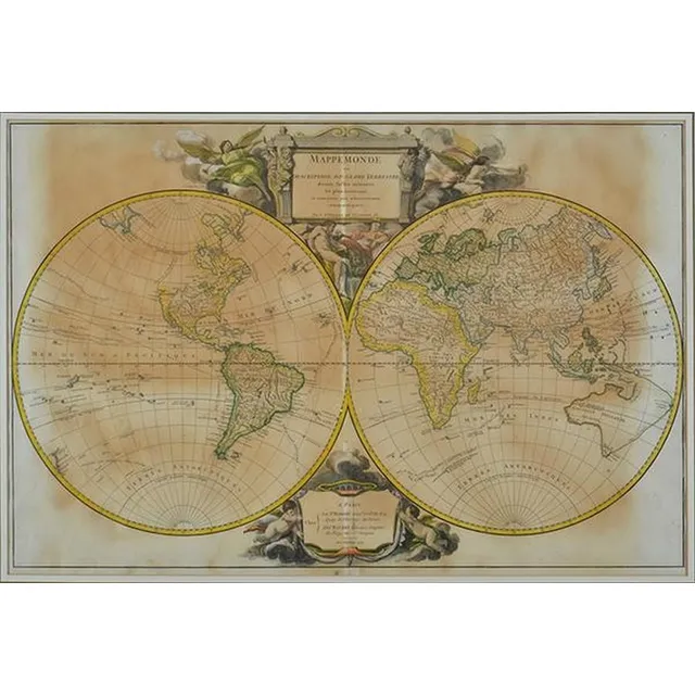
1700 French World Map with Explorer Cartouches
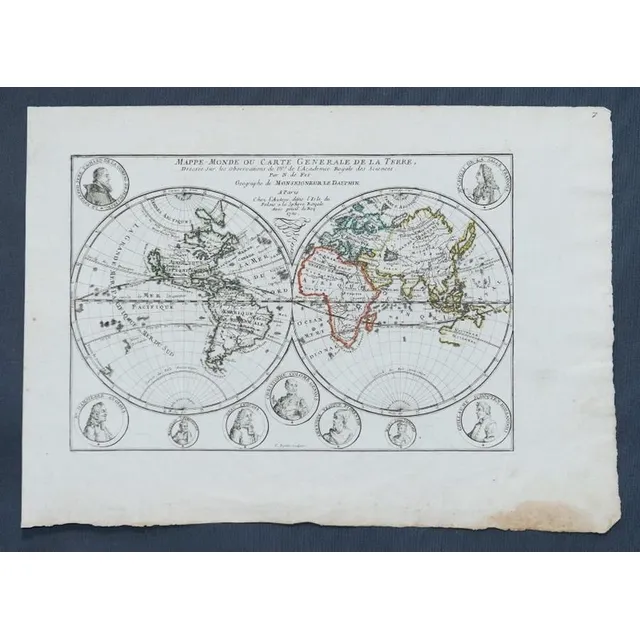
Map, Mappe-Monde Ou Carte Generale de La Terre. Pub. France c.1700. General world view with cartouches of explorers. Copper engraving & hand coloured. 24 x 3 5 cm
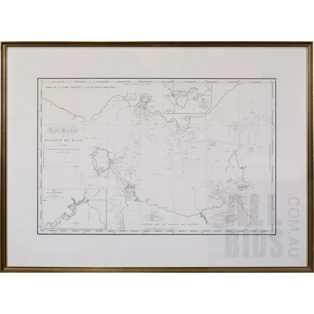
General Map of Bass Strait, 1812
Louis Claude Desaulses de Freycinet (French 1779-1842) carte generale du Detroit de Bass (a la Nouvelle Hollande) 1802 and 1803, Published Paris 1812
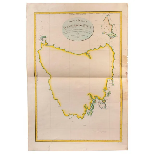
Freycinet's Map of Australia, 1808
leLOUIS de Freycinet 'Carte Generale de la Terre de Diemen, Comprenant les decouve Louis de Freycinet, 'Carte Generale de la Terre de Diemen, Comprenant les decouvertes et les travaux Geographiques executes dans cette partie a borde des Corvettes le…
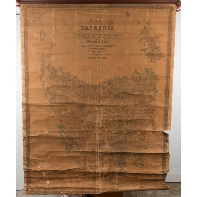
Damaged Tasmania map from 1859
'Tasmania in 1859' by Sprent/Hogan;, 2 examples of this large wall map, both in poor condition. (2).
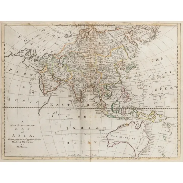
Ancient Map of Asia with Speculative Southern Australia Coastline
Thomas Bowen (1733 - 1790), 'A New & Accurate Map of Asia, drawn from the most approved Modern Maps & Charts.', London, 1799, some contemporary hand-colouring, 32 x 41 cm (plate), 57 x 66 cm overall with frame. Shows a largely speculative Southern…
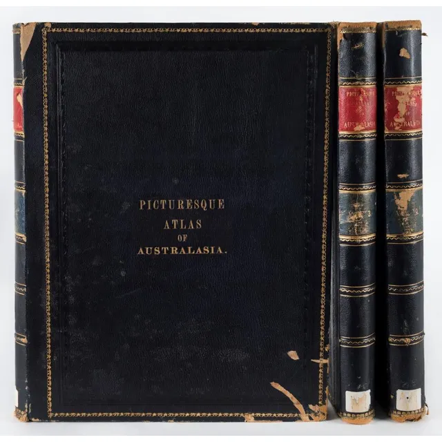
'Picturesque Atlas of Australasia' - Ex-Library Edition
'Picturesque Atlas of Australasia' edited by Hon. Andrew Garran (Melb. Syd. 1886), 3 vol. blue morocco, ex library edition, boards chipped and scuffed, internally good.
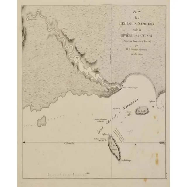
Map of Iles Louis-Napoleon and Swan River, 1807
Map: plan des Iles Louis-Napoleon et de la riviere. Des Cygnes (swan river) Freycinet, Louis Claude. Published Paris 1807 / 1811. Charting undertaken on the W.A. Coast 1801 - 1803. 16.8 x 21 cm
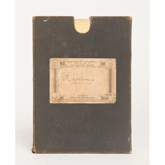
Tasmania 1883 Large Folding Map on Linen
TASMANIA' 1883 large folding map in 30 sectors laid down on linen and contained in a slip-case from the supplier: Edward Stanford Ordnance Maps, Charing Cross. Published by authority of the Honorable N.J.Brown, Minister of Land & Works. Litho: R.Bennett,…
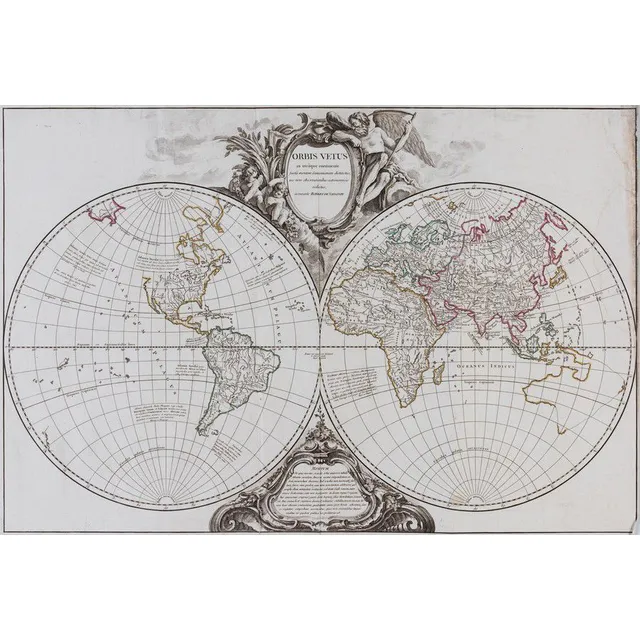
1757 Double Hemisphere World Map with Hypothetical Australia Connection
Vaugondy, Robert de. Orbis Vetus in Utraque Contiente. Paris: c.1757. Double hemisphere world map, with hypothetical east coast of Australia connected to New Zealand and New Guinea. Ornate cartouche above and below. Original outline colour. 50 x 75 cm.…
Historic Australian Map Collection
Australia: Collection of maps in folder, noted 'Chart of the Track of the Dolphin, Tamar, Swallow & Endeavour through the South Seas...' by Bowen [London, 1773], 'Karte von Australien' by Johannes Walch [Augsburg, c1810], 'Oceanique Centrale' by Pierre…
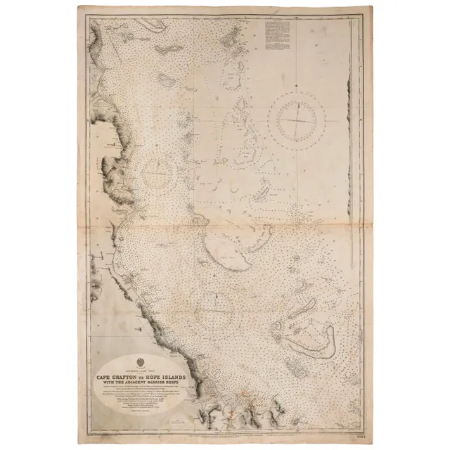
Admiralty Chart of Australia's East Coast (1909)
Wharton, Capt. W.J.L., RN, Australia - East coast: Admiralty chart (no 2924) 'Cape Grafton to hope Islands, with the adjacent Barrier Reefs', February 1909 edition, overall 103 x 69 cm. Endorsed verso 'S S Essex Lance Owner's Chart'.
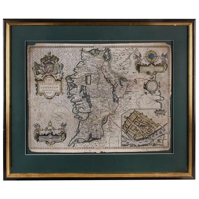
Framed English and Irish County Maps, 1610-1720
(1610) (4 items) English & Irish County maps comprising 'The Province of Connaugh with the citie of Galwaye Described' by John Speed (1610); 'The East riding of Yorkshire' by Robert Morden (c.1720); 'Oxford Shire' by Robert Morden (1695); and 'Hertford…
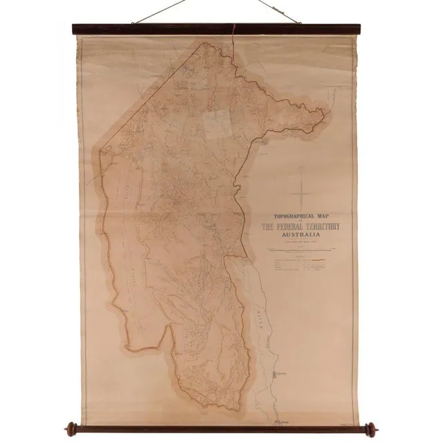
Topographical Map of Federal Territory Australia, 1910
Topographical Map of the Federal Territory Australia, Compiled, Drawn and Printed at the Department of Lands, Sydney, 1910, 90 x 125 cm, supported on a turned cedar roll by the noted map mounter J.Creffield of Melbourne., George Sydney Jones [1864-1927,…
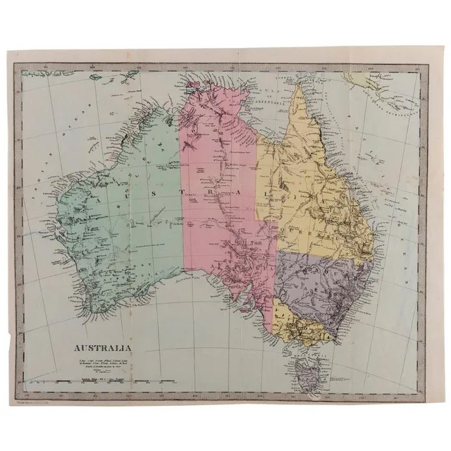
Antique Australian Maps Collection
Australia: A collection of maps including A. & C. Black (1851), Bartholomew (1853), Archer (c1860), Blackie & Son (c1870), Johnston (1886), Harmsworth (c1920) and other similar. (24 items). Various sizes, mixed condition.
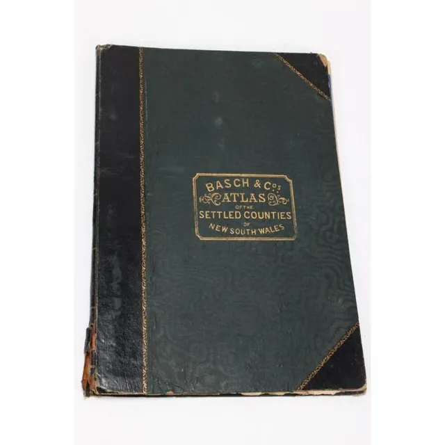
New South Wales Settled Countries Atlas, 1872
Atlas of Settled Countries of New South Wales, by Basch & Co's, featuring twenty maps of the Colony, c.1872
General Map of New Holland, 1808-1811
Louis Claude Desaulses de Freycinet (French 1779-1842) carte generale de la Nouvelle Hollande 1808, Published Paris 1811
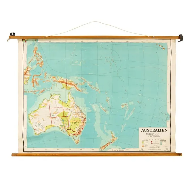
Scandinavian Map of Australia on Pine Frame
Scandinavian map of Australia, material backed paper on pine frame, Scandinavia, c 1950/60s, 34 cm high, 118 cm wide
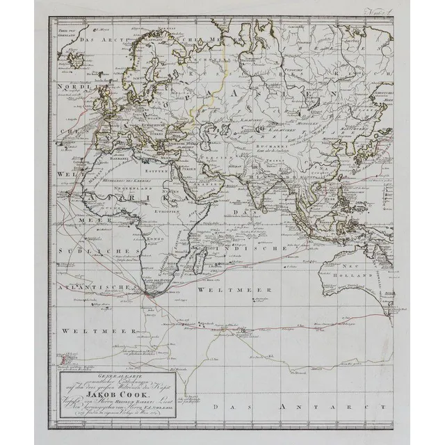
Cook's Three Voyages World Map (9 words)
(World map) Heinrich Robert / F. A. Schraembl, 1789, Generalkarte soemmtlicher Entdeckungen auf den drei Grossen Weltreisen des Kapit Jacob Cook. Two sheets, each 49 x 60 cm to the printed margins. Large world map showing the routes of three voyages made…
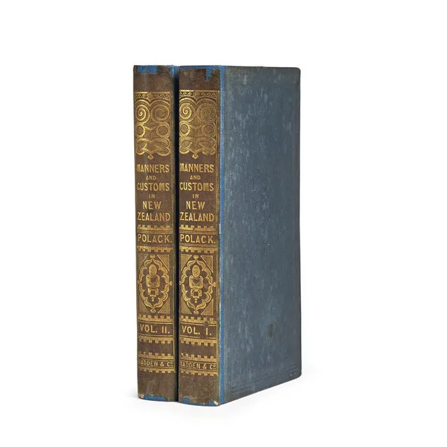
Manners and Customs of New Zealanders
(New Zealand), Polack, Joseph Samuel, Manners and Customs of the New Zealanders, with Notes Corroborative of their Habits, Usages, etc. And Remarks to Intending Emigrants. (London: James Madden && Co. Hatchard & Son, 1840). Two volumes. Small octavo,…
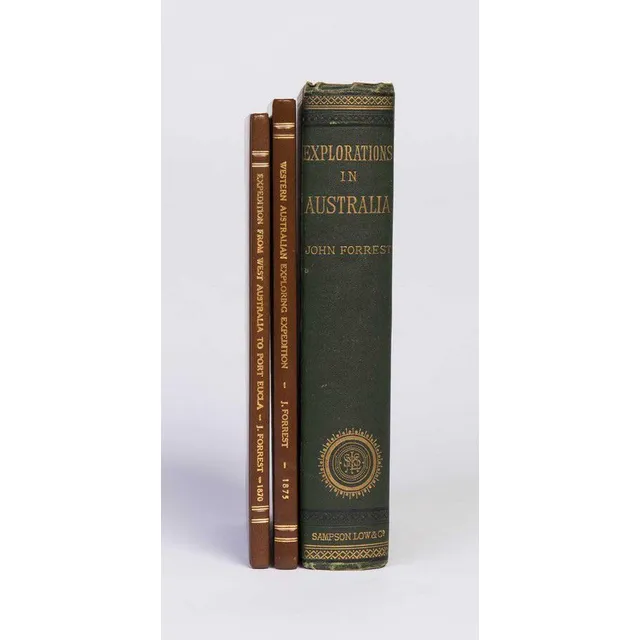
Australian Exploration Journals with Maps and Plates
Forrest, John. Explorations in Australia. 1. Explorations in search of Dr. Leichhardt and party. 2. From Perth to Adelaide, around the Great Australian Bight. III. From Champion Bay, across the desert to the Telegraph at Adelaide. London, 1875. Octavo,…
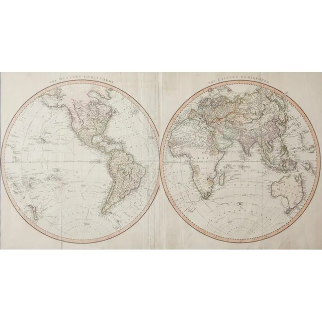
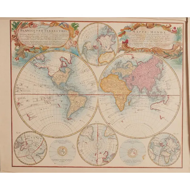
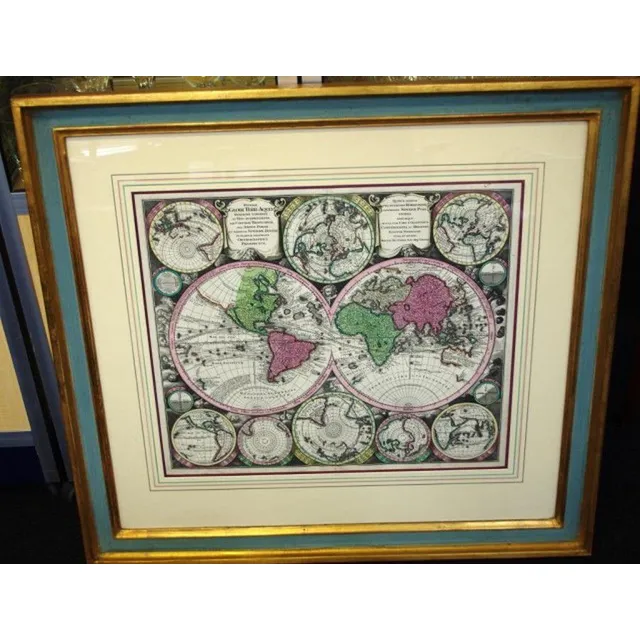
Bellin's Hemispheres Map, 1742
Jacques-Nicolas Bellin - maps of the Hemispheres, C.1742, hand coloured print, map shows the Eastern Hemispere and the Western hemisphere and was made under the direction of the secretary of state to the King of France., 500 x 89.5 cm
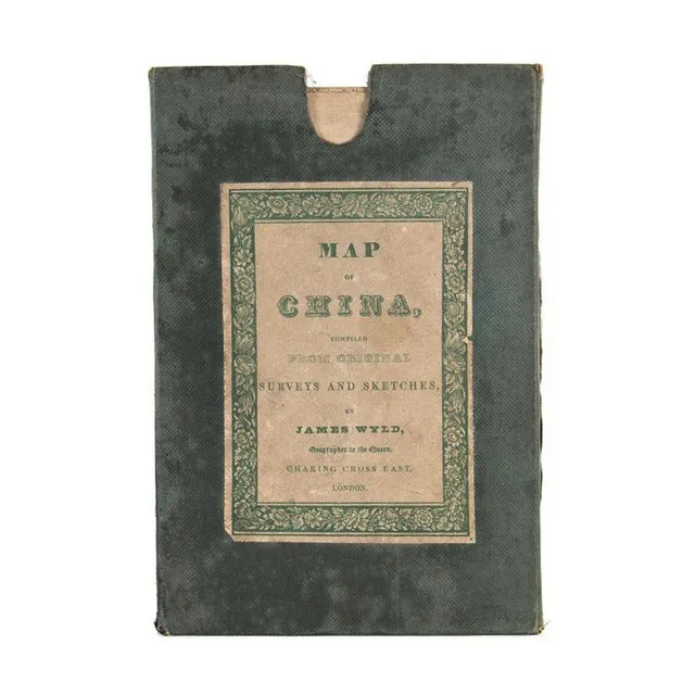
1840 Map of China by James Wyld
Map of China compiled from original survey and sketches by James Wyld, circa 1840, original cloth-backed folding edition in green cloth covered slipcase, 66 cm x 83 cm
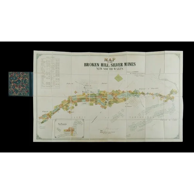
Broken Hill Silver Mines Map (NSW) - c1895
Map of the Broken Hill silver Mines New South Wales. Publ. By E R Morris, map lithographer & licensed draftsman Queensland offices bridge St, Sydney. Map laid on linen & folded into hard covers, c1895. (6.5 x 10.5 cm).
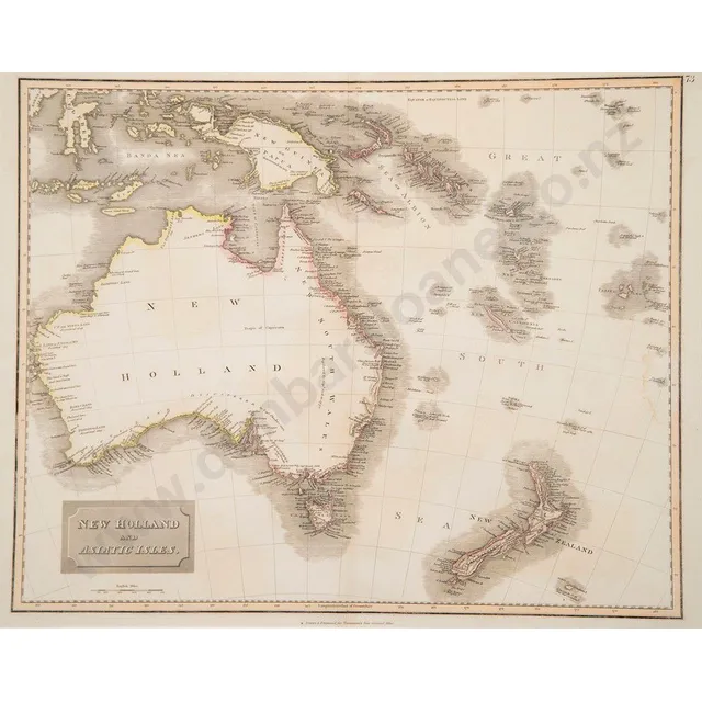
New Holland & Asiatic Isles Map, 1814
Early 19th century hand coloured map of New Holland and Asiatic Isles drawn and engraved for Thomsons new general atlas circa 1814, 51 x 65 cm (framed)
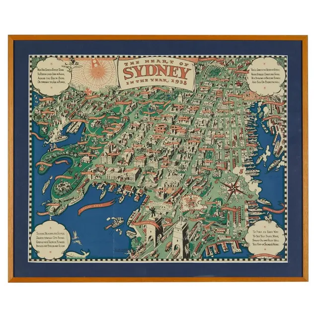
Sydney's Heart, 1938 Map
After Robert Emerson Curtis (1898-1996), 'The heart of Sydney in the year 1938' a three colour map, published by John Fairfax & Sons, 1938, 47 x 59 cm
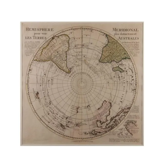
Hemisphere Terres
'Hemisphere Pour Voir Les Terres'. By Guillaume Delifle 1739. Hand coloured. 48 x 48 cm
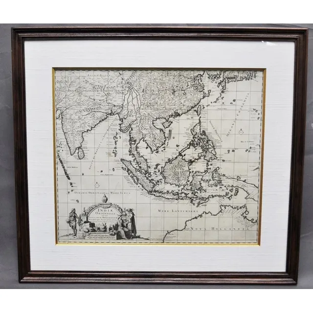
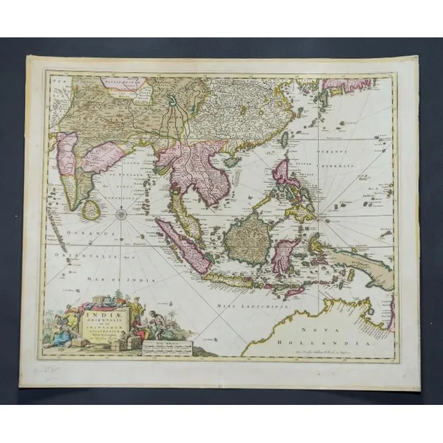
India and Adjacent Islands Map by Visscher
Map, 'Indiae Orientalis,' VISSCHER. Nicholas VISSCHER (1649-1702) 'Indiae Orientalis nec non Insularum Adiacentum.'. Engraving. 52 x 62 cm
World Map 1748 by Bellin
Map, the world, 1748. 'Essay d' Une Carte Reduite Contenant les Partes Connuees du globe Terrestre,' by Jacques-Nicolas Bellin. Coloured copper engraving. 48 x 64 cm
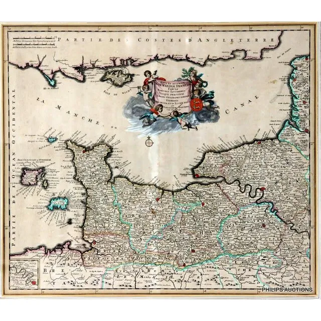
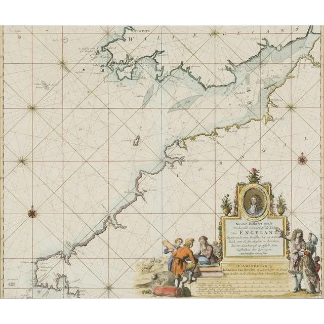
French Map of English Channel by Theodorum Danckers (1790)
An antique framed French map of the English Channel by Theodorum Danckers, circa 1790, with a decorative title cartouche 'Normandiae Ducatus Tabula' with Latin inscription showing 'La Manche Canal' with some hand colouring; Antique Maps and Print Shoppe,…
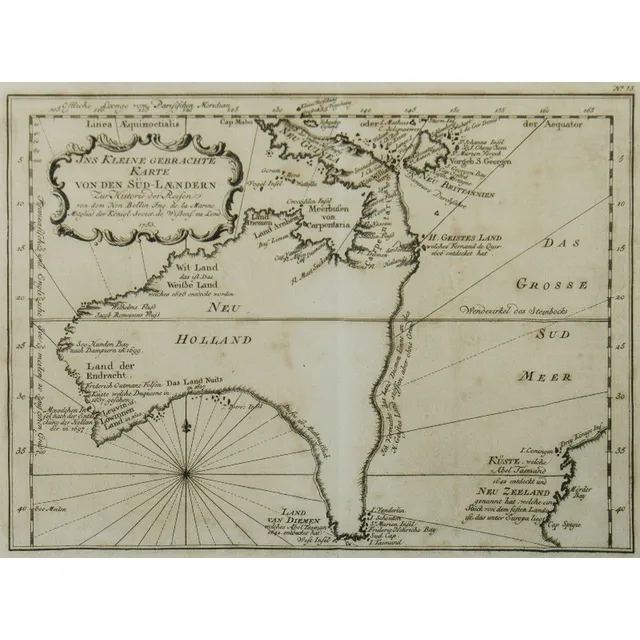
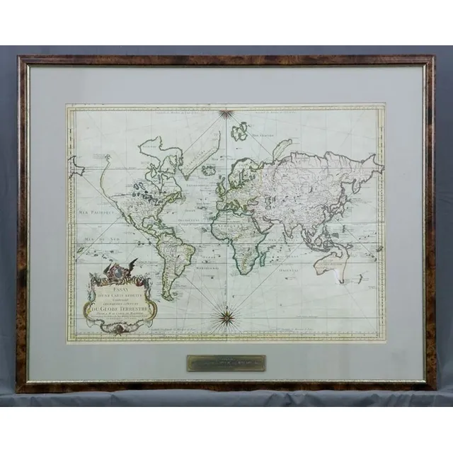
Australia Map, 1753
Map, Australia, by Jacques Nicholas Bellin, 'Ins Kleine Gebrachte Karte von den Sud-Landern', 1753. Copper engraving, 20 x 27.5 cm.
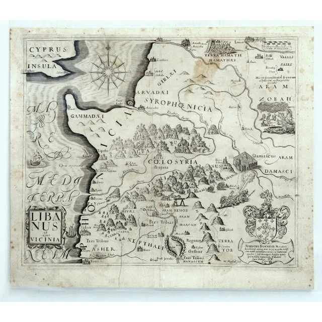
Early Maps of the Holy Land (or) Western Mediterranean Maps
Maps (5) Early Maps of The Holy Land. 5 Maps of Western Mediterranean encompassing modern Palestine, Israel, Lebanon, Jordan & Syria, by Simeoni Bonnell & others. Pub. In A Pisgah-Sight of Palestine and the Confines Thereon by Thomas Fuller, 1650, 29 x 34…
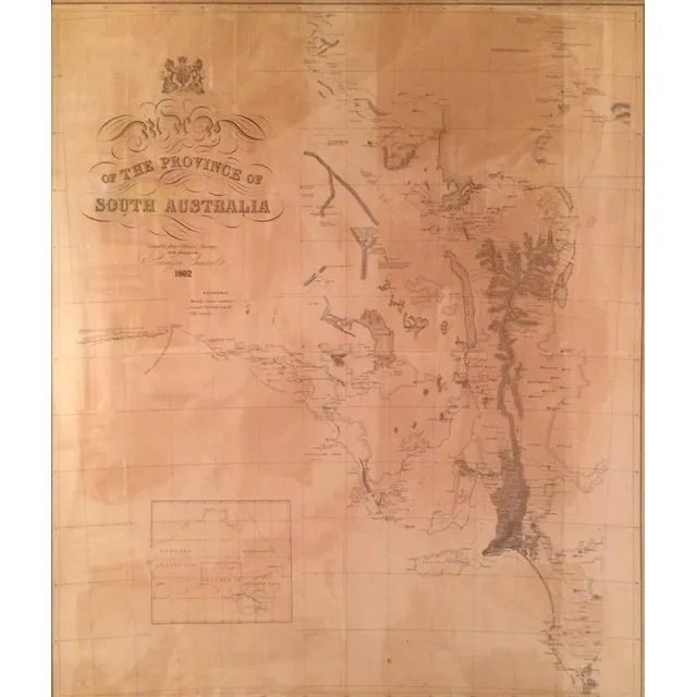
1862 Map of South Australia
Map of the Province of South Australia 1862, printed by R. K. Burt London, lithograph, 76 x 66 cm
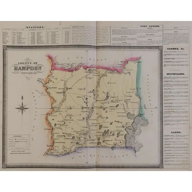
1874 Victorian Counties Atlas with Hand-Coloured Maps
Victoria: Hiscocks, F.E. & Co., publishers. 'F.E. Hiscocks & Co.'s New Victorian, Counties Atlas. Melbourne, 1874'. Folio, title, 5 leaves of letterpress and 22 lithographed maps, hand-coloured, original leather & cloth binding with the original gilt…
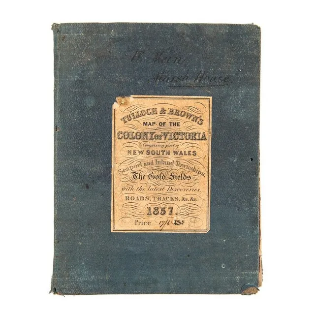
1857 Map of Victoria with Gold Fields and Townships
Tulloch & Brown's Map of the Colony of Victoria Comprising part of New South Wales. Seaport and Inland Townships, the Gold Fields with the latest Discoveries, Roads, Tracks, &e. &c. 1857' (Tulloch & Brown, Melbourne, 1857) large map mounted on linen and…
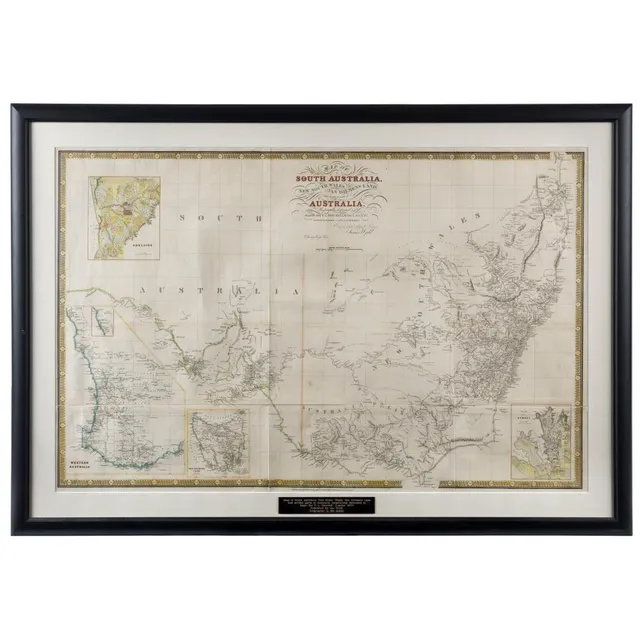
Early Map of Australia and Surrounding Territories
James Wyld, map of South Australia, New South Wales, van Diemen's land, and Settled parts of Australia., Respectfully dedicated to Major Sir T.L. Mitchell K.t D.C.L. F.G.S. &c Surveyor general of New South Wales, (London: circa 1841), 62 x 94 cm; hand…
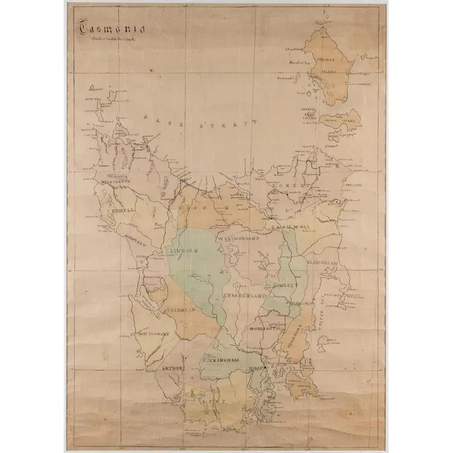
Hand-Coloured Map of Former Counties in Tasmania
Tasmania', hand coloured lithograph showing 18 former counties of Tasmania, scale: 5 miles to 1 inch, 74 cm x 52 cm
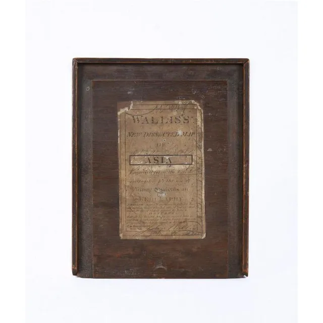
1830 Wallis Map of Asia for Young Students
Circa 1830, 'Wallis's New Dissected Map of Asia Engraved From the Latest Authority For the Use of Young Students in Geography' [J.Wallis, No.42 Skinner St. snow Hill]. Printed lithographic map cut into sections and laid down on interlocking wooden pieces,…
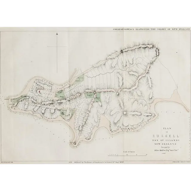
Russell Plan Map, August 1842
A plan map of Russell, lithographic print, printed August 1842 by Luke and James Hansard, lithographed by J.Arrowsmith. 29 x 40.5 cm

Hawthorn-Prahran 1887 Map Set
Hawthorn - Prahran circa 1887. Two canvas backed maps scale 400 feet to an inch, stone engraved by Clarence Woodhouse [printed by John Batton 79 Queen St], housed in original black cloth covered boards with gilt lettering.
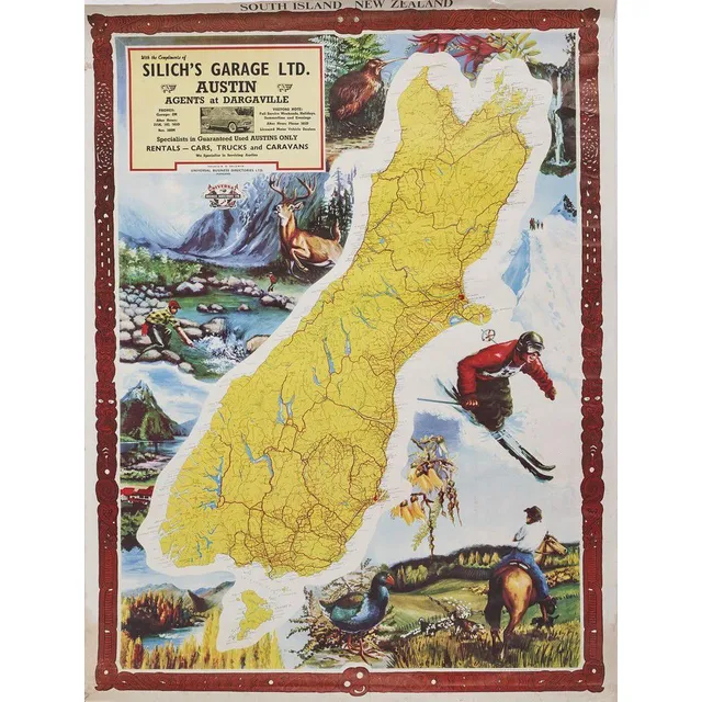
South Island Map with Wildlife and Maori Carvings
A map of the South Island produced by universal Business Directories Ltd, a colourful graphic map of the South Island. Issued by universal Business Directories Ltd, published by a. D. Baldwin. Featuring an AD for Silich's garage Ltd. The background…
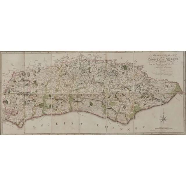
Sussex Topographical Map, 1799
A framed topographical map, The County of Sussex, 1799 by Thomas Gream, six folds., 38 cm, high 60 cm, wide
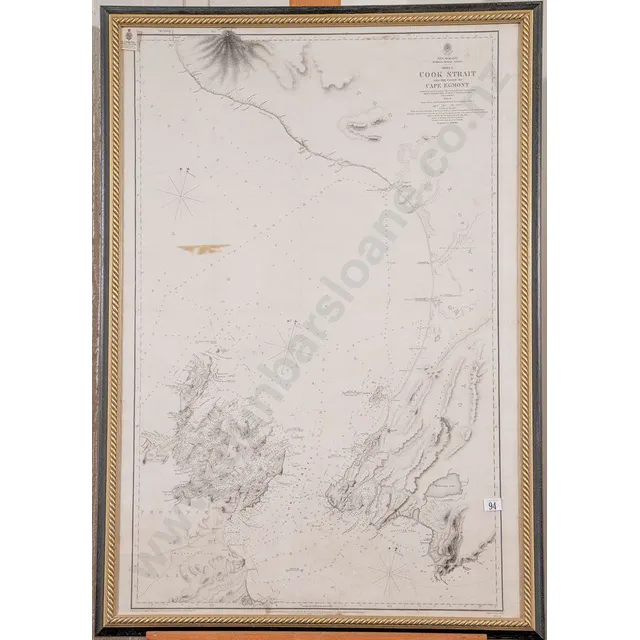
Captain Stokes' Map of Cook Strait and Coast
19th century map of Cook Strait and the coast to Cape Egmont Surveyed by Captain Stokes onboard hallmarked Sterling Acheron 1849-1852, 100 x 68 cm (framed).
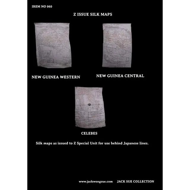
Z Special Unit's Unique Silk Maps
3 silk Maps. These maps were issued to Z special Unit for use behind Japanese lines Whilst many silk maps were used during World War II, these ones were unique to Z special Unit in that they were passed on to Jack by fellow Z man Jack Bickford
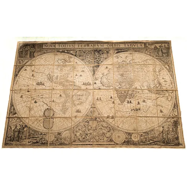
Frederik de Wit's World Map on Fabric
A large printed paper on fabric 'Nova Totivs Terrarvm Orbis Tabvla' map of the world 196 cm x 131 cm after Frederik de Wit's original map, c1670, holding box included
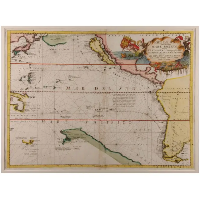
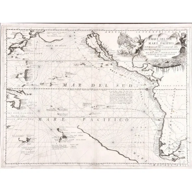
"Mare Del Sud" Map by Vincenzo Coronelli
'Mare Del Sud Detto Altrimenti Mare Pacifico'. By Vicenzo Coronelli. Hand coloured. 45 x 65 cm
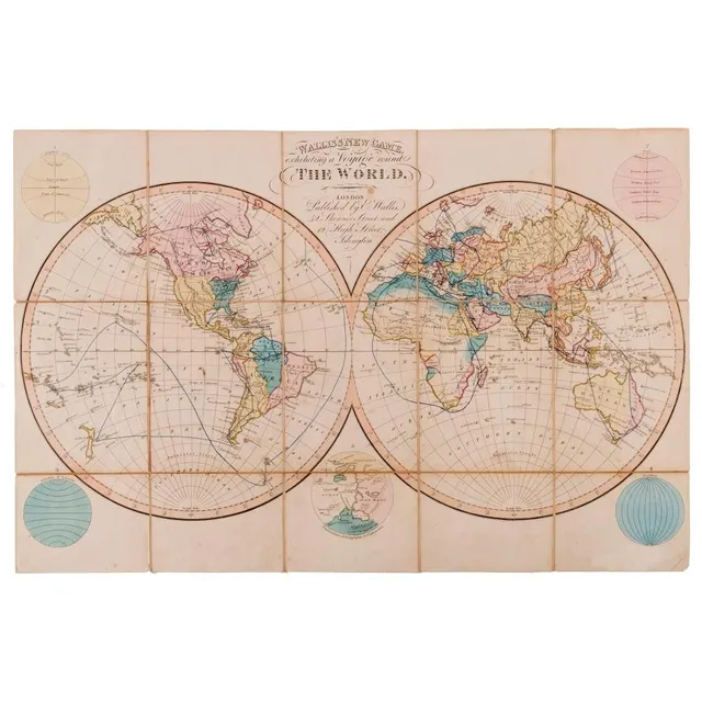
Wallis's new game, Exhibiting a voyage round the world. Wallis, Edward. [Published by published by E. Wallis, 42 Skinner Street and 12 high Street, Islington] c.1823. Engraved game map with hand colour, dissected and mounted on linen, folding into o
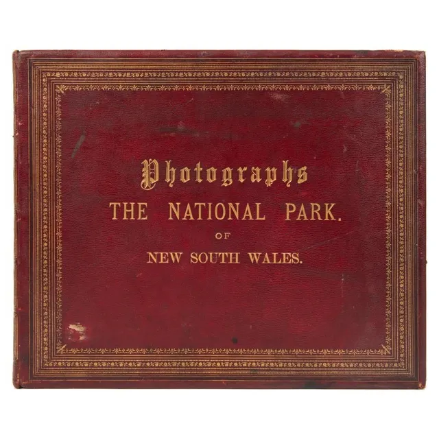
Leather-bound, gilt-titled and decorated album: 'Photographs - the National park of New South Wales.' containing 32 images with a printed map and introductory page from the Government Printing office dated March 1888; followed by an index to the ima
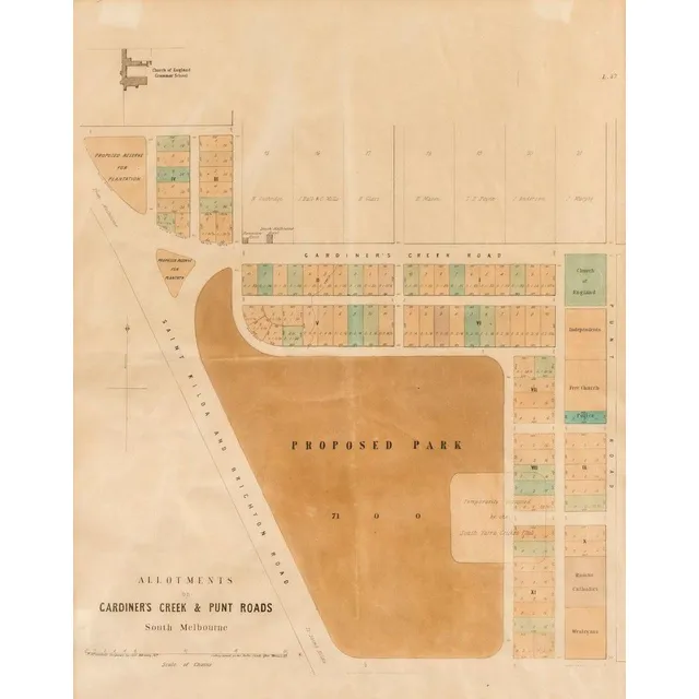
South Melbourne Allotments and Proposed Park Sub-Division Plan
South Melbourne: 'Allotments on Gardiner's Creek & Punt Road, South Melbourne, lithographed sub-division plan by P.M. McGoldrick, Temporary Surveyor, dated February 1859, showing 'Proposed Park' (Fawkner Park, created in 1862), Gardiner's Creek Road (now…
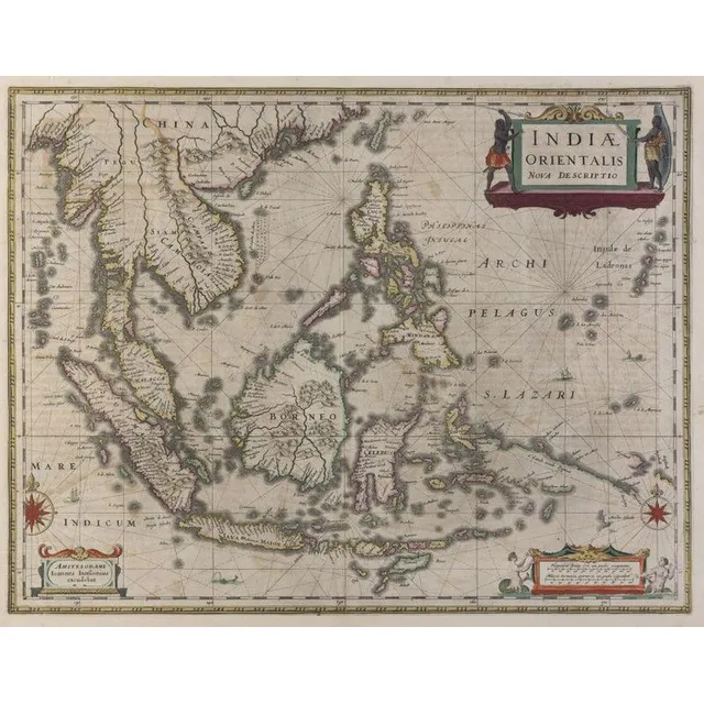
Dutch Map of East Indies and Australia (1630)
Johannes Janssonius (Dutch, 1588- 1664)., Indiae Orientalis, Nova Descriptio, [Dutch Map Of The East Indies] 1630., Copperplate engraving, text including title in plate, overall, 50 x 58 cm (paper). Some hand colouring. Text includes 'Amstelodami. Ioannes…
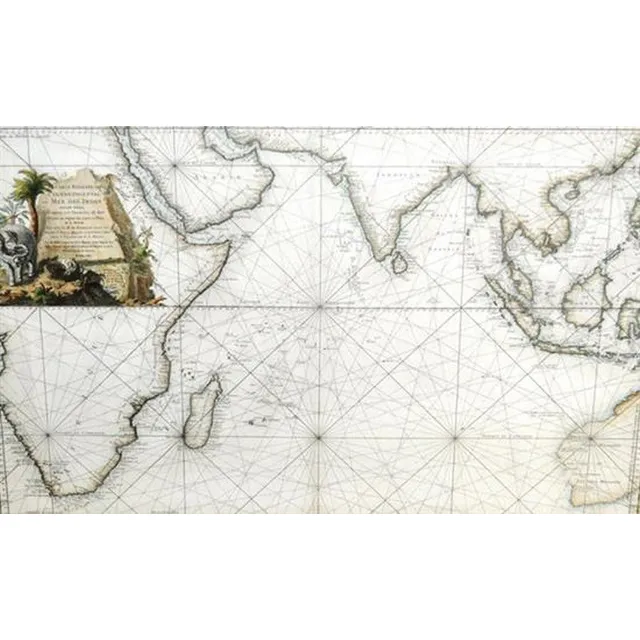
Eastern Ocean Map
After Jacques Nicolas Bellin, (1703 - 1772) France, Map - 'Carte Reduite de L'Ocean Oriental ou mer des Indes, Hand coloured engraving, 57 x 88 cm
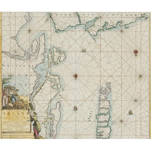
Hand-Coloured Map of Scotland and Ireland (1681)
Jjoannes Van Keulen, Yrland, Schotland, hand coloured map, circa. 1681, 50 cm high, 58 cm wide
New Map of East India and Adjacent Islands, 1670
Map, Indiae Orientalis nec Non Insularum Adiacentium Nova Descriptio. Map maker Nicholaus Visscher, pub. Amsterdam, 1670. Hand coloured engraving. 48 x 5 8 cm
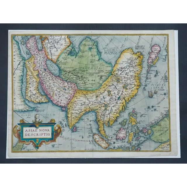
Ortelius' Map of Asia, 1574
Map, Asiae Nova Descriptio. Map of Asia by Abraham Ortelius, pub. Amsterdam c.1574. Hand coloured engraving. 37 x 4 9 cm
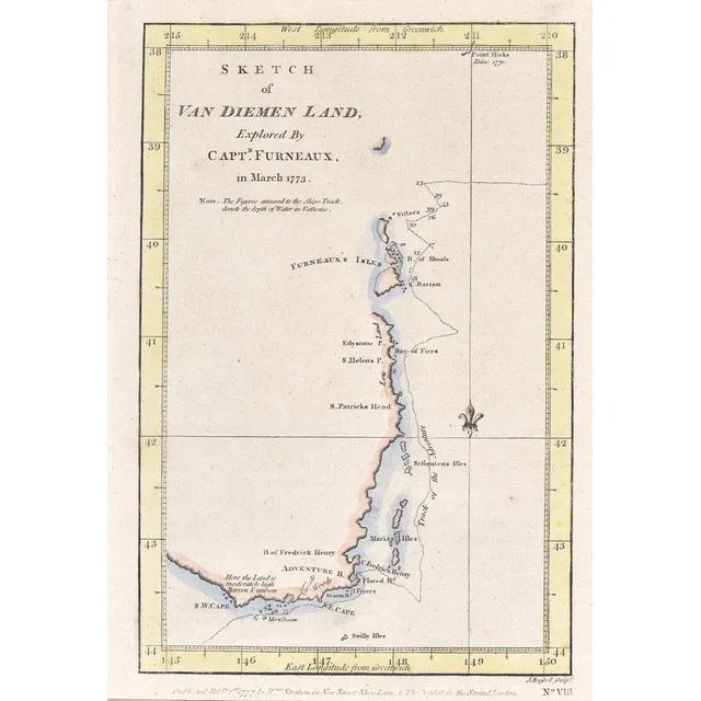
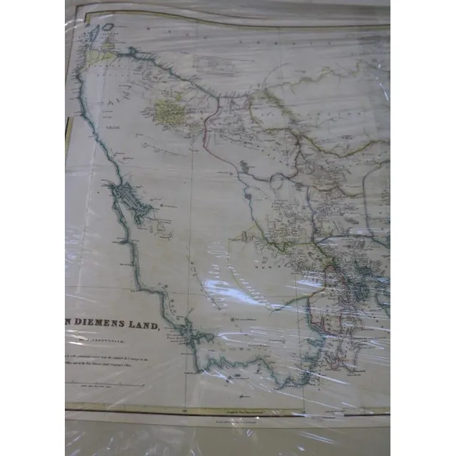
First British Map of Tasmania, 1777
Sketch of van Diemen land; Strahan & Cadell, London, 1777; Explored by Captain Furneaux in March 1773, hand coloured. Being the first British chart of Tasmania. 23 cm x 16 cm
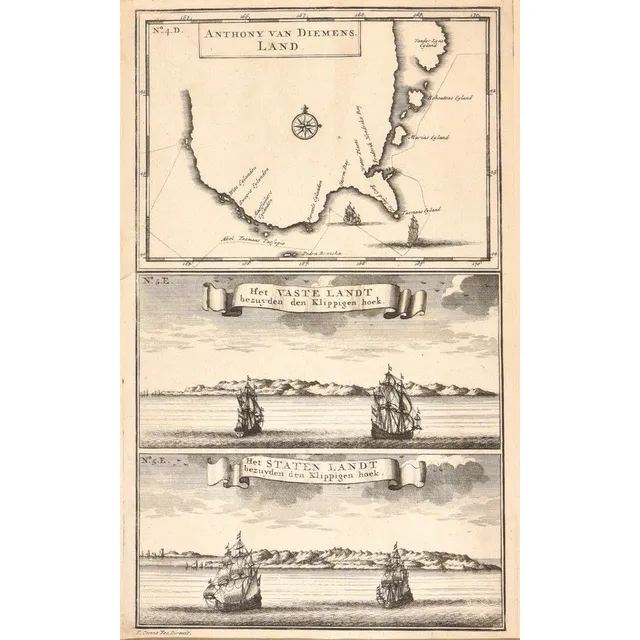
Early Map of Tasmania and Abel Tasman's Voyage
Anthony van Diemens Land; Francois Valentijn, Amsterdam, circa 1726; an early map of Tasmania showing the track of Abel Tasman's epic first voyage of 1642-1643, which resulted in the discovery of Tasmania and New Zealand. 19 cm x 30 cm

Calvert Expedition, Australia 1896
Hill. J.G., compiler. The Calvert Scientific Exploring Expedition, Australia, 1896. London, 1905. Small quarto, pp. viii, 44, with frontispiece map and large folding map, original cloth., Scarce acount of this disastrous Western Australian expedition led…
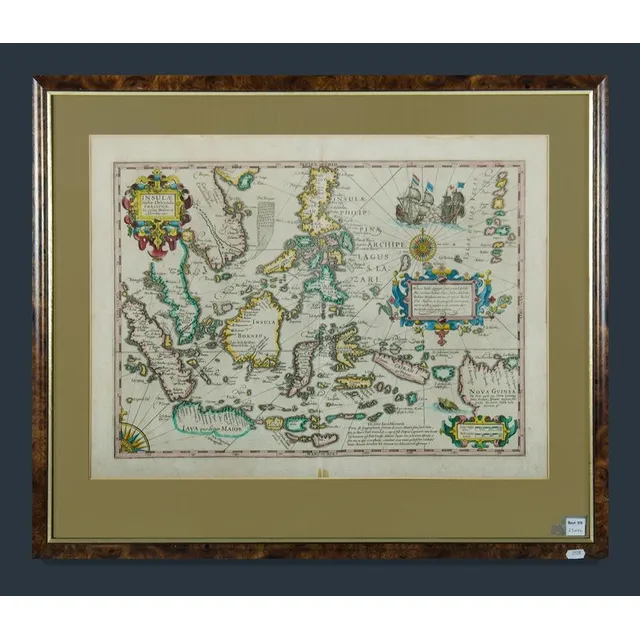
East Indies Map with New Guinea
Framed decorative colour map of the East Indies showing a portion of New Guinea. Insulae Indicae Orientalis Precipual. Image (40 x 53 cm) frame (57 x 68 cm)
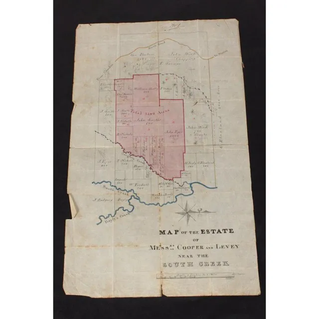
Estate of Copper and Levey Hand-Drawn Map
Australian Colonial hand drawn map of the Estate of copper and Levey, near south creek (Badgery Creek), showing the current landowners such as John Piper and Blaxland and the areas that Cooper and Levey were acquiring, signed P.L Bemi, 42 cm x 26 cm
New World Chart with British and La Perouse's Tracks
Laurie & Whittle, (London, 1800), A New Chart of the World on Wright's or Mercator's Projection in which are Exhibited all the parts hitherto Explored or discovered with the Tracks of the British Circumnavigators Byron, Wallis, Carteret and Cook, &c. and…
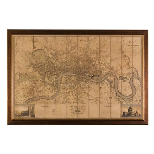
Greenwood's 1827 Map of London
A large map of London after the original by C & J Greenwood, 1827, 124 x 192 cm
Mortier's Pacific Ocean Map, 1700
Mortier Pacific Ocean map. 'Mer de Sud ou Pacifique' from suite du Neptune Francois pub. Amsterdam 1,700. Short edge tears, foxing. Hand coloured copper engraving, 60 x 75 cm (plate)
The First Detailed Mapping of The Adelaide Region, Carte Generale de la Terre Napoleon, [Baudin Expedition map] Louis de Freycinet, [Paris: grave par Tardieu, 1808.], attractively hand coloured, 54 x 78 cm (sight); framed 80 x 104 cm. At the time of the…
French Map of South West Australia, 1792-1793
Map original early French map of south West Australia depicts, Rottnest, swan river, Pt. Leeuwin etc.. A fairly rare copper plate engraving. Shows the voyages of the French vessels, Resecherche and Esperance in 1792 to 1793. Published as plate number 11…
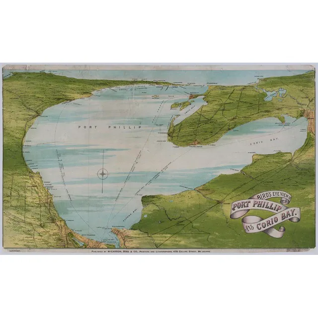
Bird's Eye View of Port Phillip & Corio Bay (1872)
(Victoria) 'Bird's Eye View Of Port Phillip And Corio Bay' 1872, Colour lithograph, title in image lower right, publisher's line in lower margin, 41 x 68 cm. Old folds, scratches and stains, repaired tears and slight paper loss. Linen-backed. 'Published…
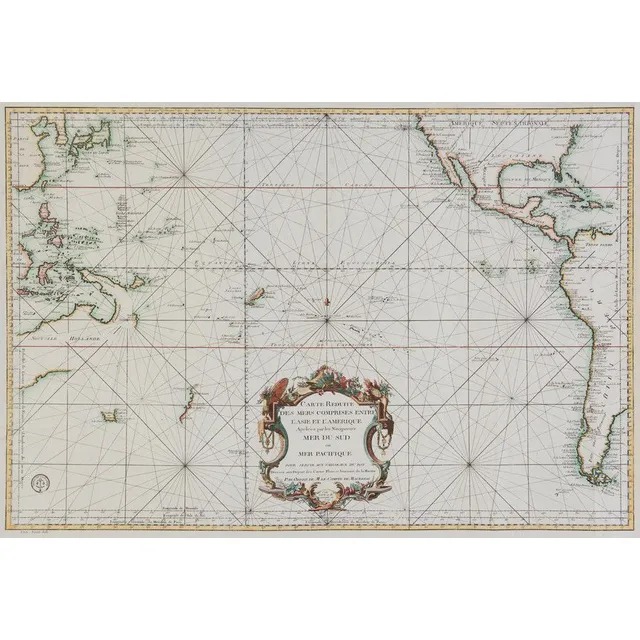
South Pacific and Surrounding Coasts, 1776
Bellin, Jacques Nicolas, 1776, Carte Reduite des Mers Comprises Entre l'Asie et l'Amerique Apelees par les Navigateurs Mer du Sud ou Mer Pacifique.., Paris, 1776, 63 x 89 cm. The chart focuses on the South Pacific, extending to China, Korea & Japan in the…
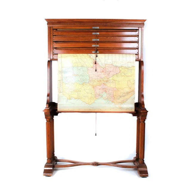
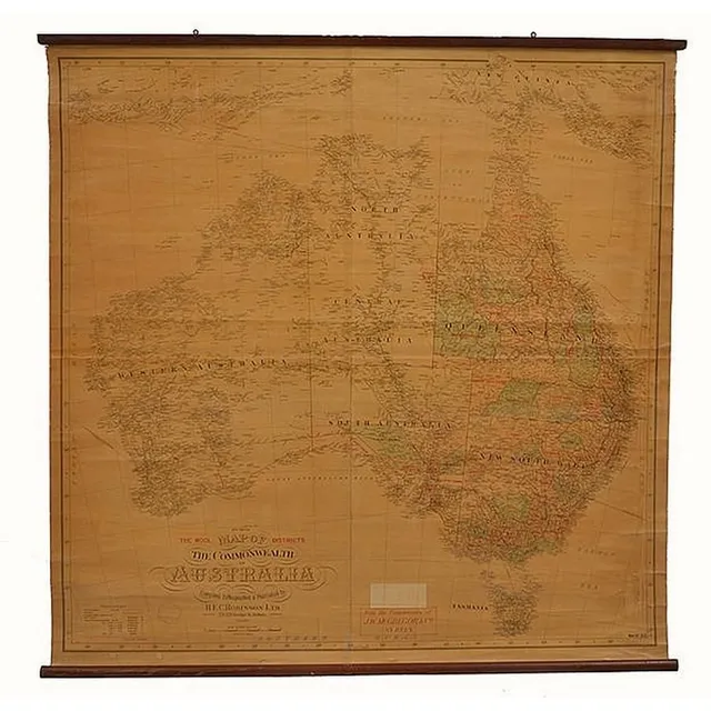
Vintage Australian Map Stand
Map stand, early 20th century classic style yellow oak (maple?), stand containing five state maps on Rollers showing pastoral Stations of Australia etc, by H E C Robinson Ltd George Street Sydney
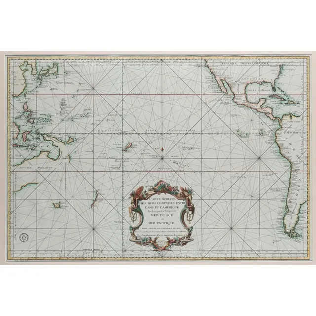
Pacific Ocean Discoveries 1700s
Bellin, Jacques Nicolas (1703-1772). 'Carte Reduite Des Mers Comprises Entre L'Asie et L'Amerique Apelees par les Navigateurs Mer Du Sud ouMer Pacifique...', [Paris: Depot de la Marine, 1776.], attractively hand-coloured, 55 x 82 cm (image), 83 x 112 cm…
Hand-Coloured Lunar Map by Johann Gabriel Doppelmair
Tabula Selenographica, Johann Gabriel Doppelmair (1671-1750), Nuremberg, circa 1742, hand coloured engraved double-hemisphere of the lunar surface, vertical seam to centre, the map, 47.5 x 59 cm. Provenance: Purchased from Baynton- Williams, London in the…
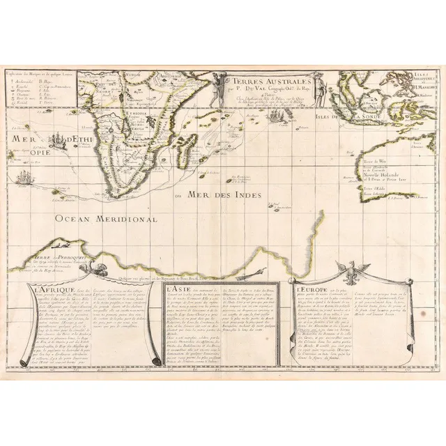
Dutch Discoveries in New Holland and Indian Ocean (1684)
Terres Australes; Pierre du Val (1619-1683), Paris, 1684; a hand coloured map of the Dutch Discoveries in the New Holland and the Indian Ocean. Third issue, the first being 1677. 59.5 x 42 cm
Hand-Coloured Map of England, 1681
Ionhannah Van Keulen, Engeland, hand coloured map, circa. 1681, 50 cm high, 55 cm wide
Seutter's 17th Century World Map
Matthias Seutter 17th century map, entitles 'Diversi Globi Terr-Aquei Statione Variante et Visu Intercedente, per Ambos Polos et Particul. Sphaerae Zenith in Planum Delineati Orthographici Prospectus, Quibus Additae pro Mutatione Horizontis Differentes…
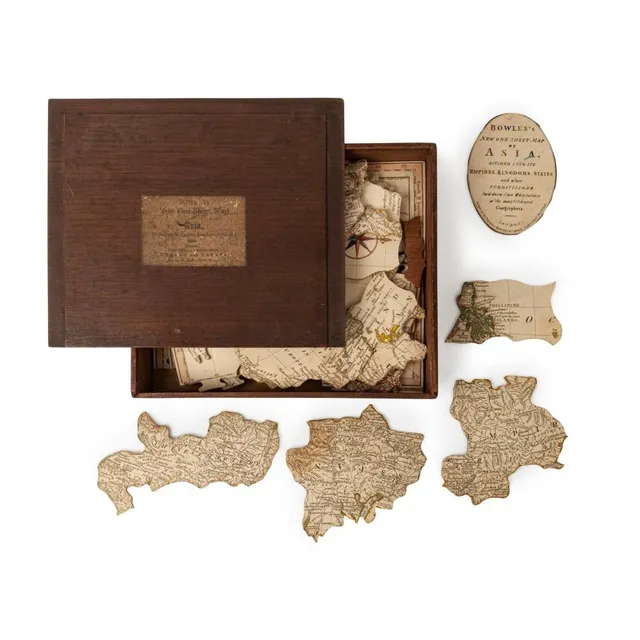
Bowles's One-Sheet Map of Asia Puzzle, c. 1801
Bowles's new One-Sheet map of Asia, divided into its Empires, Kingdoms, States, &c., [Bowles and carver, St. Paul's church Yard], circa 1801, Dissected map, 54 pieces with three blank replacement pieces (the lost pieces in the regions of Java, Sumatra and…
Nouvelle Hollande Map, 1753
Map, Nouvelle Hollande, 1753. Cartographer Bellin, as published in Prevost Histoire Generale des Voyages, Paris, 1753, height and coloured copper engraving, 21 x 28 cm
Rare Map of New South Wales and British Settlements
Rare Chart / Map of New South Wales (Van Diemen's Land) & Survey in the Interior of New South Wales, also showing the British Settlements at Port Jackson, J, Aspin, Hewitt Buckingham Place, approx 52 cm x 62 cm (Excellent condition, framed and glazed) See…
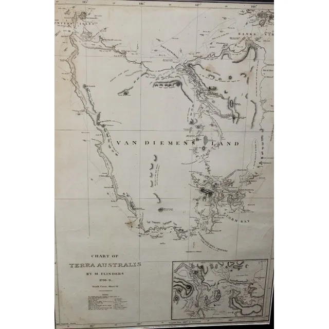
Chart of Terra Australis by M. Flinders 1798
Chart of Terra Australis by M. Flinders 1798, 99 published 1814, G&W Nicol 66 cm x 46 cm
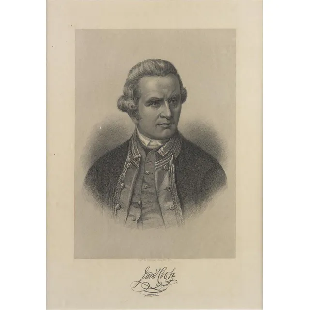
Captain Cook Chart and Portrait
Captain Cook: 'A New and Complete Chart of the World, Displaying the Tracks of Captn Cook, and other Modern Navigators' by Thomas Bowen [London, c1787], plus Portrait of Captain James Cook 'Engd. by H.B.Hall's Sons, New York' [c1880]. Both framed, various…
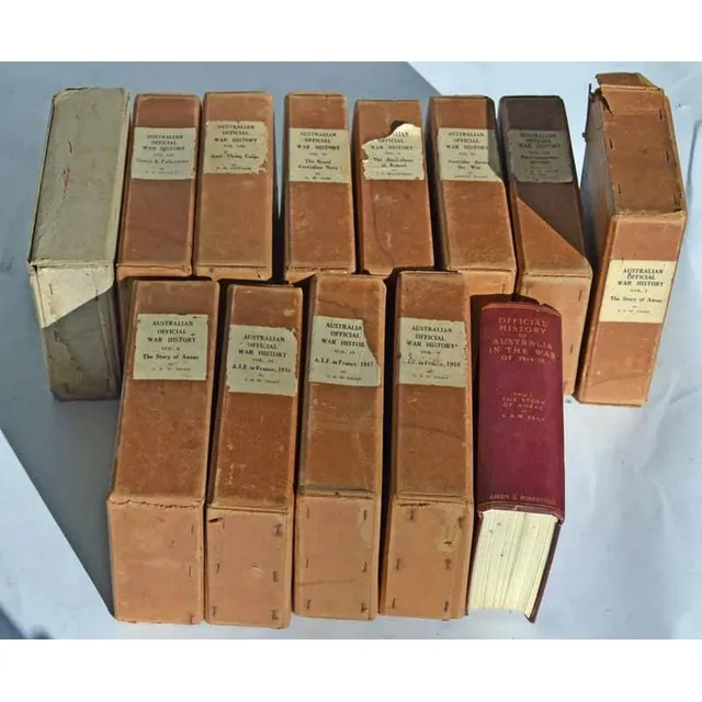
The Story of Anzac: C.E.W. Bean's 12 Volumes
Charles Edwin Woodrow bean (C.E.W. Bean) 1879 - 1968. The story of Anzac; 12 volumes with original covers 'From the outbreak of war to the end of the first phase of the Gallipoli campaign, May 4, 1915', with 111 maps and 56 illustrations Ninth edition,…
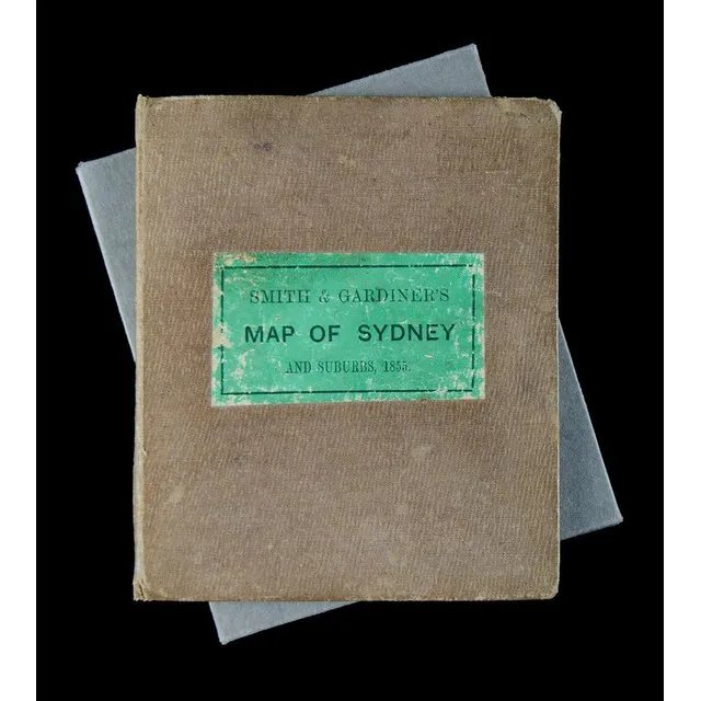
1855 Map of Sydney & Suburbs in Leather Binding
Smith & Gardiner's map of Sydney & Suburbs 1855. Leather bound cover (11.5 x 14 cm), inside folds out to a 32.5 x 38.5 cm map on material. Enclosed by a protective cardboard folder to fit.
Map of the Pacific Ocean by V.M. Coronelli
Mare Del Sud, Detto Altrimenti Mare Pacifico; Vincenzo Maria Coronelli (1650-1718), Venice, circa 1691; an engraved and uncoloured map of the Pacific Ocean. 62 x 47 cm
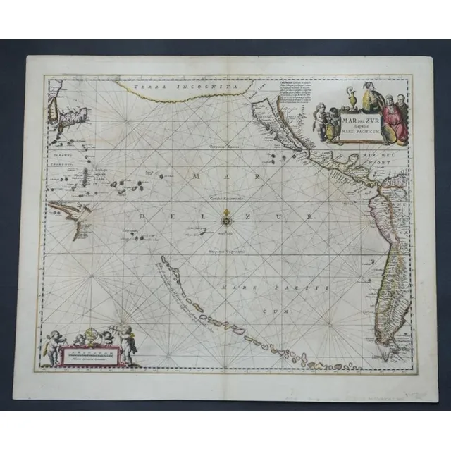
Mar Del Zur Hispanis Mare Pacificum Map, 1650
Map, Mar Del Zur Hispanis Mare Pacificum. Jan Jansson mapmaker, published Amsterdam 1650. Hand coloured engraving. 44 x 5 5 cm