Early Map of Australia and Surrounding Territories
click the photo to enlarge
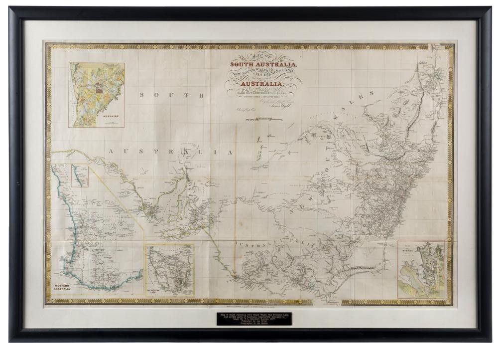
James Wyld, map of South Australia, New South Wales, van Diemen's land, and Settled parts of Australia., Respectfully dedicated to Major Sir T.L. Mitchell K.t D.C.L. F.G.S. &c Surveyor general of New South Wales, (London: circa 1841), 62 x 94 cm; hand coloured, linen backed; framed 78 x 109 cm overall. This version of the map shows inserts of Adelaide, Sydney, Western Australia and van Diemens land; Victoria is still labelled 'Australia Felix'
You must be a subscriber, and be logged in to view price and dealer details.
Subscribe Now to view actual auction price for this item
When you subscribe, you have the option of setting the currency in which to display prices to $Au, $US, $NZ or Stg.
This item has been sold, and the description, image and price are for reference purposes only.
- Circa - A Latin term meaning 'about', often used in the antique trade to give an approximate date for the piece, usually considered to be five years on either side of the circa year. Thus, circa 1900 means the piece was made about 1900, probably between 1895 and 1905. The expression is sometimes abbreviated to c.1900.
This item has been included into following indexes:
- maps - general 445