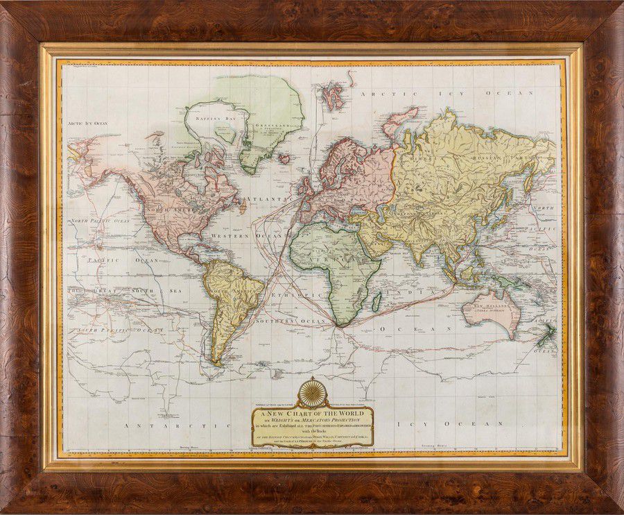
New World Chart with British and La Perouse's Tracks
You must be a subscriber, and be logged in to view price and dealer details.
Subscribe Now to view actual auction price for this item
When you subscribe, you have the option of setting the currency in which to display prices to $Au, $US, $NZ or Stg.
This item has been included into following indexes:
Visually similar items

NSW Maps: 'Map of Part of New South Wales' by Lizars [Edinburgh, 1824], plus 'New South Wales, Compiled under the Superintendence of the Society for the Diffusion of Useful Knowledge' [London, 1833], both framed, various sizes.

'Sydney Harbour Trust Birds Eye View Of The Port Of Sydney' by W. Withers, circa 1918 lithograph on card, glazed and framed in oak 65 x 80 cm

A needlework silk on linen Sampler '1725', English, 18th century, 21 cm wide, 41 cm high
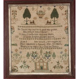
Early 19th century framed sampler, of rectangular form, decorated with vases of flowers, lions and crowns under trees, 'Be Christ my pattern and my guide...Miss Johnson's school. Dec 13. 1825/Prepare to meet thy God in Glory', in tones of green, brown and