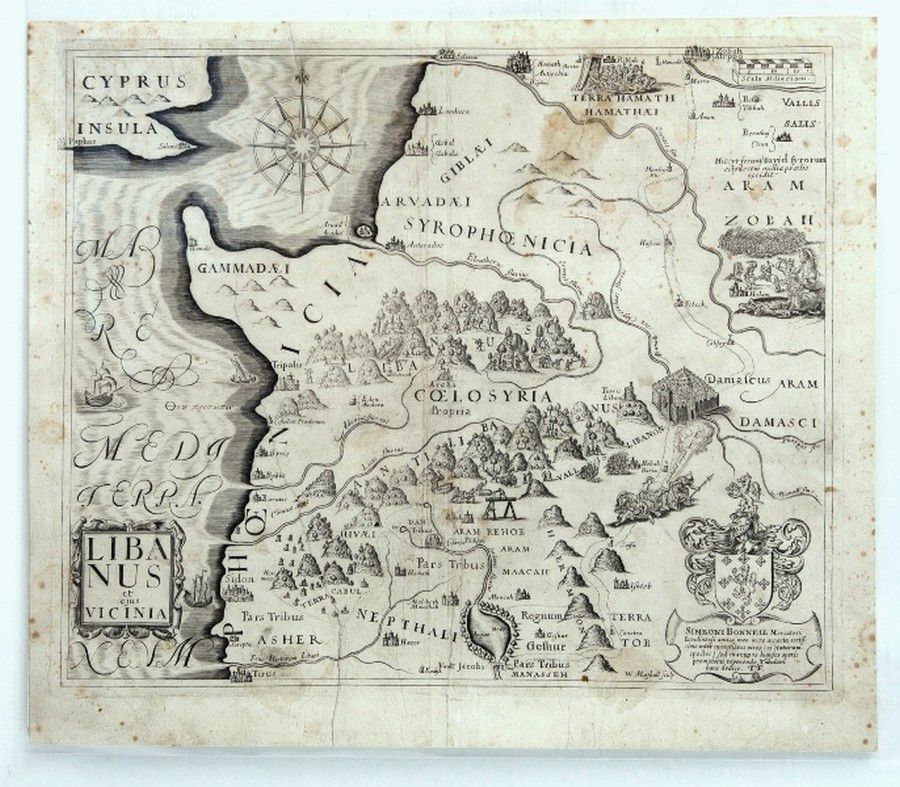
Early Maps of the Holy Land (or) Western Mediterranean Maps
You must be a subscriber, and be logged in to view price and dealer details.
Subscribe Now to view actual auction price for this item
When you subscribe, you have the option of setting the currency in which to display prices to $Au, $US, $NZ or Stg.
This item has been included into following indexes:
- maps - general 445
Visually similar items

Edward (Ted) Scorfield (1882-1965). Large pen and ink cartoon on card. Circa 1950 'Doing a bit of Weeding?'40 x 44 cm. Toned with light foxing. Carl Lyon (1903-1982). Two horizontal pairs of original pen and ink 'Wally and the Major' cartoons. 55 x 24 cm.

Dietrici (1712-1774) 'Le Satyr Chez Les Paysans' 18th century etching

Warwick Armstrong: 1922 programme, 'Complimentary Smoke night, tendered to Mr.Warwick Armstrong. Melbourne Town Hall, March 31st 1922', with 3 signatures on front cover including Monty Noble & Warwick Armstrong. Folded, but scarce and attractive

Louis Kahan: Shearing the Lambs 1982 etching, signed dated and editioned to margin, 40 x 29 cm