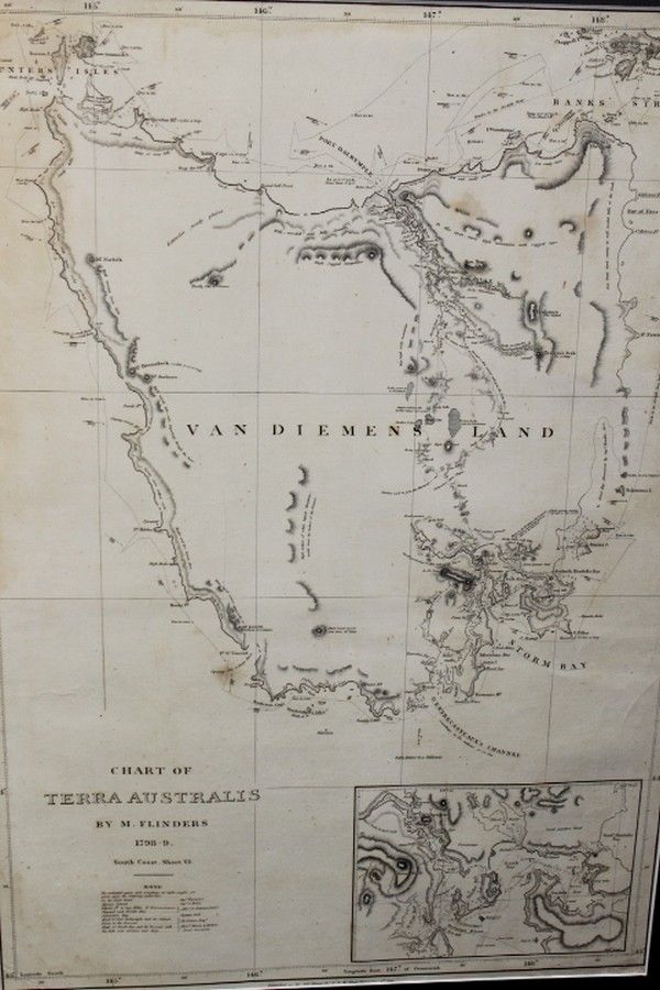
Chart of Terra Australis by M. Flinders 1798
You must be a subscriber, and be logged in to view price and dealer details.
Subscribe Now to view actual auction price for this item
When you subscribe, you have the option of setting the currency in which to display prices to $Au, $US, $NZ or Stg.
This item has been included into following indexes:
- maps - general 445
Visually similar items

Map, 'Royaume de Hongrie et Pays Adjacents,' par M.Bonne, Andre Scul. Engraving. 25 x 36 cm

Map, in Notitiam Ecclesiasticam Africae. Map of Spain, Eastern Mediterranean and north Africa by Philippe Buache, pub. Paris 1745. Hand coloured copper engraving. 49 x 64 cm

Slowman, John: Found Guilty of burgulary at the Central Criminal Court, London and transported for 14 years aboard the 'Anson' (departed 23rd Sept.1843, arrived at Vdl 4th Feb.1844): printed vellum document filled out in mss in various hands, being a compl
A New & Correct Chart of all the Known World by Emanuel Bowen [London 1744]. 46 x 38 cm