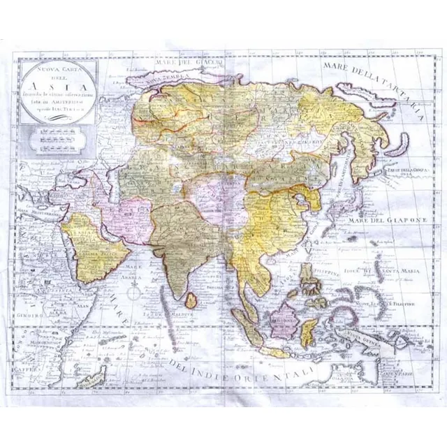
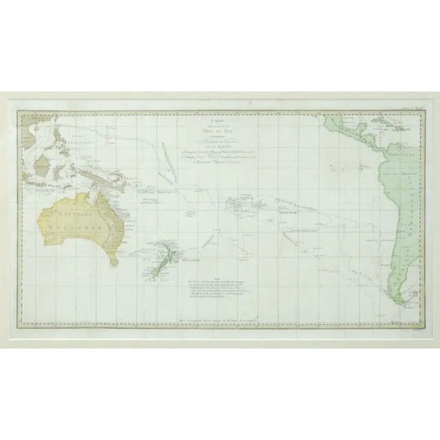
1740 Map of Asia, Indonesia, Australia, and Africa
MAP - Tirion, Isaak. Nouva Carta dell Asia Venice, Giovanni Albrizzi, 1740 engraved map, hand coloured outline and original wash, watermarked paper. Covers mainland Asia and Indonesian islands, also features East African coast and Arabia. Small aspects of…
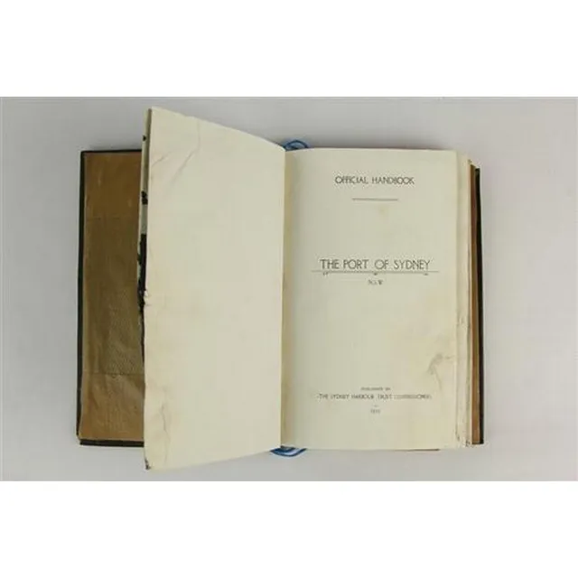
Sydney Port Handbook 1919 with Maps and Dimensions
Port of Sydney NSW official Handbook 1919 published by the Sydney Harbour Trust Comissioners, with various maps, coloured & otherwise, dimensions 22.5 x 15 cm
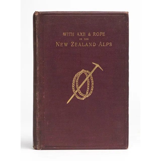
Alpine Adventures in New Zealand
(New Zealand) Mannering, George Edward, With Axe and Rope in the New Zealand Alps. (1st ed. London and New York: Longmans, Green, & Co., 1891). 8vo. viii, 139, 24p. Frontispiece, plates, folding coloured map, publishers? catalogue. Gilt decorated maroon…
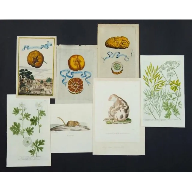
Early Botanical and Faunal Prints Collection
Various early botanical & Faunal prints, including Phalanger Tachete by A. Prevost. From Atlas Zoologique which accompanied voyage Antour de Monde by Saulces & Freycinet, Paris c1820; 11 botanical prints by Weinmann, c1745; three German fruit prints, 1708…
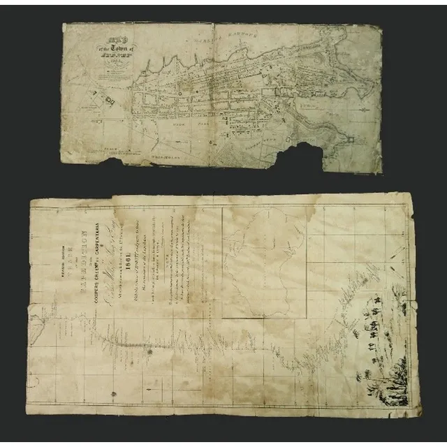
Early Australian Maps: Burke-Wills Expedition & Sydney Town, 1833
Two early Australian Maps. 'Track of the Expedition from Coopers Creek to Carpentaria by Burke, Wills, King & grey.' pub. De Gruchy & Leigh Melbourne, 1861.linen backed, top margin trimmed, stains. Also 'Map of the Town of Sydney, 1833.' engraved by…
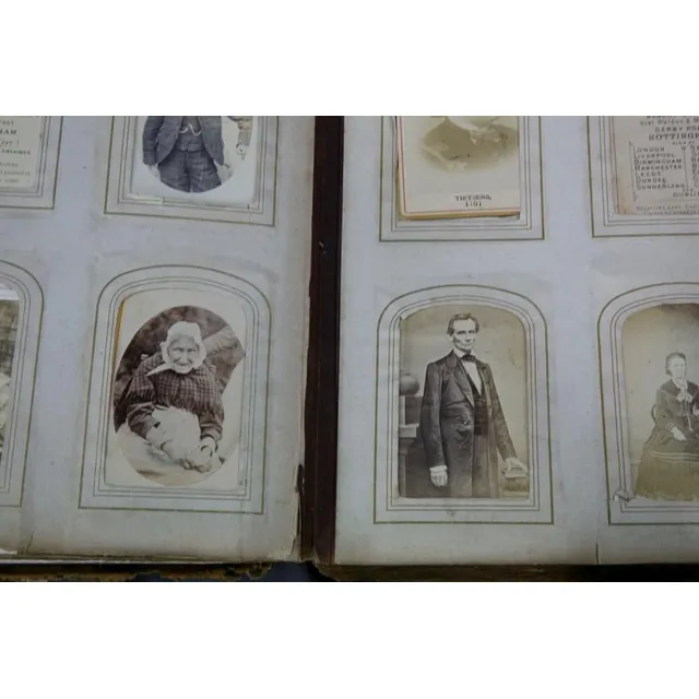
19th Century Cartes de Visite and Famous Figures
Album 19th century photographs etc. Carte de visite, famous figures incl. Lincoln & HRH the Prince of Wales; some explorer & town views, children & animals. Mostly English.
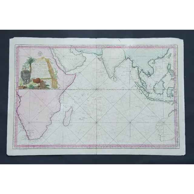
Eastern Ocean Map, Bellin, Paris 1757
Map, Carte Reduite de L'Ocean Oriental ou Mer des Indes. Mapmaker J N Bellin, pub. Paris, 1757. Hand coloured engraving. 56 x 8 8 cm
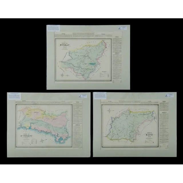
NSW County Maps with Towns and Rivers (3)
Maps (3), NSW County, St Vincent, Murray & King, including. Towns, Araluen, Braidwood, Queanbeyan (Canberra area noted), Dalton & Gunning. Publ. 1872, hand coloured lithograph (3), 38 x 53 cm (each)
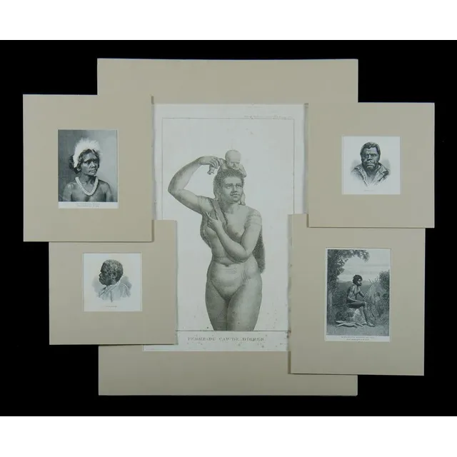
Perouse Atlas & Aboriginal Engravings from Raven Collection
Six items. After Jean Piron, 'Femme Du Cap De Diemen.' plate 6 form 'Atlas Du Voyage a La Recherche De La Perouse,' pub. Paris 1800 etching (44 x 31 cm). Also, 5 wood engravings depicting aboriginal subjects including. King Billy & Truganini. Collection…
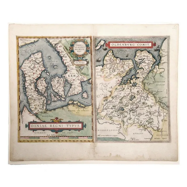
Denmark Maps by Ortelius, Anthoniszoon & Oldenburg, 1598
Map, Ortelius, Daniae Regni Typus. 2 Maps, Denmark by Anthoniszoon & Oldenburg Commit. Pub. By Ortelius, Antwerp, 1598, 35 x 50 cm
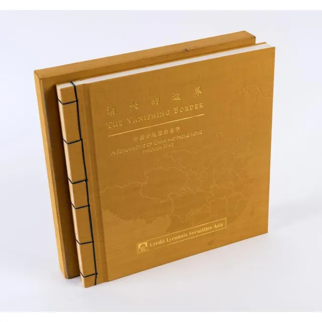
The Vanishing Border: China and Hong Kong Retrospective
The Vanishing Border: A Retrospective of China and Hong Kong through Maps published by Credit Lyonnais Securities (Asia) Ltd. [Hong Kong, 1997], limited edition of 3000 copies, embossed yellow cloth boards with gilt lettering and blue thread binding, in…
Auckland Fire Brigade Map Folio, 1928
An old 'Auckland Key to Block Plans' folio of street maps in folder form as used by the fire brigade, printed detail including 'Council of Fire & Accident Underwriters Associations of New Zealand in December 1928. Superseding Previous Issue'. 38 cm x 50 cm
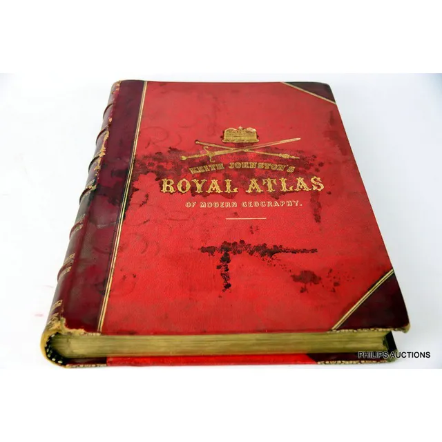
1884 Royal Atlas of Modern Geography
Keith Johnston's Royal atlas of modern Geography, 1884 edition, a red leather bound and tooled volume by Alexander Keith Johnston, Geographer, to the Queen for Scotland, published by W & A.K. Johnston, Easter Road, Edinburgh, length 51 cm, width 35 cm
Cook's Voyages and Historical Prints Collection
A collection of mounted lithographs, engravings and reproductions, depicting Cook's Voyages, figurative studies and historical maps, 23 x 37 cm (average image size)
Chart of Pacific Ocean with Cook's voyages and incomplete coastlines
Map: 'Chart of the Pacific Ocean' circa 1820 showing New Holland with incomplete northern and southern coastlines and only the east coast of Van Diemen's Land; Papua or New Guinea largely incomplete; Japan, Philippines, eastern China and the north and…
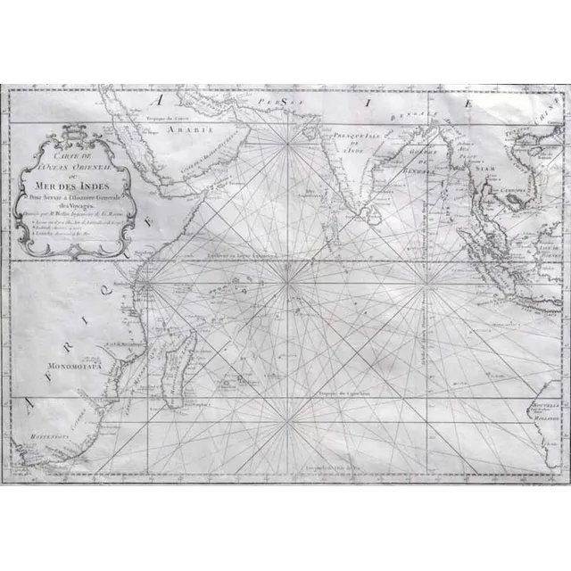
Carte de L'Ocean Oriental (Map of Eastern Ocean)
MAP - Bellin, Jacques Nicolas. Carte de L'Ocean Oriental ou Mer Des Indes, Paris, Didot, 1750. Engraved map, covers the entire Indian Ocean. Eastern coast of Africa and Madagascar depicted along with southern Arabia and India. Indonesian Islands and…

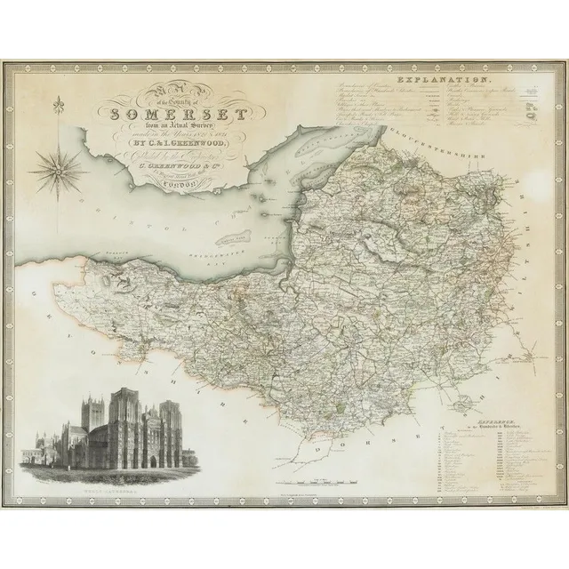
Somersetshire Map, 1787
L. Cary, Map of Somersetshire, hand coloured engraving, circa.1787, 39 cm high, 51 cm wide
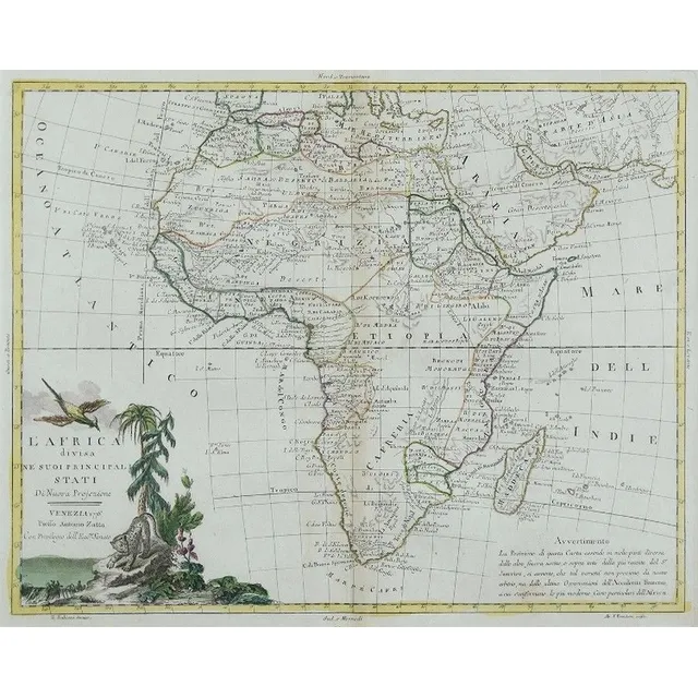
Africa Divided: Zatta's 1776 Map
Map, L'Africa Divisa Ne Suoi Principali Stati. By Antonio Zatta, pub. Venice 1776. Hand coloured with pictorial title vignettes. Copper engraving. 31 x 41 cm
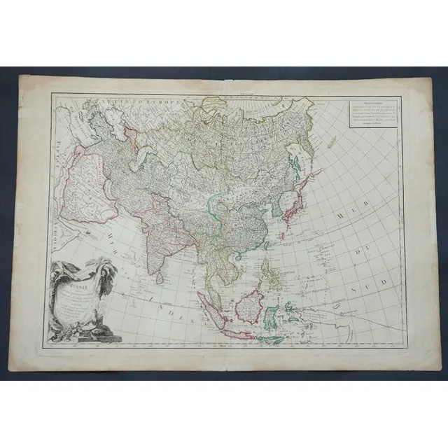
Asia's Main States
Map, L'Asie Divisee en ses pair of incipaux Etats. Mapmaker, Jean Janvier, pub. Paris 1760. Hand coloured engraving. 49 x 6 8 cm
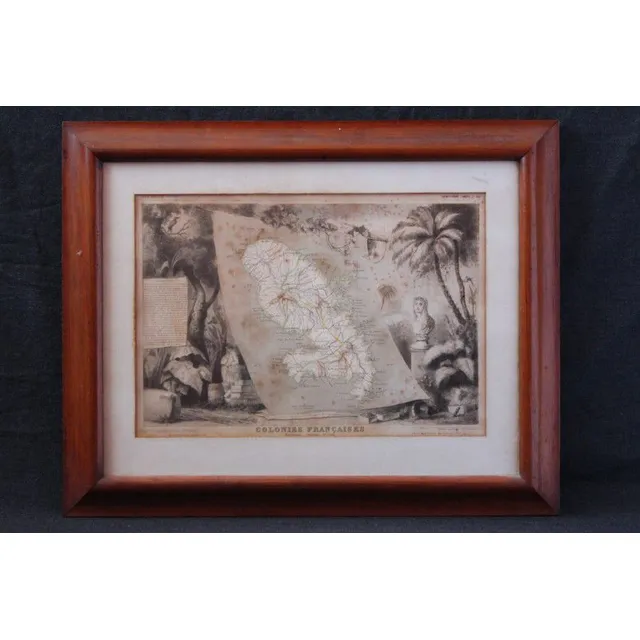
French Colonies Map, Martinique, 1856
Map mid 19th century, 'Colonies Francaise', 'Martinique Amerique ' by Victor Levasseur, c.1856, handcoloured etching, framed, 30 cm x 42 cm
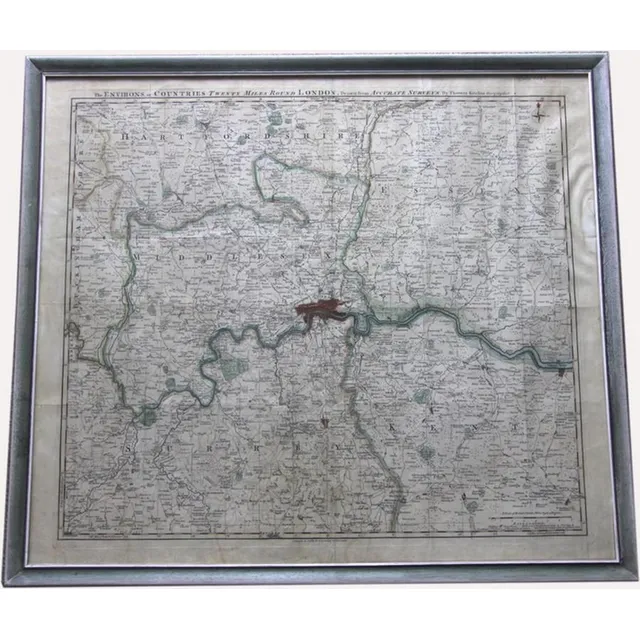
London Environs Antique Map
Antique map of environs. Twenty miles around London drawn from accurate surveys by Thomas Kitchin. Published by R & I Godsley. Circa 1756. 53 x 60 cm
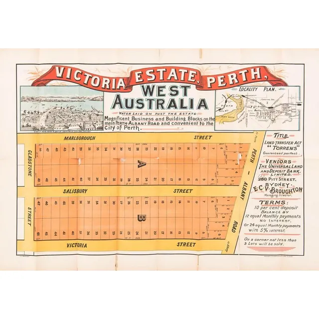
Victoria Estate Lithograph Advertisement
'Victoria Estate, Perth, West Australia' lithograph real estate advertising with lithograph view & locality map, printed by Websdale, Shoosmith & Co Litho, Sydney. Multiple rips particularly to the folds. 78 x 57 cm
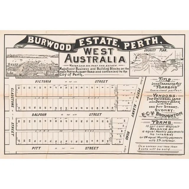
Perth Real Estate Lithograph Advertising (2 items)
'Burwood Estate, Perth' & 'Albert Park Estate, Perth' lithograph broadside real estate advertising both with locality map & one with engraved view, printed by Websdale, Shoosmith & Co Litho, Sydney. Some rips along the folds & the bottom margin. Early…
Hand-Coloured Map of England by Saxton and Kip
Christoper Saxton, Hand coloured engraved map by William Kip, circa. 1575, 38 x 27.5 cm
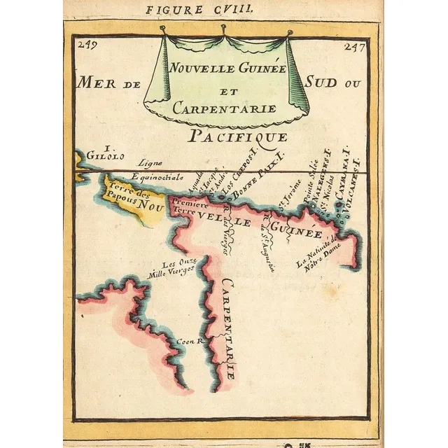
Early Maps of Australia and New Zealand
MALLET MAPS, 'Nouvelle Guinee et Carpentarie'&'Des Terres Australes', by Allain Manesson-Mallet [Paris, 1683], both window mounted, framed &glazed, each about 28 x 34 cm. Early maps showing Australia &NZ
New Zealand Map by M. Bonne (Hand-Coloured)
'Carte De La Nouvelle Zeelande'. By M. Bonne. Hand coloured. 37 x 25 cm
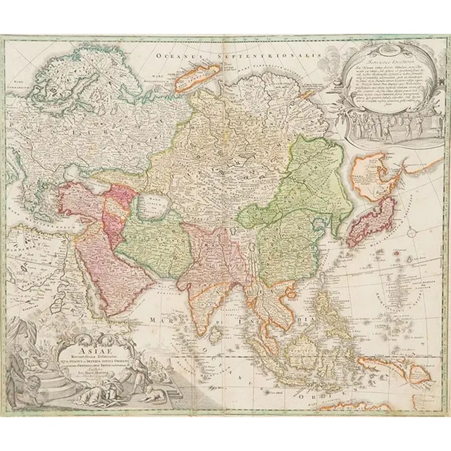
1730 Hand Coloured Map of Asia by Homann
18th century (1730) hand coloured map Asiae Authore Ion. Bapt. Homann 49 x 58 cm
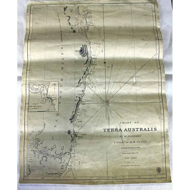
Flinders' Chart of Terra Australis (1799-1802)
A Cahrt of Terra Australis, 'By M. Flinders, Comm'r. Of H.M. Sloop Investigator. 1799-1802''. Paper on canvas. Engraved by J. & C. Walker, circa 1858. 64.5 x 47.6 cm
South Seas Chart: Monats, Carteret, Cook (1765-69)
Framed Chart of the South Seas. Engraved by Bernard, France. Showing routes taken by Captain Monats 1765, Captain Carteret 1767, Lieutenant Cook 1769. Hand coloured engraving. 69 x 39 cm
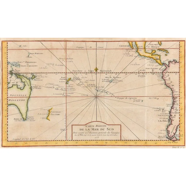
Reduced Map of the South Pacific
Carte Reduite De La Mer Del Sud; Jacques Nicolas Bellin (1703-1772), Paris, circa 1753; the hand coloured early map of Australia and New Zealand. 36 cm x 21 cm
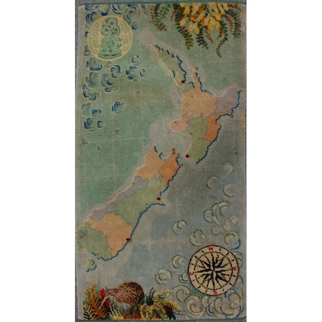
Vintage Feltex NZ Map Rug with Hei Tiki & Compass
A vintage Feltex New Zealand map rug, machine woven in colours, hei tiki in rondel top left corner, a compass bottom right. 128.5 cm x 68 cm
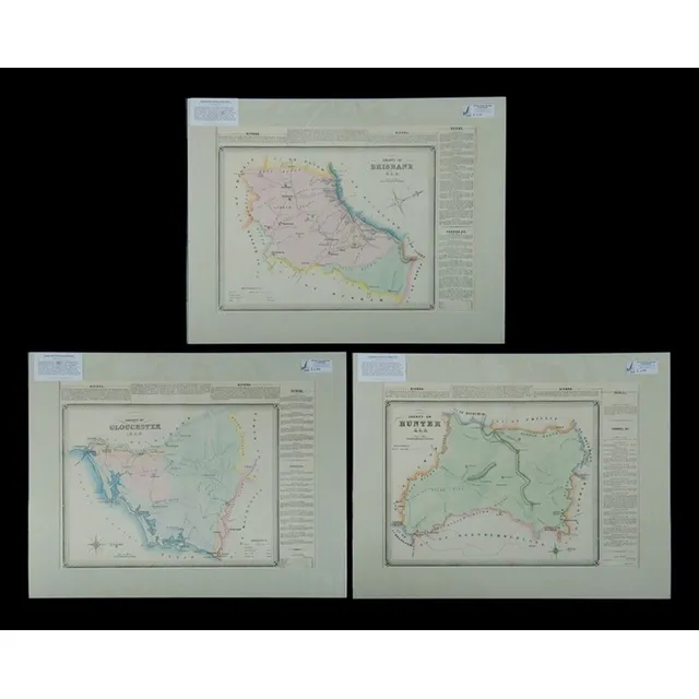
NSW County & Towns Map, 1872
Maps (3), NSW County, Brisbane, Gloucester & hunter, including. Towns, Scone, Boggibri, Bullah-della & Gloucester. Pub. 1872, hand coloured lithograph (3), 38 x 53 cm (each)
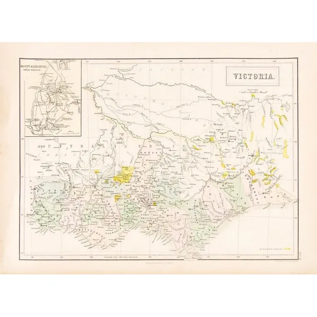
1853 Victoria Goldfields Map by J. Bartholomew
C1853 Goldfields map of Victoria drawn and engraved by J.Bartholomew (Edinburgh), Unframed, 32 x 43 cm
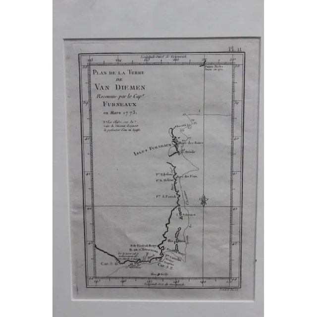
1773 Map of Maria Island, Van Diemens Land
Original map of Maria Island van Diemens Land dated 1773, 24 x 17 cm
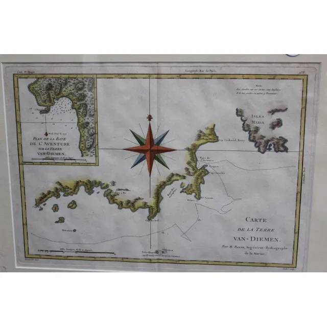
1777 Map of Maria Island, Van Diemens Land
Original map, Maria Island, van Diemens Land dated 1777, 37 x 27 cm
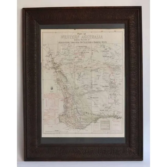
Western Australia Agricultural Land and Rainfall Map
A lithograph map of Western Australia c.1903 - 04 showing Position of Agricultural Land open for selection & Rainfall Belts. Pether, Governmen Lithographer Perth W.A. 63 x 48.5 cm (poster image size)
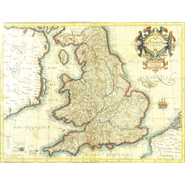
16th Century Map of England and Wales by Mercator
A 16th century map of England and Wales by Gerhard Mercator, published by Hondius c.1630s, entitled in a decorative cartouche, 'Anglia Regnum'. Detailed with Latinized names of counties and detailed with town names from Saxton's Map of 1579, additionally…
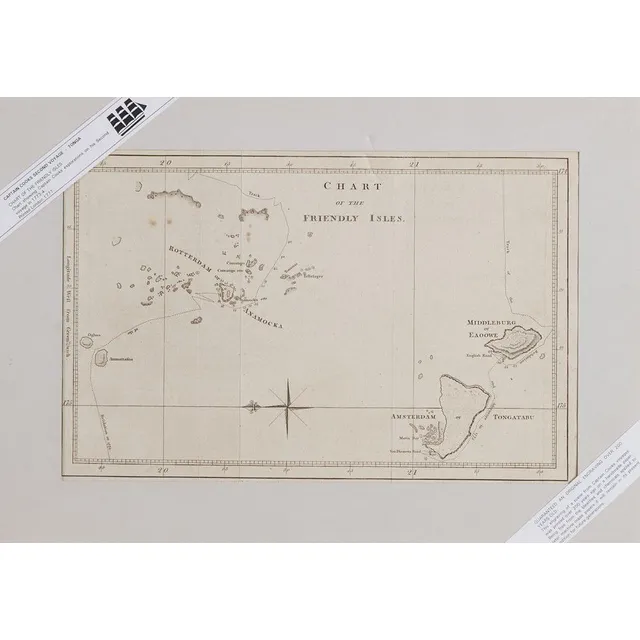
Chart of Friendly Isles, 1777
Chart of the Friendly Isles, lithograph. Printed in London 1777. From Captain James Cook's second voyage 1773 - 1774. Mounted on board, 21.5 x 33.1 cm
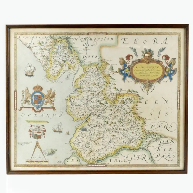
Early English Maps: Saxton and Speed
Two early English maps, one by Christopher Saxton, 'Lancastriae 1577' and 'Chester' by John Speed. Each 42 cm x 53 cm.
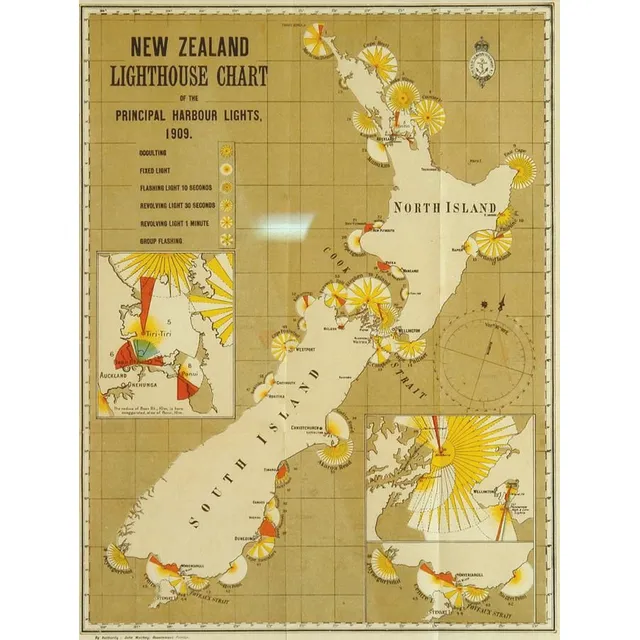
1909 N.Z. Lighthouse Chart in Frame
'N.Z. Lighthouse Chart' the principal harbour lights, 1909, printed in colours by the Marine Department, framed and glazed. 30 cm x 23 cm
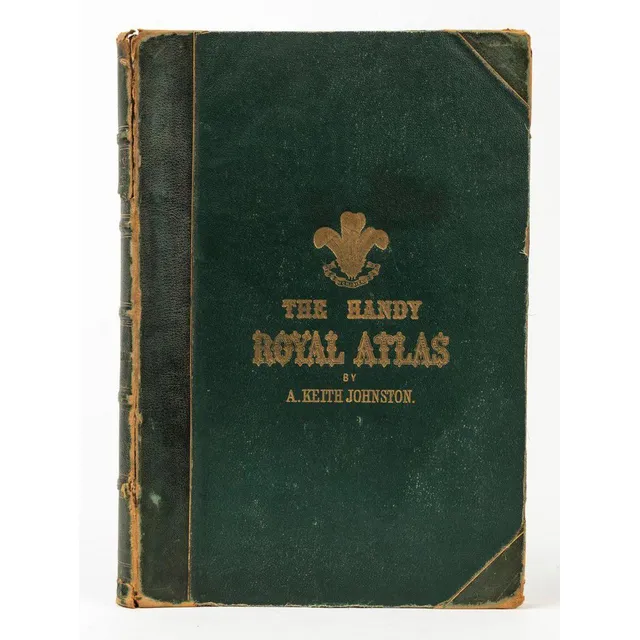
Keith Johnston Handy Royal Atlas (1877)
Alex. Keith Johnston Handy Royal Atlas of Modern Geography (Edinburgh & London; W. & A.K. Johnston, 1877) Folio, half-crushed green morocco over pebbled cloth; all edges gilt, frontispiece chart of the North Polar regions. 45 double-page engraved maps; 2…
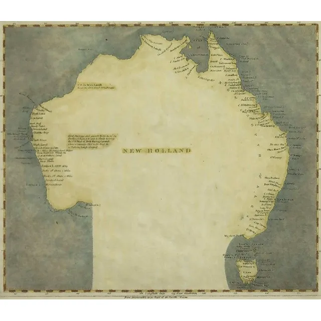
Map of New Holland, 1804-5
Map of new Holland circa 1804-5. Showing surveyed & charted areas. Pub. By Arrowsmith and Lewis. Engraving. 20.5 x 25 cm
The Kingdom of England
Map, 'The Kingdome of England,' John Speed 1610. Described by Christopher Saxon, augmented by John Speed; with costumed figures vignettes to each side. Hand coloured engraving. 38.5 x 51 cm
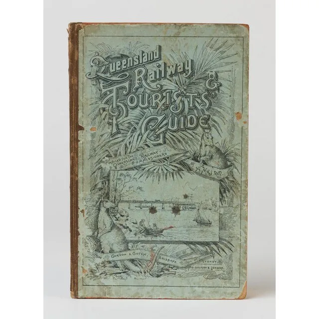
Queensland Railway & Tourists' Guide (1890)
Meston, Archibald (1851-1924), Queensland Railway & Tourists' Guide, compiled under instructions from the Queensland Railway Commissioners. (Brisbane, Gordon & Gotch (1890)). 176p, illustrated with 22 leaves of plates, folding colour map of Queensland…
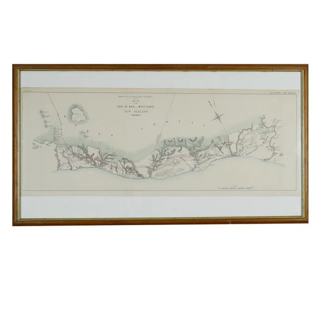
West Coast War Map 1869
A 'Map of the Seat of War.- West Coast. New Zealand' 1869 by Arrowsmith for Enclosure in the Governor's Despatch No.7 (Hansard). 32 x 84 cm.
1744 Hand-Coloured World Map by Emanuel Bowen
After Emanuel Bowen: a New and Accurate Chart of the World, hand coloured framed map bearing date 1744 upper right 36 x 44 cm (image)

Native Tribes of Northern Territory: Introduction & Report
Spencer, W. Baldwin. An introduction to the study of certain native tribes of the Northern Territory. [With] Preliminary report on the Aboriginals of the Northern Territory. Melbourne, 1912-13. Bulletin of the Northern Territory, numbers 2 and 7, quarto,…
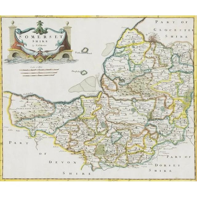
Hand-Coloured Map of Somersetshire (1695)
Robert Morden, Somersetshire, hand coloured map, circa. 1695, 35 cm high, 41 cm wide
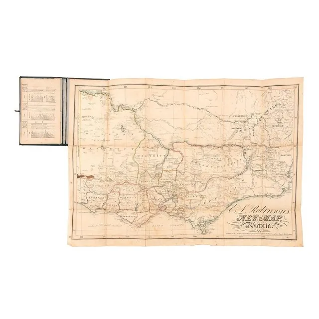
1862 Victoria Pocket Map by E.L. Robinson
Victoria: 'E.L. Robinson's New Pocket Map of Victoria' (Robinson, Melbourne, 1862) engraved by W.Palmer. Linen-backed folding map contained in a pocket-book sized gilt-lettered cloth folder with ties. Affixed to the inside front cover is a list of the…
Early Engravings Collection
Five early engravings. 'Esher place in County of Surrey, the seat of Thomas cotton..... After L. Knyss; grand Riss und Prospect... Vestung und Stadt Dunsberg u Trankenbar by Matthaus Seutter, pub. 1745. Plan & view of Danish East India Co. In present day…
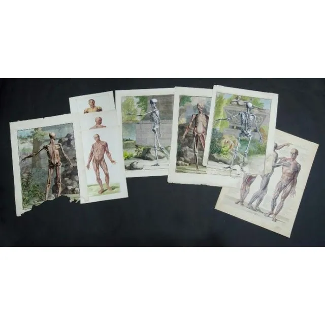
Anatomical Atlas with Skeletal Studies and French Charts
Jan Wandelaar, (Dutch 1690-1759) four Skeletal studies. From the Anatomical Atlas Tabular V, pub by Joannem & Verbeek, 1740. Two have major losses to bottom 12 cm. Also French anatomical charts, 1 with index. Hand coloured copper etching (8) 54 x 39 cm…
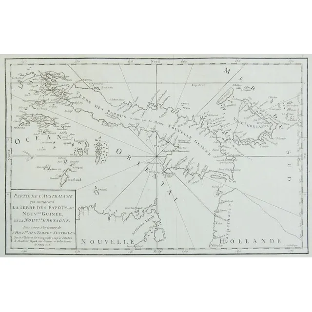
Australia: Papuan and Brittany Lands, 1756
Map, 'Partie de l'Australie,' 1756. 'Partie de l'Australie qui comprend la Terre des Papous ou Nouv. Le Guinee, et la Nouv. Le Bretagne,' l'Histoire des Terres Australes, Robert de Vaugondy, 1756. Engraving. 28.5 x 42 cm (sheet)
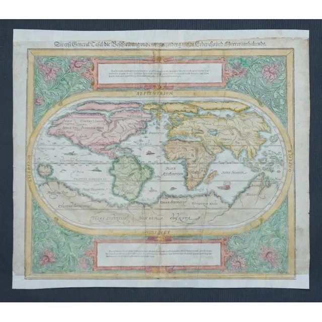
Munster's 1550 Hand-Coloured World Map
Map, c1550 world map by Munster. 'Die erste General Tafel/die Beschreibung und den Zirkel des ganzen Erdrichs un Meeresinnhaltende.' central fold line with repair. Also lower margin restored. Top margin trimmed into title. Hand coloured Woodcut. 33 x 3 6…
![[Antarctic Exploration], 'The Voyage of the Discovery' by…](https://img.carters.com.au/640x640/16a30f34ffa2d489ef057d9a251390f0.webp)
[Antarctic Exploration], 'The Voyage of the Discovery' by Captain Robert F. Scott, [London : Smith, Elder & Co., 1905] 1st edition in 2 vols. Vol I, pp xx, 556; Vol II, pp xii, 508. Complete with all plates and folding maps. Illustrations. Publisher's…
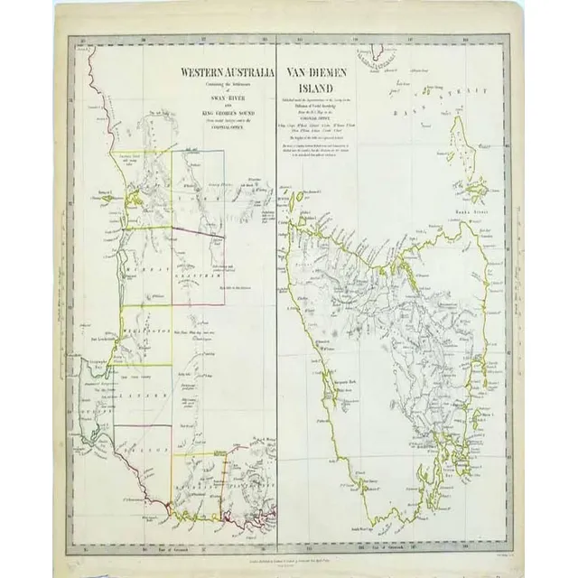
Western Australia and Van-Diemen's Island Map
Map: Western Australia and van-Diemen's Island a map of Western Australia containing the settlements of swan river and King George sound from recent surveys sent to the Colonial office. The other section of the map depicting van-Diemen Island, published…
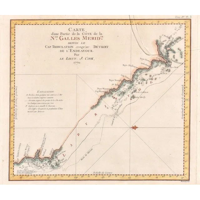
Coastline Map of New South Wales, 18th Century
Carte D'Une Partie De La Cote De La N.Le Galles Merid.Le Depuis Le cap Tribulation, James Cook, Paris, late 18th century; the coloured engraving showing a portion of the New south Wales coastline, from cape Tribulation to Endeavour Straits and cape York;…
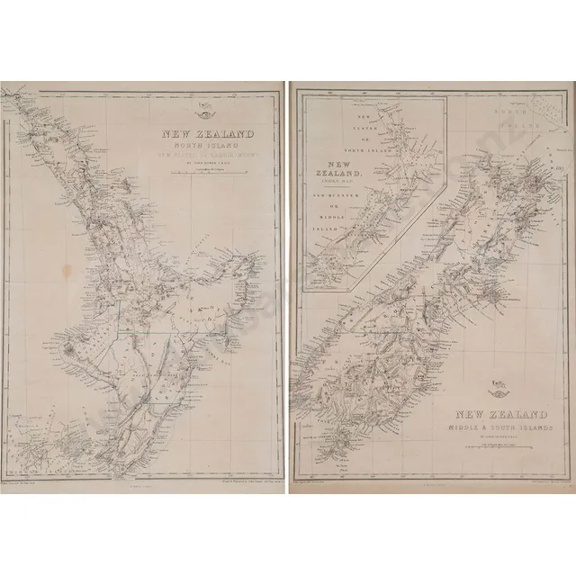
Pair of New Zealand Maps, c1855
John Dower (after) pair of New Zealand north & South Island maps New Zealand North Island new Ulster or Eahein O Mauwe & New Zealand middle & South Islands, lithographed by E Weller, c1855, 47 x 42 cm
Polynesia Map by Reilly (1795)
Franz Johann Joseph von Reilly 1766-1820 map 'Karte von der Inselwelt, Polynesien oder dem Funften Welttheile', published Vienna 1795, 46 cm x 63.7 cm and 82 cm x 97.5 cm frame
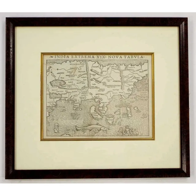
Rare Munster Map of Asia, 1540
Rare Sebastian Munster 1488 - 1552 map 'India Extrema XIX Nova Tabula', printed Basle, 1540, 25.5 cm x 33.9 cm and 53.5 cm x 61 cm frame. The first printed map of Asia, from the rare first edition of Munster's 'Geographia Universalis'
![[Gregory]. Papers relating to an expedition recently undertaken…](https://img.carters.com.au/640x640/87a39cefb50eb588489e53cdb710f831.webp)
Exploring Northern Territory of Australia (9 words)
[Gregory]. Papers relating to an expedition recently undertaken for the purpose of exploring the Northern Territory of Australia. London, 1857. British Parliamentary Paper, small folio, pp. [iv], 30 with folding coloured map by Arrowsmith, quarter morocco…
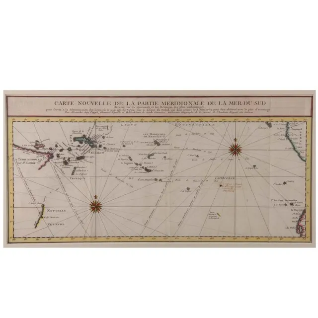
Southern Pacific Ocean Map
'Carte Nouvelle De La Partie Meridionale De La Mer Du Sud'. By Aleaxandre Guy Pingre. Hand coloured. 23 x 48 cm
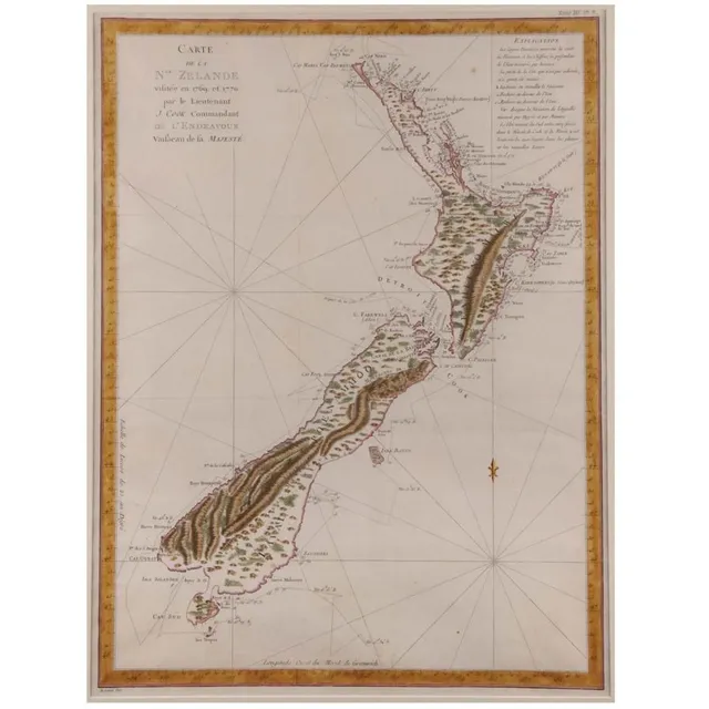
1769 New Zealand Map by Lieutenant J. Cook
'Carte De La Nouvelle Zelande Vifite'e En 1769'. By Lieutenant J Cook, Commander of the Endeavour 1770. Hand coloured. 49 x 39.5 cm
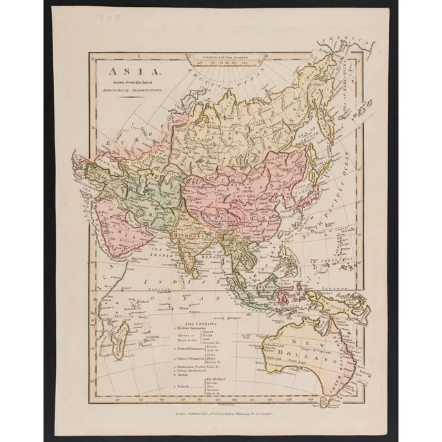
Asia and New Holland, 1808 Astronomical Observations
Robert Wilkinson: Asia, drawn from the latest Astronomical Observations, contemporary hand-colouring, [London, 1808], includes New Holland, 34 x 27 cm.
D'Urville's Cook's Strait Chart (1827) - Unframed
Unframed C1832 chart of Cook's Strait, Dumont D'Urville from his voyage of discovery in the Astrolabe 1827, 60 x 89 cm
16th Century Hand-Coloured Map of England and Scotland
A map of England and Scotland; Sebastian Munster, circa 1578; the hand coloured wood cut map; 18 x 30 cm
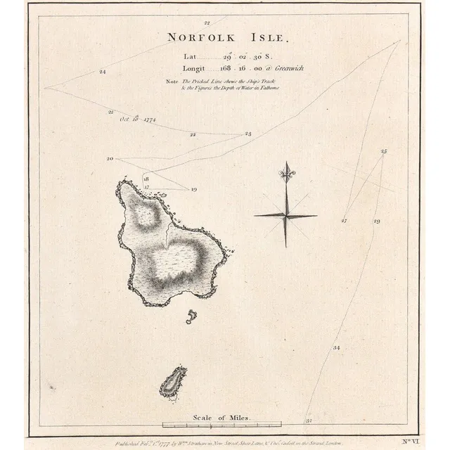
Norfolk Isle Map, 1777
A map of Norfolk Isle; Strahan & Cadell, London, 1777; the engraved nautical chart, published in Cook's a voyage towards the south pole, and round the world. 20 cm x 33 cm
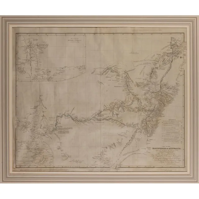
Discoveries of Australia, 1832
After J Arrowsmith, map of the Discoveries of Australia 1832, dedicated to the right Honourable Viscount Goderich. Hm Principal Secretary of state for the Colonies and President of the Royal Geographical Society, published 15 February 1832, J Arrowsmith,…
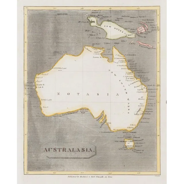
Australasia Map with Notasia and Hypothetical New Guinea
Scott, R. (Mackinzie & Dent, Newcastle on Tyne, Nd but 1811), Australasia, but unlike the earlier c1,800 edition showing the coastline more complete, the map also has 'Notasia' printed in the centre of the landmass. New Guinea and the surrounding islands…
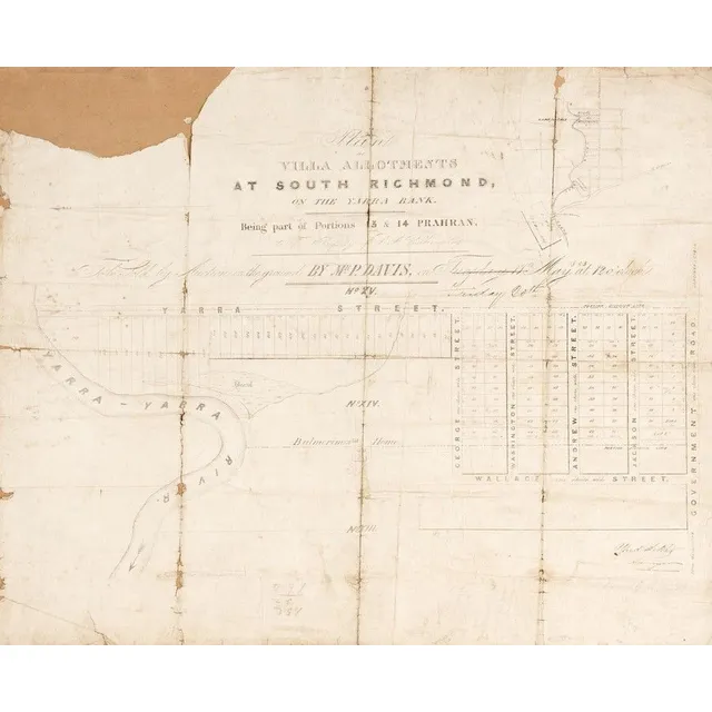
Antique Maps of Richmond, Phillip Island, and Bourke County
MAPS: c1853-84 maps, 'Plan of Villa Allotments at South Richmond', 'Town and Country Lands, Phillip Island', 'Boroondara, County of Bourke'. Various sizes. Poor/G condition
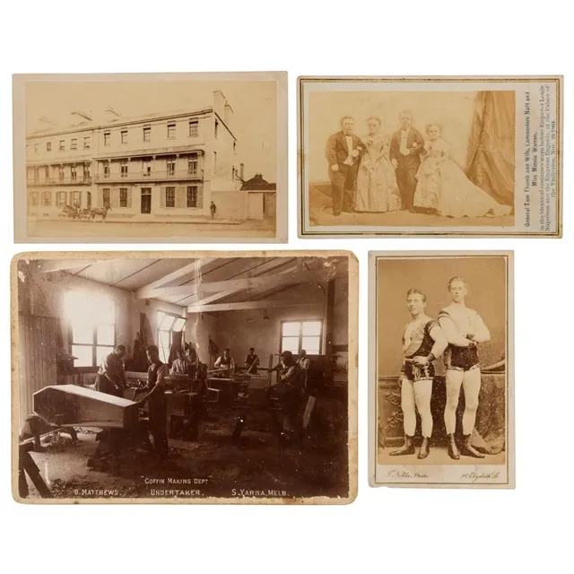
Photographs & postcards including carte-de-visit early Sydney street scene with inscription, general Tom Thumb and wife, Commodore Nutt and Miss Minnie Warren, 'Coffin Making DEPt. B. Mathews Undertaker, S. Yarra, Melbourne', plus others, (52 items
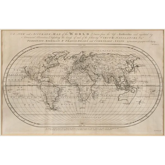
Accurate Oval Map of World with Circum-Navigators' Courses
Bowen, Emanuel (1694? - 1767), A New and Accurate Map of the World. Drawn from the best Authorities and regulated by Astronomical Observations: Describing the Course of each of the following Circum-Navigators Vizt. Ferdinand Magellan, Sr. Francis Drake…
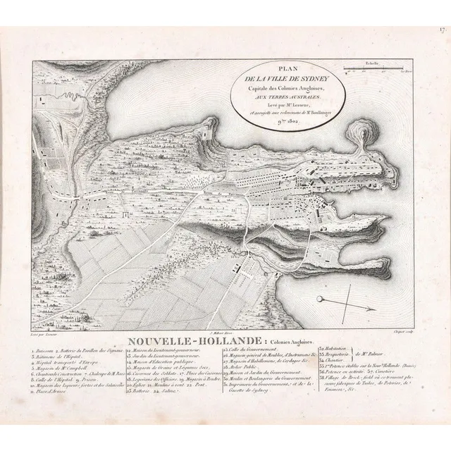
Sydney City Plan, 19th Century Engraving
Plan De La Ville De Sydney; after Charles Alexander Lesueur, France, early 19th century; engraving. Foxing in places; 25.5 cm x 22 cm
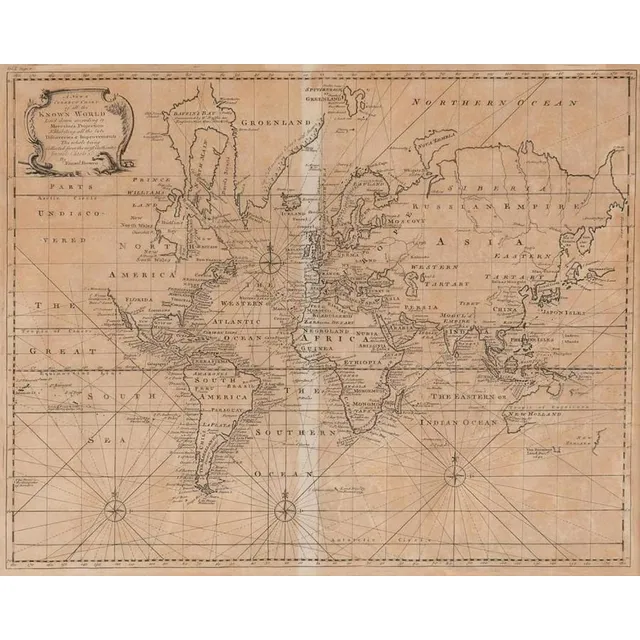
Emanuel Bowen's World Map, London 1744
A New & Correct Chart of all the Known World by Emanuel Bowen [London 1744]. 46 x 38 cm
Sketch of Van Diemens Land History and Arrowsmith Map
Book, 1832, sketch of the History of van Diemens Land, James Bischoff, including Arrowsmith map, separately mounted
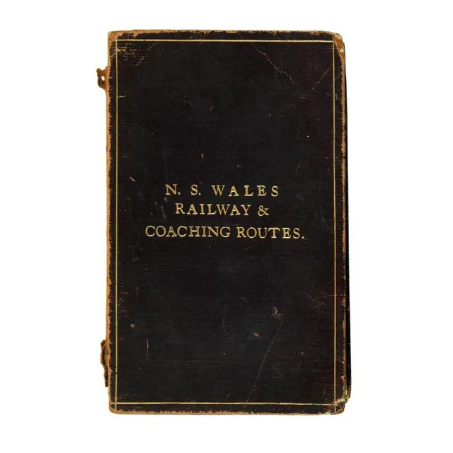
NSW Railway & Coaching Routes Map (1904)
New South Wales railway & coaching Routes. Map showing coach & other routes from the various stations, together with mileage from Sydney, with diagrams of north coast, south coast & parts of Southern & Western lines. Scale 29 miles to one inch. Printed at…
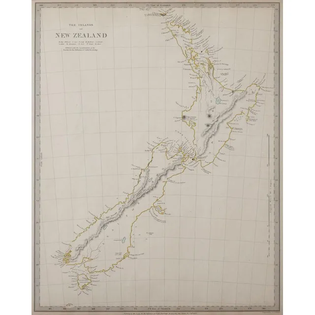
New Zealand Map 1838 by J & C Walker
Map of New Zealand for the Society for Diffusion of Useful Knowledge, c1838, engraved on paper by J & C Walker, 400 x 32 cm
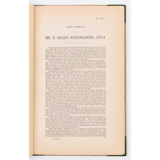
Ernest Giles's Central Australian Explorations, 1873-74
Giles, Ernest. Mr.Ernest Giles's explorations, 1873-74. [Adelaide, 1874]. South Australian Parliamentary Paper, small folio, drop title, pp.70 with folding map, half calf. Some very slight marginal staining at end., The first printing of the great…
17th Century Map of Great Britain and Ireland by John Speed
A 17th century map by John Speed 'The Kingdome of Great Britaine and Ireland', published Bassett & Chiswell c.1676, copper engraved map with hand colouring; text verso, plate 38.5 x 51.5 cm. Originally pub. 1612 for Speed's 'Theatre of the Empire..'.
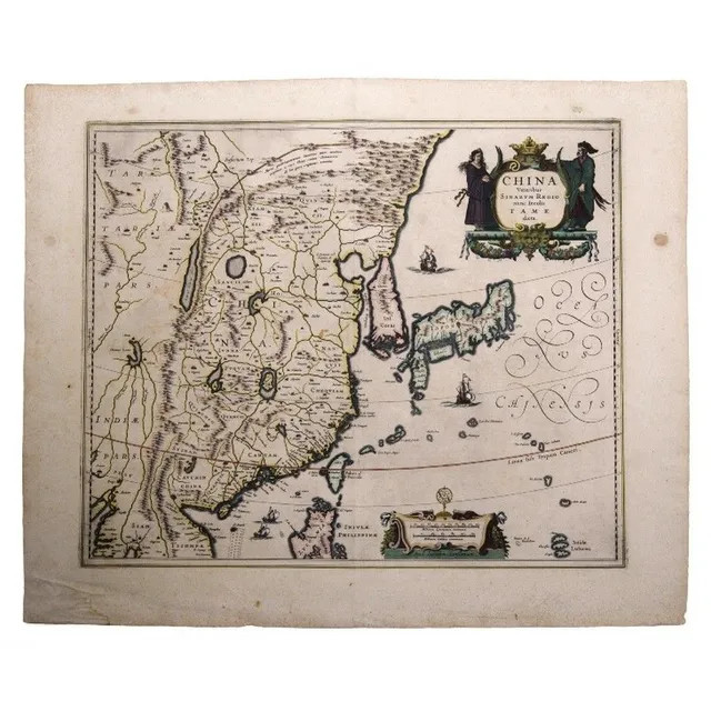
Jannson's Map of Ancient China and Neighboring Regions
Map, Jannsons china Veteribus Sinarum Regio. Map incorporates Eastern china, Japan, Korea, parts of India & Siam. Pub. Amsterdam 1658. Hand coloured copper engraving, 41 x 51 cm
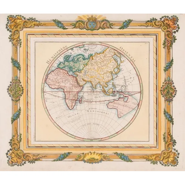
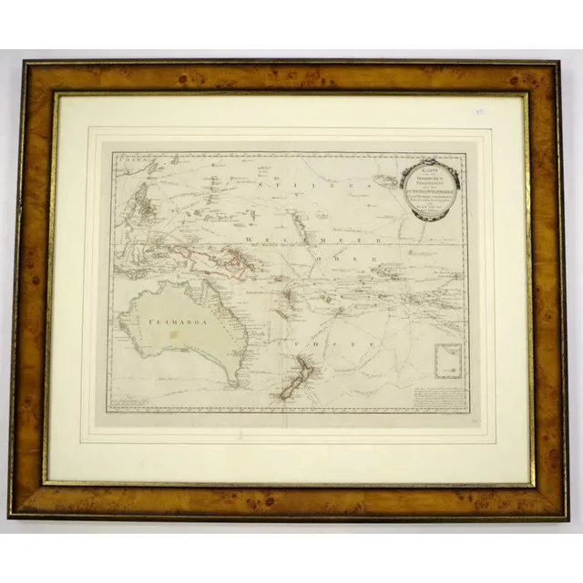
French Hemisphere Oriental Map, 1768
Map: A French hand coloured map 'Hemisphere Oriental', circa 1768, attributed to Brion de la Tour, pre Captain Cook with undefined east coast of Australia. 42 x 36 cm
Exploration of the South Pacific by European ships
Benard, Robert (Paris, 1774), Carte d'une partie de la Mer du Sud Contenant les Decouvertes de Vaisseaux de sa Majeste: Le Dauphin, Commodore Byron, la Tamar, Capitne Mouats, 1765. Le Dauphin, Capitne Wallis, Le Swallow, Capitne Cartaret, 1767. et…
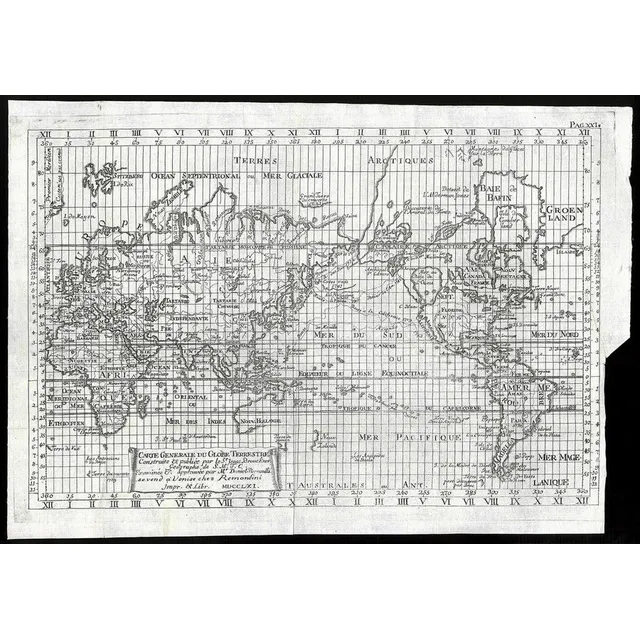
Brouckner/Remondini Map of the World, 1761
Brouckner/Remondini, Carte Generale du Globe Terrestre, Venice, 1761, 25 x 36 cm overall. This uncommon map is Remondini's reduction of Isaak Brouckner's map of the world. It features an extravagant collection of Northwest Passage theories, including one…
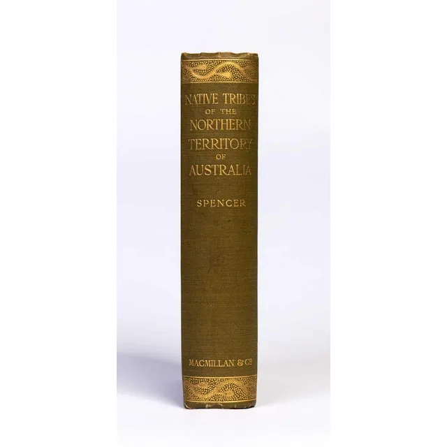
Native Tribes of Northern Territory Australia
Spencer, W. Baldwin. Native tribes of the Northern Territory of Australia. London, 1914. Thick octavo, with folding map and numerous plates, some coloured, original gilt-decorated cloth.
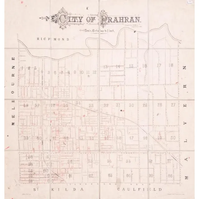
Prahran City Map 1882
City of Prahran. Compiled by T. B. Muntz, City Surveyor, 1882, fold-up map in 16 sections on linen-backing, with many properties added in red ink, overall 83 x 90 cm.
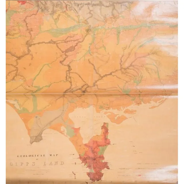
Gipps Land Geological Map (c.1875)
Geological Map of Gipps Land (Sheet No.1), Surveyed by R. A. F. Murray under the direction of the Mining department, Melbourne [c1875], linen-backed roll-up map, size 97 x 110 cm.
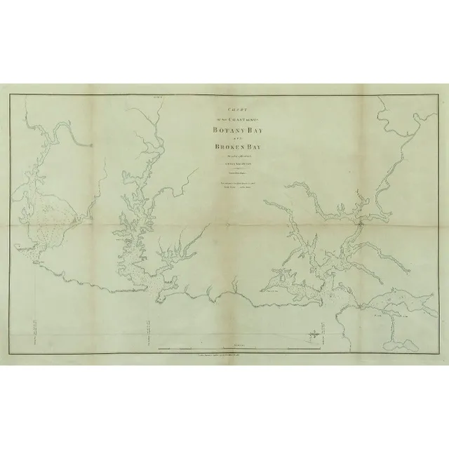
Coastal Chart: Botany Bay to Broken Bay, 1792
1792 Chart of the Coast between Botany Bay & broken Bay. As surveyed by Capt. John hunter. Pub. By John Stockdale, London 1792. Engraving. 43 x 75 cm
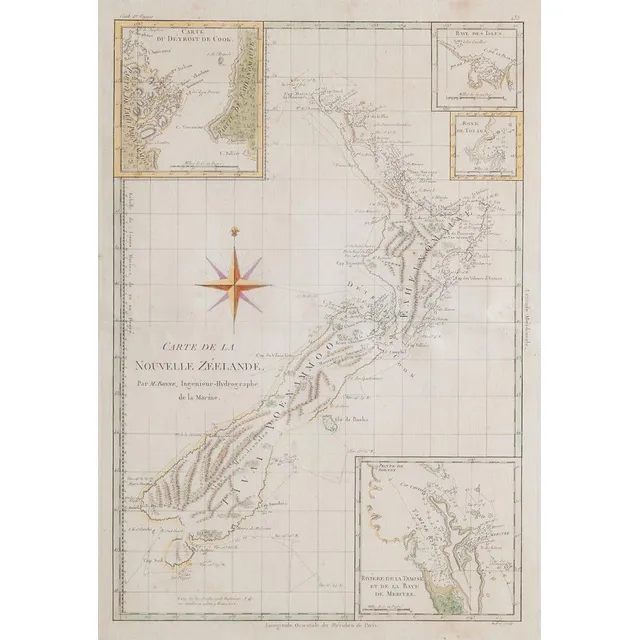
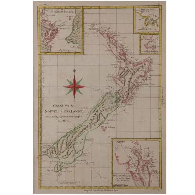
Antique French Map of New Zealand
An antique French map of New Zealand, titled 'Carte de la Nouvelle Zeelande' Par M. Bonne, Ingnieur-Hydrographe de la marine. Print 37 x 25.5 cm frame 53.5 x 41 cm
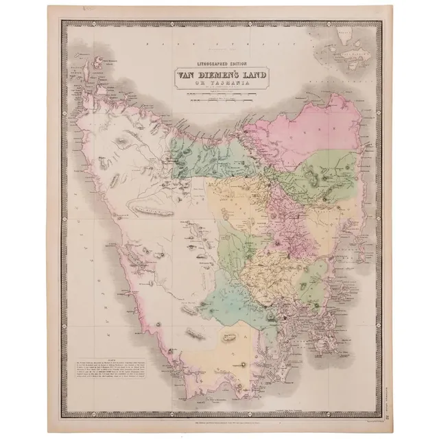
1846 Tasmania Map by W. & A.K. Johnston
W. & A.K. Johnston, 'Van Diemen's land or Tasmania : lithographed Edition', highly detailed hand-coloured map, circa 1846, 65 x 53 cm.
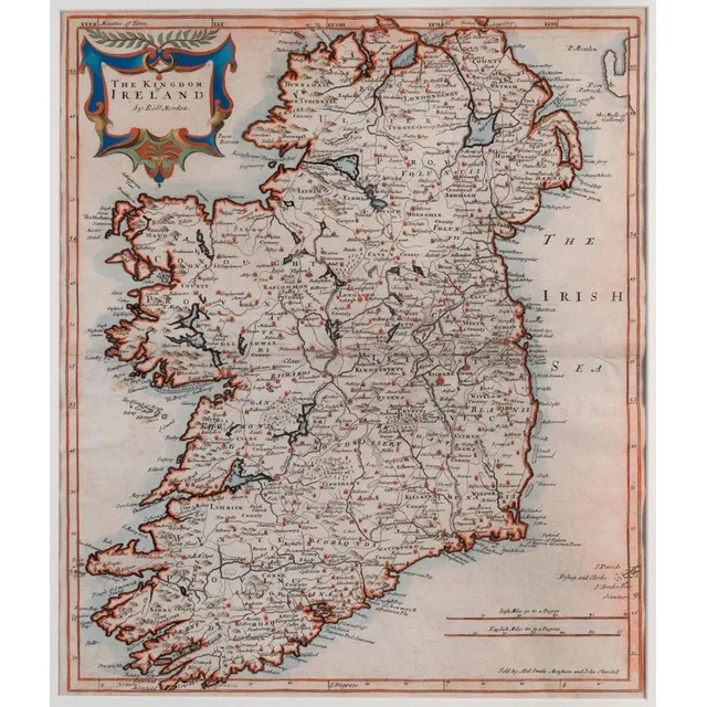
Ireland Map by Robert Morden, 1695
Robert Morden (d.1703) the Kingdom of Ireland 1695, copperplate engraving, hand-coloured 41.5 x 45 cm. The map appeared in an early edition of Camden's Britannia. It includes towns, roads, mountains, rivers, churches, lakes and many other details.
Vintage Visuals: 18th-20th Century Maps, Charts, and Prints
Range of maps, charts, posters, engravings and prints, 18th to 20th century, inspection will reward
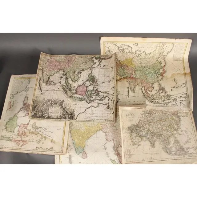
18th Century Maps of Asia and India
Five wonderful 18th century maps, c.1702-1793, including 'Asien,' by T.Mollo/Schmidt, 'India Orinetalis,' by S.C.M. George August, 'Carte Indes Orientales,' by Charles Henry Friso/Homann Erben and 'Charte von Asien,' by F.L. Guslefeld/Homann (5)
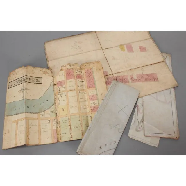
Colonial Maps of Australia
Five Australian Colonial maps, including town plan of Liverpool, 1847 state of Blighs terrace, Subdivision of Lots 26 & 27 Point Piper Estate, plan of land Ownership along Edgecliff Rd and 1895 plan showing alternate roads Macquarie mountain
Hand-Coloured Mappemonde Map by Robert de Vaugondy (1752)
Mappemonde map, Robert de Vaugondy (1688-1766), France, circa 1752, hand coloured world map in two hemispheres, the map 47 x 70.5 cm. Provenance: Purchased from the Parker gallery, London, 1979
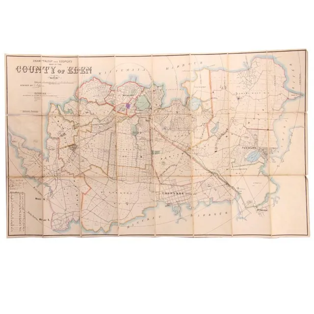
Hand-Coloured Map of Eden Auckland, c. 1880
A hand coloured map of the 'County of Eden Auckland', c. 1880, by Champtaloup and Cooper. Some hand notation to side. 53 x 87 cm