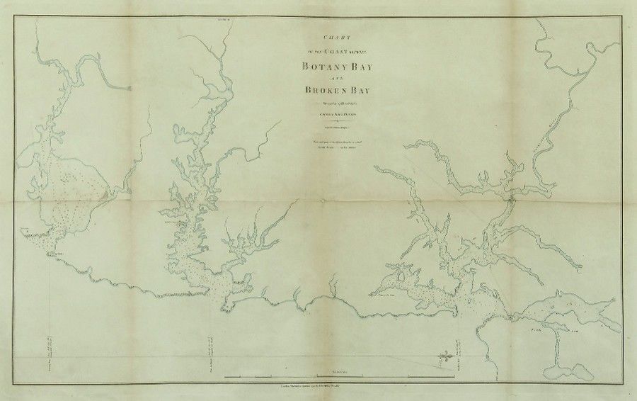
Coastal Chart: Botany Bay to Broken Bay, 1792
You must be a subscriber, and be logged in to view price and dealer details.
Subscribe Now to view actual auction price for this item
When you subscribe, you have the option of setting the currency in which to display prices to $Au, $US, $NZ or Stg.
This item has been included into following indexes:
- maps - general 445
Visually similar items

Map, 'Royaume de Hongrie et Pays Adjacents,' par M.Bonne, Andre Scul. Engraving. 25 x 36 cm

Chart of part of the South Sea shewing the tracts & discoveries made by His Majestys Ships Dolphin...& Tamer....1765, Dolphin...& Swallow...1767, and Endeavour, Lieutenant Cooke, 1769', engraved by W.Whitchurch [London, 1773], window mounted, framed & glaz
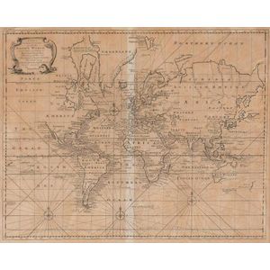
A New & Correct Chart of all the Known World by Emanuel Bowen [London 1744]. 46 x 38 cm

Copper engraved map of Firth of Thames, Bay of Islands and Tolaga Bay entitled 'riviere Tamise et Baye Mercure a la Nle. Zelande' with insets 'Baye des Isles dans la Nle. Zelande' and 'Baye de Tolaga dans la Nle. Zelande', engraved by Robert Benard. From t