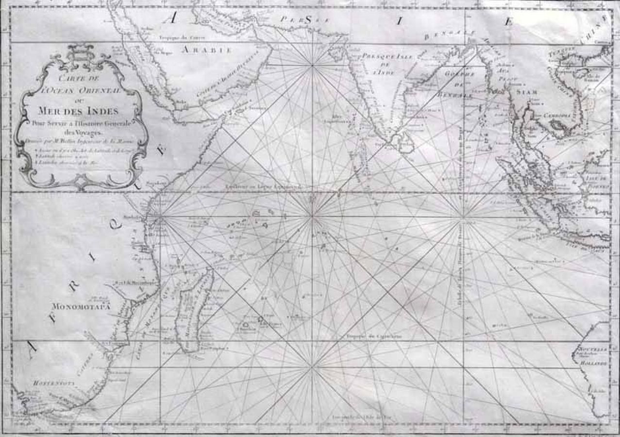
MAP - Bellin, Jacques Nicolas. Carte de L'Ocean Oriental ou Mer…
click the photo to enlarge
MAP - Bellin, Jacques Nicolas. Carte de L'Ocean Oriental ou Mer Des Indes, Paris, Didot, 1750. Engraved map, covers the entire Indian Ocean. Eastern coast of Africa and Madagascar depicted along with southern Arabia and India. Indonesian Islands and south-East Asia, including southern china, also featured. Small portion of the Western Australian coast depicted, entitled 'Nouvelle Hollande'. Text in French 34.2 x 47.8 cm. Provenance: Robert Muir old & rare books, the Laith Reynolds collection

You must be a subscriber, and be logged in to view price and dealer details.

Subscribe Now to view actual auction price for this item

When you subscribe, you have the option of setting the currency in which to display prices to $Au, $US, $NZ or Stg.

This item has been sold, and the description, image and price are for reference purposes only.

This item has been included into following indexes:

Visually similar items

17th century map of Java and part Borneo, Sumatra. 'Insul' Iav' Cum Parte Insularum Borneo Sumatr',' by Schenk and Valk, pub. Amsterdam c.1650. Hand coloured engraving. 40 x 51 cm

Sold by in for
You can display prices in $Au, $US, $NZ or Stg.

Harold Brocklebank Herbert (1892-1945): etching 'An Old Gumtree' 24/50 (framed) 12 cm x 15 cm; plus two George Colville unframed etchings 'Xmas 1941' and 'The Little Dock' c1941. (3 items)

Sold by in for
You can display prices in $Au, $US, $NZ or Stg.

Henri Van Raalte (1881-1929), Calm Morning, etching 14/25, 20 x 22 cm

Sold by in for
You can display prices in $Au, $US, $NZ or Stg.

Four antique Dutch tiles, painted with ships, circa 1700

Sold by in for
You can display prices in $Au, $US, $NZ or Stg.