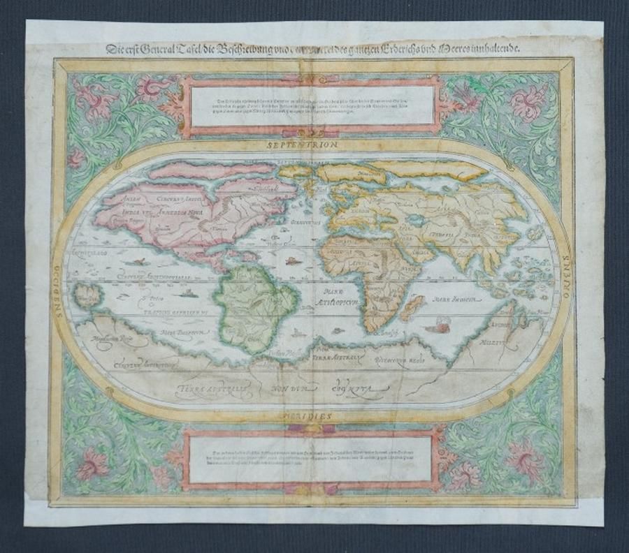
Munster's 1550 Hand-Coloured World Map
You must be a subscriber, and be logged in to view price and dealer details.
Subscribe Now to view actual auction price for this item
When you subscribe, you have the option of setting the currency in which to display prices to $Au, $US, $NZ or Stg.
This item has been included into following indexes:
- maps - general 445
Visually similar items

NSW Maps: 'Map of Part of New South Wales' by Lizars [Edinburgh, 1824], plus 'New South Wales, Compiled under the Superintendence of the Society for the Diffusion of Useful Knowledge' [London, 1833], both framed, various sizes.

Map, Indiae Orientalis nec Non Insularum Adiacentium Nova Descriptio. Map maker Nicholaus Visscher, pub. Amsterdam, 1670. Hand coloured engraving. 48 x 5 8 cm

A George III linen cross-stitch needlework sampler, English, 18th century, dated 1768. 40 cm high, 35 cm wide

Robert Wilkinson pub, after, map of China 1809 hand-coloured engraving 24 x 29.5 cm