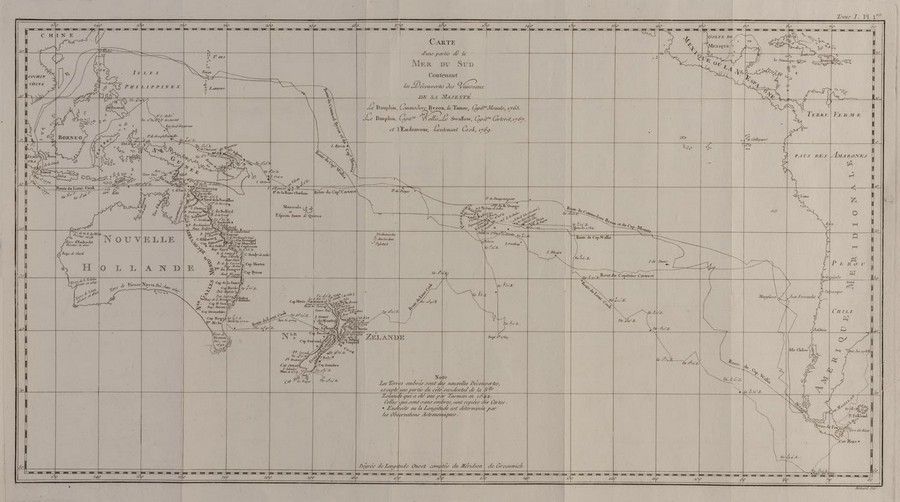
Exploration of the South Pacific by European ships
You must be a subscriber, and be logged in to view price and dealer details.
Subscribe Now to view actual auction price for this item
When you subscribe, you have the option of setting the currency in which to display prices to $Au, $US, $NZ or Stg.
This item has been included into following indexes:
Visually similar items

Map of the South Sea, limited edition

(World map) Heinrich Robert / F. A. Schraembl, 1789, Generalkarte soemmtlicher Entdeckungen auf den drei Grossen Weltreisen des Kapit Jacob Cook. Two sheets, each 49 x 60 cm to the printed margins. Large world map showing the routes of three voyages made b

Map: 'Chart of the Pacific Ocean' circa 1820 showing New Holland with incomplete northern and southern coastlines and only the east coast of Van Diemen's Land; Papua or New Guinea largely incomplete; Japan, Philippines, eastern China and the north and sout
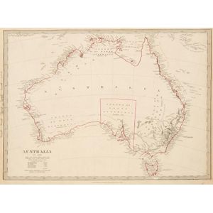
Maps: Group of 8 maps of Australia including c1839 showing the Colony of South Australia. 19th & 20th century. Varying sizes