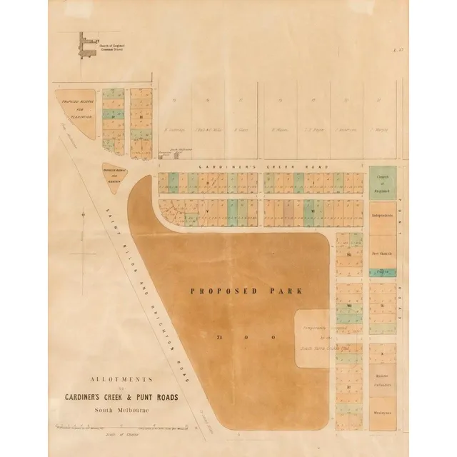
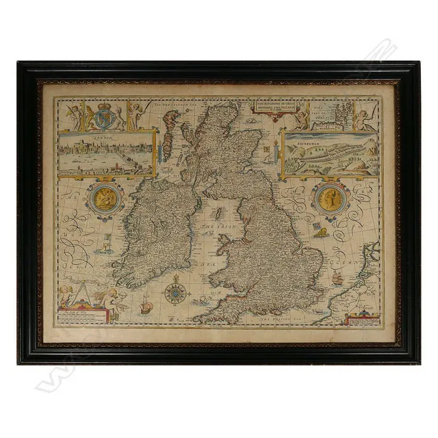
South Melbourne Allotments and Proposed Park Sub-Division Plan
South Melbourne: 'Allotments on Gardiner's Creek & Punt Road, South Melbourne, lithographed sub-division plan by P.M. McGoldrick, Temporary Surveyor, dated February 1859, showing 'Proposed Park' (Fawkner Park, created in 1862), Gardiner's Creek Road (now…
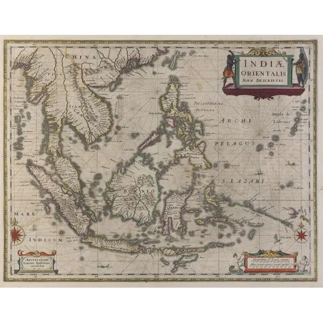
Dutch Map of East Indies and Australia (1630)
Johannes Janssonius (Dutch, 1588- 1664)., Indiae Orientalis, Nova Descriptio, [Dutch Map Of The East Indies] 1630., Copperplate engraving, text including title in plate, overall, 50 x 58 cm (paper). Some hand colouring. Text includes 'Amstelodami. Ioannes…
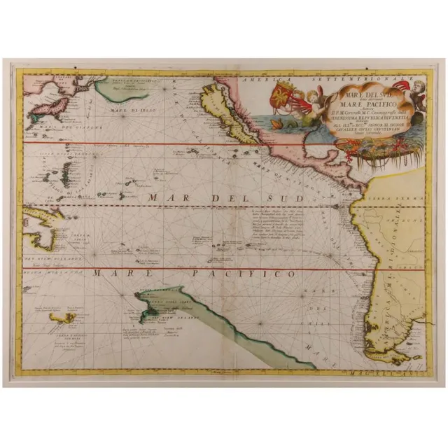
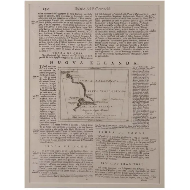
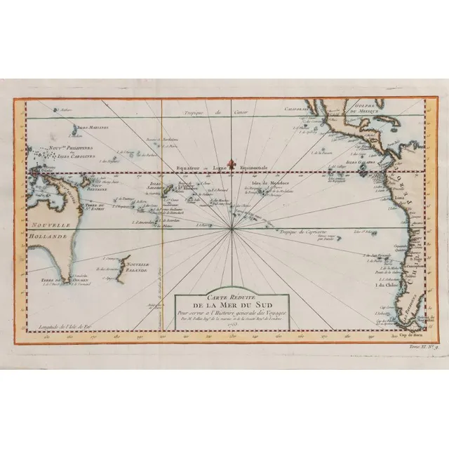
"Mare Del Sud" Map by Vincenzo Coronelli
'Mare Del Sud Detto Altrimenti Mare Pacifico'. By Vicenzo Coronelli. Hand coloured. 45 x 65 cm
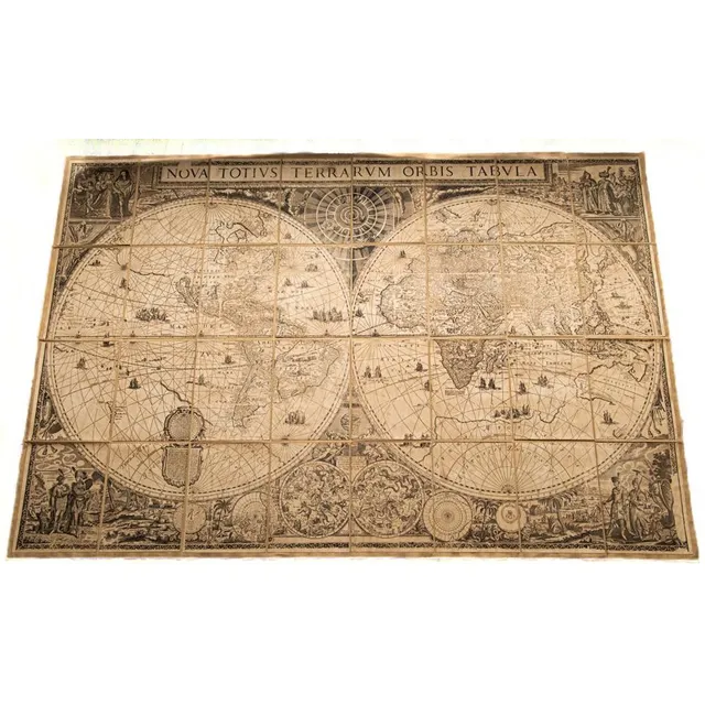
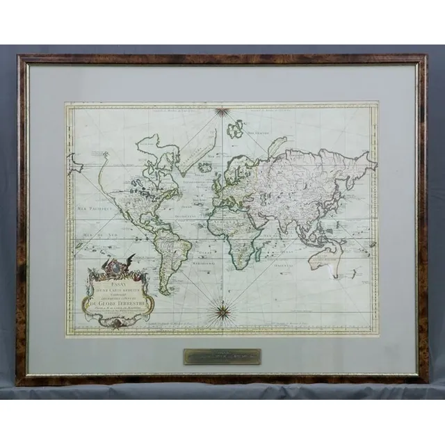
Frederik de Wit's World Map on Fabric
A large printed paper on fabric 'Nova Totivs Terrarvm Orbis Tabvla' map of the world 196 cm x 131 cm after Frederik de Wit's original map, c1670, holding box included
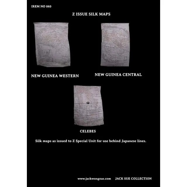
Z Special Unit's Unique Silk Maps
3 silk Maps. These maps were issued to Z special Unit for use behind Japanese lines Whilst many silk maps were used during World War II, these ones were unique to Z special Unit in that they were passed on to Jack by fellow Z man Jack Bickford
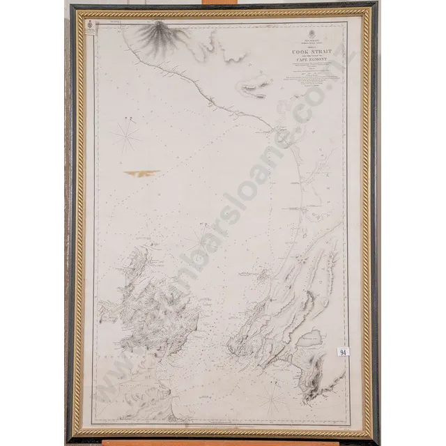
Captain Stokes' Map of Cook Strait and Coast
19th century map of Cook Strait and the coast to Cape Egmont Surveyed by Captain Stokes onboard hallmarked Sterling Acheron 1849-1852, 100 x 68 cm (framed).
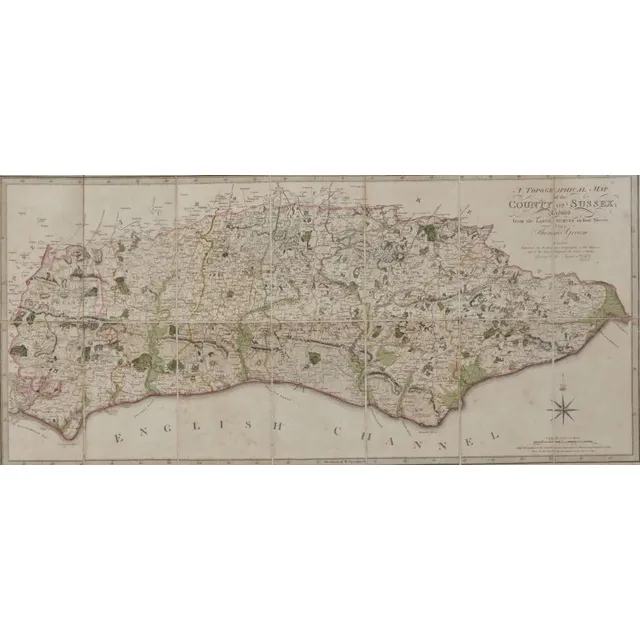
Sussex Topographical Map, 1799
A framed topographical map, The County of Sussex, 1799 by Thomas Gream, six folds., 38 cm, high 60 cm, wide
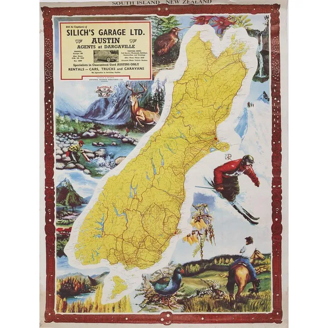
South Island Map with Wildlife and Maori Carvings
A map of the South Island produced by universal Business Directories Ltd, a colourful graphic map of the South Island. Issued by universal Business Directories Ltd, published by a. D. Baldwin. Featuring an AD for Silich's garage Ltd. The background…

Hawthorn-Prahran 1887 Map Set
Hawthorn - Prahran circa 1887. Two canvas backed maps scale 400 feet to an inch, stone engraved by Clarence Woodhouse [printed by John Batton 79 Queen St], housed in original black cloth covered boards with gilt lettering.
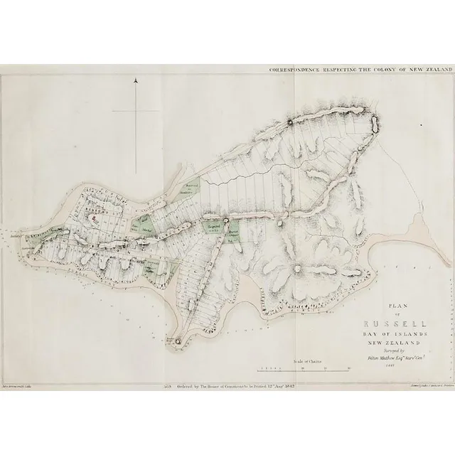
Russell Plan Map, August 1842
A plan map of Russell, lithographic print, printed August 1842 by Luke and James Hansard, lithographed by J.Arrowsmith. 29 x 40.5 cm
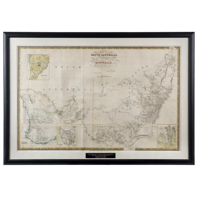
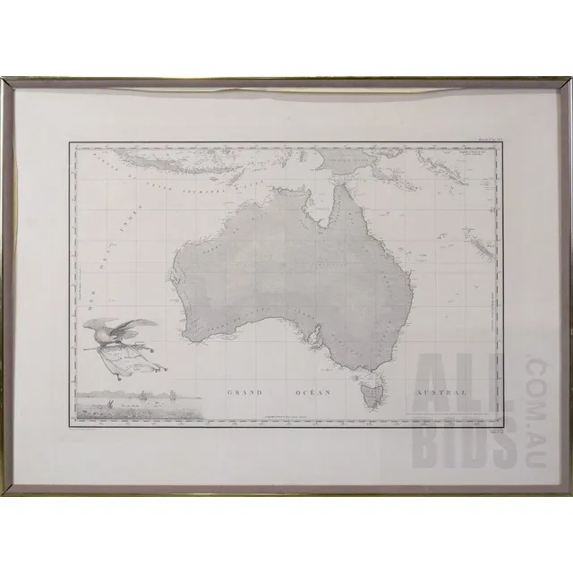
Early Map of Australia and Surrounding Territories
James Wyld, map of South Australia, New South Wales, van Diemen's land, and Settled parts of Australia., Respectfully dedicated to Major Sir T.L. Mitchell K.t D.C.L. F.G.S. &c Surveyor general of New South Wales, (London: circa 1841), 62 x 94 cm; hand…
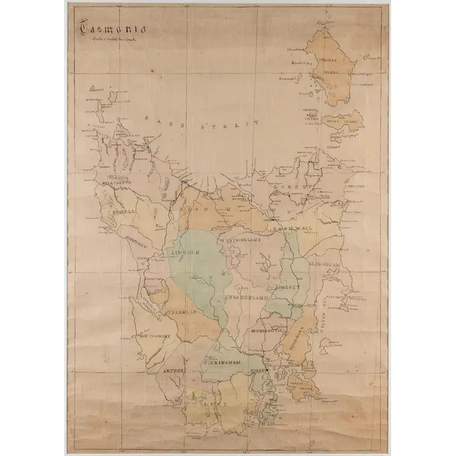
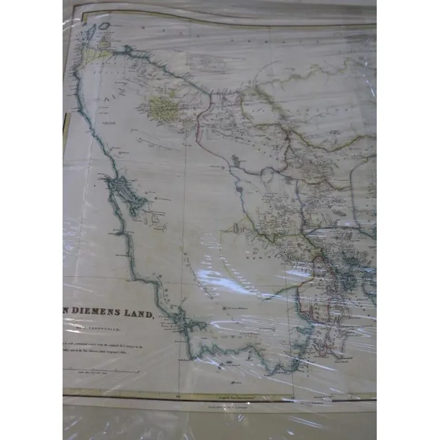
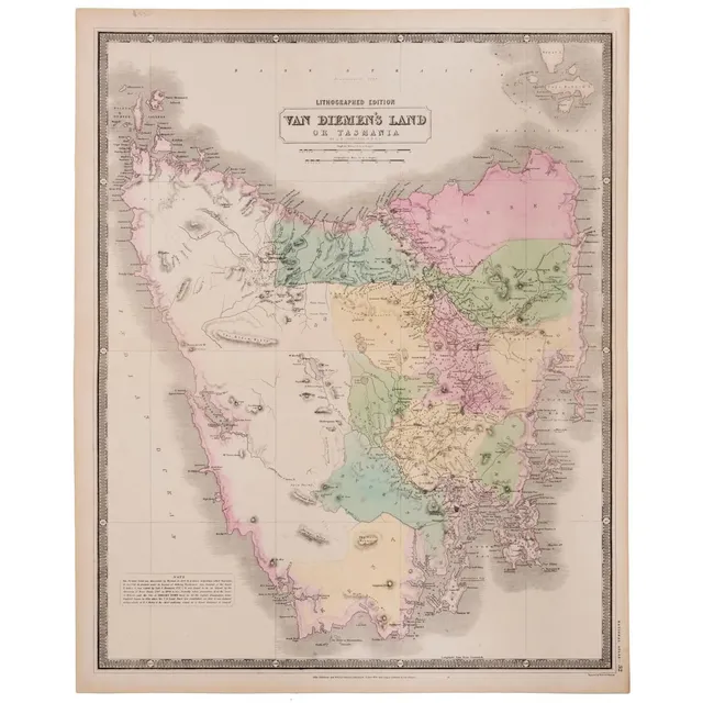
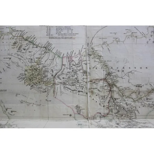
Hand-Coloured Map of Former Counties in Tasmania
Tasmania', hand coloured lithograph showing 18 former counties of Tasmania, scale: 5 miles to 1 inch, 74 cm x 52 cm
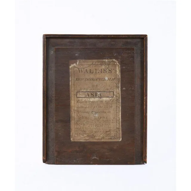
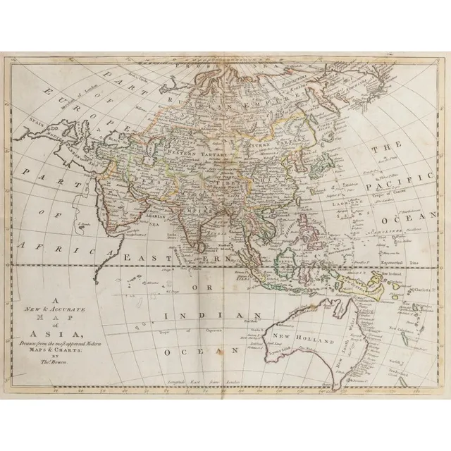
1830 Wallis Map of Asia for Young Students
Circa 1830, 'Wallis's New Dissected Map of Asia Engraved From the Latest Authority For the Use of Young Students in Geography' [J.Wallis, No.42 Skinner St. snow Hill]. Printed lithographic map cut into sections and laid down on interlocking wooden pieces,…
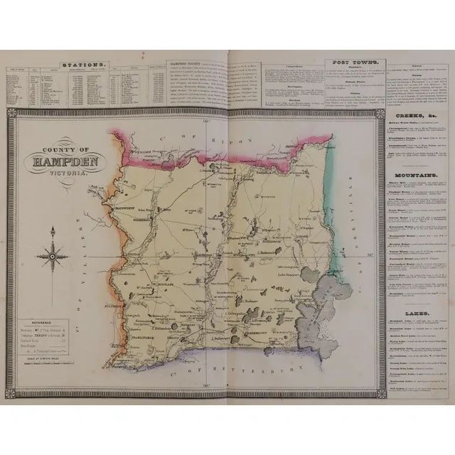
1874 Victorian Counties Atlas with Hand-Coloured Maps
Victoria: Hiscocks, F.E. & Co., publishers. 'F.E. Hiscocks & Co.'s New Victorian, Counties Atlas. Melbourne, 1874'. Folio, title, 5 leaves of letterpress and 22 lithographed maps, hand-coloured, original leather & cloth binding with the original gilt…
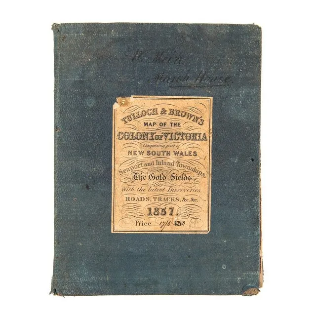
1857 Map of Victoria with Gold Fields and Townships
Tulloch & Brown's Map of the Colony of Victoria Comprising part of New South Wales. Seaport and Inland Townships, the Gold Fields with the latest Discoveries, Roads, Tracks, &e. &c. 1857' (Tulloch & Brown, Melbourne, 1857) large map mounted on linen and…
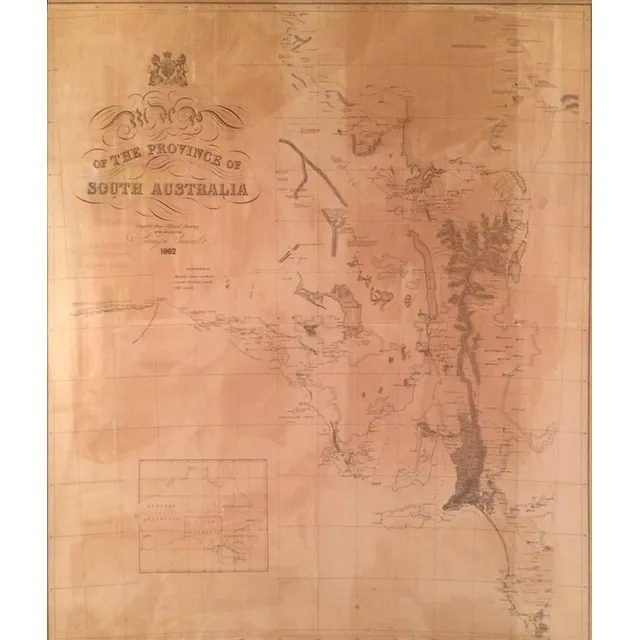
1862 Map of South Australia
Map of the Province of South Australia 1862, printed by R. K. Burt London, lithograph, 76 x 66 cm
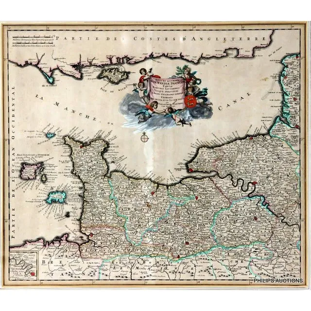
French Map of English Channel by Theodorum Danckers (1790)
An antique framed French map of the English Channel by Theodorum Danckers, circa 1790, with a decorative title cartouche 'Normandiae Ducatus Tabula' with Latin inscription showing 'La Manche Canal' with some hand colouring; Antique Maps and Print Shoppe,…
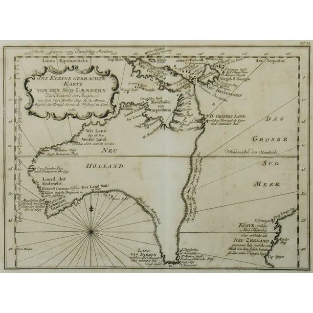
Australia Map, 1753
Map, Australia, by Jacques Nicholas Bellin, 'Ins Kleine Gebrachte Karte von den Sud-Landern', 1753. Copper engraving, 20 x 27.5 cm.
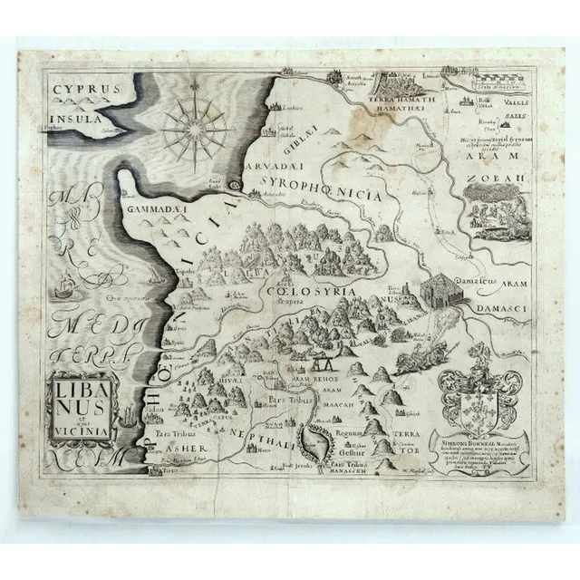
Early Maps of the Holy Land (or) Western Mediterranean Maps
Maps (5) Early Maps of The Holy Land. 5 Maps of Western Mediterranean encompassing modern Palestine, Israel, Lebanon, Jordan & Syria, by Simeoni Bonnell & others. Pub. In A Pisgah-Sight of Palestine and the Confines Thereon by Thomas Fuller, 1650, 29 x 34…
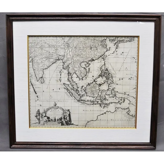
India and Adjacent Islands Map by Visscher
Map, 'Indiae Orientalis,' VISSCHER. Nicholas VISSCHER (1649-1702) 'Indiae Orientalis nec non Insularum Adiacentum.'. Engraving. 52 x 62 cm
World Map 1748 by Bellin
Map, the world, 1748. 'Essay d' Une Carte Reduite Contenant les Partes Connuees du globe Terrestre,' by Jacques-Nicolas Bellin. Coloured copper engraving. 48 x 64 cm
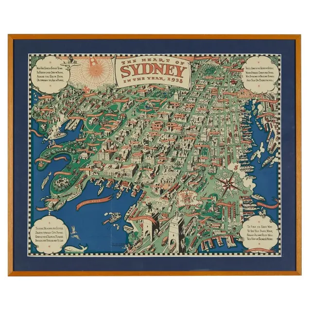
Sydney's Heart, 1938 Map
After Robert Emerson Curtis (1898-1996), 'The heart of Sydney in the year 1938' a three colour map, published by John Fairfax & Sons, 1938, 47 x 59 cm
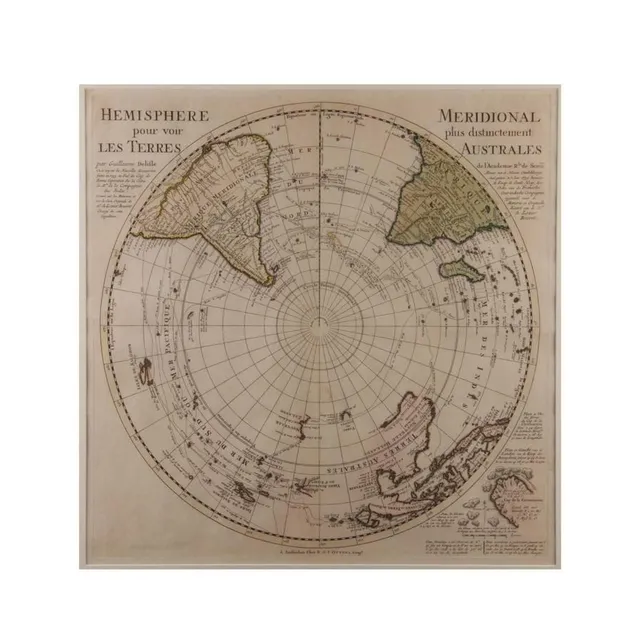
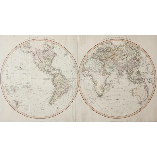
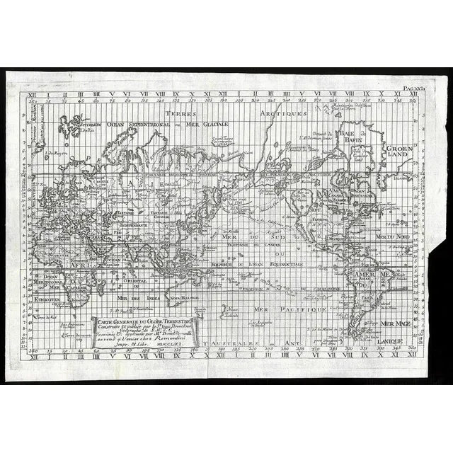
Hemisphere Terres
'Hemisphere Pour Voir Les Terres'. By Guillaume Delifle 1739. Hand coloured. 48 x 48 cm
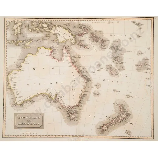
New Holland & Asiatic Isles Map, 1814
Early 19th century hand coloured map of New Holland and Asiatic Isles drawn and engraved for Thomsons new general atlas circa 1814, 51 x 65 cm (framed)
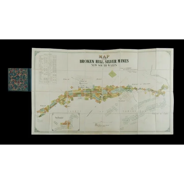
Broken Hill Silver Mines Map (NSW) - c1895
Map of the Broken Hill silver Mines New South Wales. Publ. By E R Morris, map lithographer & licensed draftsman Queensland offices bridge St, Sydney. Map laid on linen & folded into hard covers, c1895. (6.5 x 10.5 cm).
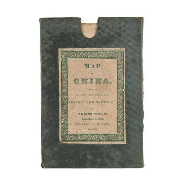
1840 Map of China by James Wyld
Map of China compiled from original survey and sketches by James Wyld, circa 1840, original cloth-backed folding edition in green cloth covered slipcase, 66 cm x 83 cm
Bellin's Hemispheres Map, 1742
Jacques-Nicolas Bellin - maps of the Hemispheres, C.1742, hand coloured print, map shows the Eastern Hemispere and the Western hemisphere and was made under the direction of the secretary of state to the King of France., 500 x 89.5 cm
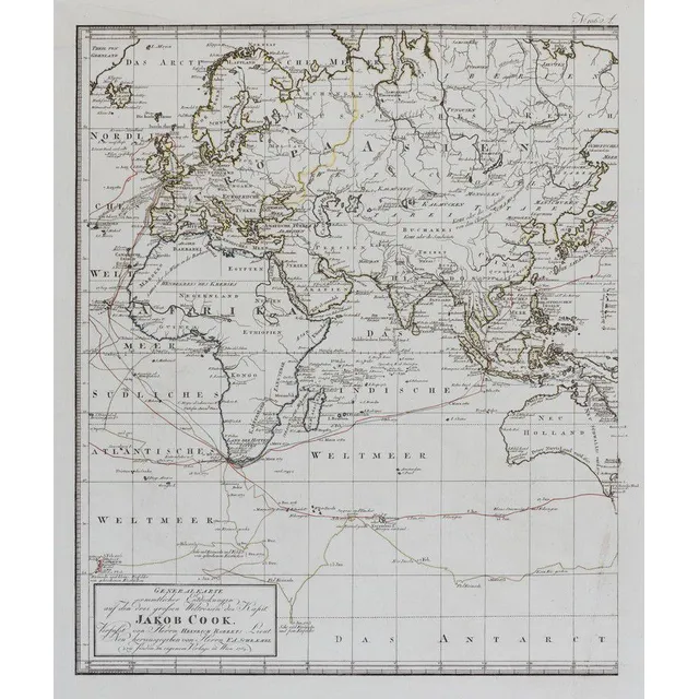
Cook's Three Voyages World Map (9 words)
(World map) Heinrich Robert / F. A. Schraembl, 1789, Generalkarte soemmtlicher Entdeckungen auf den drei Grossen Weltreisen des Kapit Jacob Cook. Two sheets, each 49 x 60 cm to the printed margins. Large world map showing the routes of three voyages made…
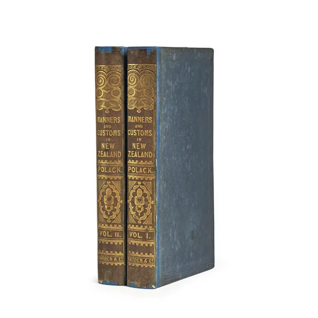
Manners and Customs of New Zealanders
(New Zealand), Polack, Joseph Samuel, Manners and Customs of the New Zealanders, with Notes Corroborative of their Habits, Usages, etc. And Remarks to Intending Emigrants. (London: James Madden && Co. Hatchard & Son, 1840). Two volumes. Small octavo,…
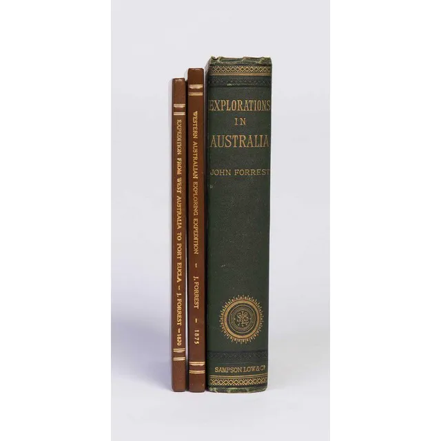
Australian Exploration Journals with Maps and Plates
Forrest, John. Explorations in Australia. 1. Explorations in search of Dr. Leichhardt and party. 2. From Perth to Adelaide, around the Great Australian Bight. III. From Champion Bay, across the desert to the Telegraph at Adelaide. London, 1875. Octavo,…
Scandinavian Map of Australia on Pine Frame
Scandinavian map of Australia, material backed paper on pine frame, Scandinavia, c 1950/60s, 34 cm high, 118 cm wide
General Map of New Holland, 1808-1811
Louis Claude Desaulses de Freycinet (French 1779-1842) carte generale de la Nouvelle Hollande 1808, Published Paris 1811
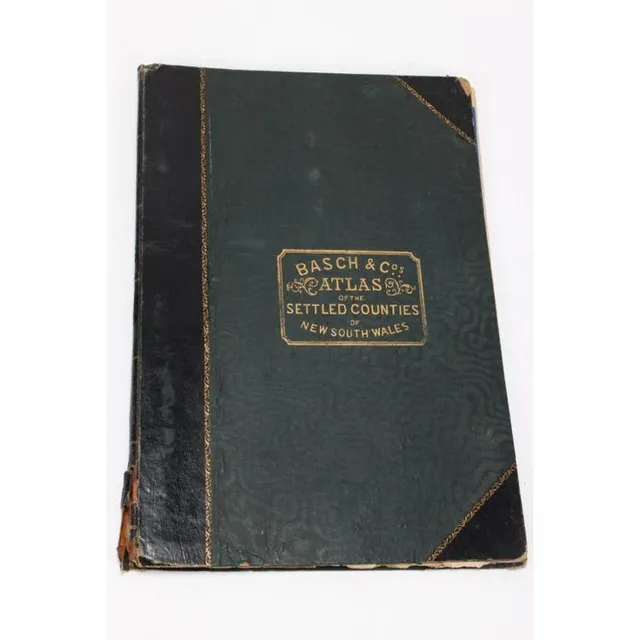
New South Wales Settled Countries Atlas, 1872
Atlas of Settled Countries of New South Wales, by Basch & Co's, featuring twenty maps of the Colony, c.1872
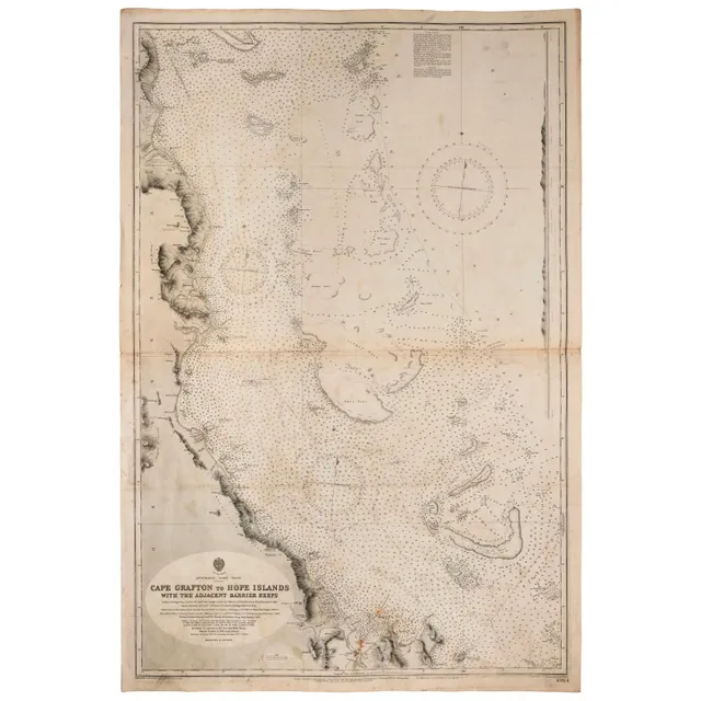
Admiralty Chart of Australia's East Coast (1909)
Wharton, Capt. W.J.L., RN, Australia - East coast: Admiralty chart (no 2924) 'Cape Grafton to hope Islands, with the adjacent Barrier Reefs', February 1909 edition, overall 103 x 69 cm. Endorsed verso 'S S Essex Lance Owner's Chart'.
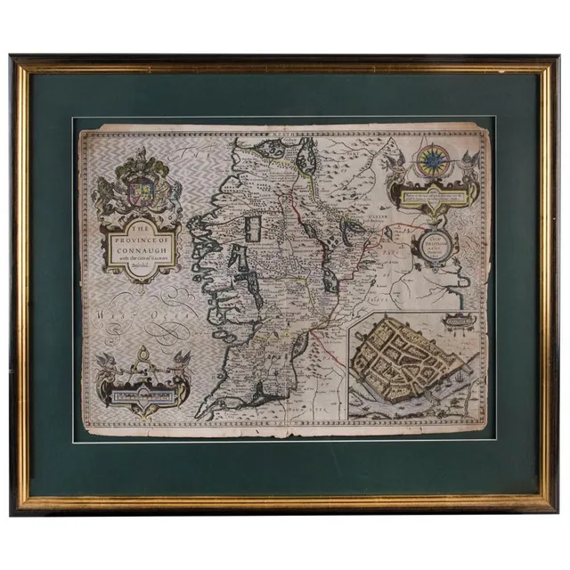
Framed English and Irish County Maps, 1610-1720
(1610) (4 items) English & Irish County maps comprising 'The Province of Connaugh with the citie of Galwaye Described' by John Speed (1610); 'The East riding of Yorkshire' by Robert Morden (c.1720); 'Oxford Shire' by Robert Morden (1695); and 'Hertford…
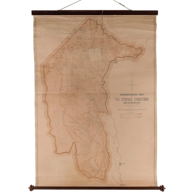
Topographical Map of Federal Territory Australia, 1910
Topographical Map of the Federal Territory Australia, Compiled, Drawn and Printed at the Department of Lands, Sydney, 1910, 90 x 125 cm, supported on a turned cedar roll by the noted map mounter J.Creffield of Melbourne., George Sydney Jones [1864-1927,…
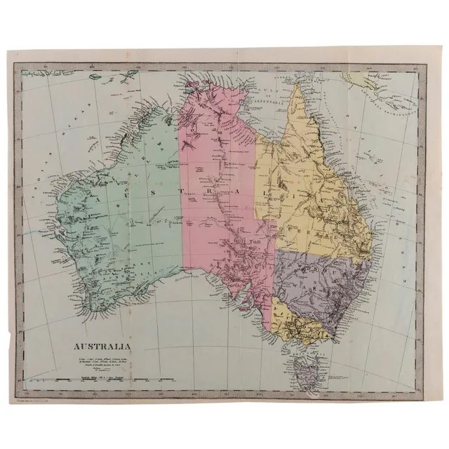
Antique Australian Maps Collection
Australia: A collection of maps including A. & C. Black (1851), Bartholomew (1853), Archer (c1860), Blackie & Son (c1870), Johnston (1886), Harmsworth (c1920) and other similar. (24 items). Various sizes, mixed condition.
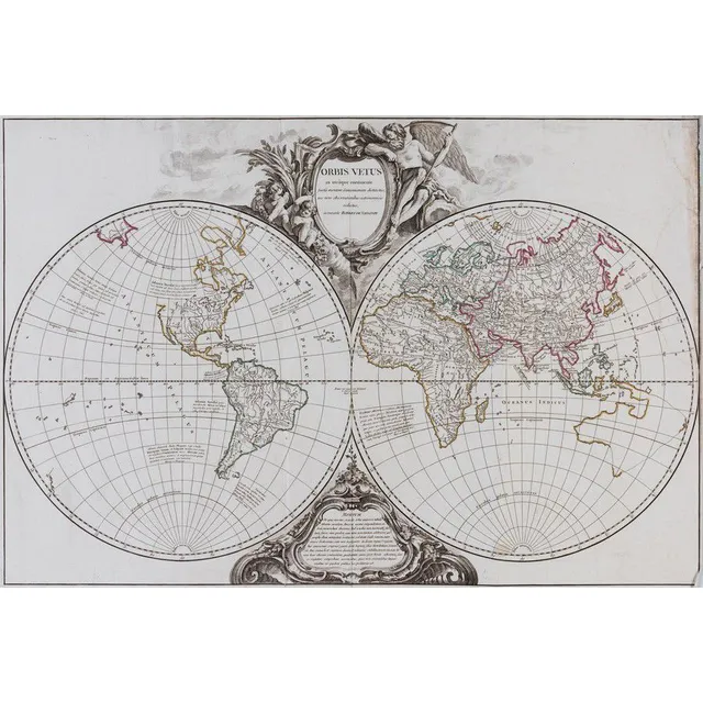
1757 Double Hemisphere World Map with Hypothetical Australia Connection
Vaugondy, Robert de. Orbis Vetus in Utraque Contiente. Paris: c.1757. Double hemisphere world map, with hypothetical east coast of Australia connected to New Zealand and New Guinea. Ornate cartouche above and below. Original outline colour. 50 x 75 cm.…
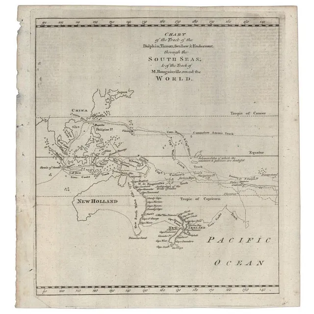
Historic Australian Map Collection
Australia: Collection of maps in folder, noted 'Chart of the Track of the Dolphin, Tamar, Swallow & Endeavour through the South Seas...' by Bowen [London, 1773], 'Karte von Australien' by Johannes Walch [Augsburg, c1810], 'Oceanique Centrale' by Pierre…
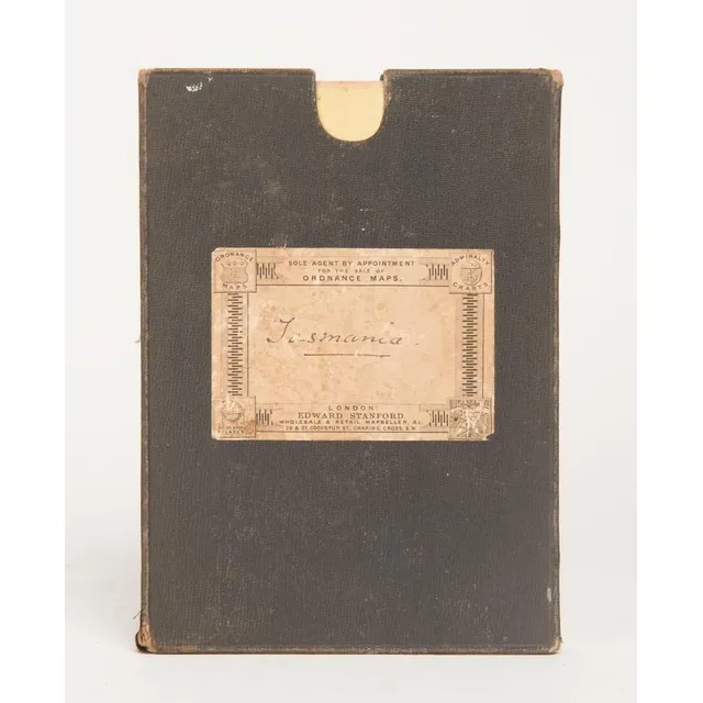
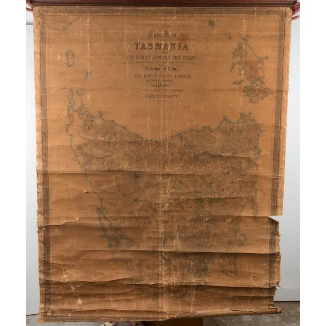
Tasmania 1883 Large Folding Map on Linen
TASMANIA' 1883 large folding map in 30 sectors laid down on linen and contained in a slip-case from the supplier: Edward Stanford Ordnance Maps, Charing Cross. Published by authority of the Honorable N.J.Brown, Minister of Land & Works. Litho: R.Bennett,…
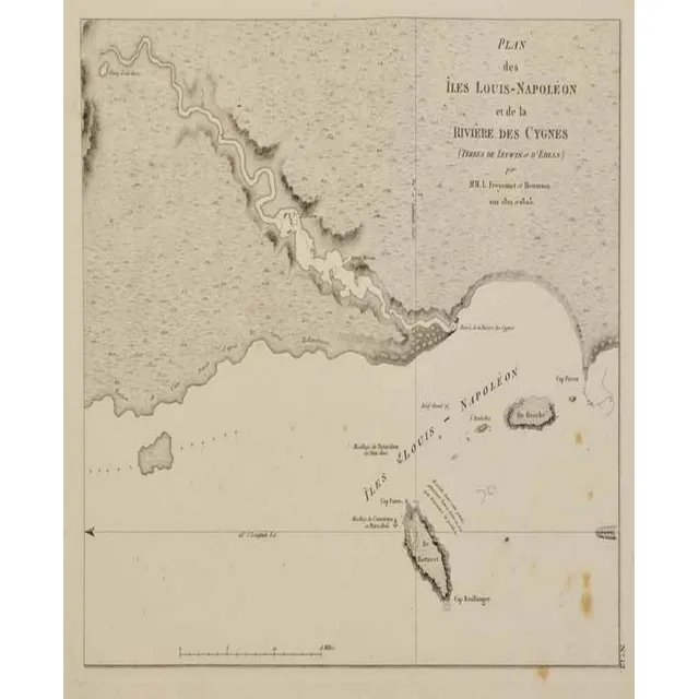
Map of Iles Louis-Napoleon and Swan River, 1807
Map: plan des Iles Louis-Napoleon et de la riviere. Des Cygnes (swan river) Freycinet, Louis Claude. Published Paris 1807 / 1811. Charting undertaken on the W.A. Coast 1801 - 1803. 16.8 x 21 cm
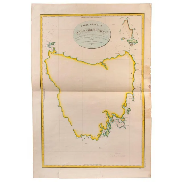
Freycinet's Map of Australia, 1808
leLOUIS de Freycinet 'Carte Generale de la Terre de Diemen, Comprenant les decouve Louis de Freycinet, 'Carte Generale de la Terre de Diemen, Comprenant les decouvertes et les travaux Geographiques executes dans cette partie a borde des Corvettes le…
Damaged Tasmania map from 1859
'Tasmania in 1859' by Sprent/Hogan;, 2 examples of this large wall map, both in poor condition. (2).
Ancient Map of Asia with Speculative Southern Australia Coastline
Thomas Bowen (1733 - 1790), 'A New & Accurate Map of Asia, drawn from the most approved Modern Maps & Charts.', London, 1799, some contemporary hand-colouring, 32 x 41 cm (plate), 57 x 66 cm overall with frame. Shows a largely speculative Southern…
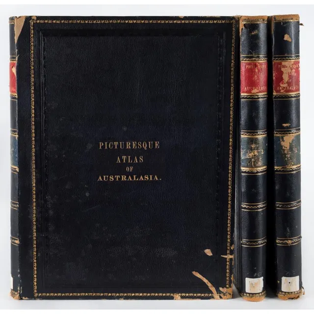
'Picturesque Atlas of Australasia' - Ex-Library Edition
'Picturesque Atlas of Australasia' edited by Hon. Andrew Garran (Melb. Syd. 1886), 3 vol. blue morocco, ex library edition, boards chipped and scuffed, internally good.
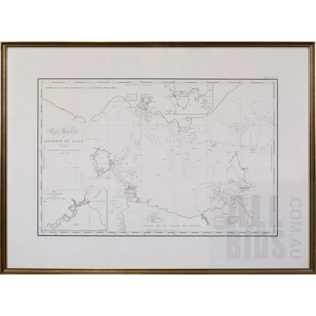
General Map of Bass Strait, 1812
Louis Claude Desaulses de Freycinet (French 1779-1842) carte generale du Detroit de Bass (a la Nouvelle Hollande) 1802 and 1803, Published Paris 1812
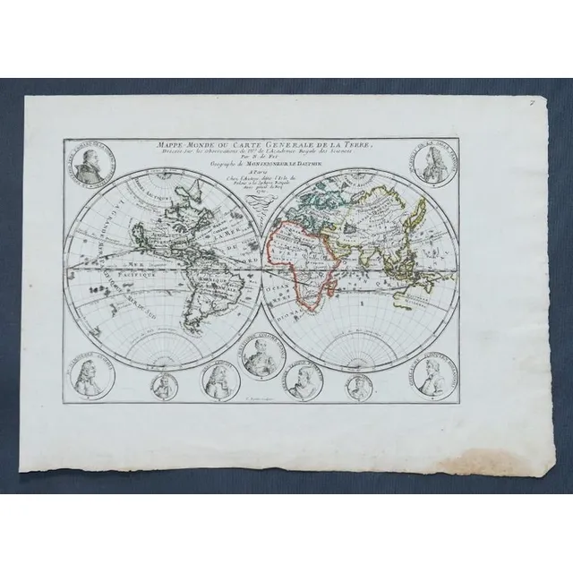
1700 French World Map with Explorer Cartouches
Map, Mappe-Monde Ou Carte Generale de La Terre. Pub. France c.1700. General world view with cartouches of explorers. Copper engraving & hand coloured. 24 x 3 5 cm
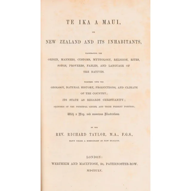
Te Ika A Maui: New Zealand and Its Inhabitants (1855)
(New Zealand) Taylor, Rev. Richard, Te Ika A Maui, New Zealand And Its Inhabitants, (Wertheim and Macintosh, London 1855) Green blindstamped pebbled cloth, gilt lettering on spine, 490 pp. plus 6 pp. publishers ads at rear, brown endpapers. Includes the…
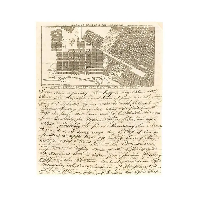
1854 Melbourne Map & Letter on Firearms Sales in Victoria
A lettersheet (folded to provide 4 sides) headed 'Map of Melbourne & Collingwood' with a detailed representation of the street grid, gardens and some significant buildings, with numbered references below the map. [Published by Blundell, engraved and…
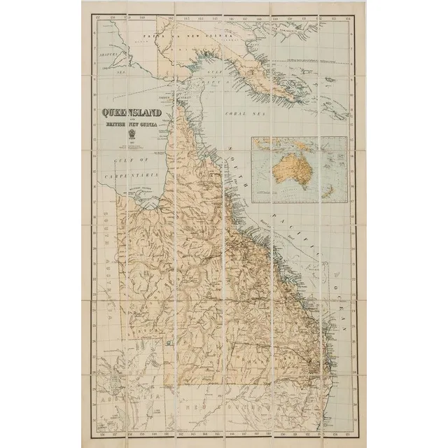
Queensland and British New Guinea 1897' large format map printed by the Surveyor General's Office, Brisbane, in 36 sections laid down on stiffened linen. Overall 103 x 69.5 cm.
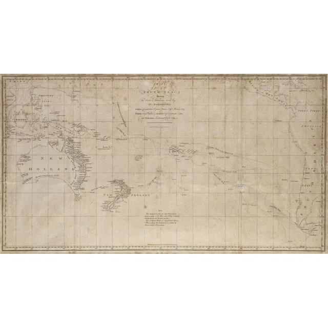
South Sea Discoveries Chart, 1765-1769
Chart of part of the South Sea shewing the tracts & discoveries made by His Majestys Ships Dolphin...& Tamer....1765, Dolphin...& Swallow...1767, and Endeavour, Lieutenant Cooke, 1769', engraved by W.Whitchurch [London, 1773], window mounted, framed &…
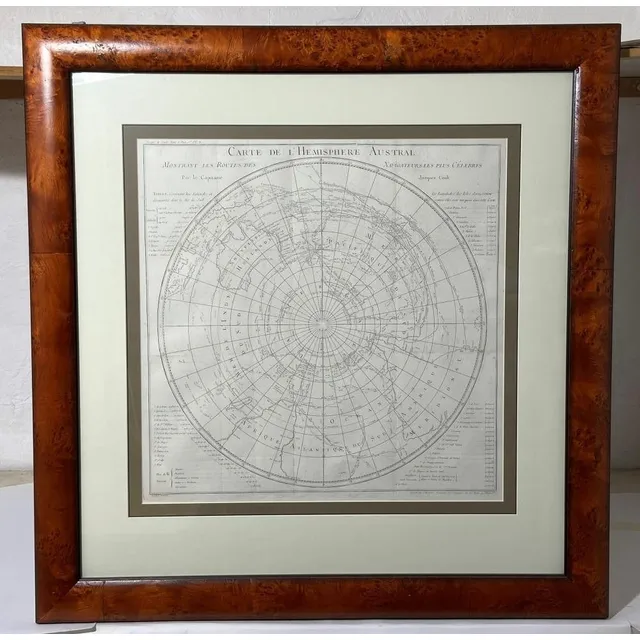
(Cook, James) Carte de L'Hemisphere Austral, montrant les Routes des Navigateurs les plus Celebres, engraved chart, French edition (1778) of Cook's chart showing tracks of Cook's three circumnavigations, good condition, mounted & framed, 56 x 56 cm, frame…
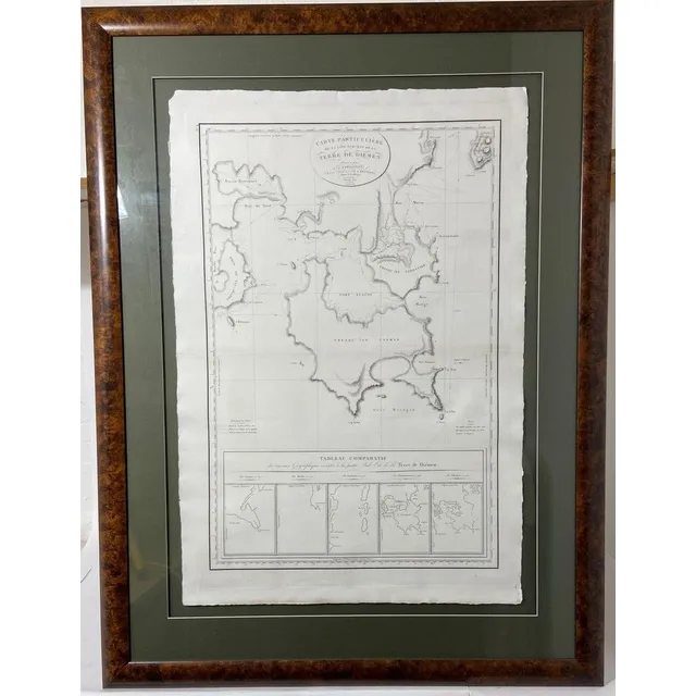
Freycient, L. Carte Particuliere De La Cote Sud-Est De La Terra De Diemen, (Paris, 1812), engraved chart of the southeast portion of Tasmania, surveyed during the Baudin expedition and published by Freycinet, five inset charts, center fold, good condition…
Carte Reduite-De La Mer De Sud 1753., and, Chart of Part of The Coast of New South Wales From Cape Tribulation to Endeavour Straits By Lieut. J Cook 1770, two engravings, each with printed text in image, 20.5 x 35.5 cm and 30 x 34 cm
Antique Hand Coloured Maps of British Isles and Munster
Two framed antique hand coloured maps of the British Isles & the Province of Munster. Frames approximately 182 cm x 67 cm
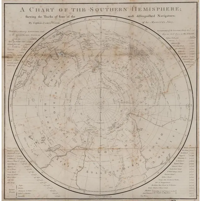
Captain Cook's Southern Hemisphere Chart (1777)
A Chart of the Southern Hemisphere by Captain James Cook, published by William Strahan [London 1777]. 55 x 57 cm
Captain Cook's World Map Puzzle
'A New Map of the World, exhibiting the tracks of Captain Cook and all the modern discoveries' A dissected puzzle made in England circa 1790, missing three pieces. A wooden boxed set depicting a map of the world charting Cook's three voyages and the…
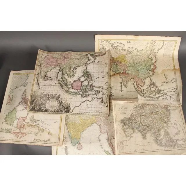
18th Century Maps of Asia and India
Five wonderful 18th century maps, c.1702-1793, including 'Asien,' by T.Mollo/Schmidt, 'India Orinetalis,' by S.C.M. George August, 'Carte Indes Orientales,' by Charles Henry Friso/Homann Erben and 'Charte von Asien,' by F.L. Guslefeld/Homann (5)
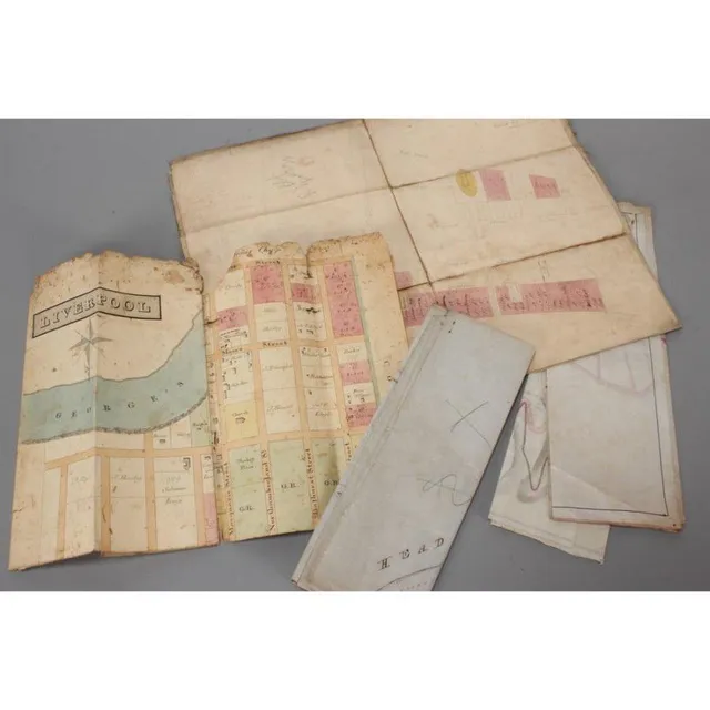
Colonial Maps of Australia
Five Australian Colonial maps, including town plan of Liverpool, 1847 state of Blighs terrace, Subdivision of Lots 26 & 27 Point Piper Estate, plan of land Ownership along Edgecliff Rd and 1895 plan showing alternate roads Macquarie mountain
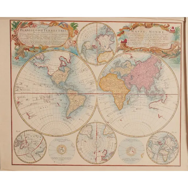
Hand-Coloured Mappemonde Map by Robert de Vaugondy (1752)
Mappemonde map, Robert de Vaugondy (1688-1766), France, circa 1752, hand coloured world map in two hemispheres, the map 47 x 70.5 cm. Provenance: Purchased from the Parker gallery, London, 1979
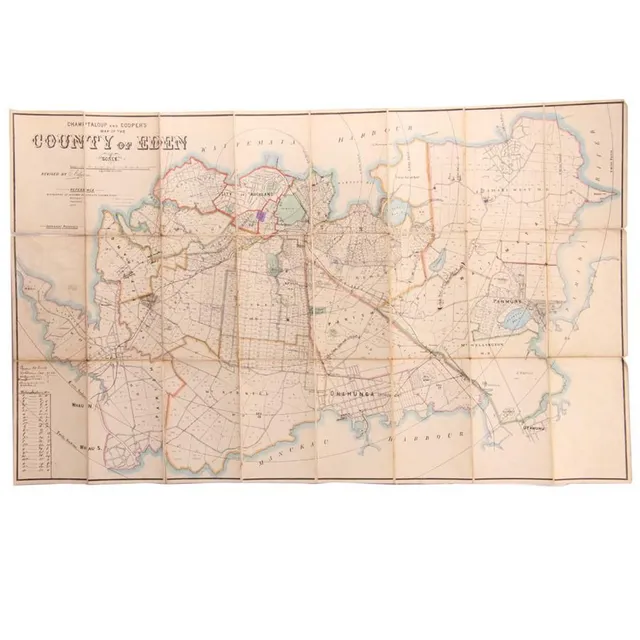
Hand-Coloured Map of Eden Auckland, c. 1880
A hand coloured map of the 'County of Eden Auckland', c. 1880, by Champtaloup and Cooper. Some hand notation to side. 53 x 87 cm
1846 Tasmania Map by W. & A.K. Johnston
W. & A.K. Johnston, 'Van Diemen's land or Tasmania : lithographed Edition', highly detailed hand-coloured map, circa 1846, 65 x 53 cm.
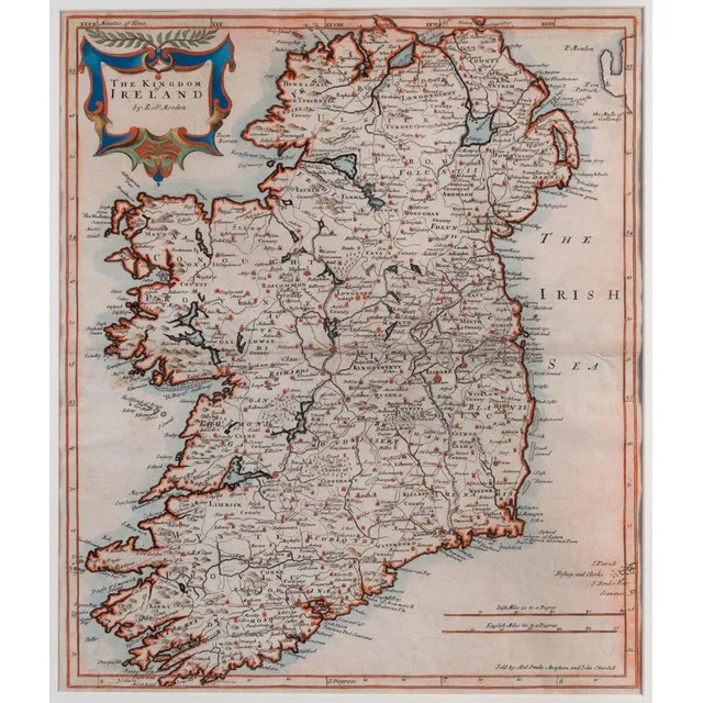
Ireland Map by Robert Morden, 1695
Robert Morden (d.1703) the Kingdom of Ireland 1695, copperplate engraving, hand-coloured 41.5 x 45 cm. The map appeared in an early edition of Camden's Britannia. It includes towns, roads, mountains, rivers, churches, lakes and many other details.
Vintage Visuals: 18th-20th Century Maps, Charts, and Prints
Range of maps, charts, posters, engravings and prints, 18th to 20th century, inspection will reward
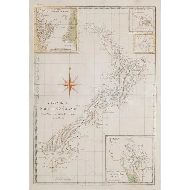
Antique French Map of New Zealand
An antique French map of New Zealand, titled 'Carte de la Nouvelle Zeelande' Par M. Bonne, Ingnieur-Hydrographe de la marine. Print 37 x 25.5 cm frame 53.5 x 41 cm
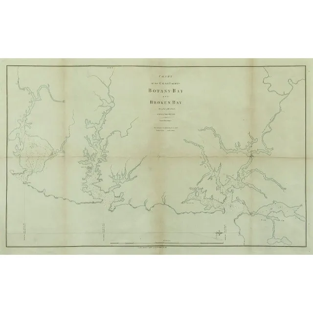
Coastal Chart: Botany Bay to Broken Bay, 1792
1792 Chart of the Coast between Botany Bay & broken Bay. As surveyed by Capt. John hunter. Pub. By John Stockdale, London 1792. Engraving. 43 x 75 cm
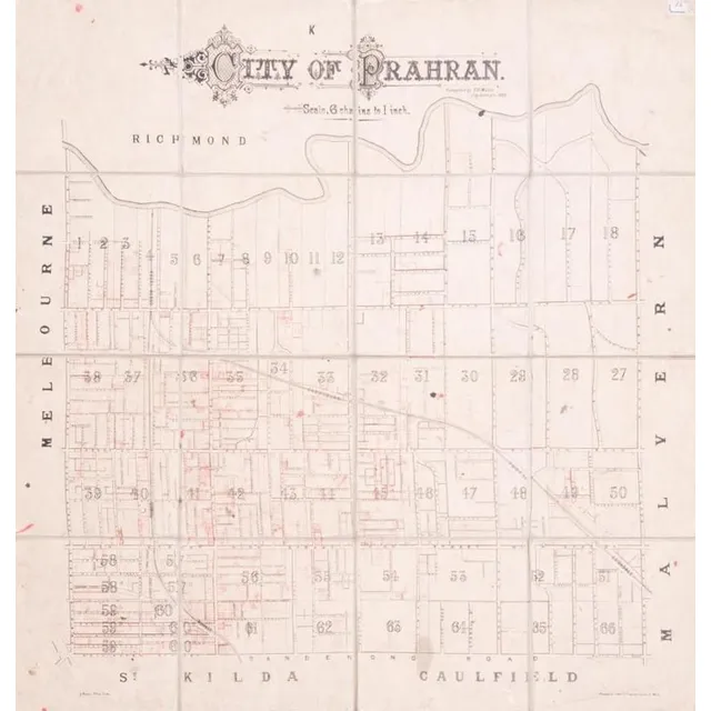
Prahran City Map 1882
City of Prahran. Compiled by T. B. Muntz, City Surveyor, 1882, fold-up map in 16 sections on linen-backing, with many properties added in red ink, overall 83 x 90 cm.
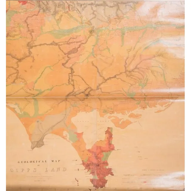
Gipps Land Geological Map (c.1875)
Geological Map of Gipps Land (Sheet No.1), Surveyed by R. A. F. Murray under the direction of the Mining department, Melbourne [c1875], linen-backed roll-up map, size 97 x 110 cm.
Exploration of the South Pacific by European ships
Benard, Robert (Paris, 1774), Carte d'une partie de la Mer du Sud Contenant les Decouvertes de Vaisseaux de sa Majeste: Le Dauphin, Commodore Byron, la Tamar, Capitne Mouats, 1765. Le Dauphin, Capitne Wallis, Le Swallow, Capitne Cartaret, 1767. et…
Brouckner/Remondini Map of the World, 1761
Brouckner/Remondini, Carte Generale du Globe Terrestre, Venice, 1761, 25 x 36 cm overall. This uncommon map is Remondini's reduction of Isaak Brouckner's map of the world. It features an extravagant collection of Northwest Passage theories, including one…
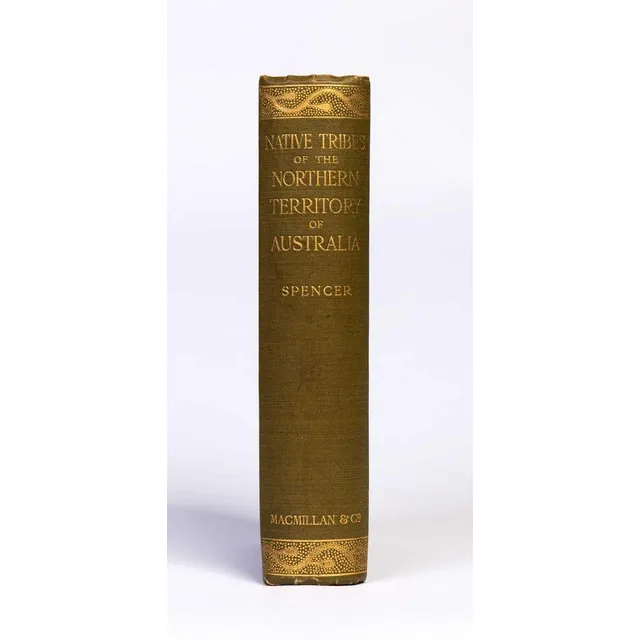
Native Tribes of Northern Territory Australia
Spencer, W. Baldwin. Native tribes of the Northern Territory of Australia. London, 1914. Thick octavo, with folding map and numerous plates, some coloured, original gilt-decorated cloth.
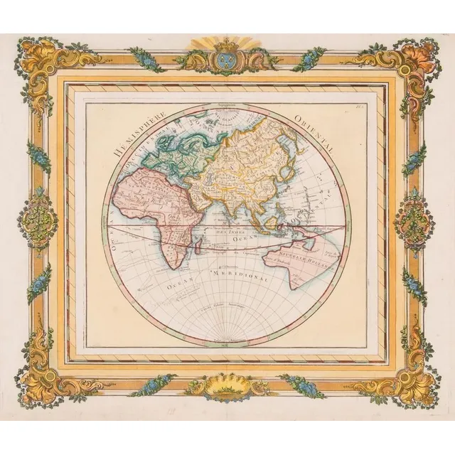
French Hemisphere Oriental Map, 1768
Map: A French hand coloured map 'Hemisphere Oriental', circa 1768, attributed to Brion de la Tour, pre Captain Cook with undefined east coast of Australia. 42 x 36 cm
Jannson's Map of Ancient China and Neighboring Regions
Map, Jannsons china Veteribus Sinarum Regio. Map incorporates Eastern china, Japan, Korea, parts of India & Siam. Pub. Amsterdam 1658. Hand coloured copper engraving, 41 x 51 cm
17th Century Map of Great Britain and Ireland by John Speed
A 17th century map by John Speed 'The Kingdome of Great Britaine and Ireland', published Bassett & Chiswell c.1676, copper engraved map with hand colouring; text verso, plate 38.5 x 51.5 cm. Originally pub. 1612 for Speed's 'Theatre of the Empire..'.
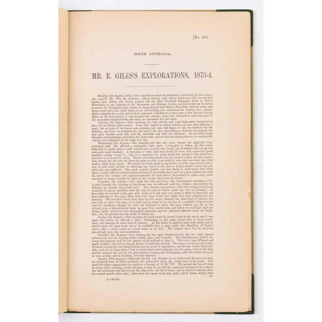
Ernest Giles's Central Australian Explorations, 1873-74
Giles, Ernest. Mr.Ernest Giles's explorations, 1873-74. [Adelaide, 1874]. South Australian Parliamentary Paper, small folio, drop title, pp.70 with folding map, half calf. Some very slight marginal staining at end., The first printing of the great…
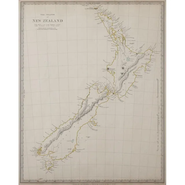
New Zealand Map 1838 by J & C Walker
Map of New Zealand for the Society for Diffusion of Useful Knowledge, c1838, engraved on paper by J & C Walker, 400 x 32 cm
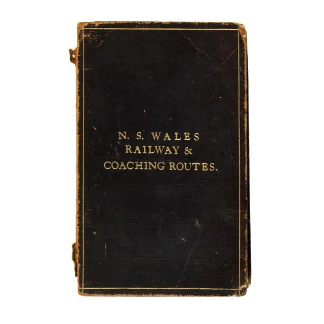
NSW Railway & Coaching Routes Map (1904)
New South Wales railway & coaching Routes. Map showing coach & other routes from the various stations, together with mileage from Sydney, with diagrams of north coast, south coast & parts of Southern & Western lines. Scale 29 miles to one inch. Printed at…
Sketch of Van Diemens Land History and Arrowsmith Map
Book, 1832, sketch of the History of van Diemens Land, James Bischoff, including Arrowsmith map, separately mounted
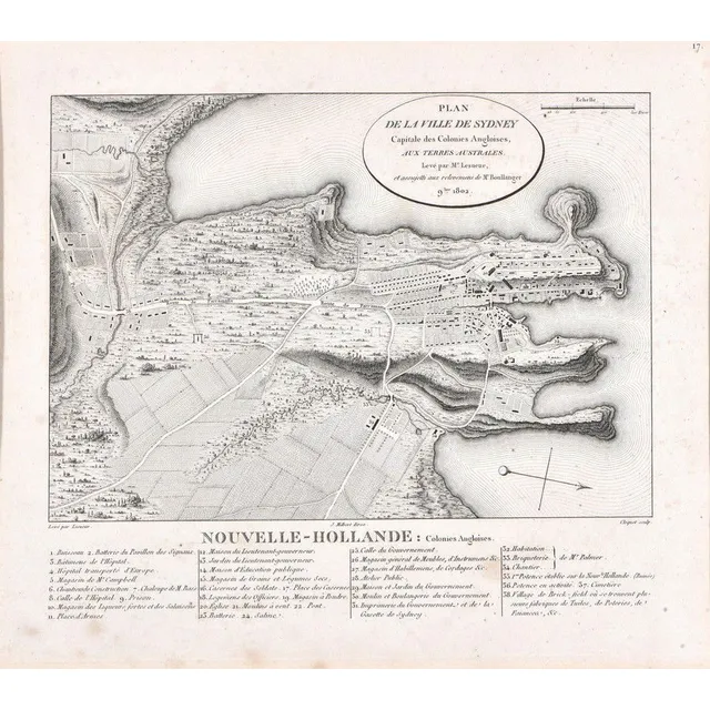
Sydney City Plan, 19th Century Engraving
Plan De La Ville De Sydney; after Charles Alexander Lesueur, France, early 19th century; engraving. Foxing in places; 25.5 cm x 22 cm
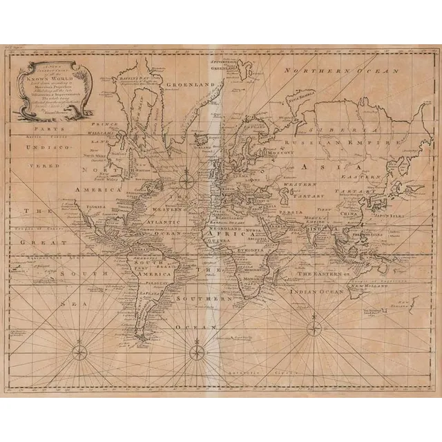
Emanuel Bowen's World Map, London 1744
A New & Correct Chart of all the Known World by Emanuel Bowen [London 1744]. 46 x 38 cm
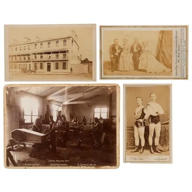
Photographs & postcards including carte-de-visit early Sydney street scene with inscription, general Tom Thumb and wife, Commodore Nutt and Miss Minnie Warren, 'Coffin Making DEPt. B. Mathews Undertaker, S. Yarra, Melbourne', plus others, (52 items
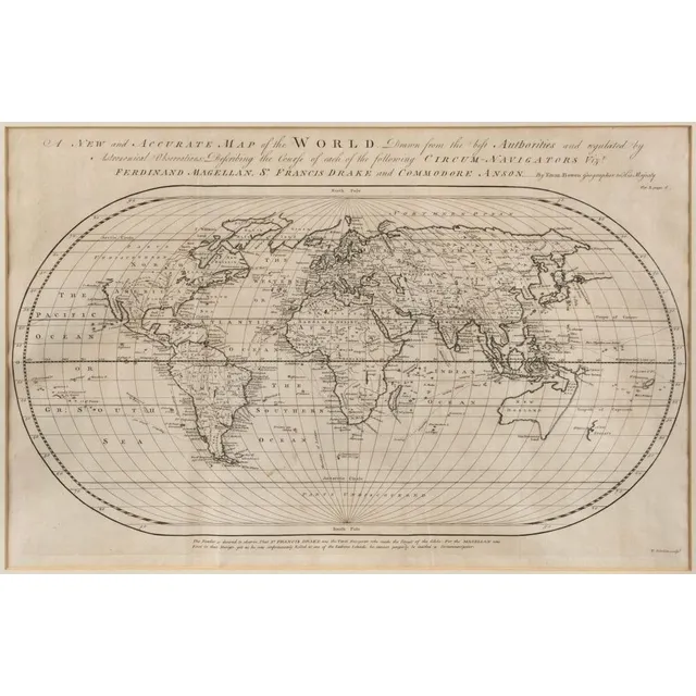
Accurate Oval Map of World with Circum-Navigators' Courses
Bowen, Emanuel (1694? - 1767), A New and Accurate Map of the World. Drawn from the best Authorities and regulated by Astronomical Observations: Describing the Course of each of the following Circum-Navigators Vizt. Ferdinand Magellan, Sr. Francis Drake…
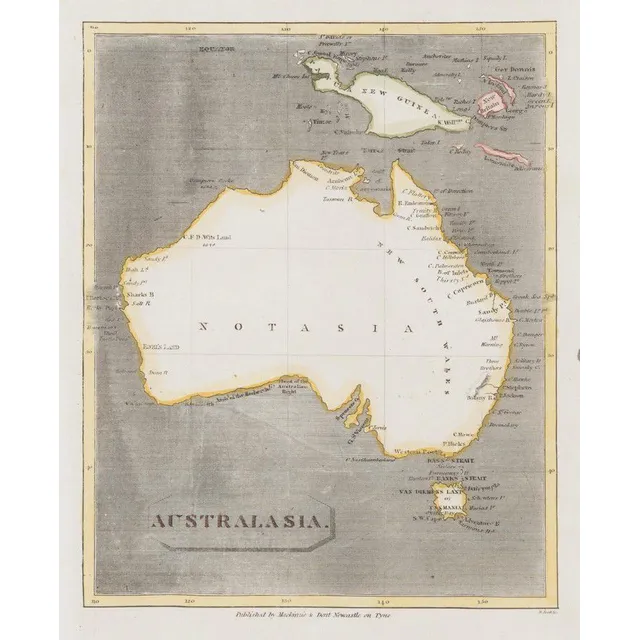
Australasia Map with Notasia and Hypothetical New Guinea
Scott, R. (Mackinzie & Dent, Newcastle on Tyne, Nd but 1811), Australasia, but unlike the earlier c1,800 edition showing the coastline more complete, the map also has 'Notasia' printed in the centre of the landmass. New Guinea and the surrounding islands…
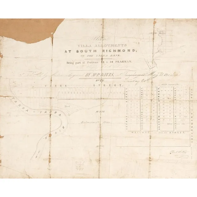
Antique Maps of Richmond, Phillip Island, and Bourke County
MAPS: c1853-84 maps, 'Plan of Villa Allotments at South Richmond', 'Town and Country Lands, Phillip Island', 'Boroondara, County of Bourke'. Various sizes. Poor/G condition
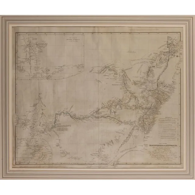
Discoveries of Australia, 1832
After J Arrowsmith, map of the Discoveries of Australia 1832, dedicated to the right Honourable Viscount Goderich. Hm Principal Secretary of state for the Colonies and President of the Royal Geographical Society, published 15 February 1832, J Arrowsmith,…
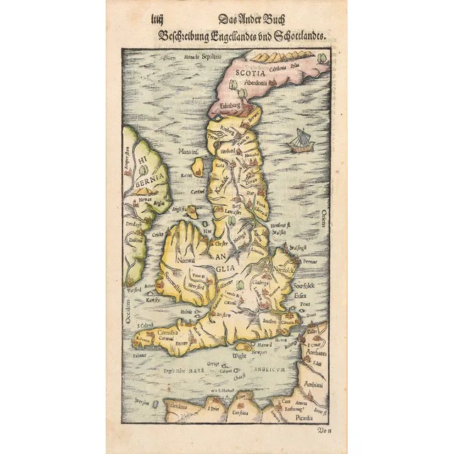
16th Century Hand-Coloured Map of England and Scotland
A map of England and Scotland; Sebastian Munster, circa 1578; the hand coloured wood cut map; 18 x 30 cm
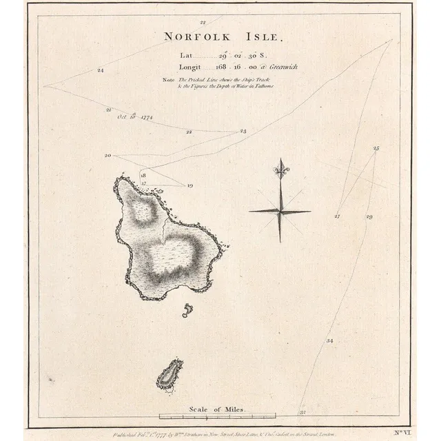
Norfolk Isle Map, 1777
A map of Norfolk Isle; Strahan & Cadell, London, 1777; the engraved nautical chart, published in Cook's a voyage towards the south pole, and round the world. 20 cm x 33 cm
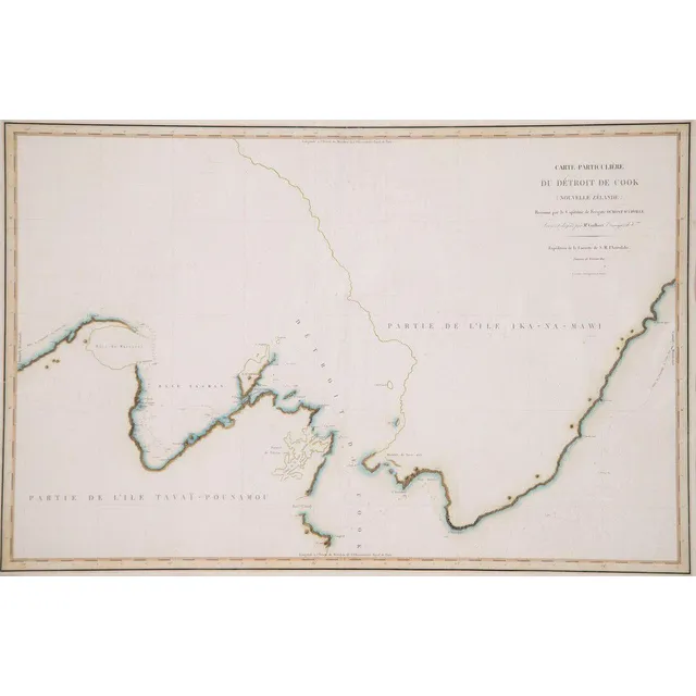
D'Urville's Cook's Strait Chart (1827) - Unframed
Unframed C1832 chart of Cook's Strait, Dumont D'Urville from his voyage of discovery in the Astrolabe 1827, 60 x 89 cm
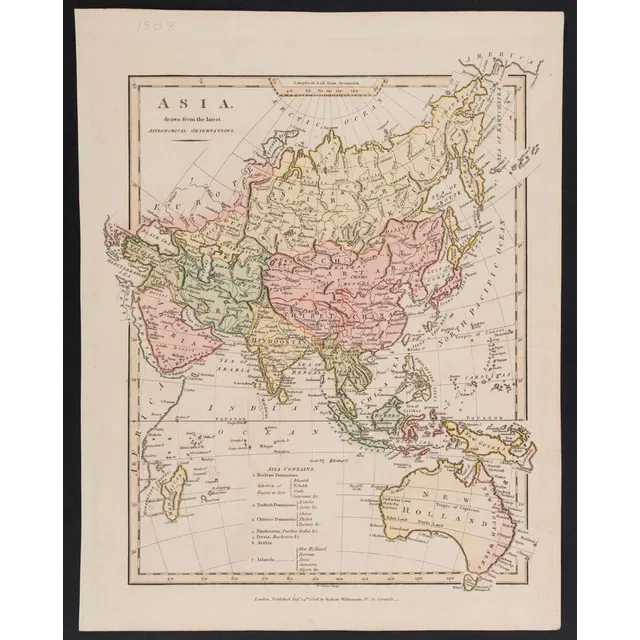
Asia and New Holland, 1808 Astronomical Observations
Robert Wilkinson: Asia, drawn from the latest Astronomical Observations, contemporary hand-colouring, [London, 1808], includes New Holland, 34 x 27 cm.
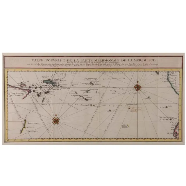
Southern Pacific Ocean Map
'Carte Nouvelle De La Partie Meridionale De La Mer Du Sud'. By Aleaxandre Guy Pingre. Hand coloured. 23 x 48 cm
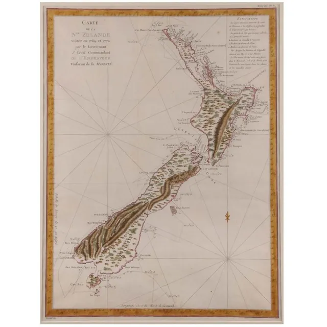
1769 New Zealand Map by Lieutenant J. Cook
'Carte De La Nouvelle Zelande Vifite'e En 1769'. By Lieutenant J Cook, Commander of the Endeavour 1770. Hand coloured. 49 x 39.5 cm
![[Gregory]. Papers relating to an expedition recently undertaken…](https://img.carters.com.au/640x640/87a39cefb50eb588489e53cdb710f831.webp)
Exploring Northern Territory of Australia (9 words)
[Gregory]. Papers relating to an expedition recently undertaken for the purpose of exploring the Northern Territory of Australia. London, 1857. British Parliamentary Paper, small folio, pp. [iv], 30 with folding coloured map by Arrowsmith, quarter morocco…