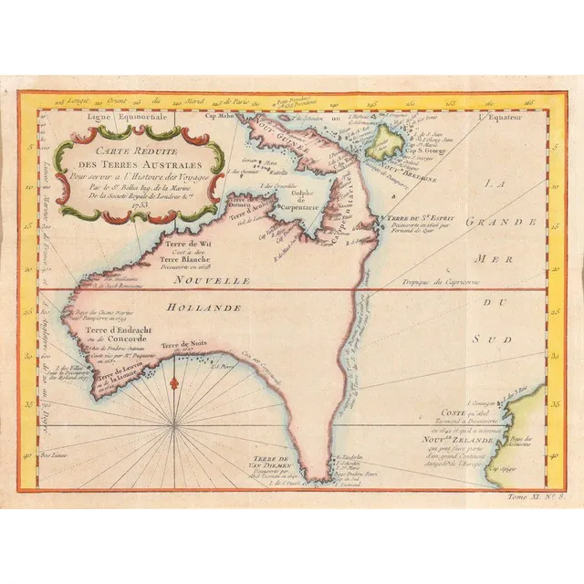
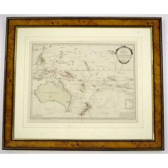
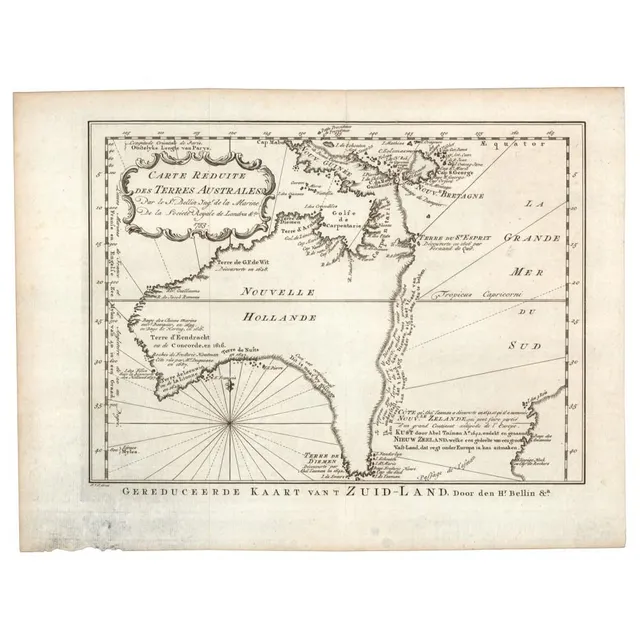
Dutch Discoveries in Early Australian Map
Carte Reduite De Terres Australes; Jacques Nicolas Bellin (1703-1772), Paris, circa 1753; the hand coloured early map of Australia with Dutch Discoveries. 30 x 22 cm
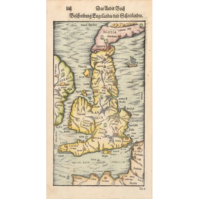
16th Century Hand-Coloured Map of England and Scotland
A map of England and Scotland; Sebastian Munster, circa 1578; the hand coloured wood cut map; 18 x 30 cm
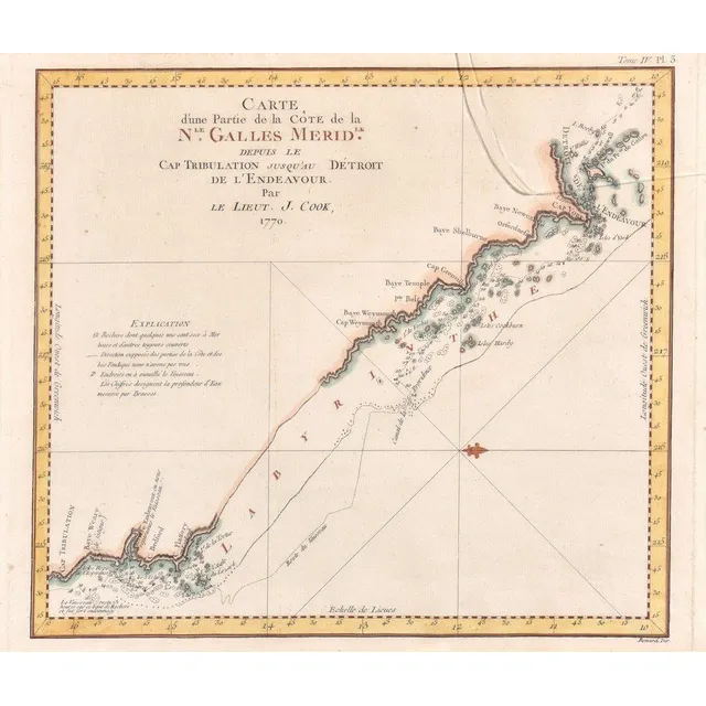
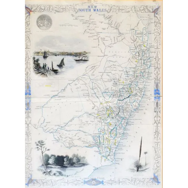
Coastline Map of New South Wales, 18th Century
Carte D'Une Partie De La Cote De La N.Le Galles Merid.Le Depuis Le cap Tribulation, James Cook, Paris, late 18th century; the coloured engraving showing a portion of the New south Wales coastline, from cape Tribulation to Endeavour Straits and cape York;…
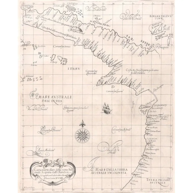
Coastal Map of Northeast Australia by Cocchini
Carta Particolare Della Costa Australe Scoperta Dall'Olandesi, Giuseppe Cocchini, Florence, 17th century; the uncoloured engraved map showing the northeast coast of Australia. 39 cm x 46 cm
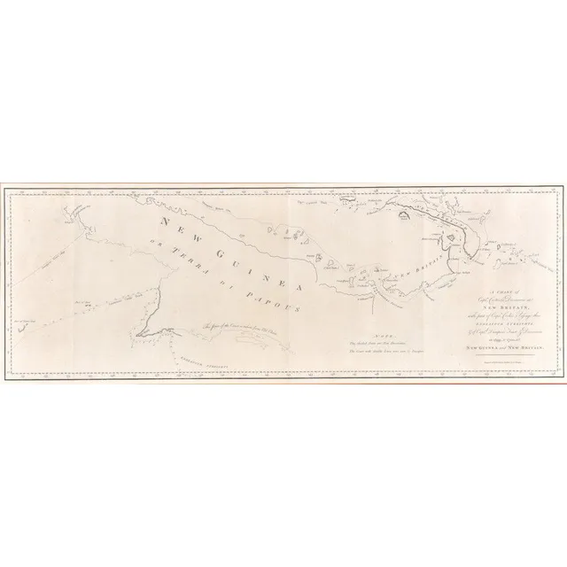
Explorations of Carteret, Cook, and Dampier in Oceania
A chart of Capt. Carteret's Discoveries at New Britain & New Guinea, Alexander Hogg, late 18th century; with part of Captn. Cook's Passage through Endeavour Streights, & of Captn. Dampier's Tract & Discoveries in 1699, & 1700, at New Guinea & New Britain.…
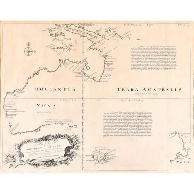
Southern Continent Map by Emanuel Bowen (1744)
A complete map of the Southern Continent; Emanuel Bowen (1693-1767), London, 1744; the uncoloured map, surveyed by Capt. Abel Tasman & depicted by order of the East India Company in Holland in the Stadt house at Amsterdam, being the first English map of…
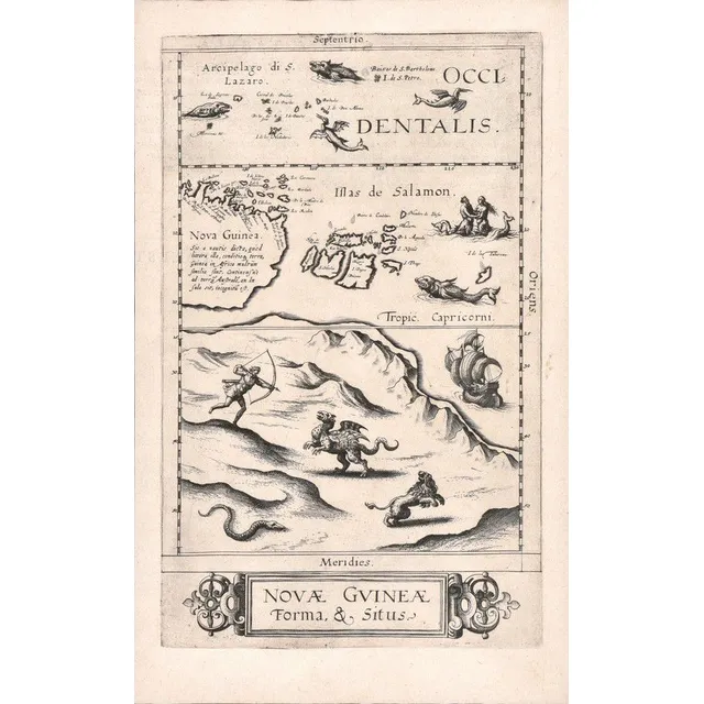
First Printed Map of Australia: Nova Guinea Forma & Situs
Nova Guinea Forma & Situs; Cornelis De Jode (1568-1600), Antwerp, 1593; the rare uncoloured map of New Guinea, is recognised as the first printed map of Australia. The whole of the lower half of the map depicts an entirely imaginary northern coast of…
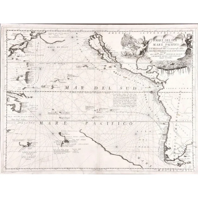
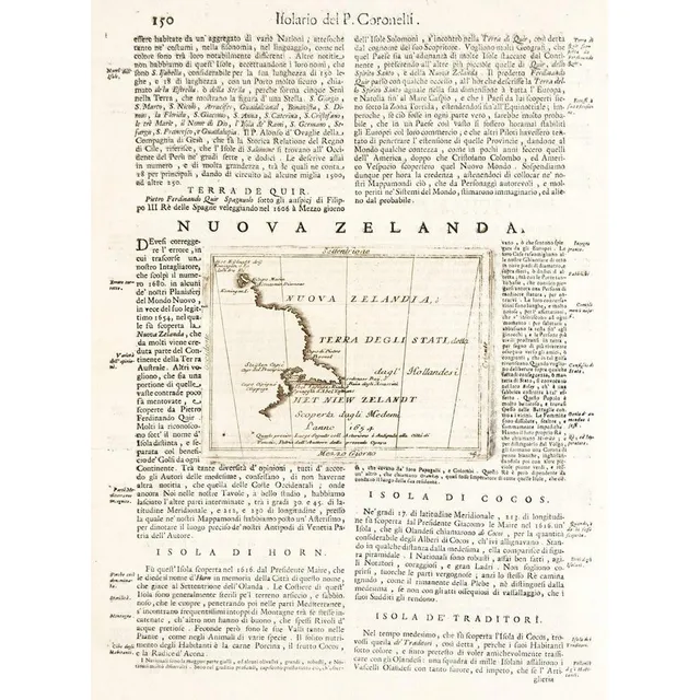
Map of the Pacific Ocean by V.M. Coronelli
Mare Del Sud, Detto Altrimenti Mare Pacifico; Vincenzo Maria Coronelli (1650-1718), Venice, circa 1691; an engraved and uncoloured map of the Pacific Ocean. 62 x 47 cm
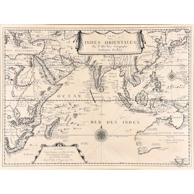
Indian Ocean Map with Abel Tasman's Voyages
Carte Des Indes Orientales; Pierre du Val (1618-1683), Paris, 1665; the uncoloured map of the Indian Ocean, featuring the explorations of Abel Tasman, derived from his voyages to Australia and New Zealand, from 1642 to 1644; 55 cm x 41 cm
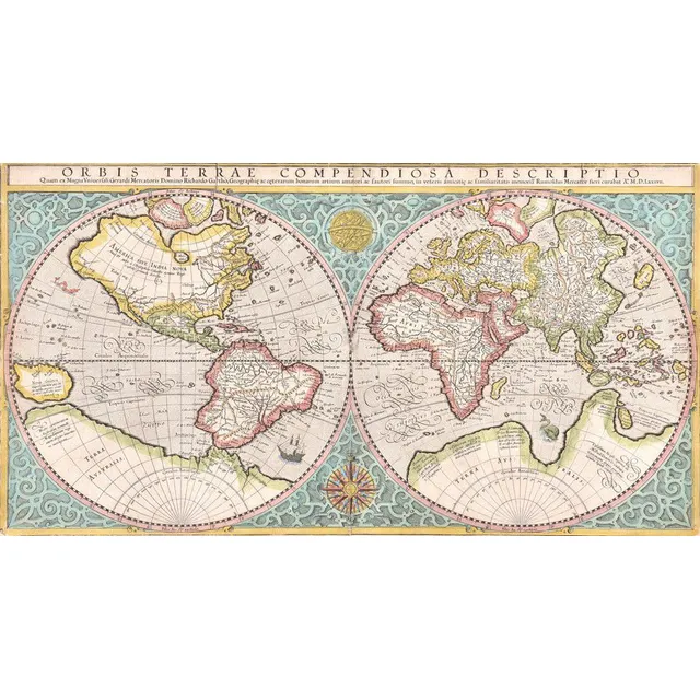
Mercator's 1587 Double-Hemisphere World Map
World map, Orbis Terrae Compendiosa Descriptio. Rumold Mercator (1545-1599), dated 1587 (circa 1619); engraved & coloured double-hemisphere world map,; 52 x 28 cm
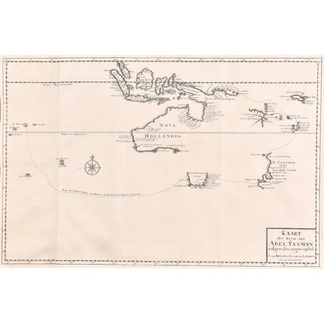
Abel Tasman's Discoveries in Australasia, 1642-1644
Kaart Der Reyse van Abel Tasman; Francois Valentijn (1666-1727), Amsterdam, 1726; Uncoloured map from Vol III, 2 of Valentijn's 'Old and New East India' detailing the discoveries of Abel Tasman in Australasia during the course of his two voyages of 1642 &…
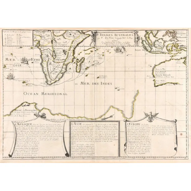
Dutch Discoveries in New Holland and Indian Ocean (1684)
Terres Australes; Pierre du Val (1619-1683), Paris, 1684; a hand coloured map of the Dutch Discoveries in the New Holland and the Indian Ocean. Third issue, the first being 1677. 59.5 x 42 cm
Cook's Discoveries: General Chart and Ship Tracks
A selection of bound maps; including a general chart: exhibiting the discoveries made by Captain. James Cook in this and his two preceding voyages; with the tracks of the ships under his command.
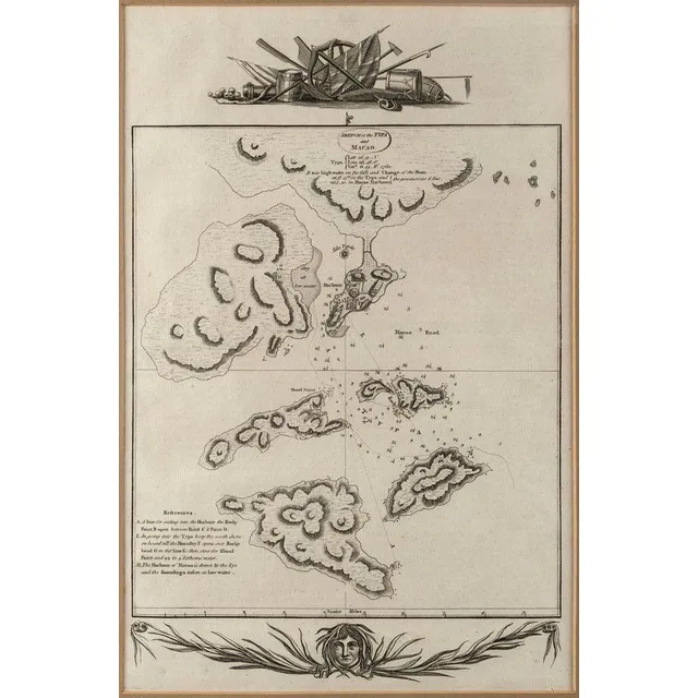
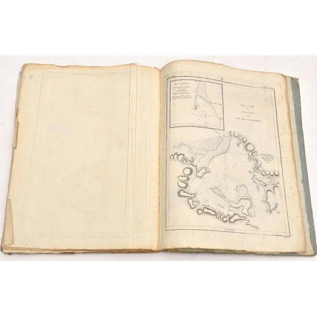
Macao Maps and Views Collection
'Sketch of the Typa and Macao' Detailed chart of Macao and neighboring islands from Cook's Voyages, c.1785. overall 34 x 22 cm Includes town plan, soundings, some topography and notes and observations. also, 'View of Macao in China' by James Heath (c…
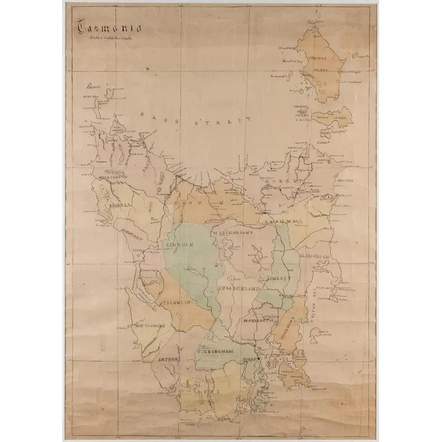
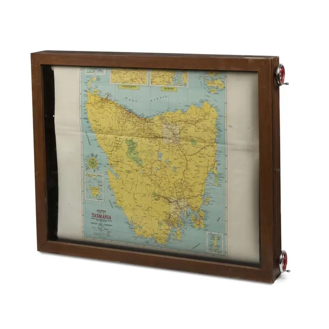
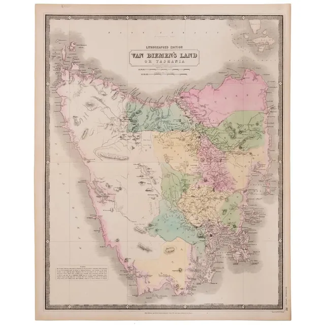
Hand-Coloured Map of Former Counties in Tasmania
Tasmania', hand coloured lithograph showing 18 former counties of Tasmania, scale: 5 miles to 1 inch, 74 cm x 52 cm
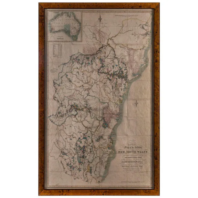
Detailed Map of New South Wales, 1837
Dixon, Robert., This Map of the Colony of New South Wales, Exhibiting the Situation and Extent of The Appropriated Lands, including the Counties, Towns, Village-Reserves, &c Compiled from Authentic Surveys &c. is respectfully Dedicated to Sir John Barrow…
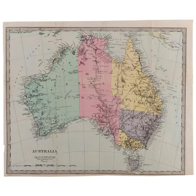
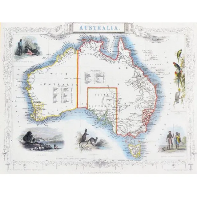
Antique Australian Maps Collection
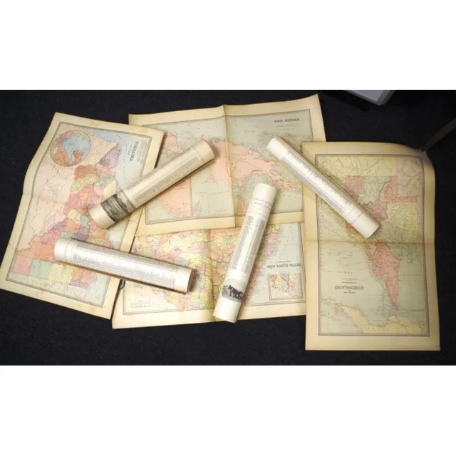
Australia: A collection of maps including A. & C. Black (1851), Bartholomew (1853), Archer (c1860), Blackie & Son (c1870), Johnston (1886), Harmsworth (c1920) and other similar. (24 items). Various sizes, mixed condition.
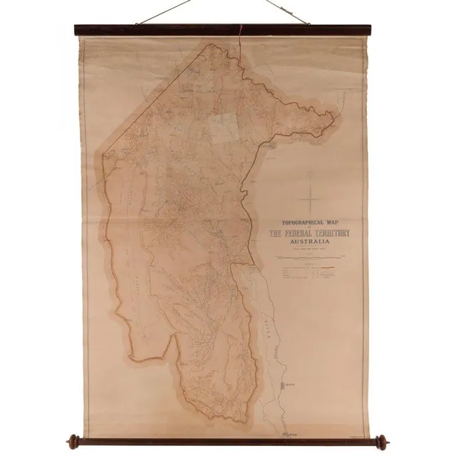
Topographical Map of Federal Territory Australia, 1910
Topographical Map of the Federal Territory Australia, Compiled, Drawn and Printed at the Department of Lands, Sydney, 1910, 90 x 125 cm, supported on a turned cedar roll by the noted map mounter J.Creffield of Melbourne., George Sydney Jones [1864-1927,…
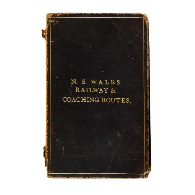
NSW Railway & Coaching Routes Map (1904)
New South Wales railway & coaching Routes. Map showing coach & other routes from the various stations, together with mileage from Sydney, with diagrams of north coast, south coast & parts of Southern & Western lines. Scale 29 miles to one inch. Printed at…
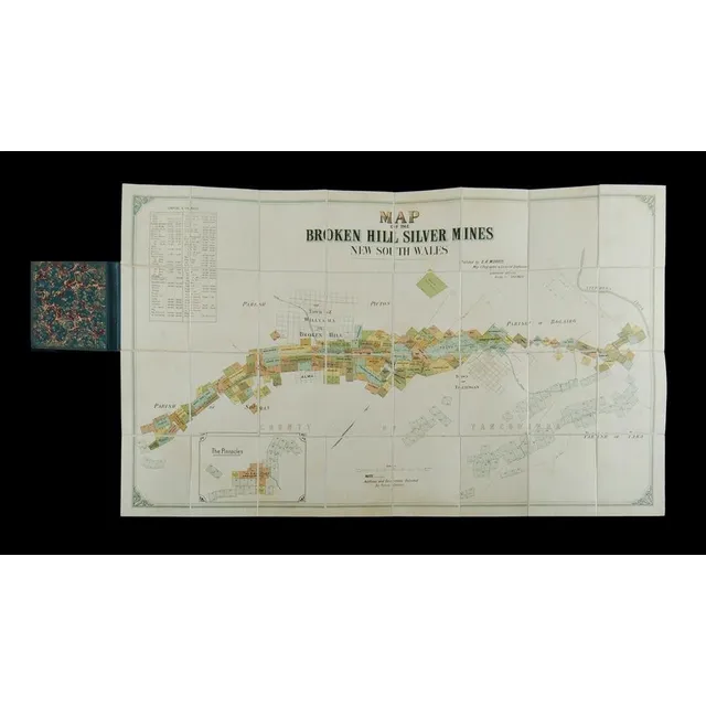
Broken Hill Silver Mines Map (NSW) - c1895
Map of the Broken Hill silver Mines New South Wales. Publ. By E R Morris, map lithographer & licensed draftsman Queensland offices bridge St, Sydney. Map laid on linen & folded into hard covers, c1895. (6.5 x 10.5 cm).
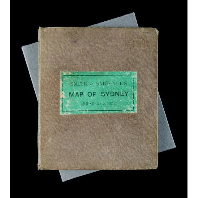
1855 Map of Sydney & Suburbs in Leather Binding
Smith & Gardiner's map of Sydney & Suburbs 1855. Leather bound cover (11.5 x 14 cm), inside folds out to a 32.5 x 38.5 cm map on material. Enclosed by a protective cardboard folder to fit.
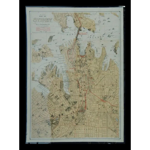
Sydney Map 1928: Wharves, Shipping, and Landmarks
Map of Sydney 2nd edition. H E C Robinson Ltd colour litho laid down on linen, enclosed in Mylar, (97 x 70 cm). North Shore bridge under construction (Sydney Harbour Bridge). All of the named wharves in Darling harbour, Walsh bay, Sydney cove, Johnstones…
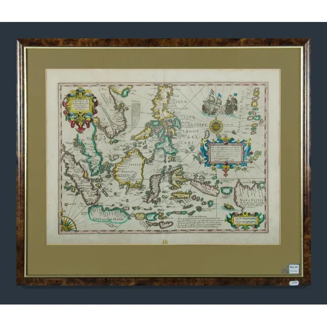
East Indies Map with New Guinea
Framed decorative colour map of the East Indies showing a portion of New Guinea. Insulae Indicae Orientalis Precipual. Image (40 x 53 cm) frame (57 x 68 cm)
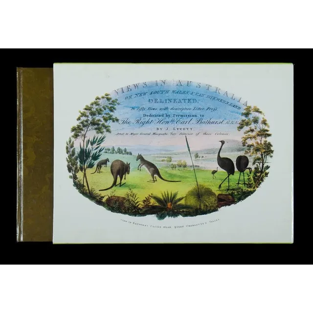
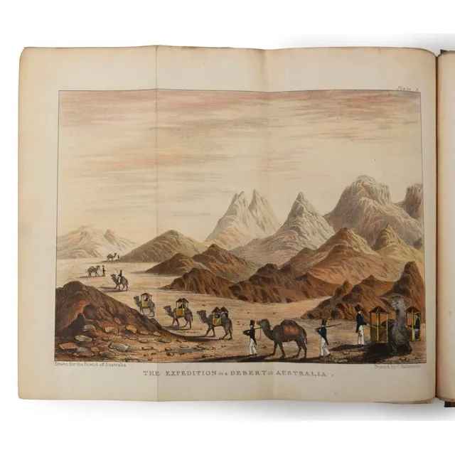
Views in Australia: 1824-1825
Book, 'Views in Australia or New South Wales & Van Diemen's Land.' by J Lycett, facsimile of the 1824-1825 edition. Oblong Quarto with 50 coloured plates and descriptive letter press, including two full page maps and 48 full page coloured plates and a…
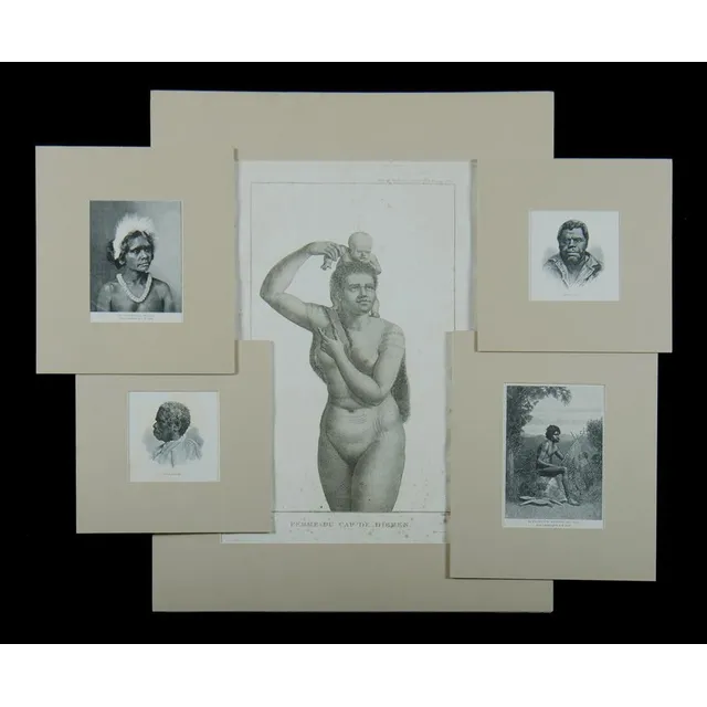
Perouse Atlas & Aboriginal Engravings from Raven Collection
Six items. After Jean Piron, 'Femme Du Cap De Diemen.' plate 6 form 'Atlas Du Voyage a La Recherche De La Perouse,' pub. Paris 1800 etching (44 x 31 cm). Also, 5 wood engravings depicting aboriginal subjects including. King Billy & Truganini. Collection…
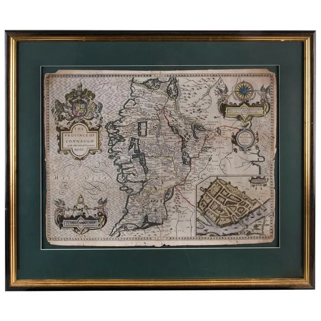
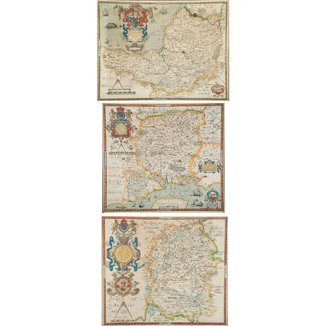
Framed English and Irish County Maps, 1610-1720
(1610) (4 items) English & Irish County maps comprising 'The Province of Connaugh with the citie of Galwaye Described' by John Speed (1610); 'The East riding of Yorkshire' by Robert Morden (c.1720); 'Oxford Shire' by Robert Morden (1695); and 'Hertford…
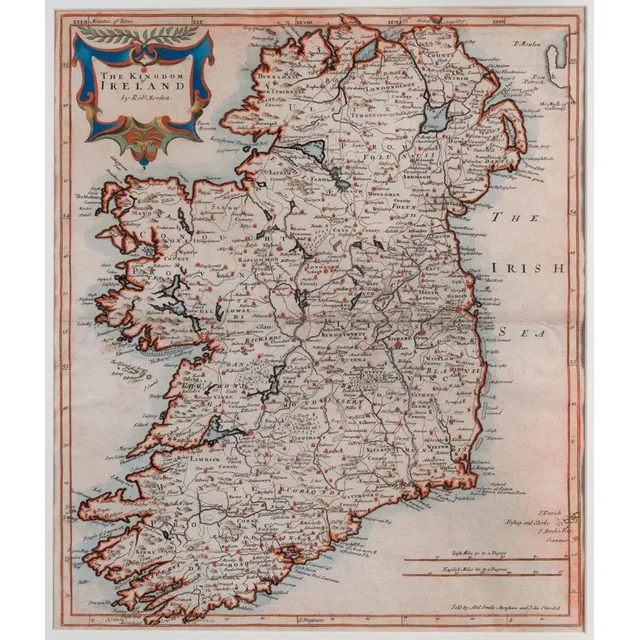
Ireland Map by Robert Morden, 1695
Robert Morden (d.1703) the Kingdom of Ireland 1695, copperplate engraving, hand-coloured 41.5 x 45 cm. The map appeared in an early edition of Camden's Britannia. It includes towns, roads, mountains, rivers, churches, lakes and many other details.
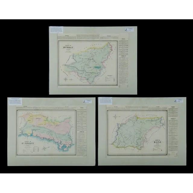
NSW County Maps with Towns and Rivers (3)
Maps (3), NSW County, St Vincent, Murray & King, including. Towns, Araluen, Braidwood, Queanbeyan (Canberra area noted), Dalton & Gunning. Publ. 1872, hand coloured lithograph (3), 38 x 53 cm (each)
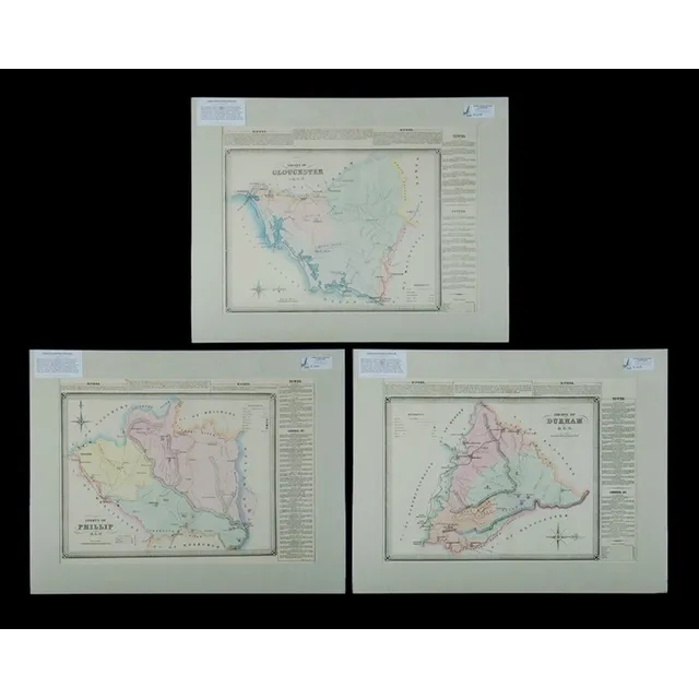
NSW County Maps with Newcastle and Towns
Maps (3), NSW County, Northumberland, Durham & Phillip, including. Towns, Newcastle, Singleton, Muscelbrook, Gressford & Mudgee, hand coloured lithograph (3), 38 x 53 cm (each)
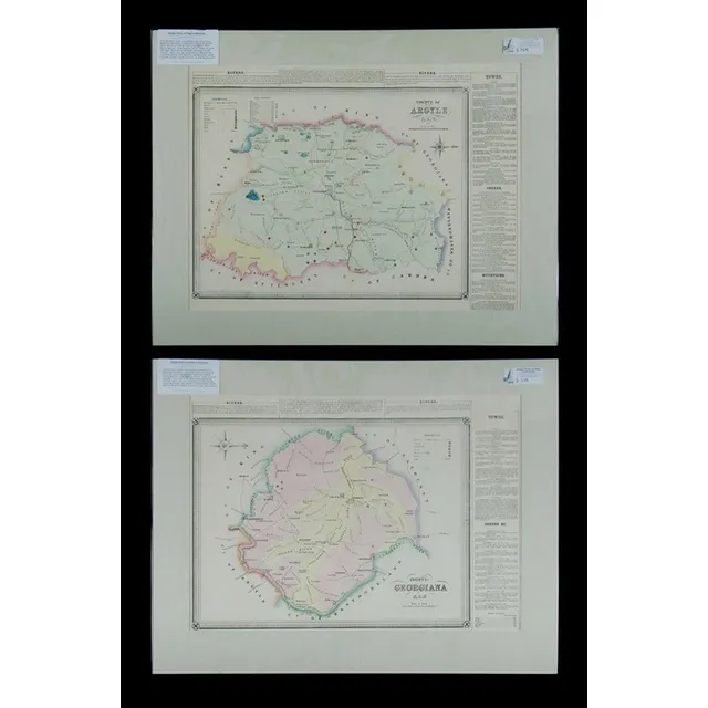
NSW County Maps: Argyle, Georgiana, Goulburn & More (2)
Maps (2), NSW County, Argyle & Georgiana, including. Goulburn, Marulan, Laggan & Rockley. Pub. 1872, hand coloured lithograph (2), 38 x 53 cm (each)
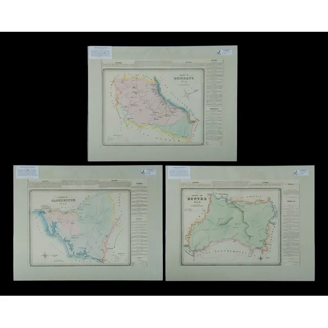
NSW County & Towns Map, 1872
Maps (3), NSW County, Brisbane, Gloucester & hunter, including. Towns, Scone, Boggibri, Bullah-della & Gloucester. Pub. 1872, hand coloured lithograph (3), 38 x 53 cm (each)
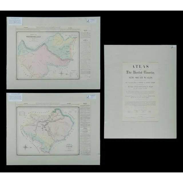
NSW County Map with Towns and Caves (1872)
Maps (2), NSW County, cook & Westmorland, including. Towns, Bowenfels, Colo, Oberon & Wambeyan, caves. Including, title page to original 1872 atlas, hand coloured lithograph (2), 38 x 53 cm (each)
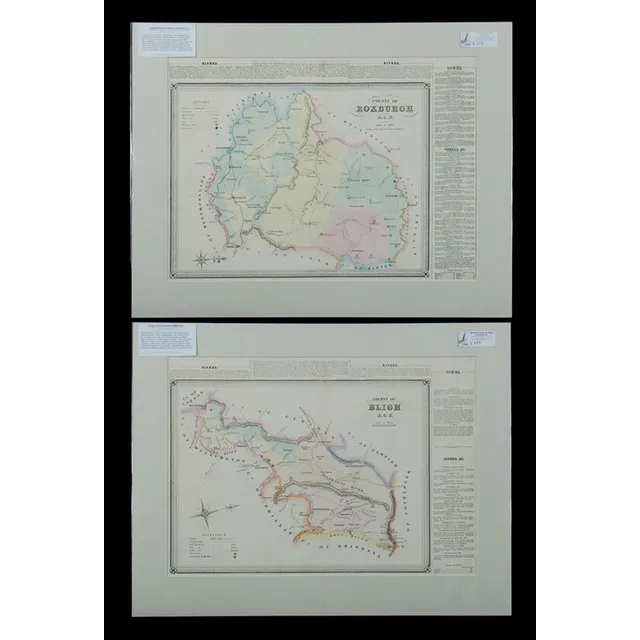
NSW County Map with Towns and Hand Colouring
Maps (2), NSW County, Roxburgh & Bligh, including. Towns Rylstone, Sofala, Cassilis & Wellington, hand coloured lithograph (2), 38 x 53 cm (each)
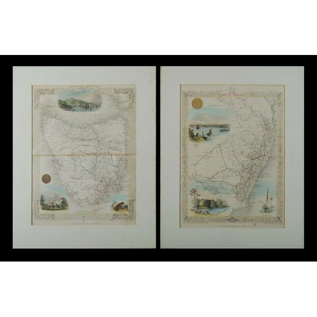
Hand-Coloured Maps of Van Diemens Land and New South Wales
Maps (2), John Tallis, 'Van Diemens Land', &, 'New south Wales.', hand coloured vignettes, hand coloured engraving (2), 35 x 26 cm (each)
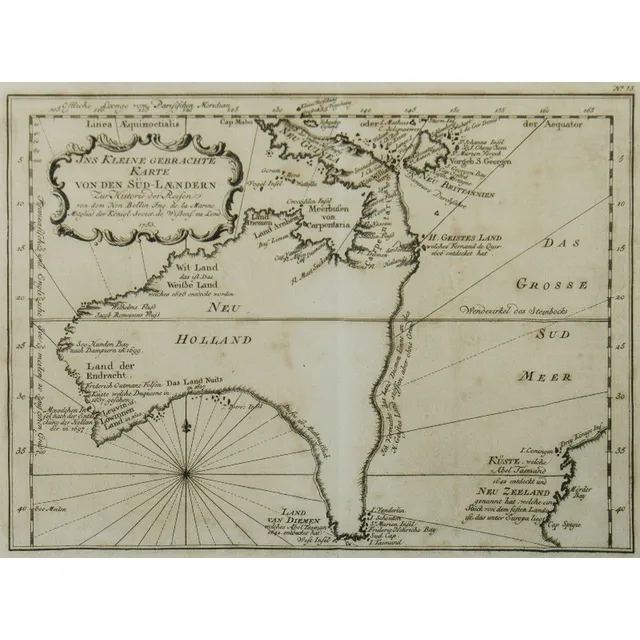
Australia Map, 1753
Map, Australia, by Jacques Nicholas Bellin, 'Ins Kleine Gebrachte Karte von den Sud-Landern', 1753. Copper engraving, 20 x 27.5 cm.
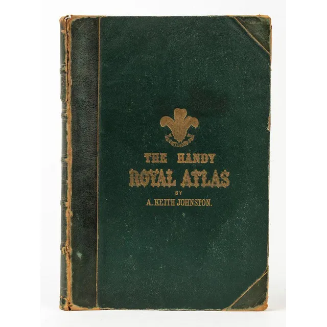
Keith Johnston Handy Royal Atlas (1877)
Alex. Keith Johnston Handy Royal Atlas of Modern Geography (Edinburgh & London; W. & A.K. Johnston, 1877) Folio, half-crushed green morocco over pebbled cloth; all edges gilt, frontispiece chart of the North Polar regions. 45 double-page engraved maps; 2…
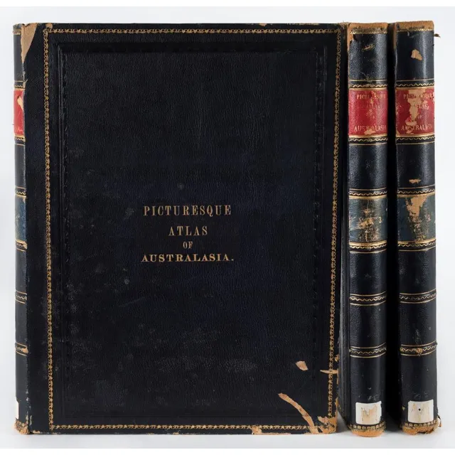
'Picturesque Atlas of Australasia' - Ex-Library Edition
'Picturesque Atlas of Australasia' edited by Hon. Andrew Garran (Melb. Syd. 1886), 3 vol. blue morocco, ex library edition, boards chipped and scuffed, internally good.
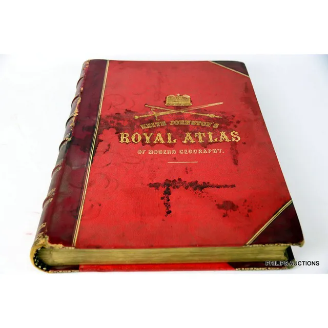
1884 Royal Atlas of Modern Geography
Keith Johnston's Royal atlas of modern Geography, 1884 edition, a red leather bound and tooled volume by Alexander Keith Johnston, Geographer, to the Queen for Scotland, published by W & A.K. Johnston, Easter Road, Edinburgh, length 51 cm, width 35 cm
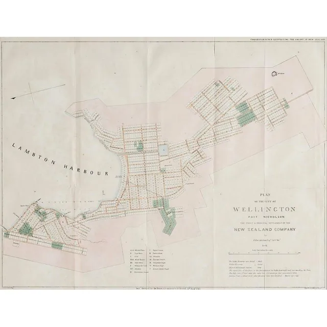
Wellington City Plan Map (1842)
A plan map for the City of Wellington, lithographic print, printed 1842 by Luke and James Hansard, lithographed by J.Arrowsmith. 48 x 61 cm
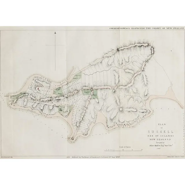
Russell Plan Map, August 1842
A plan map of Russell, lithographic print, printed August 1842 by Luke and James Hansard, lithographed by J.Arrowsmith. 29 x 40.5 cm
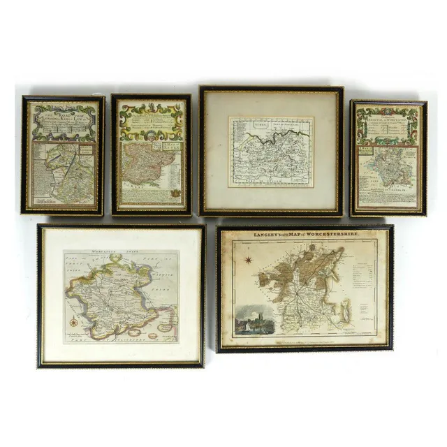
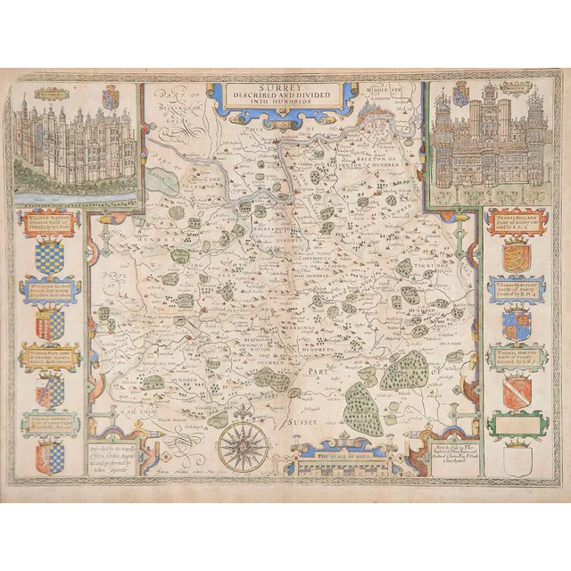
Collection of 6 Antique English County Maps
Six small antique English Counties maps, Worcestershire (3), Essex, Surrey and Cambridgeshire, largest 20 x 29.5 cm.
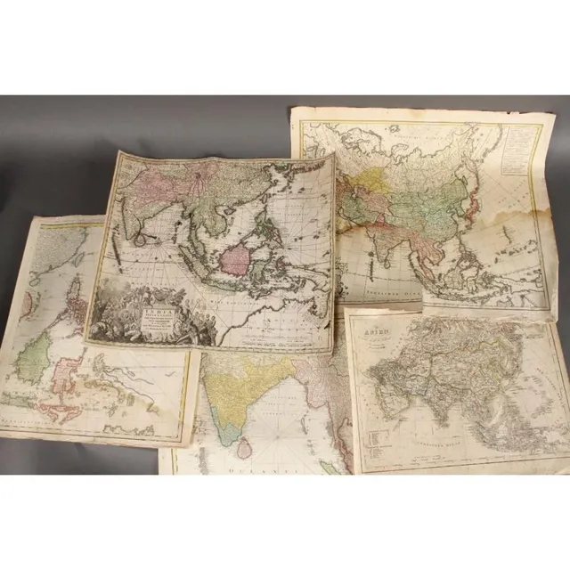
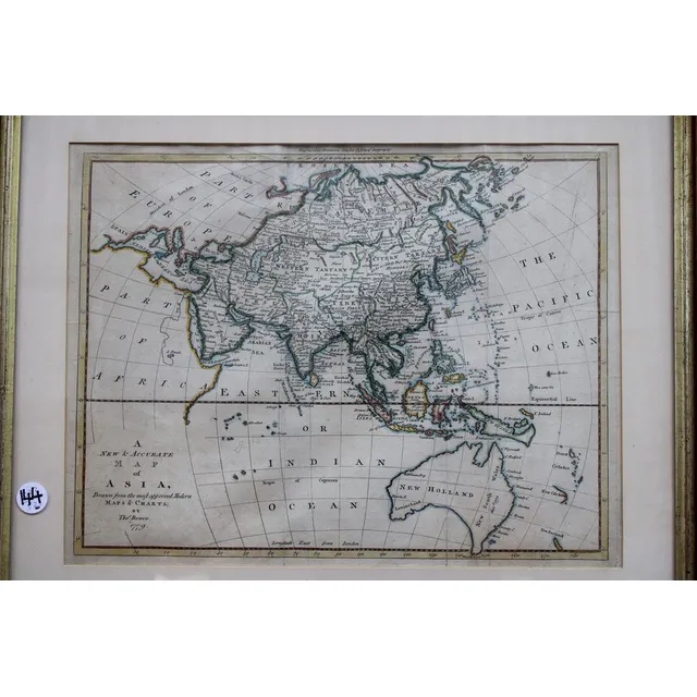
18th Century Maps of Asia and India
Five wonderful 18th century maps, c.1702-1793, including 'Asien,' by T.Mollo/Schmidt, 'India Orinetalis,' by S.C.M. George August, 'Carte Indes Orientales,' by Charles Henry Friso/Homann Erben and 'Charte von Asien,' by F.L. Guslefeld/Homann (5)
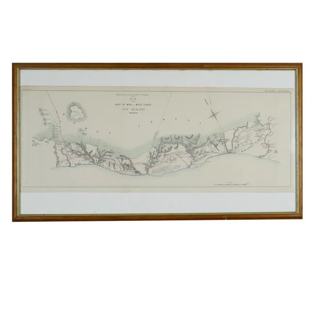
West Coast War Map 1869
A 'Map of the Seat of War.- West Coast. New Zealand' 1869 by Arrowsmith for Enclosure in the Governor's Despatch No.7 (Hansard). 32 x 84 cm.
Antique Hand Coloured Maps of Somerset, Southampton, and Wiltshire
Three antique hand coloured maps after Saxton, Somerset 41 x 53 cm, south Hampton 41 x 45 cm, Wiltshire 44 x 49 cm
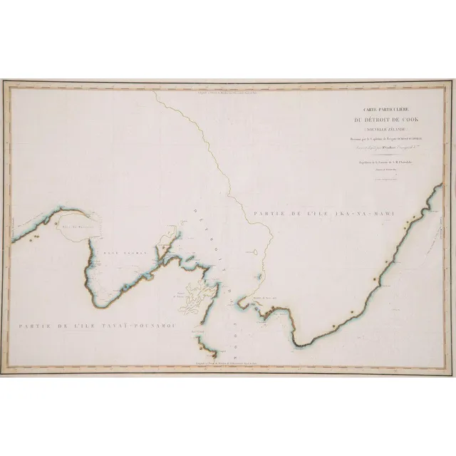
D'Urville's Cook's Strait Chart (1827) - Unframed
Unframed C1832 chart of Cook's Strait, Dumont D'Urville from his voyage of discovery in the Astrolabe 1827, 60 x 89 cm
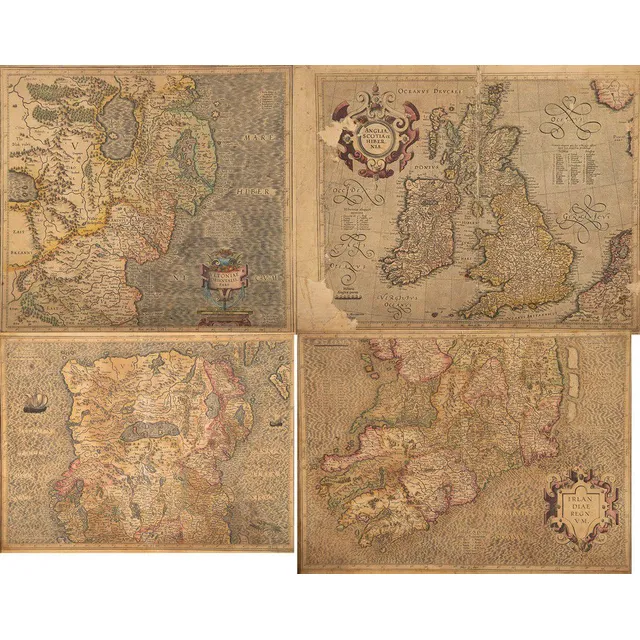
Antique Hand Coloured Maps of Ireland, England and Scotland
Four antique hand coloured maps, Irlan Diae, two versions, Anglia, Scotia et Hibernia, Orientalis (some faults), 35 x 48 cm
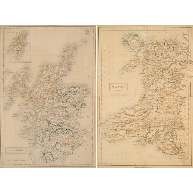
19th Century Scotland and Wales Maps by S. Hall
Two late 19th century maps, Scotland and Wales engraved by S. Hall, 38 x 26 cm
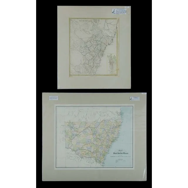
Early Maps of New South Wales, 1833-1886
Maps, 2, early maps of New South Wales. Includes eastern half with inset plan of Sydney published 1833, hand coloured engraving, 40 x 35 cm and NSW showing counties, published John Sands 1886, lithograph, 43 x 52 cm.
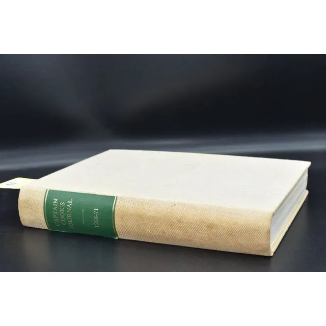
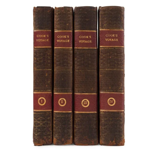
Captain Cook's First Voyage Journal
Captain Cook' Captain Cook's Journal SLSA 1968 facsimile edition, complete with all maps and illustrations, describes Cook's first voyage
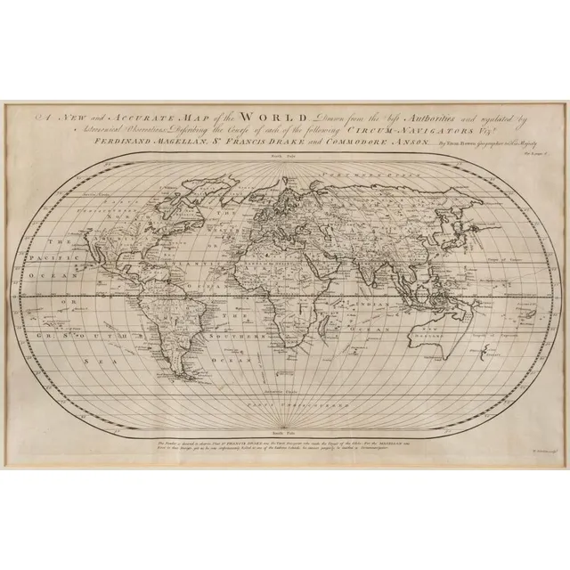
Accurate Oval Map of World with Circum-Navigators' Courses
Bowen, Emanuel (1694? - 1767), A New and Accurate Map of the World. Drawn from the best Authorities and regulated by Astronomical Observations: Describing the Course of each of the following Circum-Navigators Vizt. Ferdinand Magellan, Sr. Francis Drake…
![Bellin, Jacques Nicolas [1703-1772], Carte reduite des terres…](https://img.carters.com.au/640x640/a3675755c15f85ac2145abbb2d4b8adf.webp)
Reduced Chart of Southern Lands by Bellin, ca. 1753
Bellin, Jacques Nicolas [1703-1772], Carte reduite des terres Australes pour servir a l'histoire des voyages / par le Sr. Bellin, Ing. de la marine de la Societe Royale de Londres && ca. 1753, 22 x 29.5 cm (plate size). Original copperplate-engraved map…
Craigie's Australian States Rotary Rolling Map Cabinet
Craigie's Australian states rotary rolling map box in blackwood cabinet, early 20th century, 97 cm high, 124 cm wide, 13 cm deep
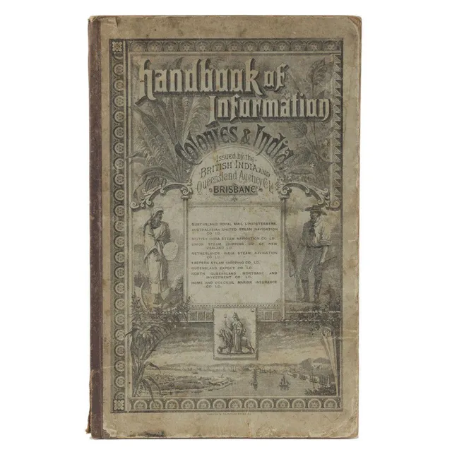
Colonial Handbook 1888
Handbook Of Information for The Colonies And India, Issued By The British India & Queensland Agency Co. Ltd. [Published by Warwick & Sapsford, Printers, Brisbane, 1888], 112pp + 46pp of advertisements, maps, plates and numerous, illustrations in the text.…
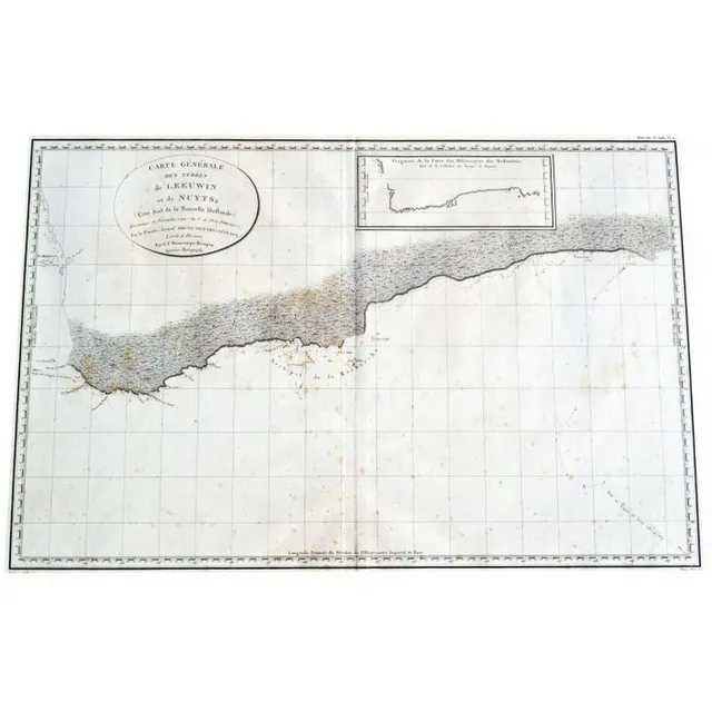
French Map of South West Australia, 1792-1793
Map original early French map of south West Australia depicts, Rottnest, swan river, Pt. Leeuwin etc.. A fairly rare copper plate engraving. Shows the voyages of the French vessels, Resecherche and Esperance in 1792 to 1793. Published as plate number 11…
Set of 6 Framed Tallis Maps of Australia (or) Australian Tallis Map Collection
Set of 6 x original Tallis maps Published London, c.1855 all, good condition, framed with original colour outlining. Good historical maps all with pictorial vignettes. Australia, Western Australia, Tasmania, Victoria, South Australia and New South Wales.…
Tallis Maps: Australia & Western Australia Regions
Two Re-Printed Tallis maps (offset lithographs in colour) Australia and Western Australia, showing regions. Both, 26 x 34 cm
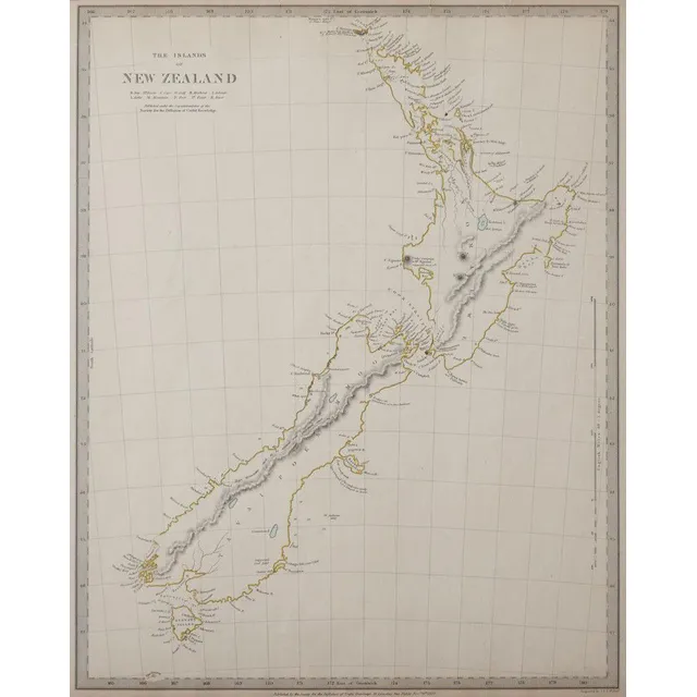
New Zealand Map 1838 by J & C Walker
Map of New Zealand for the Society for Diffusion of Useful Knowledge, c1838, engraved on paper by J & C Walker, 400 x 32 cm
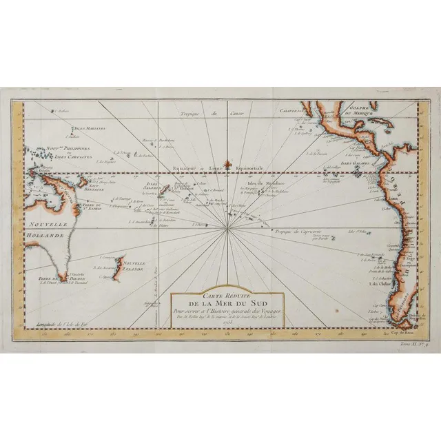
South Pacific Ocean Map (1753)
Jacques-Nicolas Bellin - map of South Pacific Ocean, C.1753, engraved on paper, 230 x 38 cm
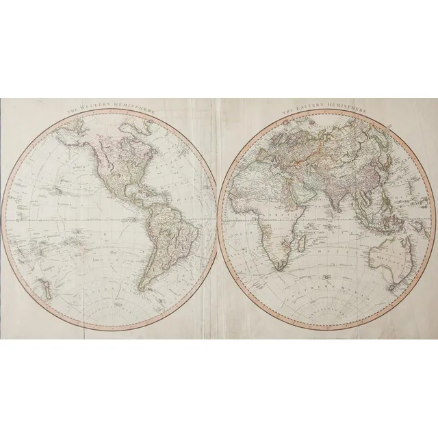
Bellin's Hemispheres Map, 1742
Jacques-Nicolas Bellin - maps of the Hemispheres, C.1742, hand coloured print, map shows the Eastern Hemispere and the Western hemisphere and was made under the direction of the secretary of state to the King of France., 500 x 89.5 cm
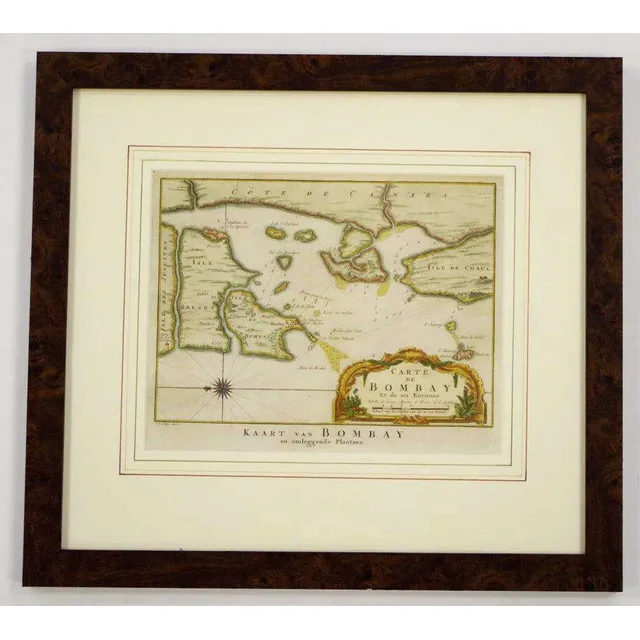
Bombay Map, 1755
Mid 18th century coloured copper plate map 'Carte de Bombay Et de ses Environs', circa 1755, by Jakob van der Schley & Jacques Nicolas Bellin, 21 cm x 26 cm and 41.5 cm x 46 cm frame
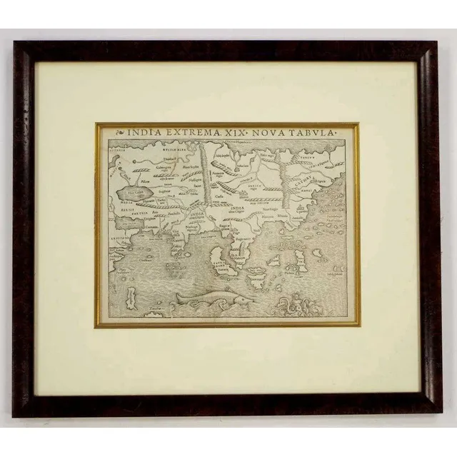
Rare Munster Map of Asia, 1540
Rare Sebastian Munster 1488 - 1552 map 'India Extrema XIX Nova Tabula', printed Basle, 1540, 25.5 cm x 33.9 cm and 53.5 cm x 61 cm frame. The first printed map of Asia, from the rare first edition of Munster's 'Geographia Universalis'
Polynesia Map by Reilly (1795)
Franz Johann Joseph von Reilly 1766-1820 map 'Karte von der Inselwelt, Polynesien oder dem Funften Welttheile', published Vienna 1795, 46 cm x 63.7 cm and 82 cm x 97.5 cm frame
Small Strip Maps of Kent, Devonshire, and Dorset
A pair of small English strip maps, one of Kent, the other double sided of Devonshire and Dorset. 18.5 x 11.5 cm
Small County Maps: Kent, Lancashire, Devonshire
Three small English county maps, Kent, Lancashire and Devonshire. Largest 21 x 26 cm
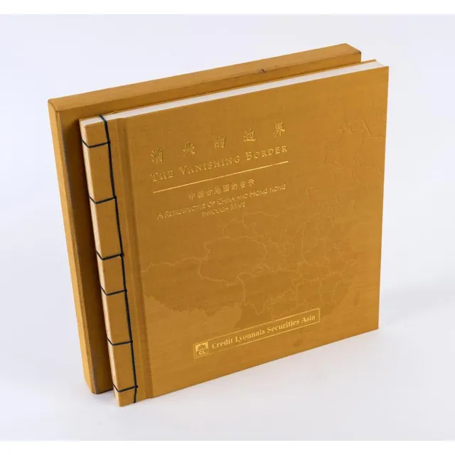
The Vanishing Border: China and Hong Kong Retrospective
The Vanishing Border: A Retrospective of China and Hong Kong through Maps published by Credit Lyonnais Securities (Asia) Ltd. [Hong Kong, 1997], limited edition of 3000 copies, embossed yellow cloth boards with gilt lettering and blue thread binding, in…
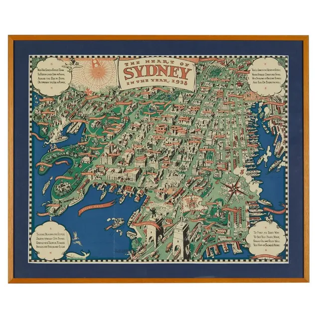
Sydney's Heart, 1938 Map
After Robert Emerson Curtis (1898-1996), 'The heart of Sydney in the year 1938' a three colour map, published by John Fairfax & Sons, 1938, 47 x 59 cm
Cook's Voyages and Historical Prints Collection
A collection of mounted lithographs, engravings and reproductions, depicting Cook's Voyages, figurative studies and historical maps, 23 x 37 cm (average image size)
Cook & Forster's Voyage around the World (1777)
Cook, James & Forster, George, a voyage round the world Performed in his Britannic Majesty's ships the Resolution and adventure, in the Years 1772, 1773, 1774, and 1775....Illustrated with a chart of the Southern Hemisphere...[Dublin, W.Whitestone, S…
Plan for Exploring and Surveying Australia's Interior
Maslen, T.J., the friend of Australia, or, a plan for Exploring the interior, and for carrying on a survey of the Whole Continent of Australia. By a Retired Officer of the Hon. East India Company's service. Illustrated with a map of Australia, and five…
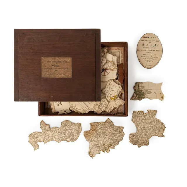
Bowles's One-Sheet Map of Asia Puzzle, c. 1801
Bowles's new One-Sheet map of Asia, divided into its Empires, Kingdoms, States, &c., [Bowles and carver, St. Paul's church Yard], circa 1801, Dissected map, 54 pieces with three blank replacement pieces (the lost pieces in the regions of Java, Sumatra and…
South Australia Atlas, G.W. Goyder, 1877-8
G.W. Goyder, plan of the Southern portion of the Province of South Australia, as divided into Counties and Hundreds, showing the most important Settlements, post Towns, Telegraph stations, main Roads, Railways &c. Compiled from official documents in the…
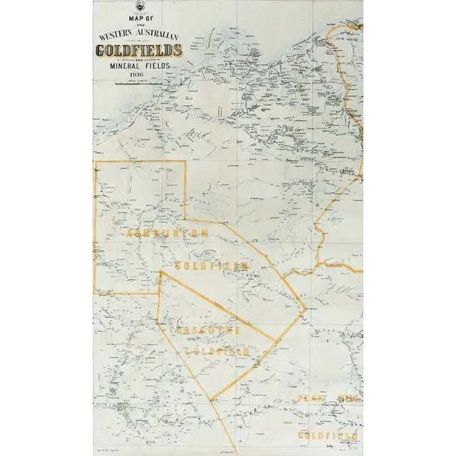
West Australian Goldfields and Mineral Fields Maps (1936-1937)
Two early 20th century West Australian goldfields and mineral fields maps, 1936 and 1937 showing localities of Ashburton, goldfields, Gascoyne, Peak hill, Pilbarra, Nullacine lithograph No.114, sheet No.5 and No.6 one dated 18.1.36, the other, 12.2.37. 96…
Cartes et plans de l'Amerique, c.1742
Bellin, Jacques Nicolas, 1703-1772 - Cartes et plans de l'Amerique, c.1742. Facsimile from original plate. Framed and mounted. 56 cm x 86 cm
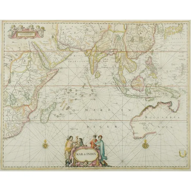
"Mar Di India" Map, 1659
Map, 'Mar Di India,' 1659. Cartographer Johannes Janssonius 1588-1664). 43 x 54 cm
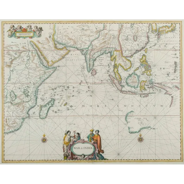
Mar Di India Map (1650)
Map, 'Mar Di India,' 1650. Cartographer Johannes Janssonius 1588-1664). 43 x 55 cm
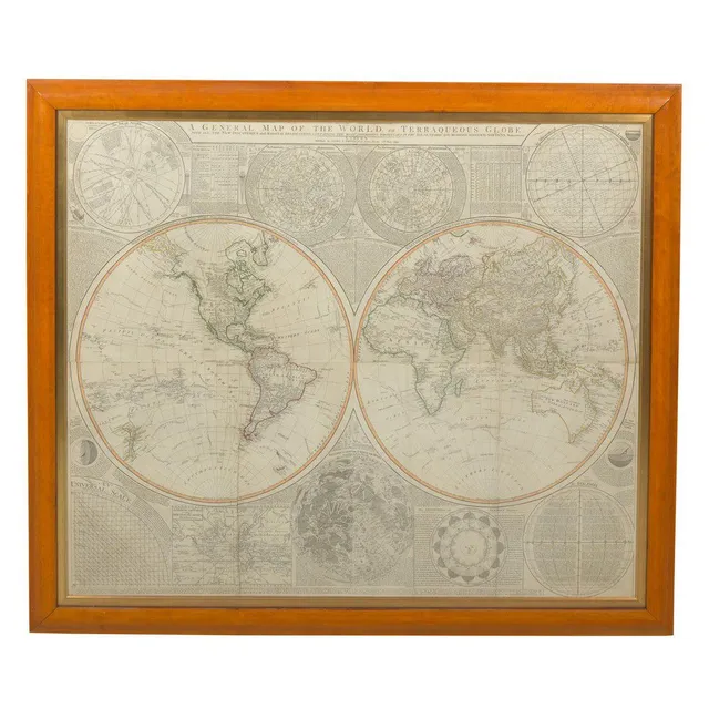
Samuel Dunn's Terraqueous Globe, 1799
A general map of the world, or Terraqueous globe, by Samuel Dunn, Published by Laurie & Whittle, no. 63 Fleet St, London, 12th May 1799. Hand coloured and printed on four sheets, joined. Glazed and framed in cedar. 102 cm x 124 cm
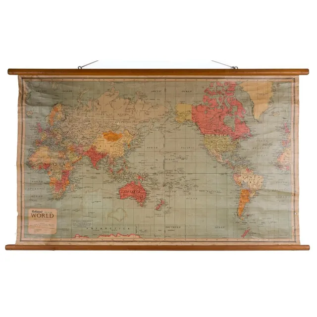
Vintage Classroom Maps of Australia and the World
Two classroom vintage maps of Australia and the world, published by Robinson's and Chas H. Scally & Co., 20th century, the larger 88 x 118 cm
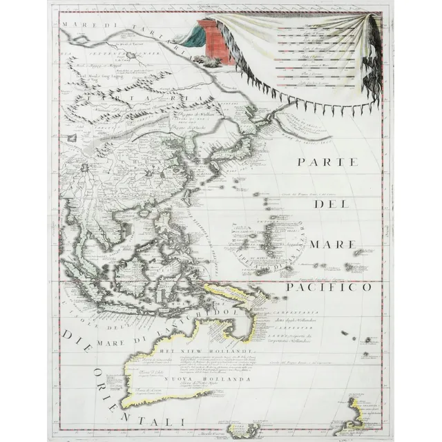
Pacific Map by Coronelli, 1691
(Parte Del Mare Pacifica), engraved by Vincent Mario Coronelli (Theologian, Mathematician & Cartographer, Venice), 1691. 46.5 x 61.5 cm (plate size), finely executed copperplate-engraved map with some sensitive hand-colouring showing the west coast of…
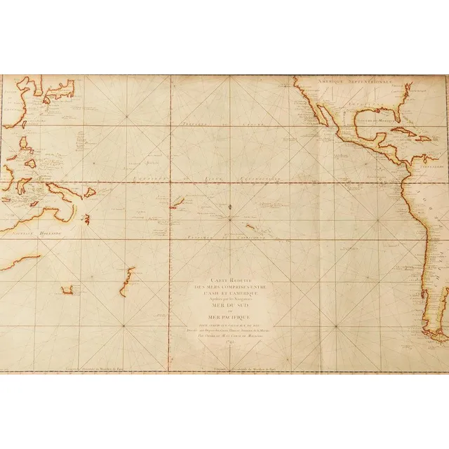
1758 Dutch Edition Map of Hypothetical East Coast Australia
Jacques Bellin: 'Carte Reduite Des Terres Australes, Par le Sr Bellin....', (Paris, 1753), lovely map showing hypothetical East coast of Australia, being the Dutch edition of 1758, 36 x 25 cm. This Dutch edition, published in 1758, is scarcer than its…
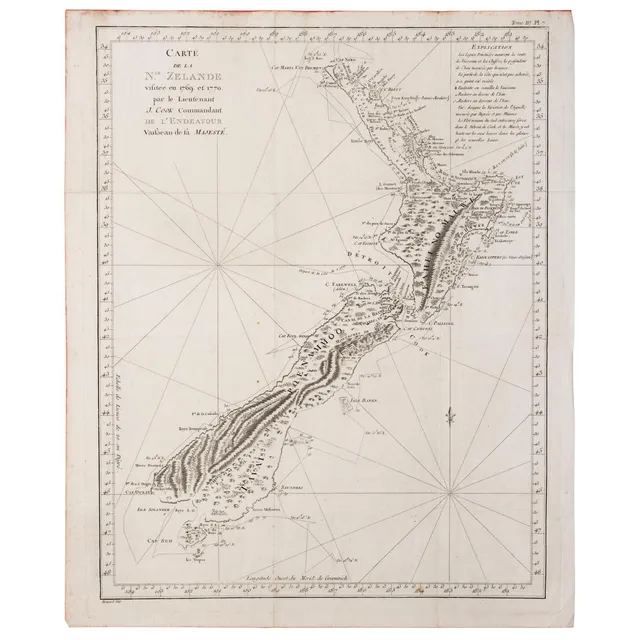
Cook's 1774 Map of New Zealand
New Zealand : James Cook: 'Carte de la N.le Zelande visitee en 1769 et 1770 par le Lieutenant J. Cook Commandant de l'Endeavour vaißeau de la Majeste', James Cook, Published Paris, 1774; engraved by Robert Benard. 49 x 38 cm. The original French edition…
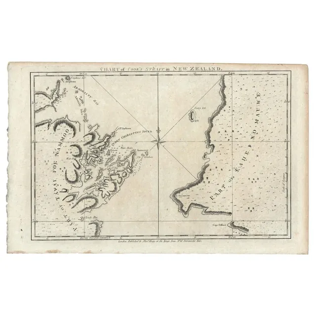
Cook's Strait Chart in New Zealand (1784)
New Zealand: 'Chart of Cook's Strait in New Zealand. From Alexander Hogg's edition of Cook's voyage to the South Pacific, (1784), copper plate engraving, 23 x 33.5 cm.
1846 Tasmania Map by W. & A.K. Johnston
W. & A.K. Johnston, 'Van Diemen's land or Tasmania : lithographed Edition', highly detailed hand-coloured map, circa 1846, 65 x 53 cm.
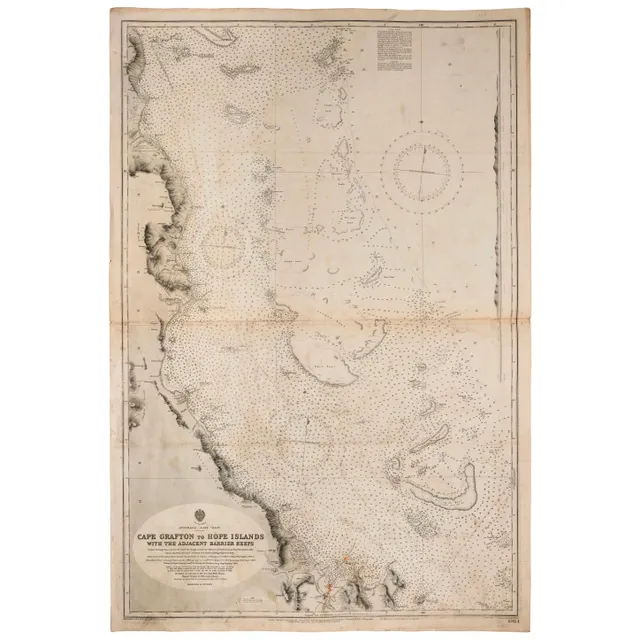
Admiralty Chart of Australia's East Coast (1909)
Wharton, Capt. W.J.L., RN, Australia - East coast: Admiralty chart (no 2924) 'Cape Grafton to hope Islands, with the adjacent Barrier Reefs', February 1909 edition, overall 103 x 69 cm. Endorsed verso 'S S Essex Lance Owner's Chart'.
French Maps: Mont Saint-Michel & Paris (19th Century)
Two framed French maps, comprising 'Le Mont Saint-Michel' and 'Paris', coloured lithographs, 19th century. 40 x 53 cm, 36 x 42 cm.
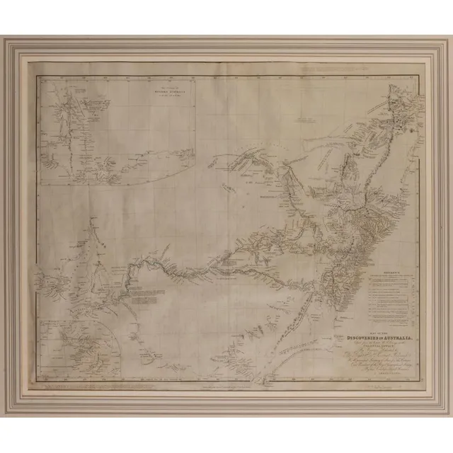
Discoveries of Australia, 1832
After J Arrowsmith, map of the Discoveries of Australia 1832, dedicated to the right Honourable Viscount Goderich. Hm Principal Secretary of state for the Colonies and President of the Royal Geographical Society, published 15 February 1832, J Arrowsmith,…
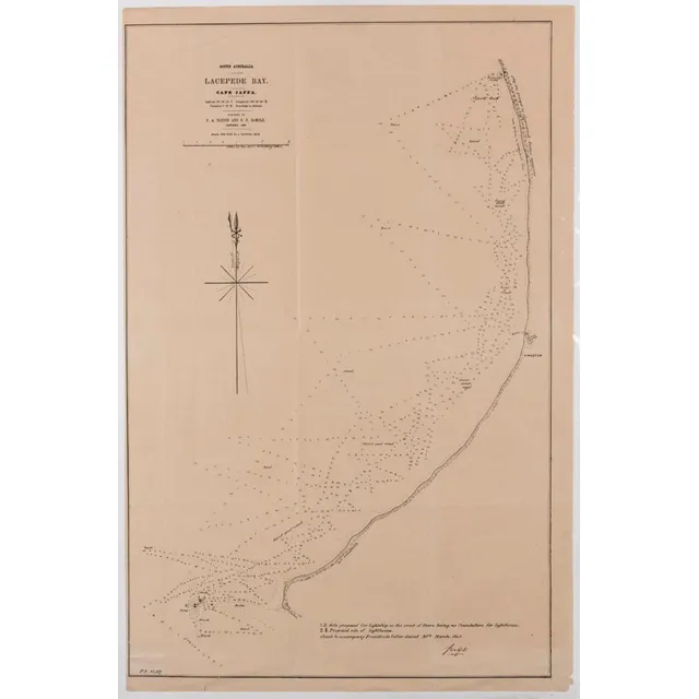
South Australia Coastal Maps: Shipping Routes and Depths
Two maps of South Australia, Lacepede bay, cape Jaffa and the Southern coastline, showing shipping courses and depth, surveyed by P a Nation and G E Demole 1859, 66 x 43.5 cm and 45.5 x 38.5 cm
Thomson's General Atlas 1817: Natural & Political Divisions
John Thomson (Scottish, 1777-C1840), a new general atlas 1817, a collection of maps and charts delineating the natural and political divisions of the Empires, Kingdoms, and States in the world, printed by George Ramsay and Company for John Thomson and…
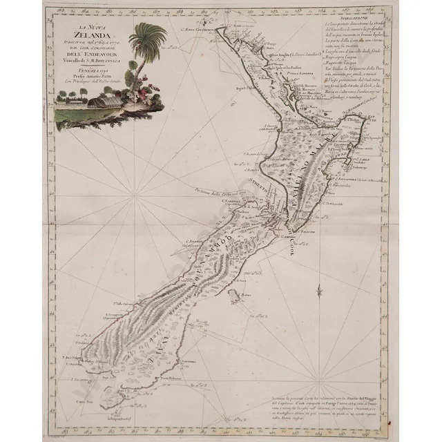
Hand Coloured Map of New Zealand by Antonio Zatta
Antonio Zatta La Nuova Zelanda hand coloured map with title vignette upper left, published Venice 1778, 47 x 37.5 cm
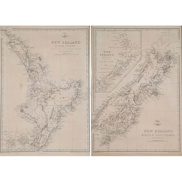
Pair of New Zealand Maps, c1855
John Dower (after) pair of New Zealand north & South Island maps New Zealand North Island new Ulster or Eahein O Mauwe & New Zealand middle & South Islands, lithographed by E Weller, c1855, 47 x 42 cm
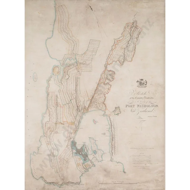
Surveyor's Map of Port Nicholson, New Zealand (1843)
Samuel Charles Brees (Chief Surveyor) sketch of the country Districts in the Vicinity of port Nicholson New Zealand January 4th 1843 (London) hand coloured engraving, published Smith & elder & Co, Cornhill Oct 2nd 1843, 76 x 57.5 cm
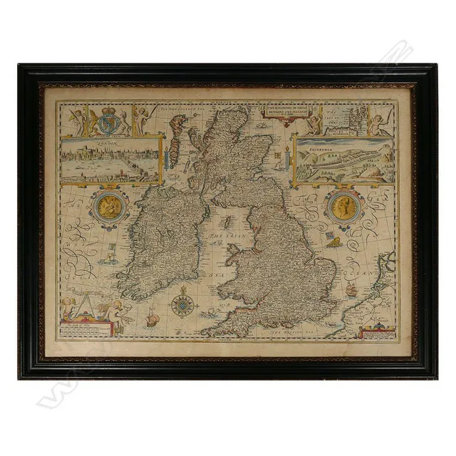
17th Century Map of Great Britain and Ireland by John Speed
A 17th century map by John Speed 'The Kingdome of Great Britaine and Ireland', published Bassett & Chiswell c.1676, copper engraved map with hand colouring; text verso, plate 38.5 x 51.5 cm. Originally pub. 1612 for Speed's 'Theatre of the Empire..'.
![English County maps: with, Oxford shire, [1695] &, the East…](https://img.carters.com.au/640x640/c4235fe2c28f9ea4a37e6face0bbff86.webp)
Framed English County Maps: Oxfordshire & East Riding Yorkshire
English County maps: with, Oxford shire, [1695] &, the East riding of Yorkshire, [c.1720], both by Robert Mordern; attractively framed & glazed, each 55 x 61 cm. (2)