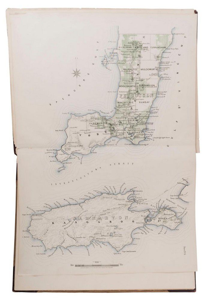
G.W. Goyder, plan of the Southern portion of the Province of…
click the photo to enlarge
G.W. Goyder, plan of the Southern portion of the Province of South Australia, as divided into Counties and Hundreds, showing the most important Settlements, post Towns, Telegraph stations, main Roads, Railways &c. Compiled from official documents in the office of the Surveyor general., [Adelaide, Surveyor General's office, 1877], elephant folio (670 mm tall), lithographed title sheet, plan and 17 double page maps of South Australia., original half dark brown morocco and light brown cloth with a large leather title-label on the front cover (31 × 22.5 cm, lettered in gilt 'Atlas of Principal Portions of Settled Districts in the Province of South Australia, 1877-8.').

You must be a subscriber, and be logged in to view price and dealer details.

Subscribe Now to view actual auction price for this item

When you subscribe, you have the option of setting the currency in which to display prices to $Au, $US, $NZ or Stg.

This item has been sold, and the description, image and price are for reference purposes only.

This item has been included into following indexes:

Visually similar items

Pair of drawings Chas Laborde (French, 1886-1941) outside the Restaurant ink wash on paper Artist Unknown, female nude, Gaze pencil on paper 31 x 19.5 cm; 31 x 20 cm

Sold by in for
You can display prices in $Au, $US, $NZ or Stg.

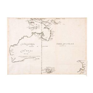
First Large-Scale Map of the Australian Continent 'Hollandia Nova detecta 1644, Terre Australe decouverte l'an 1644' by Melchisedech Thevenot [Paris, 1644]. The very rare first issue in its first state: with the latitudes incorrectly numbered, without the

Sold by in for
You can display prices in $Au, $US, $NZ or Stg.

An Indo-Persian miniature painting. 19 cm high, 10 cm wide

Sold by in for
You can display prices in $Au, $US, $NZ or Stg.

Map, 'Royaume de Hongrie et Pays Adjacents,' par M.Bonne, Andre Scul. Engraving. 25 x 36 cm

Sold by in for
You can display prices in $Au, $US, $NZ or Stg.