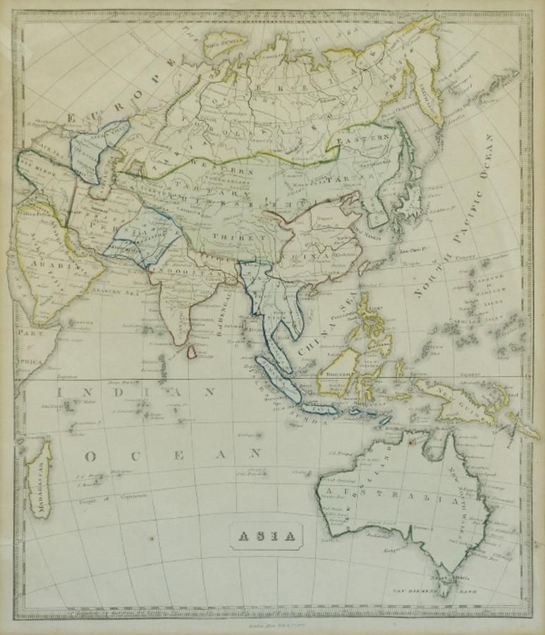
Asia & Australia Map 1839
You must be a subscriber, and be logged in to view price and dealer details.
Subscribe Now to view actual auction price for this item
When you subscribe, you have the option of setting the currency in which to display prices to $Au, $US, $NZ or Stg.
This item has been included into following indexes:
- engravings and lithographs 1,626
- lithographs 1,648
Visually similar items

Thomes Bowen (?-1790) A new and Accurate map of Asia, drawn from the most modern Maps and Charts, 1799 Handcoloured & engraved, for Middletons complete System of Geography 32.5 x 42.5 cm

(World map) Heinrich Robert / F. A. Schraembl, 1789, Generalkarte soemmtlicher Entdeckungen auf den drei Grossen Weltreisen des Kapit Jacob Cook. Two sheets, each 49 x 60 cm to the printed margins. Large world map showing the routes of three voyages made b

Map, L'Asie Divisee en ses pair of incipaux Etats. Mapmaker, Jean Janvier, pub. Paris 1760. Hand coloured engraving. 49 x 6 8 cm

Map, 'Royaume de Hongrie et Pays Adjacents,' par M.Bonne, Andre Scul. Engraving. 25 x 36 cm