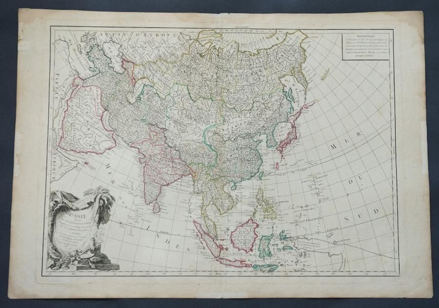
Asia's Main States
You must be a subscriber, and be logged in to view price and dealer details.
Subscribe Now to view actual auction price for this item
When you subscribe, you have the option of setting the currency in which to display prices to $Au, $US, $NZ or Stg.
This item has been included into following indexes:
- maps - general 445
Visually similar items

Map, Mar Del Zur Hispanis Mare Pacificum. Jan Jansson mapmaker, published Amsterdam 1650. Hand coloured engraving. 44 x 5 5 cm

Map, East India & Australia c1700. Africa to Japan incl. Australia. Made by van Kenlen, Amsterdam. Staining, watermarks & a few holes near the margins. Rebacked. Hand coloured engraving. 53 x 6 0 cm

Map, a new and Accurate map of Asia. Thomas Bowen, London. Pub. C.1790. Copper engraving & hand coloured. 33 x 4 3 cm
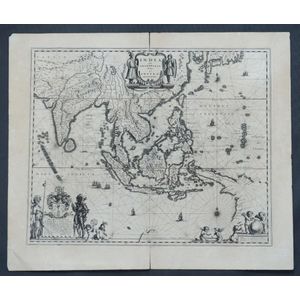
Map, India Quae Orientalis et Insulae Adiacinte. Mapmaker, Willem Janszoon Blaeu, c.1635. Engraving. 43 x 5 2 cm