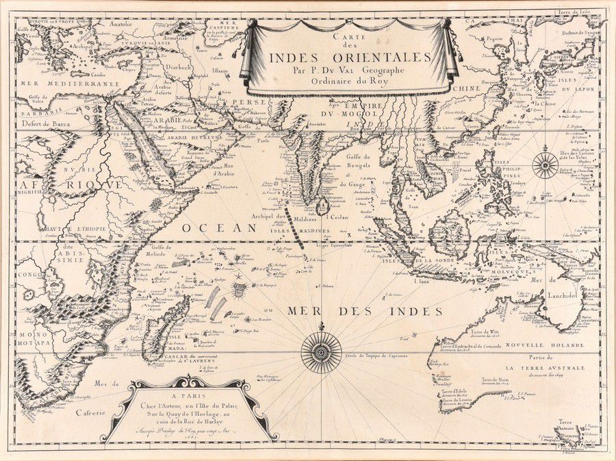
Indian Ocean Map with Abel Tasman's Voyages
You must be a subscriber, and be logged in to view price and dealer details.
Subscribe Now to view actual auction price for this item
When you subscribe, you have the option of setting the currency in which to display prices to $Au, $US, $NZ or Stg.
This item has been included into following indexes:
- maps - general 445
Visually similar items

Victorian Maps: c1865-92 maps, noted 'New Map of Bendigo & District', 'Township of Sunbury', 'Moe', 'Kororoit', 'Doutta Galla', 'Merino', 'Trawool', 'Blackwood', 'Grassdale', 'Tragowel', 'Goornong', 'Baynton'. Various sizes. Poor/G condition.,
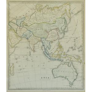
Map, 'Asia (including Australia) 1839.' Allan, Bell & Co. 1837. Engraving. 35 x 30 cm

An Indo-Persian miniature painting. 19 cm high, 10 cm wide

c1812-80 maps, noted c1812 'Oceanique', 1838 'Pacific Ocean', 1860 'Carte de la Melanesie', 1875 'Australie Occidentale' & 1880 'Australie et Polynesie'. All window mounted, various sizes. Condition varies.,