Antique Oceanic and Australasian Maps
You must be a subscriber, and be logged in to view price and dealer details.
Subscribe Now to view actual auction price for this item
When you subscribe, you have the option of setting the currency in which to display prices to $Au, $US, $NZ or Stg.
This item has been included into following indexes:
- maps - general 445
Visually similar items

i) map: Western Australia and van-Diemen's Island. Containing the settlements of swan river and King George sound from recent surveys sent to the Colonial office. the other section of the map depicting 'Van-Diemen Island', published London 1833 by Baldwin

A William IV linen cross-stitch needlework sampler, English, 19th century, worked by Elizabeth Lubben and dated 1833. 21 cm high, 21 cm wide

1827 Chart of part of New South Wales, with Plans of the Harbours. This is the 1828 issue, engraved & published by Joseph cross, London. Hand coloured engraving. 97 x 65 cm

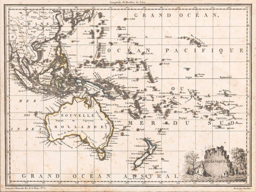
Carte Generale De L'Oceanie by Brue [Paris 1827]. 52 x 58 cm