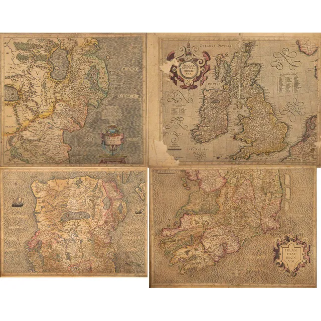
Antique Hand Coloured Maps of Ireland, England and Scotland
Four antique hand coloured maps, Irlan Diae, two versions, Anglia, Scotia et Hibernia, Orientalis (some faults), 35 x 48 cm
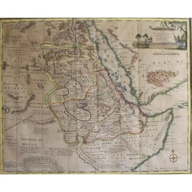
Nubia & Abissinia Map 1747 by Emanuel Bowen
Emanuel Bowen, (1693-1767) English, a new & Accurate map of Nubia & Abissinia 1747, Handcoloured engraving pub. London, 35 x 42.5 cm
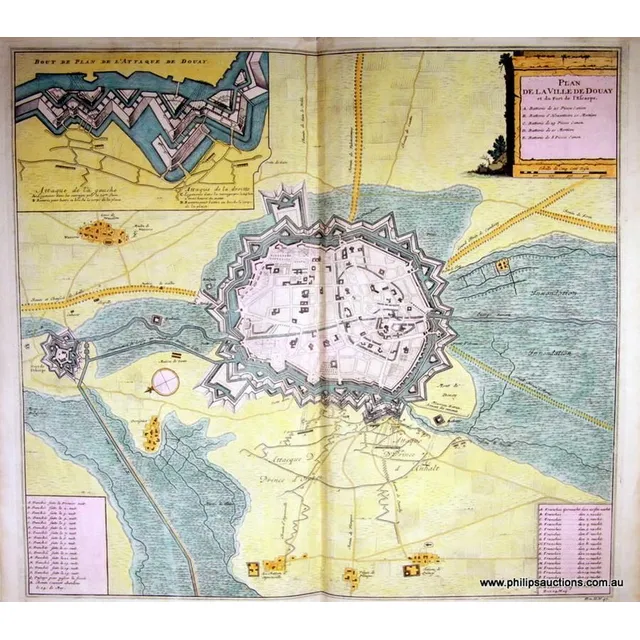
18th Century Topographical Maps and Strategic Plans
Twenty antique Topographical Maps and Strategic Plans, 18th century, including ten engraved maps of Europe from Thomas Bankes's 'New System of Geography' and ten plans of French and Flemish towns, St Omer, Mons, Eckern, Oudenard, Tournay, Menin, Daway,…
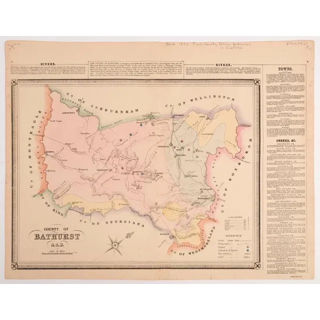
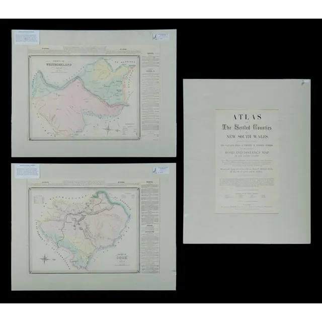
George Bishop County of Bathurst Hand-Coloured Engraving
George Bishop County of Bathurst N.S.W. hand-coloured engraving Plate from: Atlas of the settled counties of New South Wales. [Sydney: Published by Basch & Co., 1872] 43 x 55 cm sheet size.
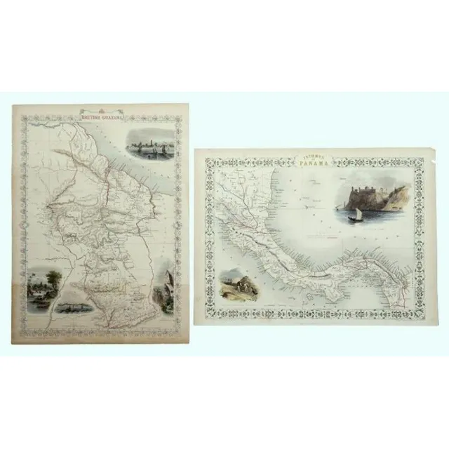
Tallis' 1851 Maps of Panama and British Guayana
Maps, Tallis, Panama & British Guayana. Isthmus of Panama with hand coloured delineation including Proposed canal; & British Guayana; both with coloured vignettes by John Rapkin, pub. By Tallis & Co. London, 1851. Hand coloured steel engraving, 37 x 27 cm…
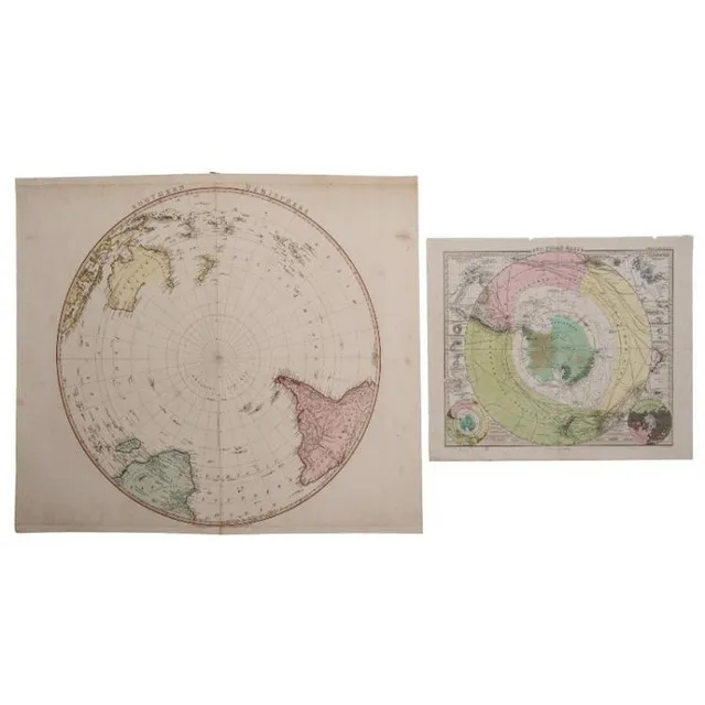
Polar Region Maps: 1802 & 1863
Maps, two of polar Region. Southern Hemisphere by William Foden, pub. London 1802; & Sud polar Karte by Petermann, pub. Stieler, Germany, 1863. Hand coloured copper engraving & coloured steel engraving.60 x 60 cm & 34 x 41 cm
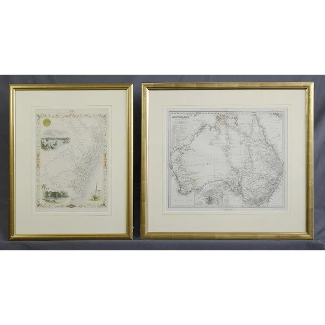
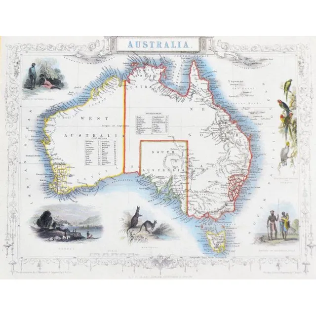
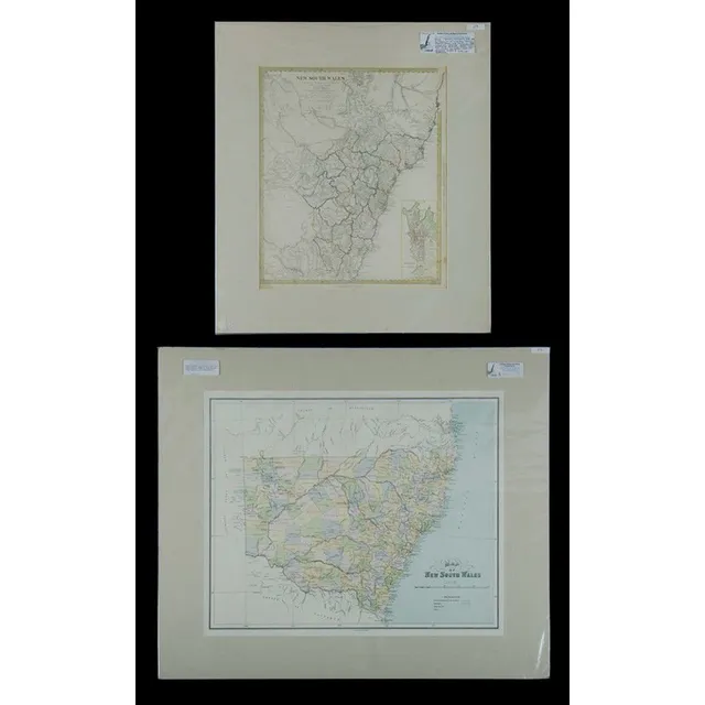
Antique Hand-Coloured Maps of Australia and NSW
Maps (2), Australia and NSW. Australien by Petermann, pub. By Justus Perthes, Germany 1871. Has inset Map of port Jackson; and NSW pub. By Tallis & Co. London c.1853. Hand coloured with Three pictorial vignettes. Hand coloured steel engraving (2). 36 x 43…
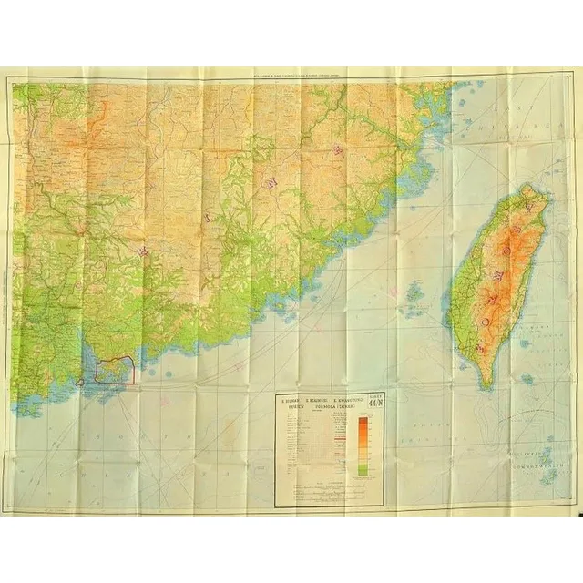
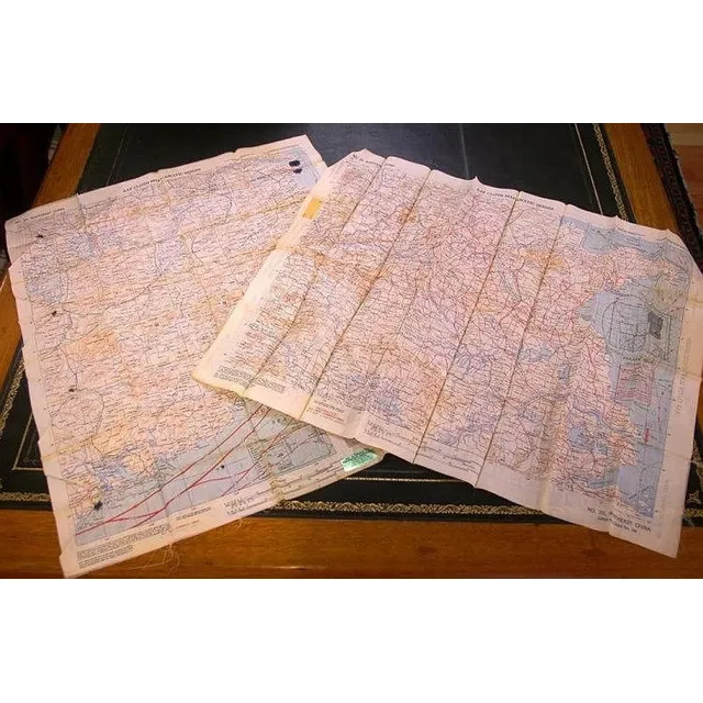
1942 China Escape Map with Hong Kong, Macao, and Shanghai
A rare escape map of China, including Hong Kong, Macao and Shanghai, printed in 1942 on rayon, 100 x 78 cm (E - M)
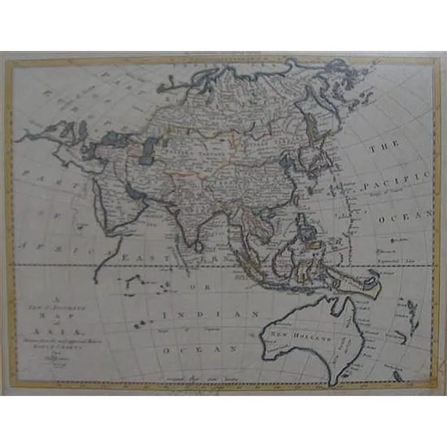
Accurate Map of Asia, 1799
Thomes Bowen (?-1790) A new and Accurate map of Asia, drawn from the most modern Maps and Charts, 1799 Handcoloured & engraved, for Middletons complete System of Geography 32.5 x 42.5 cm
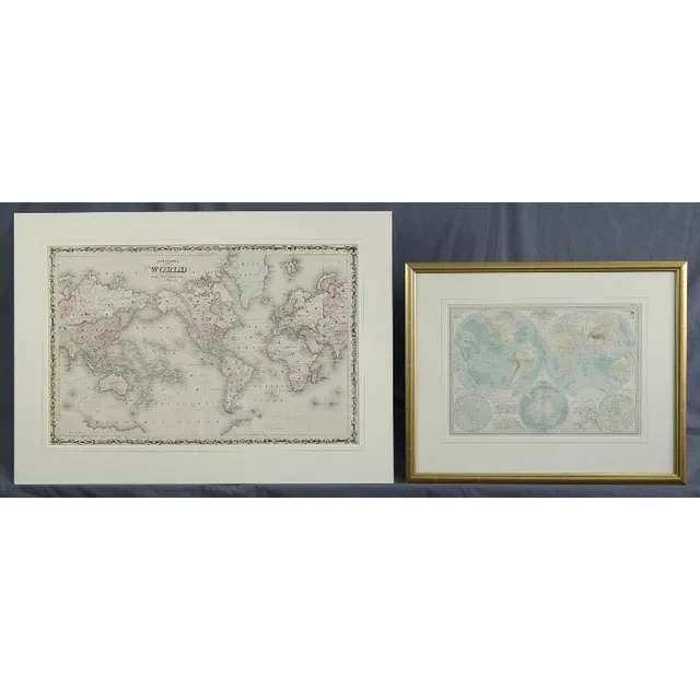
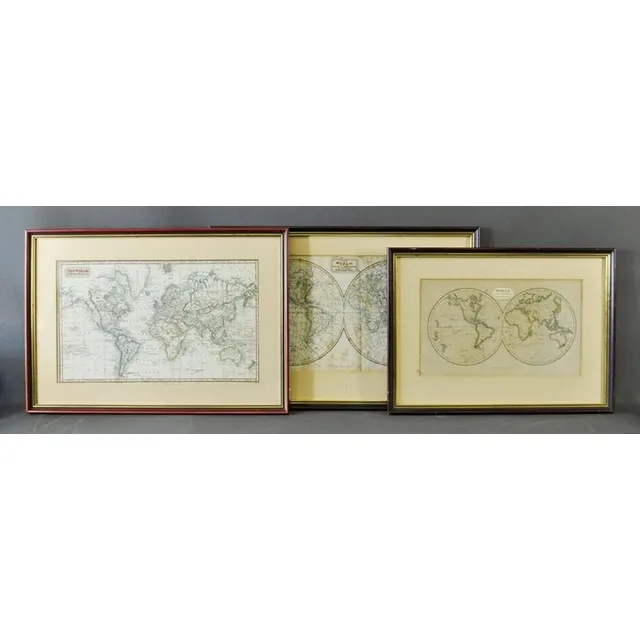
Antique World and Hemisphere Maps (2)
Maps (2), world and Hemispheres. Map of the world Mercators projection by Johnson, pub. By Johnson and Ward, NY 1863; and the century Atlas Hemispheres, pub. By century Co. NY 1897. Steel engraving (2). 42 x 64 cm and 28 x 39 cm
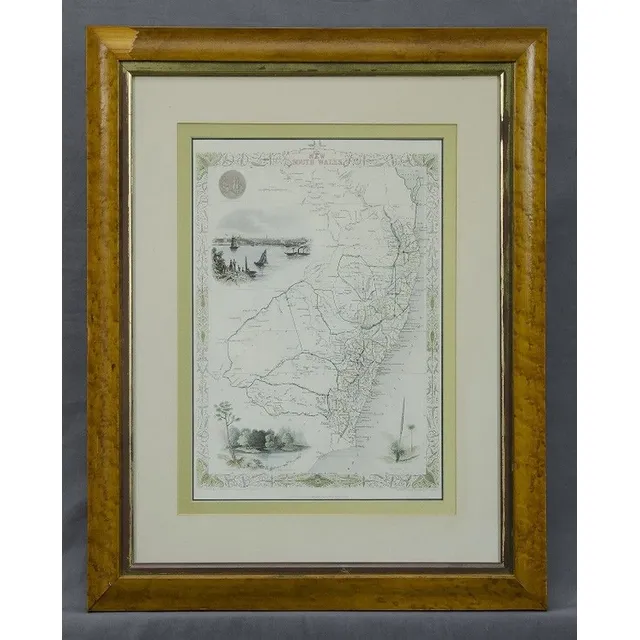
New South Wales Map by Rapkin/Tallis
Map, 'New South Wales.' J Rapkin / John Tallis. Coloured engraving. 35 x 25 cm
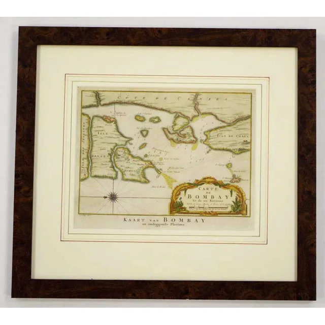
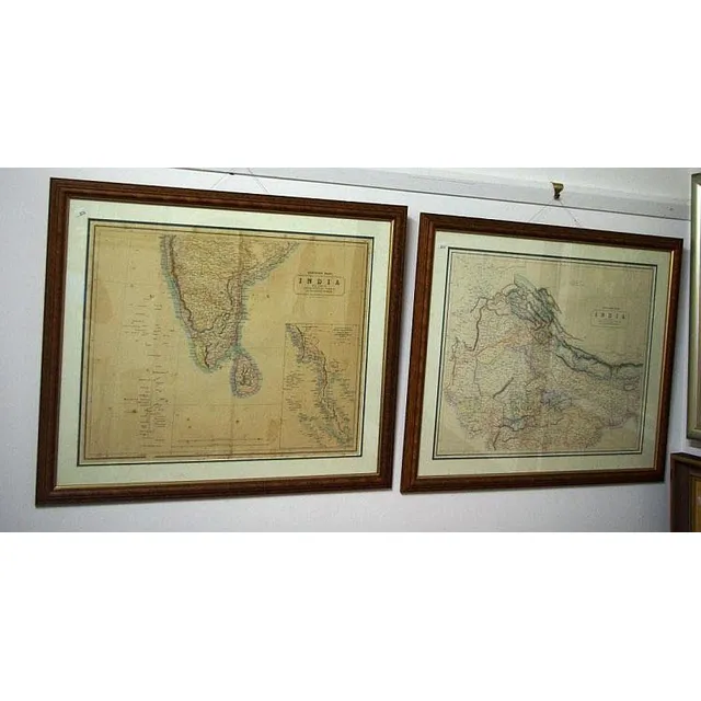
Bombay Map, 1755
Mid 18th century coloured copper plate map 'Carte de Bombay Et de ses Environs', circa 1755, by Jakob van der Schley & Jacques Nicolas Bellin, 21 cm x 26 cm and 41.5 cm x 46 cm frame
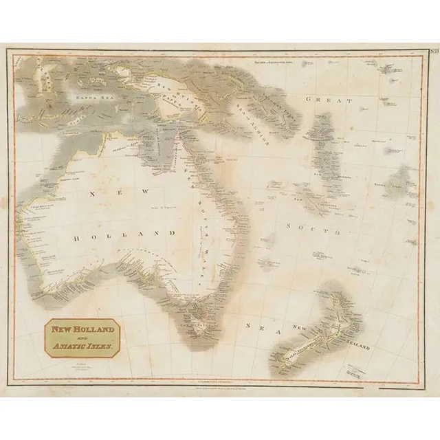
New Holland and Asiatic Isles Map for Thomson's Atlas (1814)
New Holland and Asiatic Isles map drawn & engraved for Thomsons new General Atlas 1814 53 x 66 cm (faults)
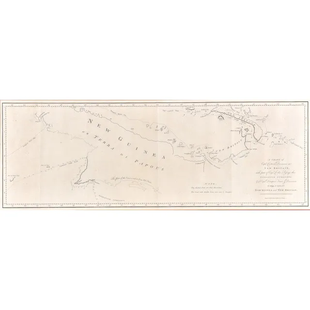
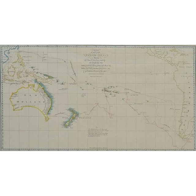
Explorations of Carteret, Cook, and Dampier in Oceania
A chart of Capt. Carteret's Discoveries at New Britain & New Guinea, Alexander Hogg, late 18th century; with part of Captn. Cook's Passage through Endeavour Streights, & of Captn. Dampier's Tract & Discoveries in 1699, & 1700, at New Guinea & New Britain.…
![Carte Generale De L'Oceanie by Brue [Paris 1827]. 52 x 58 cm](https://img.carters.com.au/640x640/39579bcec98bcd6dcbac9d546d8c9d6a.webp)
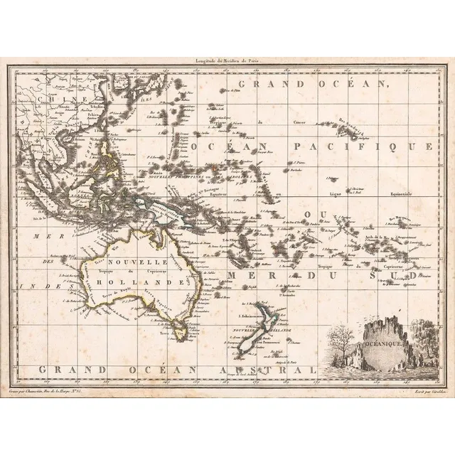
Oceanie Map by Brue [Paris 1827] - 52 x 58 cm
Carte Generale De L'Oceanie by Brue [Paris 1827]. 52 x 58 cm
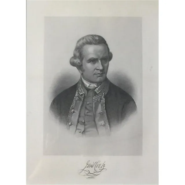
Nathaniel Dance's Portrait of James Cook Engraving
After Nathaniel dance, (1735-1811), James Cook, steel engraving, eng. Hb Hall's Sons, New York, facsimile signature below image, from Picturesque atlas of Australasia, original in National maritime Museum, Greenwich, 25.5 x 18 cm
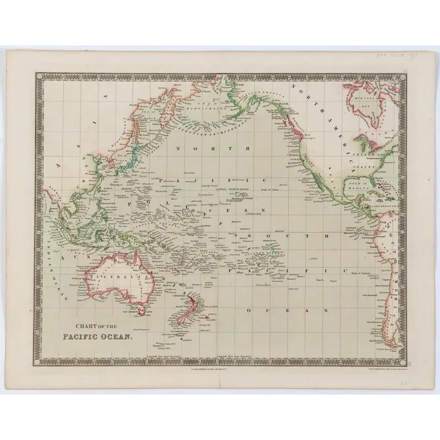
John Crane Dower's 'Chart of the Pacific Ocean' (c1836)
John Crane Dower (1791 - 1846), 'Chart of the Pacific Ocean', [London, Henry Teesdale, c1836], some hand colouring, 34 x 42 cm.
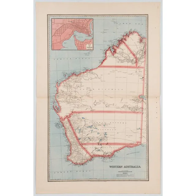
1887 Map of Western Australia with Perth inset
'Western Australia' (with inset 'City of Perth'), published in 1887 by the Picturesque Atlas Publishing Co. 67 x 45.5 cm.
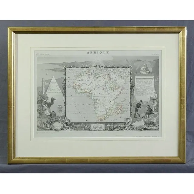
Afrique Map by Levasseur, c. 1870
Map, Afrique. By Levasseur, pub. In Atlas Universel Illustre, Paris c.1870. Hand coloured steel engraving. 33 x 45 cm
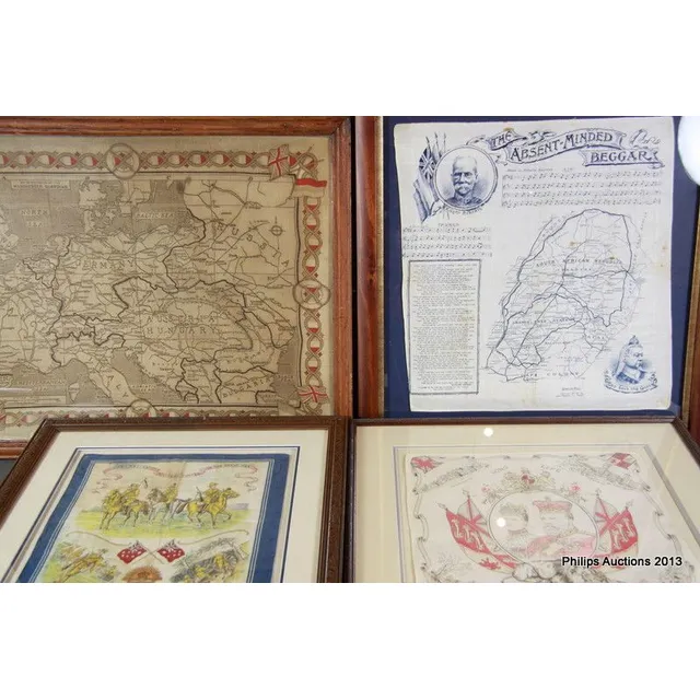
Historical Fabric Pieces Framed
A group of four printed fabric pieces of historical Interest, a Boer war-related handkerchief printed with Kipling's 'The Absent-Minded Beggar', music for it by Sullivan, a map of part of South Africa, and images of Lord Roberts and Queen Victoria; a…
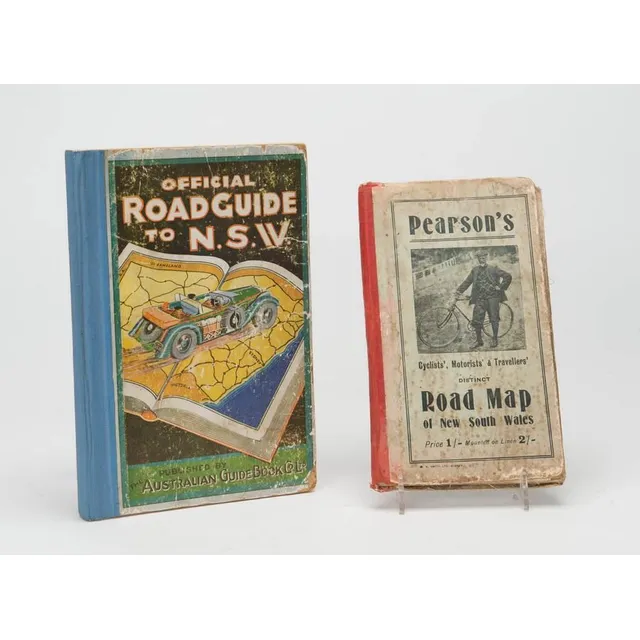
Road Maps of New South Wales (1905-1920)
Pearson's Cyclist's and Traveller's District road map of New South Wales c1905 and an Official Road Guide to New South Wales c1920 (Australian Guide Book Company). (2)
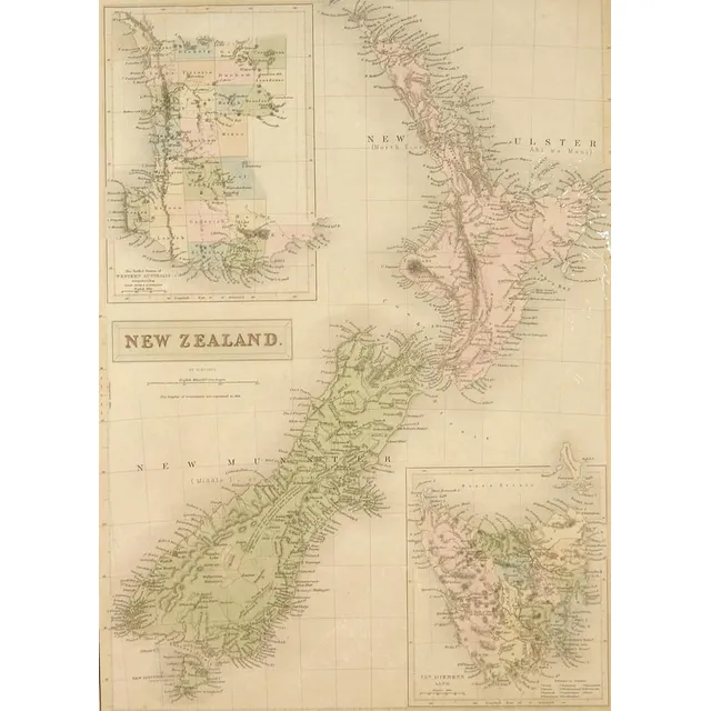
Hand-coloured map of 19th century New Zealand
A 19th century hand coloured steel engraved map of New Zealand by W. Hughes, published Edinburgh by A. & C. Black, unframed. 40 cm x 28 cm
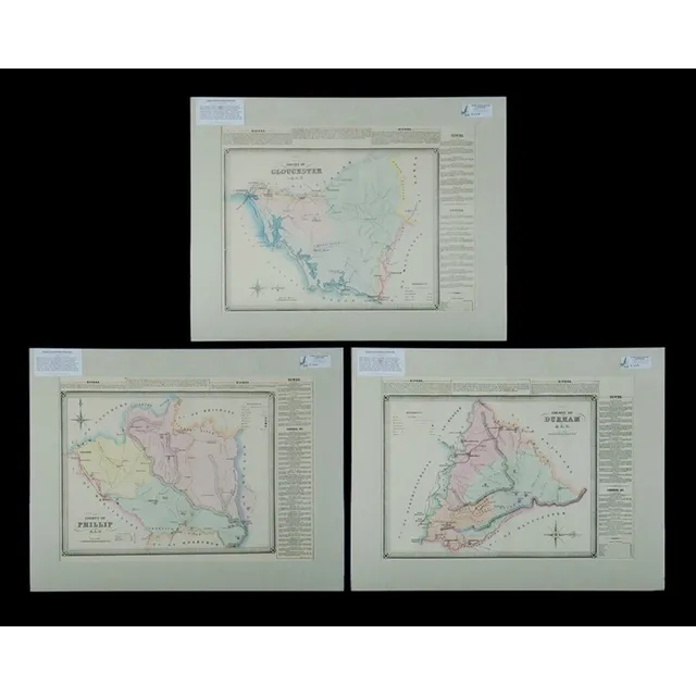
NSW County Maps with Newcastle and Towns
Maps (3), NSW County, Northumberland, Durham & Phillip, including. Towns, Newcastle, Singleton, Muscelbrook, Gressford & Mudgee, hand coloured lithograph (3), 38 x 53 cm (each)
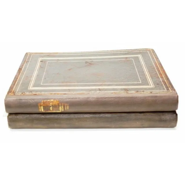
Two volumes: Picturesque Atlas Of Australia Vol. I & III, Hon. Andrew Garran, 1886, leather bound, 43.5 cm x 35 cm, binding good
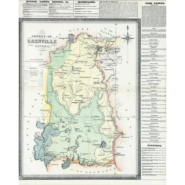
Grenville Victoria County Atlas 1874
County Of Grenville Victoria by F.E. Hiscocks & Co.'s new Victorian counties atlas, circa 1874
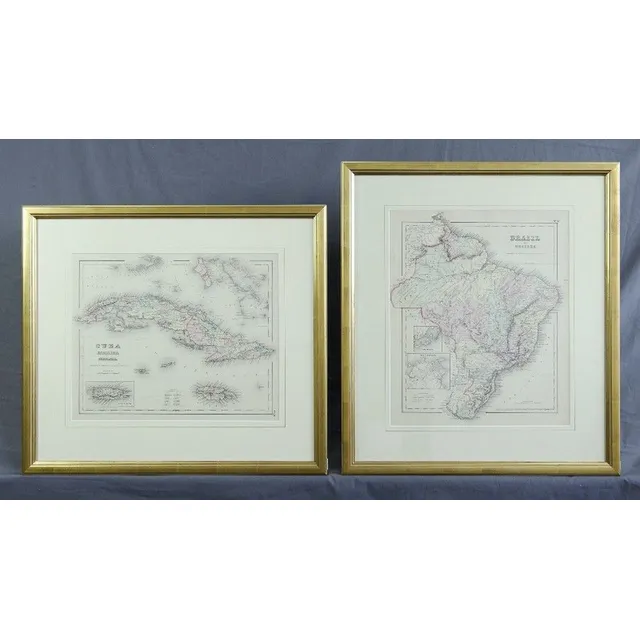
Maps of Brazil, Guayana, Cuba, Jamaica, and Porto Rico
Maps (2), Brasil and Guayana; and Cuba, Jamaica and Porto Rico. Pub. NY c.1856 J.H.Colton & Co. Hand coloured steel engraving (2). 42 x 34 cm and 32 x 40 cm
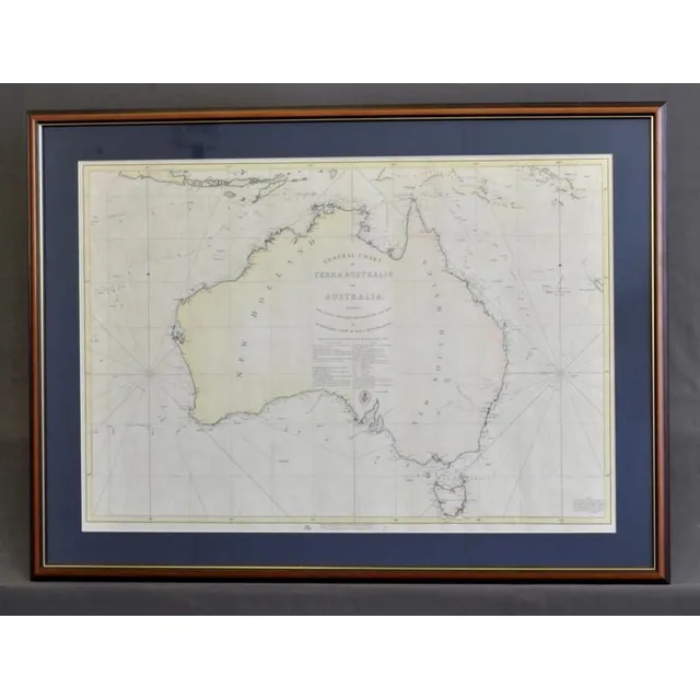
Flinders' 1814 Map of Terra Australis Reprint
Map, 'General Chart of Terra Australis.' official reprint of 1814 map charted by Matthew Flinders of the Investigator. Pair of int. 60 x 87 cm
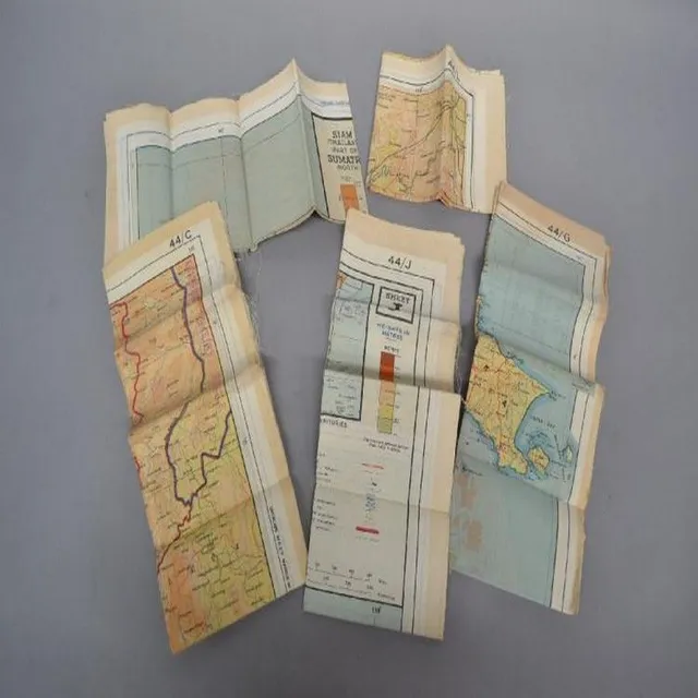
Mint WWII Escape Maps of South East Asia Set
Set of Five World War II escape maps of different areas of South East Asian. All mint condition, unopened
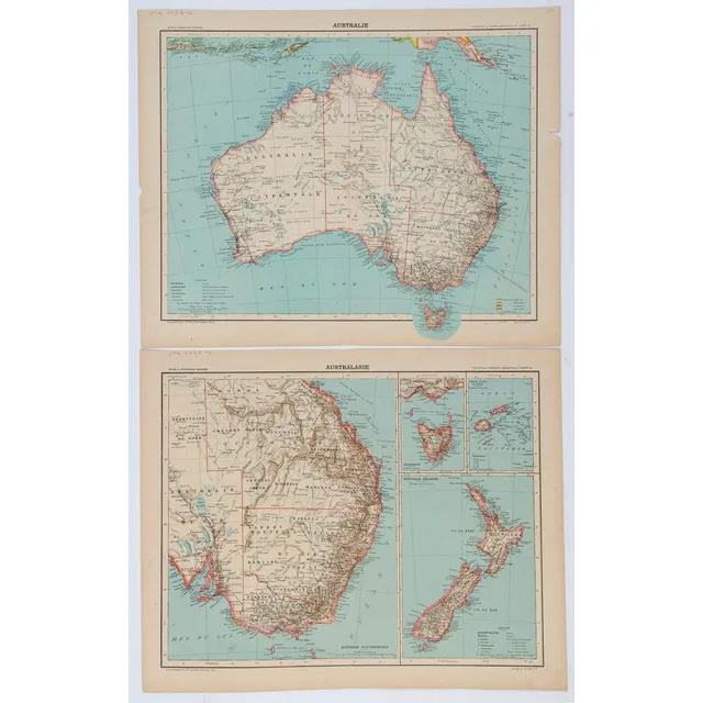
Australie and Australasie: 1890 Maps from Librairie Hachette Atlas
'Australie' and 'Australasie', two double-page maps from the Librairie Hachette Atlas (Maps 52 and 53), colour lithographs, circa 1890, both 36 x 46 cm overall. (2).
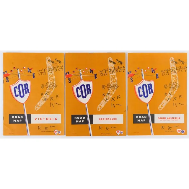
Vintage BP Road Maps for Queensland, South Australia & Victoria
Bp/C.O.R. Road Maps, mid-1950s, for Queensland (1st ed.), South Australia (2nd ed.), & Victoria (2nd ed.); all in superb condition. Printed by Premier Printing, Melbourne. (3). All 24.5 x 18 cm.
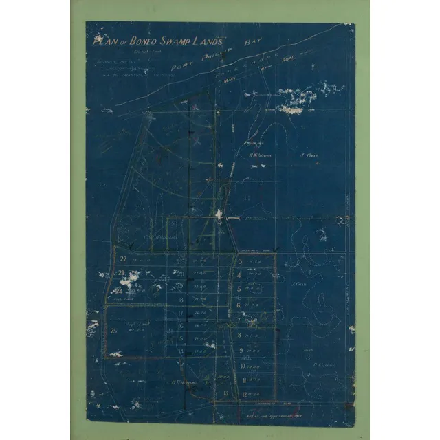
Boneo Swamp Lands Plan with Landowners and Roads
'Plan of Boneo Swamp Lands', by Johnstone & Tait, Melbourne, showing landowners, proposed roads, and drains; marked-up in crayon. Framed, overall 74 x 53 cm.
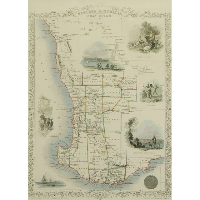
Western Australia Map by J. Rapkin
Map, 'Western Australia,' J Rapkin. Modern print taken from an original engraving. 35 x 25 cm
Framed and Mounted Nouvelle Carte Color Maps
Eight framed and mounted colour maps of Nouvelle Carte, three mounted but unframed, framed 46 by 36.5 cm approx.
Antique Oceanic and Australasian Maps
c1812-80 maps, noted c1812 'Oceanique', 1838 'Pacific Ocean', 1860 'Carte de la Melanesie', 1875 'Australie Occidentale' & 1880 'Australie et Polynesie'. All window mounted, various sizes. Condition varies.,
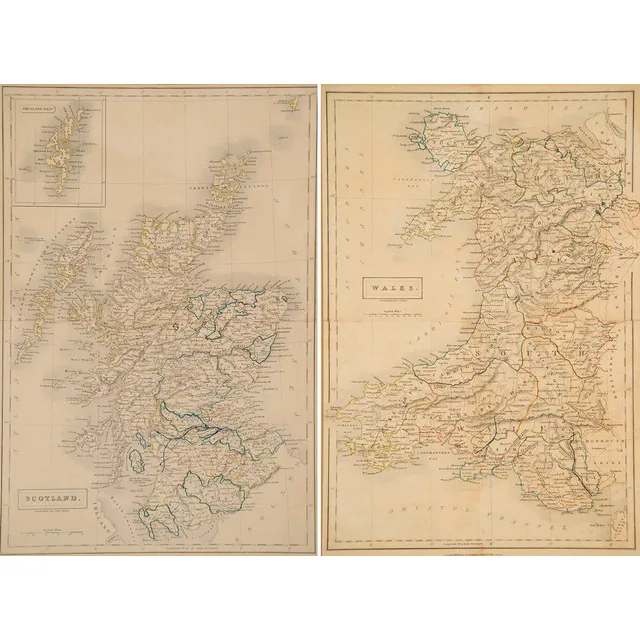
19th Century Scotland and Wales Maps by S. Hall
Two late 19th century maps, Scotland and Wales engraved by S. Hall, 38 x 26 cm
NSW County Map with Towns and Caves (1872)
Maps (2), NSW County, cook & Westmorland, including. Towns, Bowenfels, Colo, Oberon & Wambeyan, caves. Including, title page to original 1872 atlas, hand coloured lithograph (2), 38 x 53 cm (each)
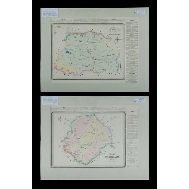
NSW County Maps: Argyle, Georgiana, Goulburn & More (2)
Maps (2), NSW County, Argyle & Georgiana, including. Goulburn, Marulan, Laggan & Rockley. Pub. 1872, hand coloured lithograph (2), 38 x 53 cm (each)
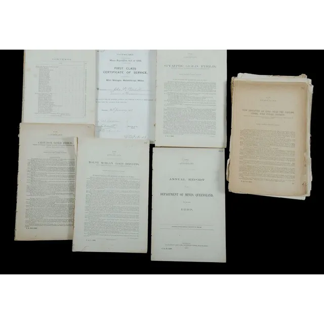
19th Century QLD Mining Reports with Maps and Diagrams
19th century Queensland Mining. Various yearly and district reports, many with folding maps and diagrams. As disbound from Government Gazettes. Spanning 1870 to 1896
Tallis Maps: Australia & Western Australia Regions
Two Re-Printed Tallis maps (offset lithographs in colour) Australia and Western Australia, showing regions. Both, 26 x 34 cm
Early Australian and World Maps (8)
Maps, two early Maps of Australia. A chart exhibiting recent discoveries from Cook?s Voyages torn at top, together with map of new Holland and Asia, together with 6 other maps Scotland, china etc c.1800. Maps (8). 32 x 27 cm (average)
Early World Maps (Three Examples)
Three early world maps, Kelly, Thomas, (2) 'The world with the Tracts & Discoveries of the Latest Navigators,' pub. C.1820; 'The world on Mercator's pair of ojection,' pub. 1824; & 'World from the Best Authorities,' pub. T.Tegg, London 1814. 23 x 42 cm,…
Early Maps of New South Wales, 1833-1886
Maps, 2, early maps of New South Wales. Includes eastern half with inset plan of Sydney published 1833, hand coloured engraving, 40 x 35 cm and NSW showing counties, published John Sands 1886, lithograph, 43 x 52 cm.
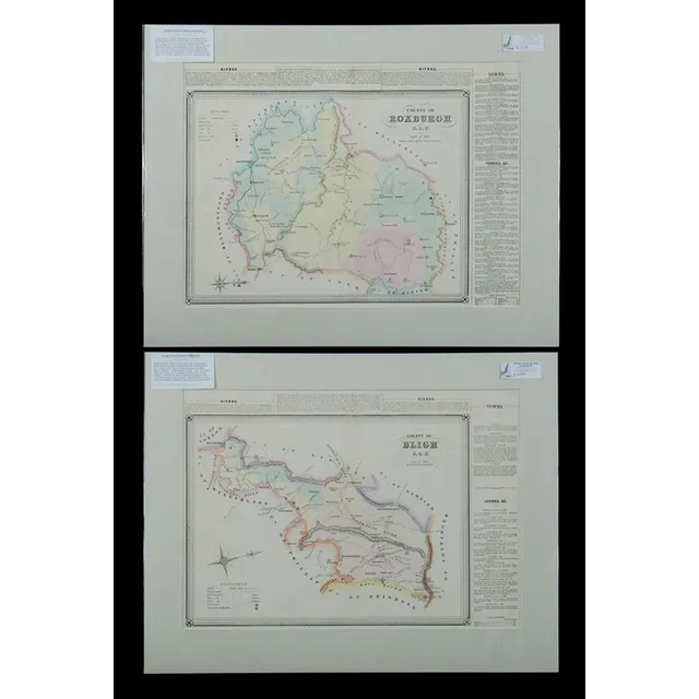
NSW County Map with Towns and Hand Colouring
Maps (2), NSW County, Roxburgh & Bligh, including. Towns Rylstone, Sofala, Cassilis & Wellington, hand coloured lithograph (2), 38 x 53 cm (each)
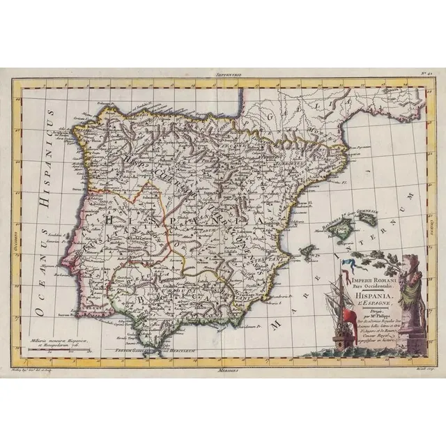
Imperii Romani Pars Occidentalis: Hispania Map (c.1780)
Map: 'Imperii Romani Pars Occidentalis. Hispania. L'Espagne' engraved map published by Moithey [Paris, c1780], size 44 x 28 cm.
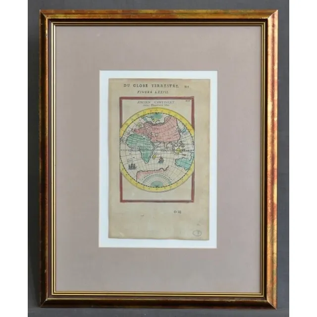
Ancien Continent Map
Map, 'Ancien Continent.' plate 77 from mallet's 'Du globe Terrestre,' Paris, 1863. 22 x 13 cm (page)
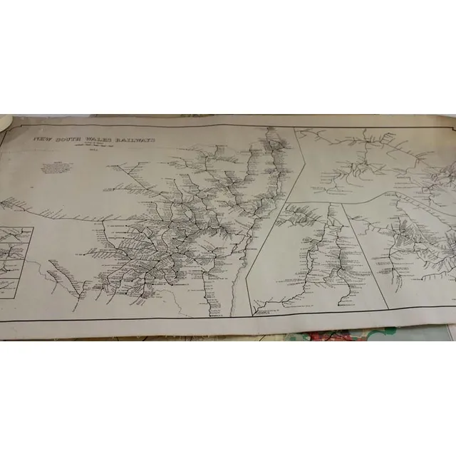
1949 Cumberland County and NSW Railway Maps
Two Maps of 'Cumberland County Planning Scheme 1949' (87 x 60 cm) and the other of 'New South Wales Railway 1949' Maps (99 x 50 cm).
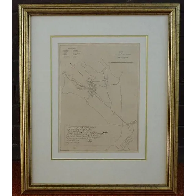
1792 Sydney Cove Map Framed Print
Framed print of 1792 map of Sydney Cove, 65 cm x 54 cm (frame) approx.
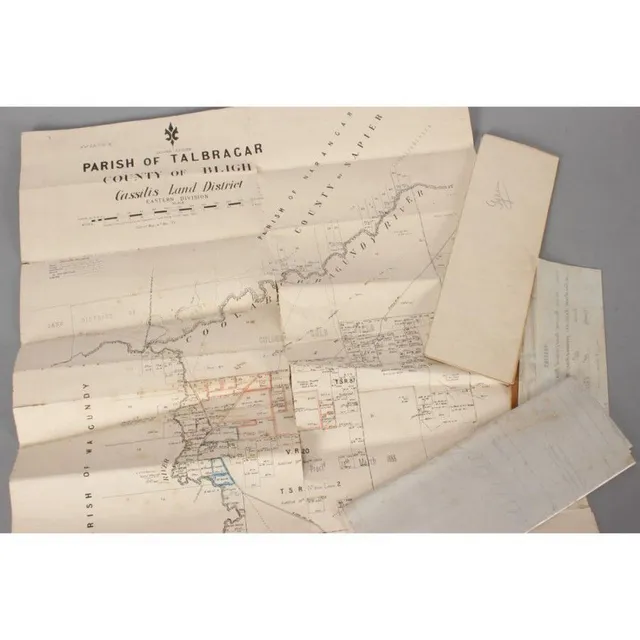
Assorted Australian and Colonial Maps and Sketches
Five Australian and Colonial maps, sketch of Shewing land in the Parish of Calderwood, tracing of Parish Calderwood Camden, print of Parish of Gyan, Parish of Talbragar County Bligh and plan of intersection of Parramatta Rd Northuberland Ave and Johston…
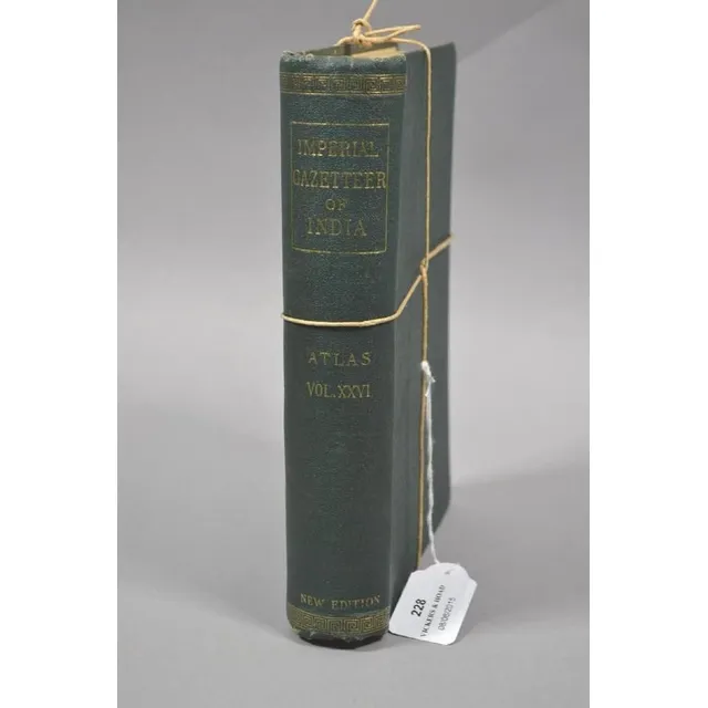
India's Imperial Gazetteer Atlas, 1932
The Imperial Gazetteer of India. Volume XXVI Atlas, 1932. Hardcover. Many detailed maps together with all sorts of information concerning the pre Independence pricey states etc.

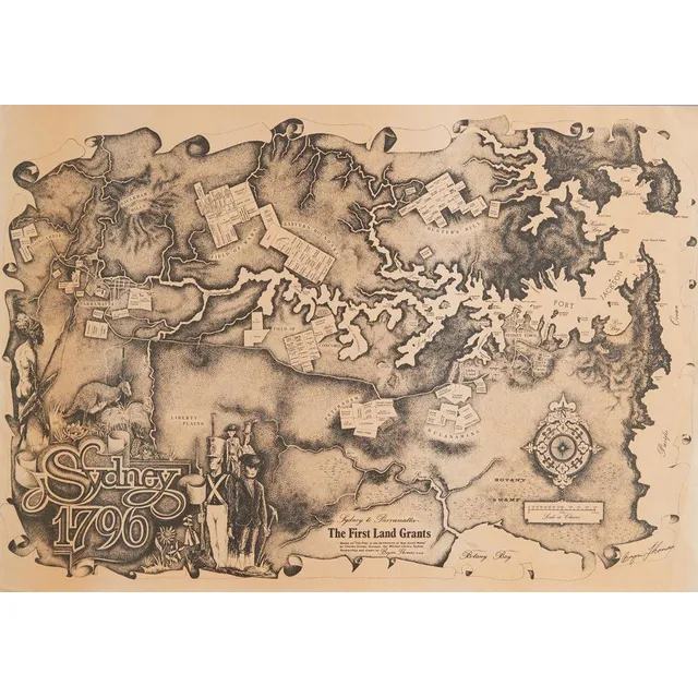
Bryan Thomas Signed Map Collection (1970s)
A collection of six signed maps by Bryan Thomas, 1970s. 42 x 59.4 cm
Australiana: Five Maps for Country and Regions
Australiana. Five maps. Country & regional. Largest measures 96 x 58 cm.
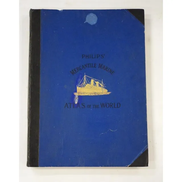
Philips' World Marine Atlas 12th Edition
Philips' Mercantile marine atlas of the world 12th edition, 53 x 39 cm.