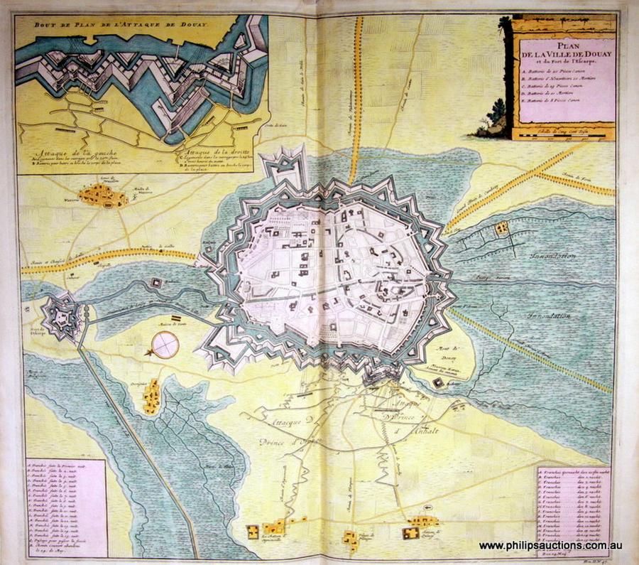
18th Century Topographical Maps and Strategic Plans
You must be a subscriber, and be logged in to view price and dealer details.
Subscribe Now to view actual auction price for this item
When you subscribe, you have the option of setting the currency in which to display prices to $Au, $US, $NZ or Stg.
This item has been included into following indexes:
- maps - general 445
Visually similar items

Jjoannes Van Keulen, Yrland, Schotland, hand coloured map, circa. 1681, 50 cm high, 58 cm wide
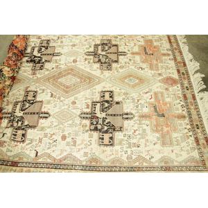
A fine hand knotted Iranian Ardabil Kelim rug a centre field of linked diamond medallions with starbursts in blue and terracotta. Together with stylised birds and animals on a cream field. Triple geometric guard borders. Finely woven kelim weave in silk an

A Photograph Album inscribed Eva M Moore July 1902, circa 1880s, including family portraiture and scenes in Venice, Killarney, The Hague, Rome, New Zealand, Windsor Castle, Isle of Wight and Melbourne 1901 during the visit of the Prince of Wales.

1901 Federation: Red cloth book with gilt title 'Commonwealth Celebrations, Melbourne. Souvenir Invitations, May, 1901', containing fi ve Souvenir Invitaions, all filled in for (Mr & Mrs H. Luke). The souvenir invitations are (A) Opening of the Parliament;