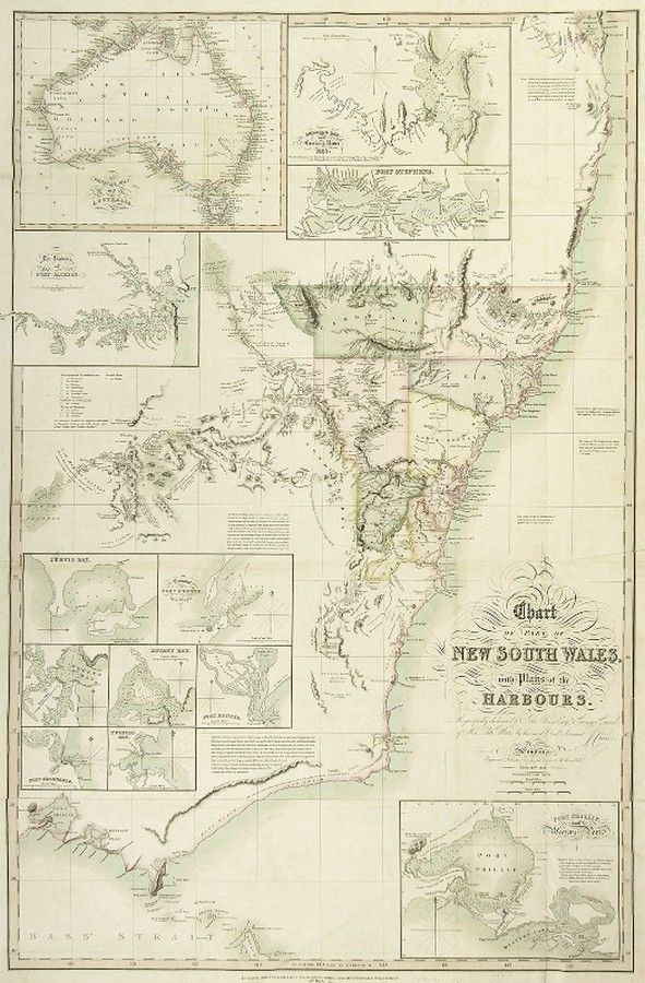
1827 New South Wales Chart with Harbour Plans
You must be a subscriber, and be logged in to view price and dealer details.
Subscribe Now to view actual auction price for this item
When you subscribe, you have the option of setting the currency in which to display prices to $Au, $US, $NZ or Stg.
This item has been included into following indexes:
- maps - general 445
Visually similar items

c1812-80 maps, noted c1812 'Oceanique', 1838 'Pacific Ocean', 1860 'Carte de la Melanesie', 1875 'Australie Occidentale' & 1880 'Australie et Polynesie'. All window mounted, various sizes. Condition varies.,

An Indo-Persian miniature painting. 19 cm high, 10 cm wide

India Map: 'Tabula Asiae X' by Sebastian Munster [Basle, c1561], window mounted, framed & glazed, overall 54 x 48 cm.
Maps: Group of 8 maps of Australia including c1839 showing the Colony of South Australia. 19th & 20th century. Varying sizes