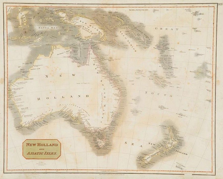
New Holland and Asiatic Isles Map for Thomson's Atlas (1814)
You must be a subscriber, and be logged in to view price and dealer details.
Subscribe Now to view actual auction price for this item
When you subscribe, you have the option of setting the currency in which to display prices to $Au, $US, $NZ or Stg.
This item has been included into following indexes:
- maps - general 445
Visually similar items
Maps: Group of 8 maps of Australia including c1839 showing the Colony of South Australia. 19th & 20th century. Varying sizes

c1812-80 maps, noted c1812 'Oceanique', 1838 'Pacific Ocean', 1860 'Carte de la Melanesie', 1875 'Australie Occidentale' & 1880 'Australie et Polynesie'. All window mounted, various sizes. Condition varies.,

i) map: Western Australia and van-Diemen's Island. Containing the settlements of swan river and King George sound from recent surveys sent to the Colonial office. the other section of the map depicting 'Van-Diemen Island', published London 1833 by Baldwin

Carte Generale De L'Oceanie by Brue [Paris 1827]. 52 x 58 cm