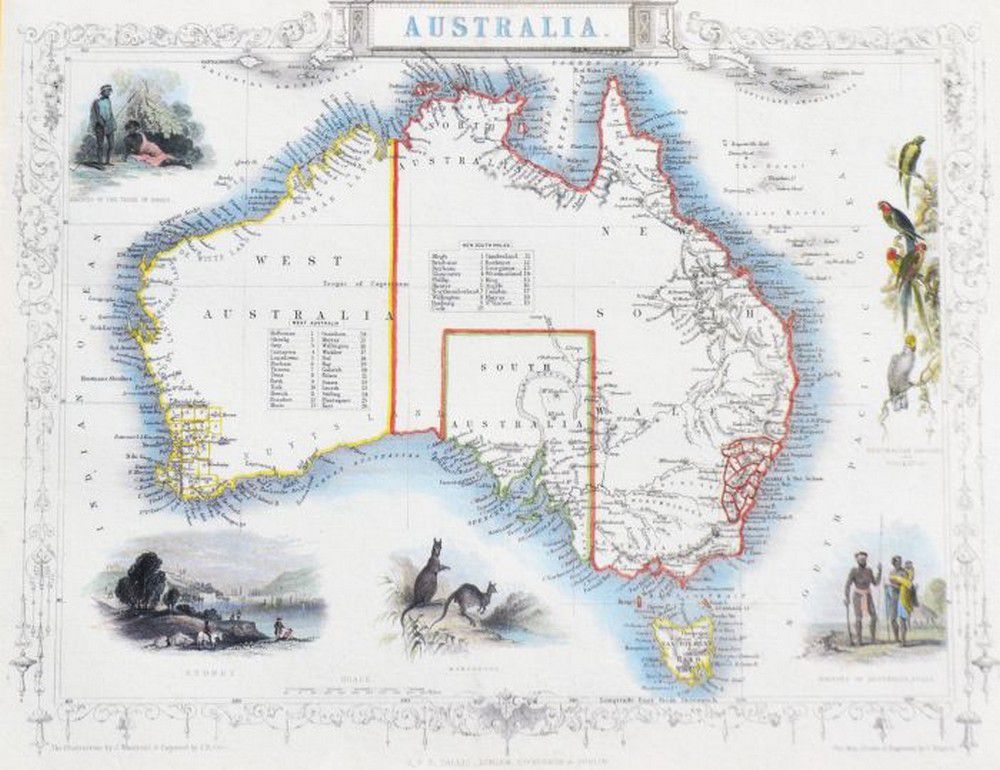
Tallis Maps: Australia & Western Australia Regions
You must be a subscriber, and be logged in to view price and dealer details.
Subscribe Now to view actual auction price for this item
When you subscribe, you have the option of setting the currency in which to display prices to $Au, $US, $NZ or Stg.
This item has been included into following indexes:
- maps - general 445
Visually similar items
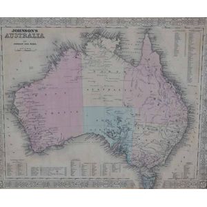
i) A 'Johnson's Australia' framed map, c.1864, by Johnson & Ward hand coloured engraved print. 32 x 40 cm (image); ii) 'The world on Mercator's Projection' framed map Published 1816 London, by C.S. Smith hand coloured engraved print note: showing Capt. Coo

'New Holland and Asiatic Isles.' pub. John, early map

'Panorama of Sydney NSW in the year 1829'. Centenary publication (1929) after a painting by Robert Burford. Published by lake & Sons Ltd, Sydney and Melbourne, from the original in the possession of Mr J Feldheim. (key numbers of interest: 18, General Darl
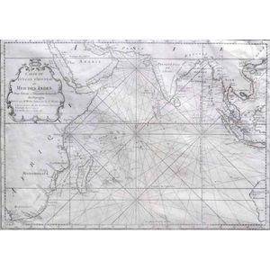
MAP - Bellin, Jacques Nicolas. Carte de L'Ocean Oriental ou Mer Des Indes, Paris, Didot, 1750. Engraved map, covers the entire Indian Ocean. Eastern coast of Africa and Madagascar depicted along with southern Arabia and India. Indonesian Islands and south-