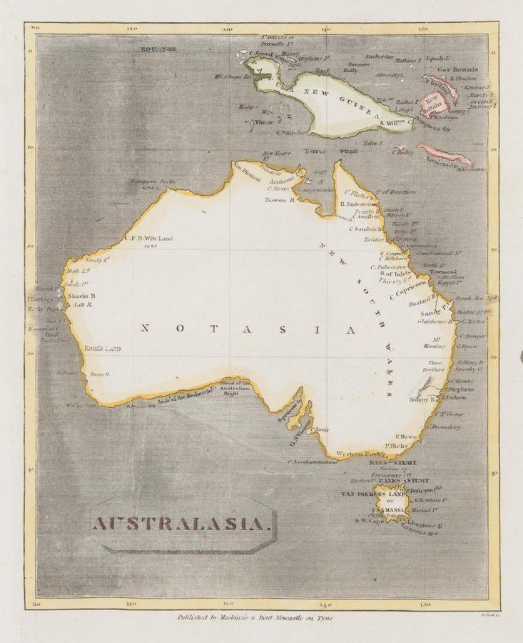
Australasia Map with Notasia and Hypothetical New Guinea
You must be a subscriber, and be logged in to view price and dealer details.
Subscribe Now to view actual auction price for this item
When you subscribe, you have the option of setting the currency in which to display prices to $Au, $US, $NZ or Stg.
This item has been included into following indexes:
- maps - general 445
Visually similar items

Map, NSW, New Zealand, New Hebrides & the Islands Adjacent. Robert Wilkinson, pub. London 1808. Inset map of port Jackson & Environs. Coloured engraving
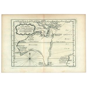
Carte Reduite Des Terres Australes, Pour servir a l'Histoire des Voyages' by Jacques Bellin, [Paris, 1753], lovely map showing hypothetical east coast of Australia, 36 x 25 cm.
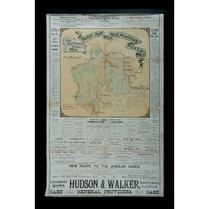
1890 Blue Mountains Tourism poster. Cameo map with local advertising as issued with the illustrated Sydney News. Also 'New Walk and Sights' guidebook c1928. 83 p.p. Childs pencil to latter blank pages.

Convicts in Van Diemen's Land, December 1861 outer cover from Highbury in London, addressed to 'Dr Hampton, Comptroller General of Convicts, Hobart Town, Van Diemens Land' and bearing a 6d mauve issued in 1854. The back panel with a fine strike of the Laun