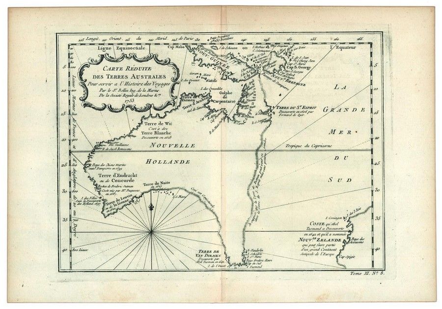
Hypothetical East Coast of Australia, 1753
You must be a subscriber, and be logged in to view price and dealer details.
Subscribe Now to view actual auction price for this item
When you subscribe, you have the option of setting the currency in which to display prices to $Au, $US, $NZ or Stg.
This item has been included into following indexes:
Visually similar items

Map, NSW, New Zealand, New Hebrides & the Islands Adjacent. Robert Wilkinson, pub. London 1808. Inset map of port Jackson & Environs. Coloured engraving

Australia: Collection of maps in folder, noted 'Chart of the Track of the Dolphin, Tamar, Swallow & Endeavour through the South Seas...' by Bowen [London, 1773], 'Karte von Australien' by Johannes Walch [Augsburg, c1810], 'Oceanique Centrale' by Pierre Lap
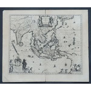
Map, India Quae Orientalis et Insulae Adiacinte. Mapmaker, Willem Janszoon Blaeu, c.1635. Engraving. 43 x 5 2 cm

Map, 'Royaume de Hongrie et Pays Adjacents,' par M.Bonne, Andre Scul. Engraving. 25 x 36 cm