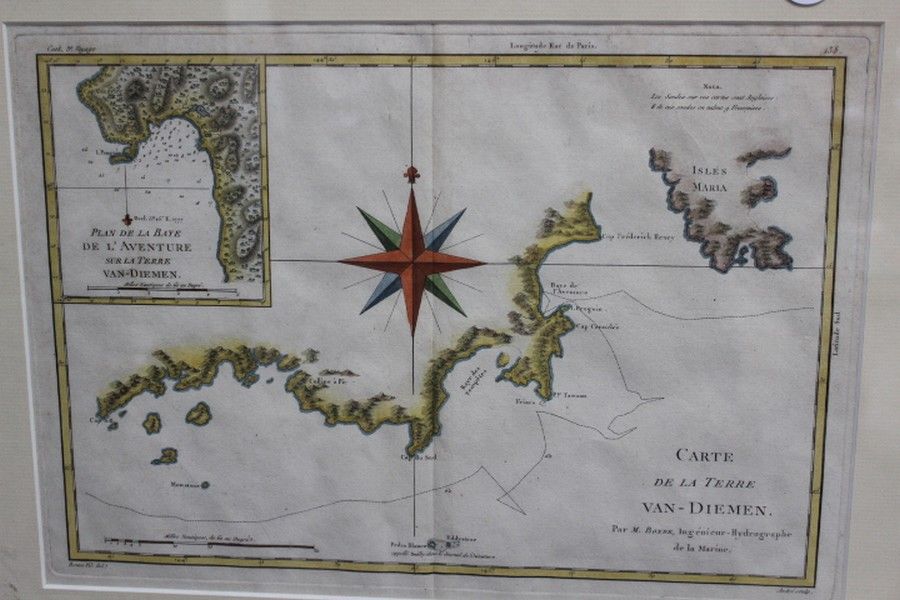
1777 Map of Maria Island, Van Diemens Land
You must be a subscriber, and be logged in to view price and dealer details.
Subscribe Now to view actual auction price for this item
When you subscribe, you have the option of setting the currency in which to display prices to $Au, $US, $NZ or Stg.
This item has been included into following indexes:
- maps - general 445
Visually similar items

Early French Van Dieman's Land Chart, hand coloured

'Carte De La Nouvelle Zeelande'. By M. Bonne. Hand coloured. 37 x 25 cm

Map, Mar di India, 1650. Cartographer Jansson, showing from cape of good Hope to Korea, including known parts of new Hollande, pub. Amsterdam, 1650, height and coloured copper engraving, 46 x 57 cm

A pair of Chinese rice paper paintings, late Qing Dynasty (late 19th century), in gouache and muted watercolours, depicting peasant workers engaged in labouring activities. Height 27 cm. Width 20 cm