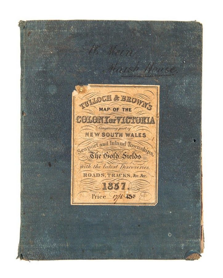
1857 Map of Victoria with Gold Fields and Townships
You must be a subscriber, and be logged in to view price and dealer details.
Subscribe Now to view actual auction price for this item
When you subscribe, you have the option of setting the currency in which to display prices to $Au, $US, $NZ or Stg.
This item has been included into following indexes:
- maps - general 445
Visually similar items
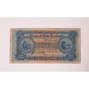
Bank of New Zealand seventh issue ten shillings 1917 bank note, detailed 'Wellington 1st Day of October 1917, No. 510190'.

TASMANIA' 1883 large folding map in 30 sectors laid down on linen and contained in a slip-case from the supplier: Edward Stanford Ordnance Maps, Charing Cross. Published by authority of the Honorable N.J.Brown, Minister of Land & Works. Litho: R.Bennett, D

Original admission ticket booklet for the 1904 Louisiana Purchase Exhibition in St. Louis. The Monthly Pass booklet is Number 17559 issued to Howard S. Levy and still contains 25 of the original tickets. The adhesive label on the back cover indicates that
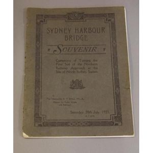
Sydney Harbour Bridge 1923 Souvenir booklet 'Ceremony of Turning the First Sod of the Northern Railway Approach at the Site North Sydney Station', 25 cm x 18.5 cm