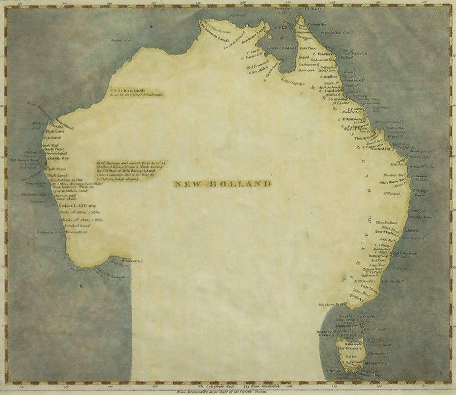
Map of New Holland, 1804-5
click the photo to enlarge
Map of new Holland circa 1804-5. Showing surveyed & charted areas. Pub. By Arrowsmith and Lewis. Engraving. 20.5 x 25 cm
You must be a subscriber, and be logged in to view price and dealer details.
Subscribe Now to view actual auction price for this item
When you subscribe, you have the option of setting the currency in which to display prices to $Au, $US, $NZ or Stg.
This item has been sold, and the description, image and price are for reference purposes only.
- Circa - A Latin term meaning 'about', often used in the antique trade to give an approximate date for the piece, usually considered to be five years on either side of the circa year. Thus, circa 1900 means the piece was made about 1900, probably between 1895 and 1905. The expression is sometimes abbreviated to c.1900.
This item has been included into following indexes:
- maps - general 445
Visually similar items

A sampler by Eliza Brinton, 1824, 47 x 40 cm
Sold by
in
for
You can display prices in $Au, $US, $NZ or Stg.

A sampler by Elizabeth Atherton, 1834 in a rosewood frame, 43 x 33 cm
Sold by
in
for
You can display prices in $Au, $US, $NZ or Stg.

Victorian pictorial needlework sampler depicting Adam and eve and the serpent in the garden, worked by Grace James aged 18, dated 1841
Sold by
in
for
You can display prices in $Au, $US, $NZ or Stg.

Sir Henry Edward Fox Young, 1859 map of Tasmania by James Sprent (large)
Sold by
in
for
You can display prices in $Au, $US, $NZ or Stg.