The First Detailed Mapping of The Adelaide Region, Carte…
click the photo to enlarge
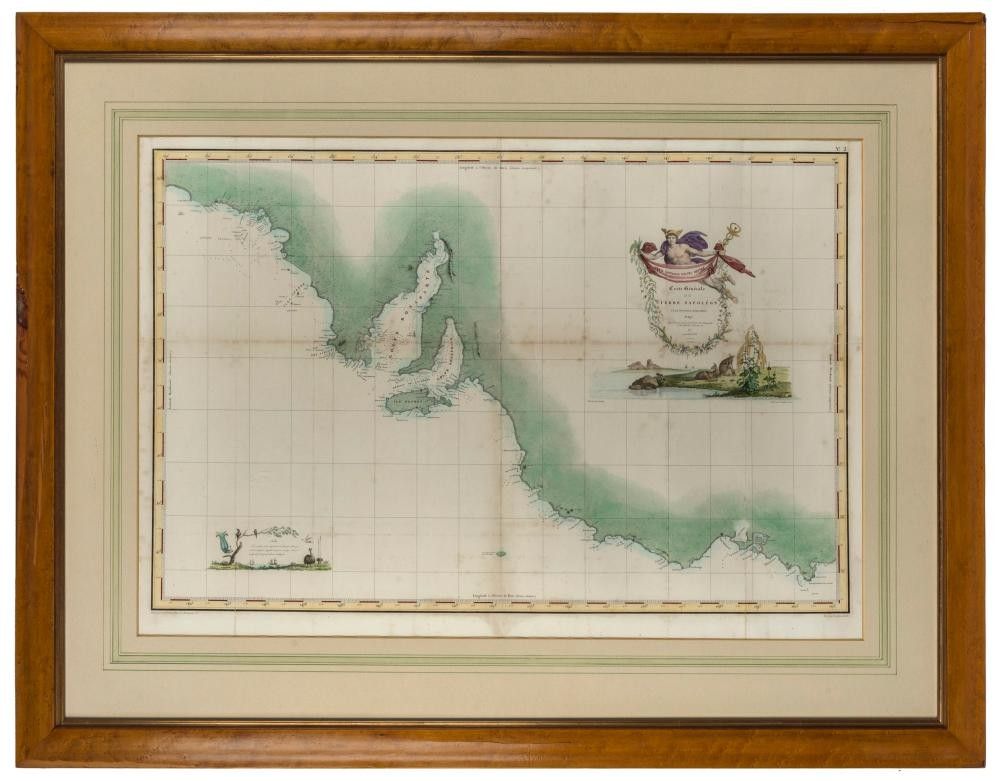
The First Detailed Mapping of The Adelaide Region, Carte Generale de la Terre Napoleon, [Baudin Expedition map] Louis de Freycinet, [Paris: grave par Tardieu, 1808.], attractively hand coloured, 54 x 78 cm (sight); framed 80 x 104 cm. At the time of the Baudin voyage, a Napoleonic order existed to conquer the continent, a plan ultimately frustrated by defeat in Europe. The place names engraved on this chart are almost entirely in French; interestingly, when the second edition of Baudin's voyage was published in 1824 most of these names were, without comment, discreetly changed into English.
You must be a subscriber, and be logged in to view price and dealer details.
Subscribe Now to view actual auction price for this item
When you subscribe, you have the option of setting the currency in which to display prices to $Au, $US, $NZ or Stg.
This item has been sold, and the description, image and price are for reference purposes only.
This item has been included into following indexes: