1758 Dutch Edition Map of Hypothetical East Coast Australia
click the photo to enlarge
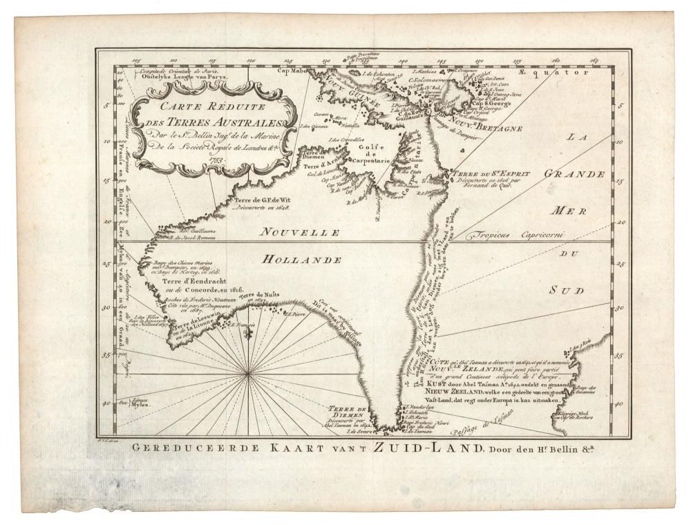
Jacques Bellin: 'Carte Reduite Des Terres Australes, Par le Sr Bellin....', (Paris, 1753), lovely map showing hypothetical East coast of Australia, being the Dutch edition of 1758, 36 x 25 cm. This Dutch edition, published in 1758, is scarcer than its French counterpart, published 5 years earlier. The original was produced by Jacques Nicolas Bellin, the inaugural Ingenieur de la marine of the Depot des cartes et plans de la marine (the French Hydrographic office). The present map is augmented with several Dutch translations and a new title at the bottom by the engraver Jakob van der Schley, of Amsterdam. Published nearly 20 years prior to Cook's 'Discovery' of the East coast in 1770, Bellin used a dotted line for his theories of the East coast of Australia, joining van Diemen's land to Espiritu Santu (New Hebrides) and Papua New Guinea and New Britain. In French and Flemish, along this imagined coast Bellin wrote 'I suppose that the land of Diemen could join with the land of the holy Ghost but (this is) without proof'. This map is highly original, with both received wisdom and new ideas. Additionally, it is one of the few eighteenth-century maps of Australia to not include Asia or the world. This Dutch edition is even rarer than its French counterparts. It is an essential map for Collectors of the cartography of Australia. We offered another example of this Dutch edition in our auction No.463. It sold for $4,800 + BP.
You must be a subscriber, and be logged in to view price and dealer details.
Subscribe Now to view actual auction price for this item
When you subscribe, you have the option of setting the currency in which to display prices to $Au, $US, $NZ or Stg.
This item has been sold, and the description, image and price are for reference purposes only.
This item has been included into following indexes: