French Map of South West Australia, 1792-1793
click the photo to enlarge
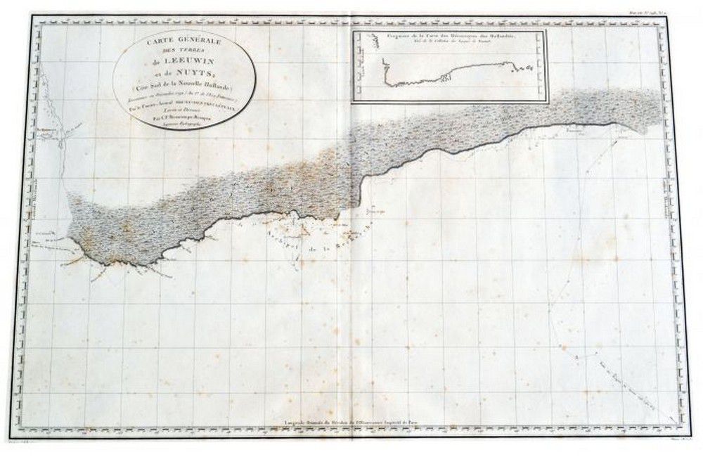
Map original early French map of south West Australia depicts, Rottnest, swan river, Pt. Leeuwin etc.. A fairly rare copper plate engraving. Shows the voyages of the French vessels, Resecherche and Esperance in 1792 to 1793. Published as plate number 11 from the, atlas du voyage de Bruny Dentrecasteaux etc. Paris in 1807. 49.5 x 76 cm (to map border)
You must be a subscriber, and be logged in to view price and dealer details.
Subscribe Now to view actual auction price for this item
When you subscribe, you have the option of setting the currency in which to display prices to $Au, $US, $NZ or Stg.
This item has been sold, and the description, image and price are for reference purposes only.
This item has been included into following indexes:
- maps - general 445