Accurate Oval Map of World with Circum-Navigators' Courses
click the photo to enlarge
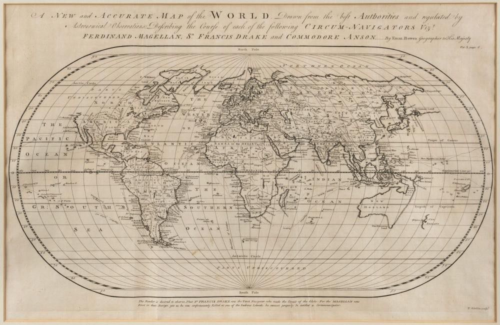
Bowen, Emanuel (1694? - 1767), A New and Accurate Map of the World. Drawn from the best Authorities and regulated by Astronomical Observations: Describing the Course of each of the following Circum-Navigators Vizt. Ferdinand Magellan, Sr. Francis Drake and Commodore Anson..By Eman. Bowen Geographer to His Majesty. circa 1745, 35 x 55 cm. A very elegant map on an oval projection. Many interesting features include the eastern third of Australia or 'New Holland' and most of New Zealand that are left ill defined as is the north west coast of America. 'De Gama's Land' is noted slightly above and to the east of Japan.
You must be a subscriber, and be logged in to view price and dealer details.
Subscribe Now to view actual auction price for this item
When you subscribe, you have the option of setting the currency in which to display prices to $Au, $US, $NZ or Stg.
This item has been sold, and the description, image and price are for reference purposes only.
- Circa - A Latin term meaning 'about', often used in the antique trade to give an approximate date for the piece, usually considered to be five years on either side of the circa year. Thus, circa 1900 means the piece was made about 1900, probably between 1895 and 1905. The expression is sometimes abbreviated to c.1900.
This item has been included into following indexes:
- maps - general 445