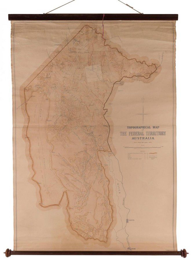
Topographical Map of the Federal Territory Australia, Compiled,…
click the photo to enlarge
Topographical Map of the Federal Territory Australia, Compiled, Drawn and Printed at the Department of Lands, Sydney, 1910, 90 x 125 cm, supported on a turned cedar roll by the noted map mounter J.Creffield of Melbourne., George Sydney Jones [1864-1927, architect] first suggested a competition to design the Federal capital in 1901 and by 1911, the Minister of Home Affairs, the legendary King O'Malley, had approved an international design competition. In 1910, The Department of lands in NSW produced this topographical map to assist the competitors, showing the location of the proposed city of Canberra in the specially created Federal Territory.

You must be a subscriber, and be logged in to view price and dealer details.

Subscribe Now to view actual auction price for this item

When you subscribe, you have the option of setting the currency in which to display prices to $Au, $US, $NZ or Stg.

This item has been sold, and the description, image and price are for reference purposes only.

This item has been included into following indexes:

Visually similar items

A pair of Art Deco style silver stone set cuff links, each centring a blue topaz to a surround of enamel

Sold by in for
You can display prices in $Au, $US, $NZ or Stg.

Ren Xun (1834 - 1893), and Yin Zhaoyong (1806-1883), Fruit and calligraphy Ink and colour on gold-flecked paper, mounted on a hanging scroll Inscribed and signed by both artists, and three seals of the artists Undated 54 cm wide. Provenance: Private collec

Sold by in for
You can display prices in $Au, $US, $NZ or Stg.

A Chinese pale jade carved pendant depicting carp and a temple. Height 5.3 cm. Width 3.8 cm

Sold by in for
You can display prices in $Au, $US, $NZ or Stg.

Antique 17th century English oak three panel top coffer, carved front frieze and panels to the front, approx 63 cm high, 124 cm long, 57 cm deep

Sold by in for
You can display prices in $Au, $US, $NZ or Stg.