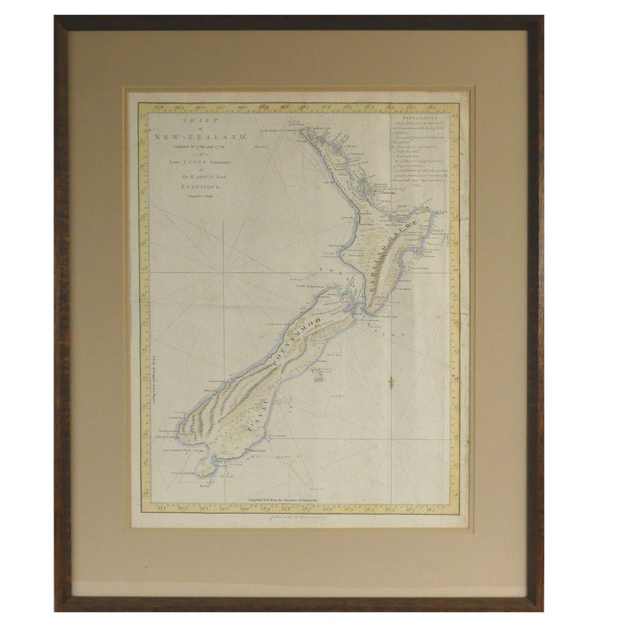
Cook's 1772 Chart of New Zealand
You must be a subscriber, and be logged in to view price and dealer details.
Subscribe Now to view actual auction price for this item
When you subscribe, you have the option of setting the currency in which to display prices to $Au, $US, $NZ or Stg.
This item has been included into following indexes:
Visually similar items

Map, NSW Coast Partie de la Nlle Galles du Sud. By Philippe Vandermaelen, published Brussels 1827. Coloured lithograph. 48 x 57 cm

Chart of Van Diemen's Land, From the Best Authorities, and From Actual Surveys and Measurements', by Thomas Scott (Edinburgh, 1824), (tear at base), impressive musk wood frame, 62 x 87 cm overall. (Tooley 1129). Provenance: Property originally of Thomas Sc

B J Loveday Survey of Roads, Cape Jervis to Clare, lithograph, vintage, c1900, glazed in frame, 59 x 66 cm

Louis-Joseph Sulas Moulin au Gerbes engraving, ed 18/80 signed lower right Exhibited: XXIVeme Exposition Biannale Internationale des Beaux-Artes Venise 1948. 25 x 39.5 cm