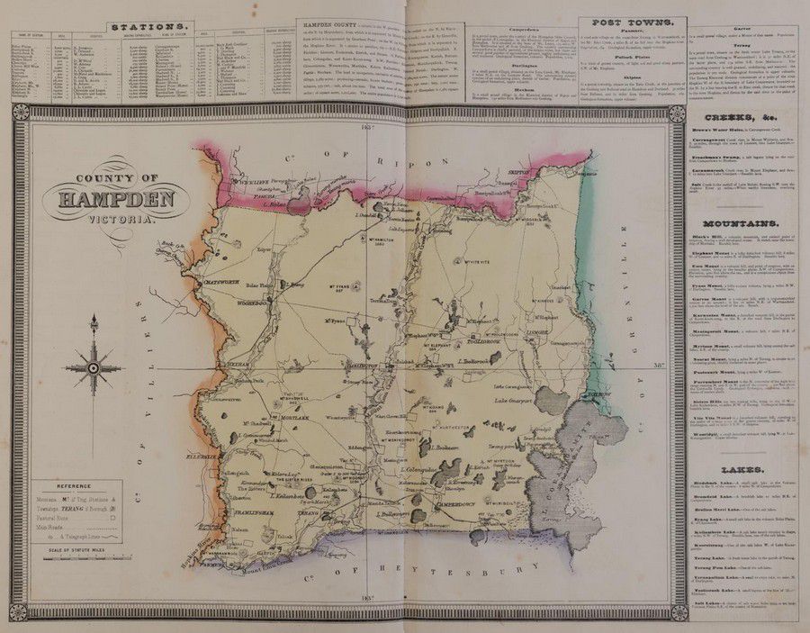
1874 Victorian Counties Atlas with Hand-Coloured Maps
You must be a subscriber, and be logged in to view price and dealer details.
Subscribe Now to view actual auction price for this item
When you subscribe, you have the option of setting the currency in which to display prices to $Au, $US, $NZ or Stg.
- Victorian Period - The Victorian period of furniture and decorative arts design covers the reign of Queen Victoria from 1837 to 1901. There was not one dominant style of furniture in the Victorian period. Designers used and modified many historical styles such as Gothic, Tudor, Elizabethan, English Rococo, Neoclassical and others, although use of some styles, such as English Rococo and Gothic tended to dominate the furniture manufacture of the period.
The Victorian period was preceded by the Regency and William IV periods, and followed by the Edwardian period, named for Edward VII (1841 ? 1910) who was King of the United Kingdom and the British Dominions and Emperor of India for the brief period from 1901 until his death in 1910.
This item has been included into following indexes:
- maps - general 445
Visually similar items

Thomes Bowen (?-1790) A new and Accurate map of Asia, drawn from the most modern Maps and Charts, 1799 Handcoloured & engraved, for Middletons complete System of Geography 32.5 x 42.5 cm

After Steinberg +, after Elliot the New York er c.1976 + Sydney c.1985 (2) Offset prints (posters), each, 101 x 70 cm

Map, 'Royaume de Hongrie et Pays Adjacents,' par M.Bonne, Andre Scul. Engraving. 25 x 36 cm

Map, L'Africa Divisa Ne Suoi Principali Stati. By Antonio Zatta, pub. Venice 1776. Hand coloured with pictorial title vignettes. Copper engraving. 31 x 41 cm