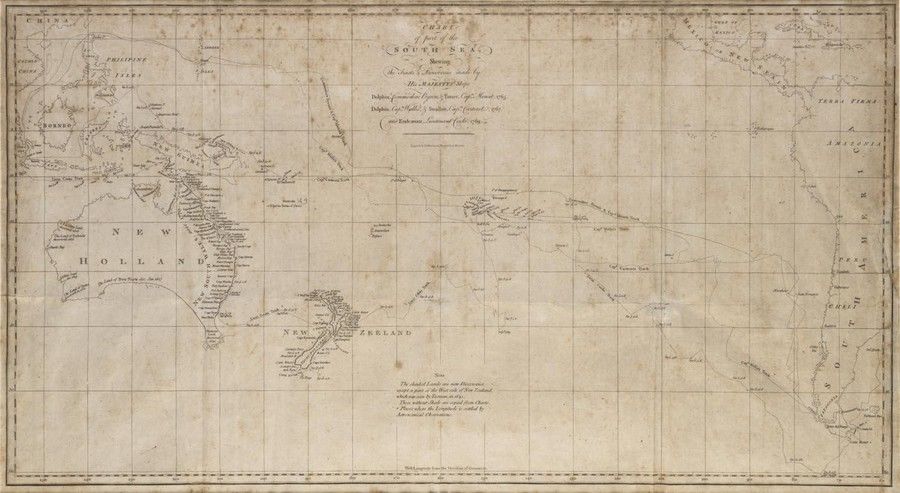
South Sea Discoveries Chart, 1765-1769
You must be a subscriber, and be logged in to view price and dealer details.
Subscribe Now to view actual auction price for this item
When you subscribe, you have the option of setting the currency in which to display prices to $Au, $US, $NZ or Stg.
This item has been included into following indexes:
Visually similar items

Slowman, John: Found Guilty of burgulary at the Central Criminal Court, London and transported for 14 years aboard the 'Anson' (departed 23rd Sept.1843, arrived at Vdl 4th Feb.1844): printed vellum document filled out in mss in various hands, being a compl

1792 Chart of the Coast between Botany Bay & broken Bay. As surveyed by Capt. John hunter. Pub. By John Stockdale, London 1792. Engraving. 43 x 75 cm
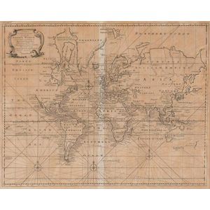
A New & Correct Chart of all the Known World by Emanuel Bowen [London 1744]. 46 x 38 cm

Benard, Robert (Paris, 1774), Carte d'une partie de la Mer du Sud Contenant les Decouvertes de Vaisseaux de sa Majeste: Le Dauphin, Commodore Byron, la Tamar, Capitne Mouats, 1765. Le Dauphin, Capitne Wallis, Le Swallow, Capitne Cartaret, 1767. et l'Endeav