Willem Janszoon Blaeu (1571-1638) and Joan Blaeu (1596-1673) were father and son map makers, astronomers, and cartographers from the Netherlands. They are considered to be among the most important figures in the history of cartography and are known for their detailed and accurate maps of the world.

Willem Janszoon Blaeu, who was born in Alkmaar, Netherlands, studied cartography, astronomy and mathematics in Amsterdam, later established himself as a globe and instrument maker, after that he started to publish maps and atlases. In 1630, he established a cartographic printing press in Amsterdam, which was one of the largest and most advanced of its kind in Europe. He is considered to be one of the founders of the Dutch school of cartography, which was known for its highly detailed and accurate maps.

Joan Blaeu, Willem's son, worked with his father in the cartographic printing press, and after his more...

5 items found:

These items have been sold, and the description, image and price are for reference purposes only.

17th century map of Hertfordshire, taken from Blaeu's atlas…

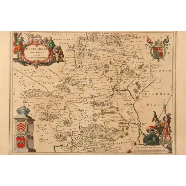
Hertfordshire Map from Blaeu's Atlas Major (1662)

17th century map of Hertfordshire, taken from Blaeu's atlas Major of 1662, copper engraved with hand coloured accents, with Latin text verso, 53 cm x 63 cm (frame)

Cantabrigiensis Comitatus: Cambridge shire, handcoloured…

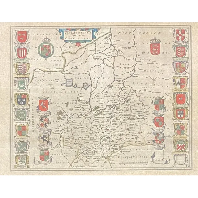
Handcoloured Map of Cambridge shire with College Coats of Arms

Cantabrigiensis Comitatus: Cambridge shire, handcoloured engraved map including Coats of arms of all the Colleges, pub. C.1650, Johannes Blaeu, centre fold, plate: 41.8 x 52.3 cm frame: 54 x 66 cm

Ptolemy's Geographica, 1974 & Blaeu's Atlas of England,…

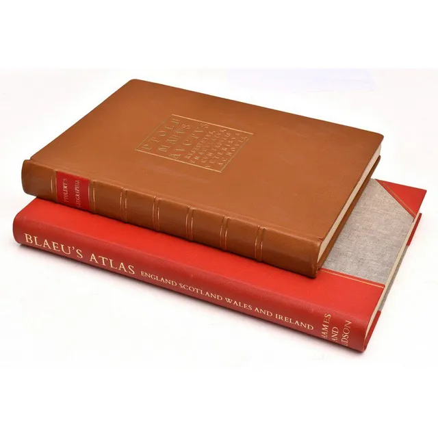
Limited Edition Atlases: Ptolemy & Blaeu

Ptolemy's Geographica, 1974 & Blaeu's Atlas of England, Scotland, Wales and Ireland; Ptolemy's Geographica, full leather binding. Limited edition no. 40 of 250, signed by the Lord Major of Plymouth, England. Blaeu's atlas of England, Scotland, Wales and…

17th century hand coloured map of Great Britain, A c.1654 map…

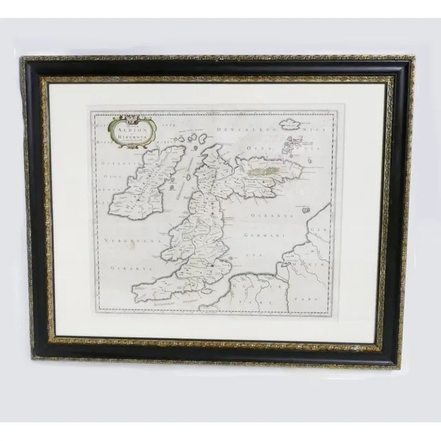
17th Century Hand-Coloured Map of Great Britain by Blaeu

17th century hand coloured map of Great Britain, A c.1654 map of the British Isles entitled 'Insulae Albion et Hibernia cum Minoribus Adjacentibus' by Johanes Blaeu. Original outline colouring. Dutch. 47.5 cm x 60 cm

Map, India Quae Orientalis et Insulae Adiacinte. Mapmaker,…

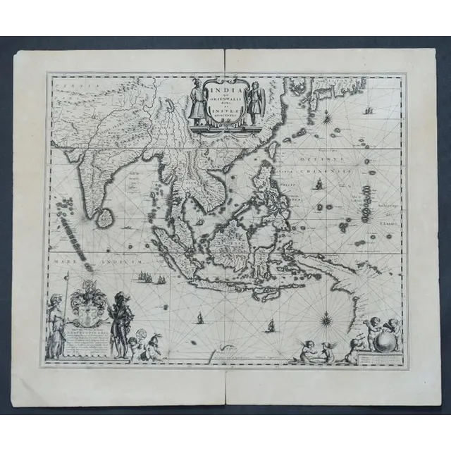
India and Adjacent Islands Map by Blaeu, c.1635

Map, India Quae Orientalis et Insulae Adiacinte. Mapmaker, Willem Janszoon Blaeu, c.1635. Engraving. 43 x 5 2 cm