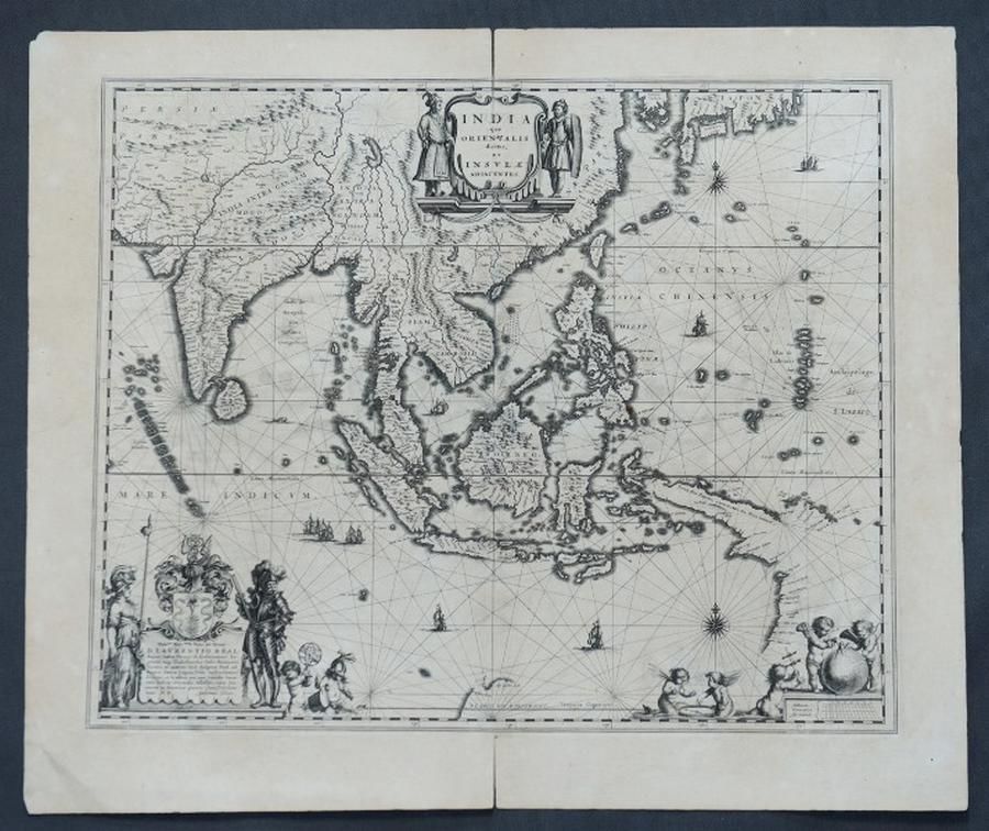
India and Adjacent Islands Map by Blaeu, c.1635
You must be a subscriber, and be logged in to view price and dealer details.
Subscribe Now to view actual auction price for this item
When you subscribe, you have the option of setting the currency in which to display prices to $Au, $US, $NZ or Stg.
This item has been included into following indexes:
Visually similar items

Map, NSW, New Zealand, New Hebrides & the Islands Adjacent. Robert Wilkinson, pub. London 1808. Inset map of port Jackson & Environs. Coloured engraving

Map, L'Asie Divisee en ses pair of incipaux Etats. Mapmaker, Jean Janvier, pub. Paris 1760. Hand coloured engraving. 49 x 6 8 cm

Map, c1690 Indonesia, Australia & Philipines. Mapmaker Vincenzo Maria Coronelli, 'Isole Dell' Indie diuise in Filippine, Molucche e della Sonda. Pub. Venice. Engraving. 47 x 6 2 cm

Australia: Collection of maps in folder, noted 'Chart of the Track of the Dolphin, Tamar, Swallow & Endeavour through the South Seas...' by Bowen [London, 1773], 'Karte von Australien' by Johannes Walch [Augsburg, c1810], 'Oceanique Centrale' by Pierre Lap