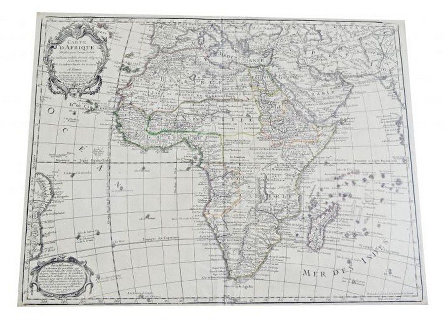
Bauche's Map of Africa 1781
You must be a subscriber, and be logged in to view price and dealer details.
Subscribe Now to view actual auction price for this item
When you subscribe, you have the option of setting the currency in which to display prices to $Au, $US, $NZ or Stg.
- Verso - Verso is the "back" side of a sheet of paper, art work, coin or medal. The front side is "recto".
This item has been included into following indexes:
Visually similar items

Benard, Robert (Paris, 1774), Carte d'une partie de la Mer du Sud Contenant les Decouvertes de Vaisseaux de sa Majeste: Le Dauphin, Commodore Byron, la Tamar, Capitne Mouats, 1765. Le Dauphin, Capitne Wallis, Le Swallow, Capitne Cartaret, 1767. et l'Endeav

Maps: Group of 10 maps of Australia, late 19th & early 20th century including Van Diemen's Land. Various sizes

A hand coloured map of the 'County of Eden Auckland', c. 1880, by Champtaloup and Cooper. Some hand notation to side. 53 x 87 cm

An Indo-Persian miniature painting. 19 cm high, 10 cm wide