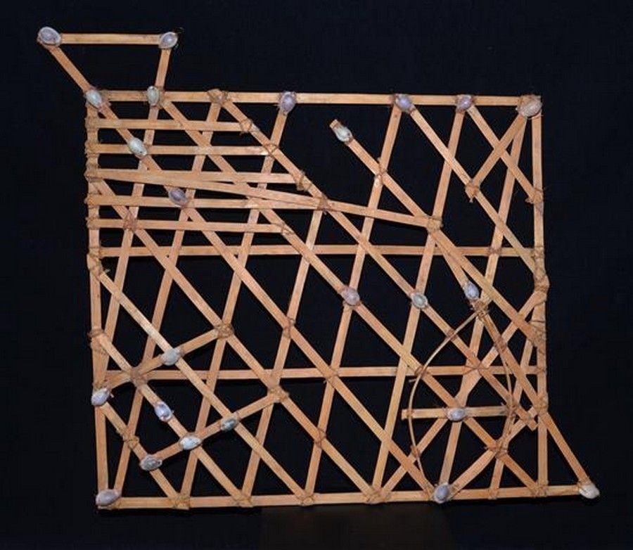
An early Micronesian navigational map, known as stick Charts…
click the photo to enlarge
An early Micronesian navigational map, known as stick Charts which were used to navigate the Pacific Islands by canoe. Made from straight and bent pieces of coconut fronds midribs and tied with sennit coconut fibre string, small Cowrie shells are tied in precise spots to identify Islands in the chain to navigate in traditional canoes from Island to Island. Provenance: C. Barnes collected this map on Truk Island in the 1950's / Todd Barlin collection. 43 x 40 cm

You must be a subscriber, and be logged in to view price and dealer details.

Subscribe Now to view actual auction price for this item

When you subscribe, you have the option of setting the currency in which to display prices to $Au, $US, $NZ or Stg.

This item has been sold, and the description, image and price are for reference purposes only.

This item has been included into following indexes:

Visually similar items

Nesting tables in teak by Arne Hovmand Olsen for Mogens Kold of Denmark. 80.5 cm wide, 40 cm deep, 50 cm high.

Sold by in for
You can display prices in $Au, $US, $NZ or Stg.

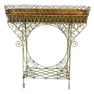
An old French iron planter, ornately decorated and with original two-handled copper liner with platform base and four scroll feet. Length 90 cm, height 89 cm

Sold by in for
You can display prices in $Au, $US, $NZ or Stg.

Humphrey Ikin, bench, wood, 2003, height 43 cm, diameter 40 cm, length 210 cm

Sold by in for
You can display prices in $Au, $US, $NZ or Stg.

B&B; Italia coffee table by Paolo Piva. Conceptual black metal triangular base with glass inset top

Sold by in for
You can display prices in $Au, $US, $NZ or Stg.