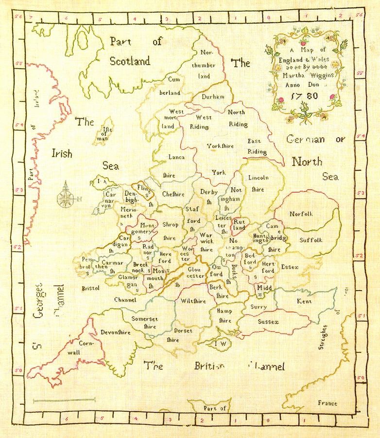
1780 Map of England & Wales Sampler
You must be a subscriber, and be logged in to view price and dealer details.
Subscribe Now to view actual auction price for this item
When you subscribe, you have the option of setting the currency in which to display prices to $Au, $US, $NZ or Stg.
This item has been included into following indexes:
- samplers 210
Visually similar items

India Map: 'Tabula Asiae X' by Sebastian Munster [Basle, c1561], window mounted, framed & glazed, overall 54 x 48 cm.

Map, 'Royaume de Hongrie et Pays Adjacents,' par M.Bonne, Andre Scul. Engraving. 25 x 36 cm

Map: Western Australia and van-Diemen's Island a map of Western Australia containing the settlements of swan river and King George sound from recent surveys sent to the Colonial office. The other section of the map depicting van-Diemen Island, published Lo

Carte Generale De L'Oceanie by Brue [Paris 1827]. 52 x 58 cm