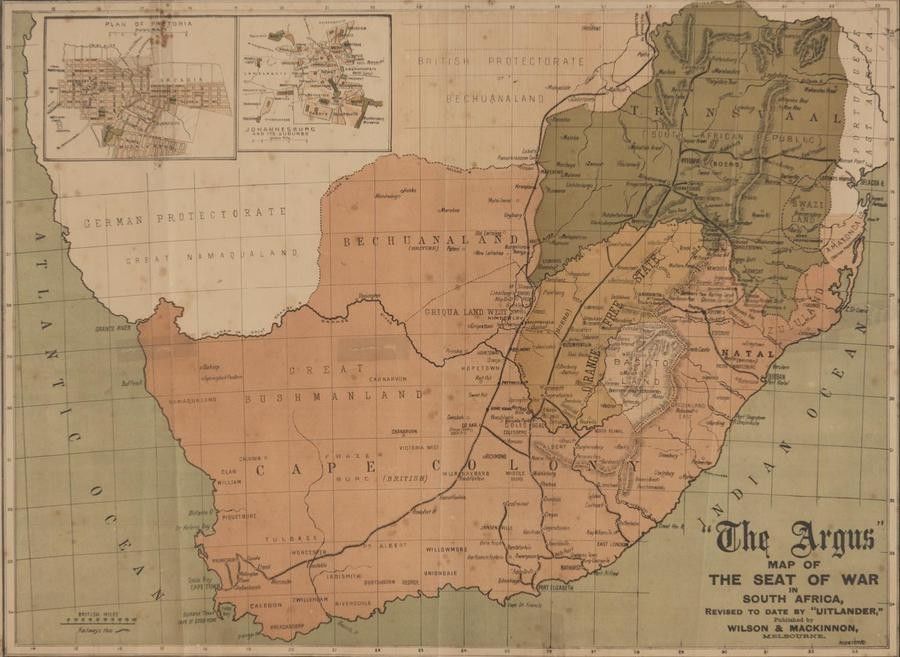
Boer War Map and Memorabilia
You must be a subscriber, and be logged in to view price and dealer details.
Subscribe Now to view actual auction price for this item
When you subscribe, you have the option of setting the currency in which to display prices to $Au, $US, $NZ or Stg.
This item has been included into following indexes:
Visually similar items

A very rare ottoman hand-coloured world map from the 'Cedid Atlas' (Atlas-i Cedid), the first published atlas in the Muslim world, printed and published in Istanbul, 1803. Based on late 18th century European world maps it details Cook's three voyages of ex

Emanuel Bowen, (1693-1767) English, a new & Accurate map of Nubia & Abissinia 1747, Handcoloured engraving pub. London, 35 x 42.5 cm

Map, 'Western Australia,' J Rapkin. Modern print taken from an original engraving. 35 x 25 cm

Map of the District of Adelaide, South Australia, published by John Arrowsmith, 1840, lithograph, 65 x 55 cm