London to Montgomery Road Map
click the photo to enlarge
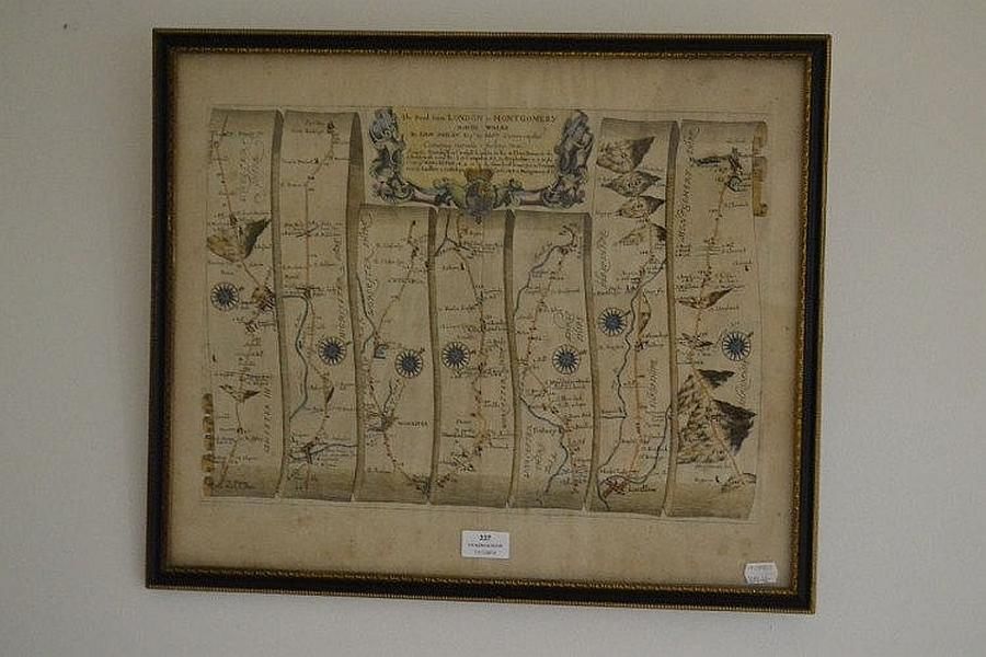
John Ogilby (1600-1676),the road from London to Montgomery, This antique strip map is from the 'Britannia' by John Ogilby, published in 1675. The colouring is later, ' the road from London to Montgomery.' from Campden to Evesholme to Worcester to hundred house to Tenbury to Ludlow to Bishops Castle to Montgomery.
You must be a subscriber, and be logged in to view price and dealer details.
Subscribe Now to view actual auction price for this item
When you subscribe, you have the option of setting the currency in which to display prices to $Au, $US, $NZ or Stg.
This item has been sold, and the description, image and price are for reference purposes only.
This item has been included into following indexes:
Visually similar items

Rare antique 17th century map by Jansson, Jan, 1588-1664 - titled Mar del zvr Hispanis Mare Pacificum, approx 46 cm x 56 cm
Sold by
in
for
You can display prices in $Au, $US, $NZ or Stg.

Map, 'Australia,' J Rapkin. Coloured engraving. 35 x 25 cm
Sold by
in
for
You can display prices in $Au, $US, $NZ or Stg.

Map, 'New South Wales.' J Rapkin / John Tallis. Coloured engraving. 35 x 25 cm
Sold by
in
for
You can display prices in $Au, $US, $NZ or Stg.

Map, NSW Coast Partie de la Nlle Galles du Sud. By Philippe Vandermaelen, published Brussels 1827. Coloured lithograph. 48 x 57 cm
Sold by
in
for
You can display prices in $Au, $US, $NZ or Stg.