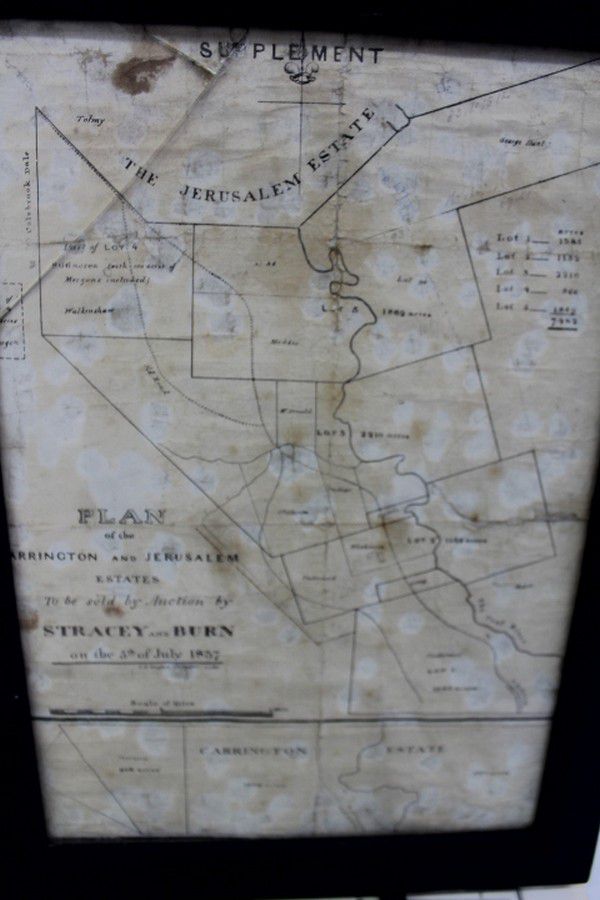
Auction: Van Diemen's Land Carrington & Jerusalem Estates (1837)
You must be a subscriber, and be logged in to view price and dealer details.
Subscribe Now to view actual auction price for this item
When you subscribe, you have the option of setting the currency in which to display prices to $Au, $US, $NZ or Stg.
This item has been included into following indexes:
Visually similar items

Hawthorn - Prahran circa 1887. Two canvas backed maps scale 400 feet to an inch, stone engraved by Clarence Woodhouse [printed by John Batton 79 Queen St], housed in original black cloth covered boards with gilt lettering.

Balance of Cricket Collection, noted c1953-54 accounts book re Lindsay Hassett Testimonial Fund; Official Returns (with attendance figures & gross takings) for 8 matches at MCG 1968-72; colour team photo 1971-72 World XI Team; World XI Christmas Cards (3);

Map of part of the Morobe District New Guinea Mandated Territory and of the Gulf and central Div. 1933-1935. Drawn by J. Nason-Jones, printed by H.E.C Robinson Ltd, 221-3 George Street, Sydney

Victorian Maps: c1865-92 maps, noted 'New Map of Bendigo & District', 'Township of Sunbury', 'Moe', 'Kororoit', 'Doutta Galla', 'Merino', 'Trawool', 'Blackwood', 'Grassdale', 'Tragowel', 'Goornong', 'Baynton'. Various sizes. Poor/G condition.,